Mori Atlas logo
Protected areaGreater Mapungubwe Transfrontier Conservation Area

Discover a pioneering transboundary conservation initiative at the confluence of the Limpopo and Shashe Rivers.

Greater Mapungubwe Transfrontier Conservation Area: Protected Area Map, Geography, and Landscape Context

The Greater Mapungubwe Transfrontier Conservation Area represents a significant protected landscape situated in South Africa, celebrated for its multifaceted identity as a multinational conservation effort. This area encompasses diverse savanna ecosystems, characterized by the confluence of the Limpopo and Shashe Rivers, and is distinguished by its rich cultural heritage, including the UNESCO World Heritage-listed Mapungubwe Cultural Landscape. Users can delve into the mapped boundaries, regional geography, and the ecological significance of this transfrontier park, understanding its role in protecting wildlife corridors and ancient human history.

Transfrontier Conservation AreaSavanna EcosystemUNESCO World Heritage SiteMulti-country Protected AreaCultural LandscapeRiparian Habitat

Greater Mapungubwe Transfrontier Conservation Area

Protected area

Park overview

Structured park overview, official facts, and landscape profile for Greater Mapungubwe Transfrontier Conservation Area

Greater Mapungubwe Transfrontier Conservation Area park facts, protected area profile, and essential visitor context
Review the core facts for Greater Mapungubwe Transfrontier Conservation Area, including designation, size, terrain, visitor scale, habitats, and operating context in one park-focused overview.

About Greater Mapungubwe Transfrontier Conservation Area

The Greater Mapungubwe Transfrontier Conservation Area represents a visionary approach to wildlife conservation in southern Africa, creating a unified ecological landscape that transcends national boundaries to protect one of the region's most biologically diverse and culturally significant areas. The conservation area is centered on the confluence of the Limpopo and Shashe Rivers, a location that has held human significance for millennia and continues to support exceptional biodiversity across its varied terrain. The transfrontier initiative emerged from collaborative efforts involving the Peace Parks Foundation, De Beers, the National Parks Trust, WWF-SA, and SANParks, with the South African component being consolidated around the core Mapungubwe National Park and the Venetia Limpopo Nature Reserve. Phase two development aims to expand the protected area further by incorporating additional properties including the proposed Limpopo Valley Conservancy, Mapesu Private Game Reserve, proposed Mogalakwena Game Reserve, and the Vhembe Game Reserve along with several smaller private farms. The dramatic landscapes and ecological contrasts within the GMTFCA create a visually stunning and naturally diverse area of southern Africa, while the presence of significant cultural heritage sites enhances the conservation area's potential for drawing both local and international visitors interested in experiencing the intersection of natural and cultural heritage.

Quick facts and research context for Greater Mapungubwe Transfrontier Conservation Area

The Greater Mapungubwe Transfrontier Conservation Area encompasses roughly 4,872 square kilometers across three nations, with 53 percent located in South Africa, 28 percent in Botswana, and 19 percent in Zimbabwe. The South African component centers on Mapungubwe National Park and the Venetia Limpopo Nature Reserve, while Botswana contributes through the Northern Tuli Game Reserve comprising 36 freehold properties. Zimbabwe's portion includes Sentinel Ranch, Nottingham Estate, and the Tuli Circle Safari Area. The area was officially renamed the Greater Mapungubwe Transfrontier Conservation Area in June 2009, having previously been known as the Limpopo-Shashe Transfrontier Conservation Area. The region supports significant populations of threatened species and contains species listed in red data books across 19 mammal species, 26 plant species, and numerous bird species.

Park context

Deeper park guide and search-rich context for Greater Mapungubwe Transfrontier Conservation Area

Greater Mapungubwe Transfrontier Conservation Area history, landscape, wildlife, and travel context
Explore Greater Mapungubwe Transfrontier Conservation Area through its history, landscape character, ecosystems, wildlife, conservation priorities, cultural context, and seasonal travel timing in a structured park guide built for atlas discovery and search intent.

Why Greater Mapungubwe Transfrontier Conservation Area stands out

The Greater Mapungubwe Transfrontier Conservation Area is especially known for its unique position as a tri-national conservation initiative protecting the wildlife-rich savanna ecosystems at the confluence of two major African rivers. The area is renowned for its exceptional cultural significance, centering on the Mapungubwe Cultural Landscape, a UNESCO World Heritage Site that reveals the archaeological remains of an ancient African kingdom that once thrived in the region. The transfrontier park is further distinguished by its role in protecting viable populations of apex predators including lion, leopard, cheetah, and African wild dog, alongside significant elephant populations in a landscape characterized by dramatic contrasts between floodplains, rocky outcrops, and rolling savanna. The combination of outstanding natural and cultural heritage within a single transboundary protected area makes this landscape particularly notable in the context of African conservation.

Greater Mapungubwe Transfrontier Conservation Area history and protected-area timeline

The establishment of the Greater Mapungubwe Transfrontier Conservation Area represents decades of conservation diplomacy and collaborative planning between South Africa, Botswana, and Zimbabwe. The formal process accelerated with the assistance of major conservation organizations including the Peace Parks Foundation, De Beers, the National Parks Trust, and WWF-SA, who helped SANParks consolidate the core area of South Africa's contribution to the proposed transfrontier conservation area. A pivotal moment came in July 2003 when the Mapungubwe Cultural Landscape was proclaimed a UNESCO World Heritage Site, providing international recognition and impetus for the broader conservation initiative. Mapungubwe National Park was officially opened on September 24, 2004, establishing the central protected area around which the transfrontier concept would develop. A memorandum of understanding regarding the transfrontier conservation area's establishment was signed on June 22, 2006, and an international coordinator was appointed to facilitate cross-border collaboration. On June 19, 2009, the Limpopo-Shashe Transfrontier Conservation Area was officially renamed the Greater Mapungubwe Transfrontier Conservation Area. Significant archaeological discoveries in 2012 on the farm Klein Bolayi, east of Mapungubwe National Park, confirmed that the Mapungubwe Cultural Landscape extends further downstream along the Limpopo Valley, corroborating evidence of human habitation in the area for more than 1,500 years.

Greater Mapungubwe Transfrontier Conservation Area landscape and geographic character

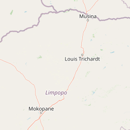
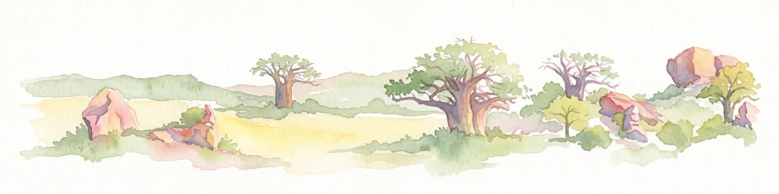
The Greater Mapungubwe Transfrontier Conservation Area encompasses a diverse range of terrain typical of the southern African savanna biome. The landscape is characterized by the dramatic confluence of the Shashe and Limpopo Rivers, where floodplains give way to undulating hills and rocky outcrops that punctuate the otherwise open savanna. The terrain within the South African portion features the characteristic landscapes of Mapungubwe National Park, with its sweeping views across the Limpopo Valley and distinctive sandstone formations. The Botswana component, centered on the Northern Tuli Game Reserve, consists of varied freehold properties supporting a mix of savanna, woodland, and riverine habitats along the Limpopo corridor. Zimbabwe's contribution includes the Tuli Circle area with its own distinctive combination of floodplain and upland environments. The overall landscape creates dramatic contrasts between riverine ecosystems, open grasslands, and rocky outcrops that define the visual character of this transfrontier region, making it one of the more visually striking protected areas in southern Africa.

Greater Mapungubwe Transfrontier Conservation Area ecosystems, habitats, and plant life

The ecological systems within the Greater Mapungubwe Transfrontier Conservation Area reflect the transitional nature of this border region between the Kalahari and the more mesic systems of eastern southern Africa. The savanna ecosystem supports a remarkable diversity of habitats ranging from riparian woodlands along the Limpopo and Shashe Rivers to open grasslands and acacia savanna on the surrounding plains. The transfrontier area's position across three countries enables ecological processes to function at a landscape scale that would be impossible within national boundaries, particularly for wide-ranging species that require large territories. The conservation area provides crucial connectivity between protected areas in each country, allowing for seasonal movements of elephant, predator populations, and other migratory species. The river systems create important ecological corridors and support distinctive riparian communities that contrast sharply with the drier savanna surrounding them. This combination of habitat diversity and landscape connectivity makes the GMTFCA ecologically significant at a regional scale.

Greater Mapungubwe Transfrontier Conservation Area wildlife and species highlights

The Greater Mapungubwe Transfrontier Conservation Area supports impressive populations of large mammals and represents an important stronghold for several threatened species in southern Africa. The area holds significant populations of bush elephant, with the open savanna and river corridors providing ideal habitat for these megaherbivores. Apex predators are well represented, with viable populations of lion, African leopard, Southeast African cheetah, and African wild dog all present within the transfrontier area. The African wild dog, in particular, benefits from the large contiguous landscape that allows for the pack movements and territory establishment that this species requires. Beyond the charismatic megafauna, the area supports approximately 19 mammal species, 26 plant species, and numerous bird species that are listed in red data books, indicating their conservation significance. The combination of diverse habitat types within a protected transfrontier landscape creates conditions that support both wide-ranging species and more specialized fauna, making the GMTFCA significant for mammalian conservation in the region.

Greater Mapungubwe Transfrontier Conservation Area conservation status and protection priorities

The Greater Mapungubwe Transfrontier Conservation Area represents a significant advance in regional conservation strategy by creating a transboundary protected area that enables ecosystem management at an appropriate ecological scale. The establishment of the GMTFCA contributes substantially to the protection of species found within the area by providing extended range, coordinated protection measures, and combined efforts across international boundaries. The conservation area addresses one of the fundamental challenges in African wildlife conservation, namely the fragmentation of protected areas by national borders that disrupts ecological processes and limits the effectiveness of conservation in isolation. The dramatic landscapes and contrasts within the GMTFCA, combined with its cultural heritage sites, create a conservation area with exceptional potential for attracting both local and international interest. The added range, protection, and combined efforts offered through the GMTFCA are strongly contributing to the long-term survival of species within the area, particularly for wide-ranging predators and elephants that require large contiguous habitats to maintain viable populations.

Greater Mapungubwe Transfrontier Conservation Area cultural meaning and human context

The Greater Mapungubwe Transfrontier Conservation Area derives its name from the Mapungubwe Cultural Landscape, a UNESCO World Heritage Site that represents one of southern Africa's most significant archaeological and cultural heritage areas. The Mapungubwe Cultural Landscape reveals the archaeological remains of an ancient African kingdom that flourished between the 10th and 13th centuries, trading gold and other commodities across Indian Ocean networks and displaying sophisticated social organization. The 2012 archaeological discoveries on the farm Klein Bolayi, east of Mapungubwe National Park, confirmed that the cultural landscape extends further downstream along the Limpopo Valley, corroborating evidence of human habitation spanning more than 1,500 years. This cultural dimension distinguishes the transfrontier conservation area from purely natural protected areas, creating a unique combination of outstanding universal value in both natural and cultural terms. The preservation of this cultural heritage within the transfrontier framework demonstrates how conservation initiatives can serve to protect not only ecological values but also the tangible connections between human communities and their ancestral landscapes.

Top sights and standout views in Greater Mapungubwe Transfrontier Conservation Area

The Greater Mapungubwe Transfrontier Conservation Area offers several outstanding features that distinguish it within the network of African protected areas. The transfrontier initiative represents one of the first multi-national conservation areas in southern Africa, creating wildlife corridors that span three countries and enable ecological processes at a landscape scale. The Mapungubwe Cultural Landscape, a UNESCO World Heritage Site, provides exceptional cultural heritage value with archaeological evidence of an ancient African kingdom. The confluence of the Limpopo and Shashe Rivers creates a visually dramatic landscape with diverse habitats supporting significant populations of elephant, lion, leopard, cheetah, and African wild dog. The combination of outstanding natural and cultural heritage within a single transboundary protected area makes this landscape particularly significant for conservation and heritage tourism alike.

Best time to visit Greater Mapungubwe Transfrontier Conservation Area

The Greater Mapungubwe Transfrontier Conservation Area can be visited throughout the year, though the optimal time for wildlife viewing typically coincides with the dry winter months from May to September when vegetation is less dense and wildlife concentrates around water sources. The summer months from October to April bring green vegetation and newborn wildlife, but some areas may become more difficult to traverse and wildlife viewing can be less productive. The Mapungubwe Cultural Landscape and archaeological sites can be explored year-round, though the cooler winter months offer more comfortable conditions for walking tours and outdoor exploration. Visitors interested in combining wildlife viewing with cultural heritage exploration will find the transfrontier area rewarding in any season, though advance planning is recommended given the cross-border logistics involved in accessing different portions of the conservation area.

Park location guide

Geography guide, regional context, and park location map for Greater Mapungubwe Transfrontier Conservation Area

Greater Mapungubwe Transfrontier Conservation Area park geography, regions, and map view in Botswana
Understand where Greater Mapungubwe Transfrontier Conservation Area sits in Botswana through a broader geographic reading of the surrounding landscape, nearby location context, and its mapped position within the national park landscape.

Map view of Greater Mapungubwe Transfrontier Conservation Area

Use this park location map to pinpoint Greater Mapungubwe Transfrontier Conservation Area in Botswana, understand its exact geographic position, and read its mapped placement within the surrounding landscape more clearly.

Pigeon | © OpenStreetMap contributors

Location context for Greater Mapungubwe Transfrontier Conservation Area

Limpopo
Park atlas

Map the regional spread of conservation efforts and compare protected landscapes surrounding this multinational area.

Discover Nearby National Parks, Protected Areas, and Regional Landscapes Beyond Greater Mapungubwe Transfrontier Conservation Area
Expand your exploration beyond the Greater Mapungubwe Transfrontier Conservation Area by discovering other national parks and protected landscapes within the surrounding southern African region. Compare diverse conservation areas, trace the geographic spread of savanna ecosystems, and understand the interconnected network of protected lands across Botswana, South Africa, and Zimbabwe.
National parkLimpopo

Mapungubwe National Park: National Park with Rich Iron Age Archaeology and Savanna Landscapes

Explore Limpopo's unique protected area at the three-nation border.

Mapungubwe National Park is a vital protected area in South Africa's Limpopo region, renowned for its dual significance as a major archaeological site and a diverse natural landscape. This national park protects a significant portion of savanna ecosystems, including unique riparian forests and mopane woodlands, surrounding the historic Mapungubwe Hill. As part of the Greater Mapungubwe Transfrontier Conservation Area, it plays a crucial role in regional conservation, offering a distinct geographic perspective at the confluence of South Africa, Botswana, and Zimbabwe, and serving as a focal point for atlas-based discovery of protected lands.

Area
280 km²
Established
1998
IUCN
II
Relief
Lowland
National parkSouth Africa

Kruger National Park: South Africa's Iconic National Park for Geographic Discovery

Explore savanna landscapes and mapped protected area boundaries.

Kruger National Park serves as a paramount example of a protected landscape, offering a rich tapestry of savanna ecosystems and varied terrain across South Africa's Lowveld. This canonical entry details its vast geographic scope, approximately 19,623 square kilometres, and its status as the nation's first national park. Understand the park's environmental context, from the Lebombo Mountains to the Limpopo River, and its integral role within larger transfrontier conservation initiatives, providing critical insight for atlas-based geographic exploration.

Area
19,623 km²
Established
1926
IUCN
II
National parkMozambique

Zinave National Park: A Mozambique National Park with Diverse Woodland and Savanna Landscapes

Explore its mapped terrain, riverine forests, and savanna ecosystems.

Zinave National Park in Mozambique is a significant protected area spanning 4,000 square kilometers. Its landscape comprises a rich variety of ecosystems, including miombo woodlands, mopane-dominated areas, acacia savannas, and distinct riverine forests along the Save River. This national park is strategically positioned within the Greater Limpopo Transfrontier Park, highlighting its importance for regional wildlife corridors and conservation geography. The terrain offers a unique insight into the transitional ecological zones of southern Africa, showcasing diverse natural habitats and mapping potential for its protected boundaries.

Area
4,000 km²
Established
1973
IUCN
II
Relief
Lowland
National parkManica Province

Chimanimani National Park: Map of Mozambique's Highest Mountain Landscape

Explore protected highland terrain and transfrontier conservation geography.

Chimanimani National Park stands as a vital protected area in Mozambique's Manica Province, celebrated for its rugged mountain landscape and the presence of Monte Binga, the country's highest point. As the Mozambican portion of the Chimanimani Transfrontier Park, it offers critical insights into cross-border conservation efforts and the preservation of unique montane ecosystems. Discover the park's geographic context, its elevation extremes, and the significance of its protected boundaries within the regional atlas.

Area
656 km²
Established
2020
IUCN
II
National parkZimbabwe

Chizarira National Park: Zimbabwe's Remote Protected Landscape on the Zambezi Escarpment

Explore rugged mountains, deep gorges, and unique woodland ecosystems.

Chizarira National Park offers an unparalleled exploration of wilderness and dramatic geography within Zimbabwe. Situated along the imposing Zambezi Escarpment, its landscape is characterized by a 600-meter drop, rugged mountains, and deep river gorges carved by perennial streams. This protected area, known for its remote appeal and rich leopard populations, provides a distinct view of miombo and mopane woodlands, contributing to its unique ecological identity within the regional geography.

Area
2,000 km²
Established
1975
IUCN
II
Relief
Mountain
National parkBotswana

Nxai Pan National Park: Botswana's Iconic Baobab Forests and Salt Pan Landscape

Explore mapped boundaries and unique regional geography.

Nxai Pan National Park offers a compelling glimpse into Botswana's unique semi-arid ecosystems, characterized by the expansive, salt-crusted Nxai Pan itself and the iconic Baines Baobabs dotting its edges. As a protected national park, it represents a significant conservation landscape within the Kalahari Desert region. Understanding its geography involves appreciating the stark visual contrasts, seasonal wetland transformations, and the vast openness of the salt pan environment.

Area
2,578 km²
Established
1992
IUCN
Ib
National parkEswatini

Hlane Royal National Park: Eswatini's Vast Protected Savanna Woodland Landscape

Mapped geography and protected area context in northeastern Eswatini.

Delve into Hlane Royal National Park, Eswatini's most extensive protected territory, a prime example of lowland bushveld savanna. This national park is defined by its expansive woodland terrain, dotted with ancient trees and seasonal water pans, creating a dynamic landscape. It is an essential component for understanding the regional geography and the distribution of protected areas within Southern Africa, offering significant opportunities for landscape exploration.

Area
300 km²
IUCN
VI
National parkZimbabwe

Kazuma Pan National Park: Zimbabwe National Park Atlas and Protected Landscape Exploration

Unique plains landscape with reliable dry-season wildlife viewing.

Kazuma Pan National Park offers a rare glimpse into Zimbabwe's expansive grassy plains and vital pans, creating a unique protected landscape. This national park is critical for understanding regional wildlife migrations and the geographic context of conservation areas in northwestern Zimbabwe, providing an essential entry point for atlas-based exploration of its terrain and ecological significance.

Area
313 km²
Established
1975
IUCN
II

Common questions about visiting, size, designation, and location context for Greater Mapungubwe Transfrontier Conservation Area

Greater Mapungubwe Transfrontier Conservation Area FAQs for park facts, access, geography, and protected area context
Find quick answers about Greater Mapungubwe Transfrontier Conservation Area, including protected-area facts, park geography, trail and visitor context, and how the park fits into its surrounding country and regional landscape.
MoriAtlas Explorer

Continue Your Protected Areas Search Across the Global Atlas

Deepen your exploration by continuing the structured search for national parks and protected areas worldwide. Utilize the comprehensive filtering capabilities to compare different conservation landscapes and refine your understanding of global park geography. Discover more about the distribution and characteristics of protected natural areas.

Global natural geography