Mori Atlas logo
National parkLa Visite National Park

Discover the unique montane ecosystems and mapped boundaries of this significant Caribbean national park.

La Visite National Park: Haiti's Premier Protected Highland Landscape and Pine Forest Atlas

(Parc National La Visite)

La Visite National Park represents a crucial protected highland landscape within Haiti's Massif de la Selle mountain range. This national park encompasses unique montane ecosystems, including extensive Hispaniolan pine forests and alpine grasslands, distinguishing its terrain from much of the surrounding Caribbean geography. Users can explore the park's mapped boundaries, understand its high-altitude setting, and appreciate its significance as a protected natural area through a detailed geographic and atlas-focused lens.

National ParkPine ForestsMontane EcosystemsBirdwatchingHighland ConservationCaribbean Protected Areas

La Visite National Park

National park

Park overview

Structured park overview, official facts, and landscape profile for La Visite National Park

La Visite National Park park facts, protected area profile, and essential visitor context
Review the core facts for La Visite National Park, including designation, size, terrain, visitor scale, habitats, and operating context in one park-focused overview.

About La Visite National Park

La Visite National Park occupies a critical ecological position in Haiti, protecting the country's highland environments within the Massif de la Selle mountain range. Established in 1983, the park safeguards approximately 11,419 hectares of mountainous terrain characterized by steep slopes, plateaus, and forest-covered ridges. The elevation range spans from lower slopes up to the park's highest point at 2,275 meters, creating distinct ecological zones that support varied vegetation communities. The park's pine forests, dominated by the Hispaniolan Pine (Pinus occidentalis), represent a significant conservation value as this species is endemic to the island of Hispaniola. Above 1,700 meters elevation, the forest composition transitions to montane broadleaf forest, while the higher elevations and more exposed areas support grassland ecosystems. The park's proximity to Haiti's capital city, Port-au-Prince, provides both accessibility and conservation challenges, as population pressure and land use demands exist in the surrounding areas.

Quick facts and research context for La Visite National Park

La Visite National Park covers 30 square kilometers (11,419 hectares) in the Massif de la Selle range, with 1,897 hectares lying above 2,000 meters elevation. The park was established in 1983 and holds IUCN category II protected area status. Its most widespread tree species is the Hispaniolan Pine (Pinus occidentalis), which dominates the park's forest cover. The park supports over 80 bird species, including several threatened and endemic species specific to the island of Hispaniola. The northern boundary follows the dramatic east-west running escarpment of the Massif de la Selle.

Park context

Deeper park guide and search-rich context for La Visite National Park

La Visite National Park history, landscape, wildlife, and travel context
Explore La Visite National Park through its history, landscape character, ecosystems, wildlife, conservation priorities, cultural context, and seasonal travel timing in a structured park guide built for atlas discovery and search intent.

Why La Visite National Park stands out

La Visite National Park is best known for its extensive Hispaniolan pine forests, which represent one of the most significant remaining stands of this endemic Caribbean pine species. The park's high-altitude grasslands and montane broadleaf forest zones create a diverse mosaic of habitats unusual for Haiti. The park is also recognized as an important birdwatching destination, hosting over 80 species including several endemic to Hispaniola. Its position as one of Haiti's two largest national parks and its dramatic mountain scenery at relatively accessible distances from Port-au-Prince give it particular regional significance.

La Visite National Park history and protected-area timeline

La Visite National Park was established by the Haitian government in 1983 as part of the country's developing national park system. The creation of the park reflected Haiti's commitment to preserving its remaining natural habitats, particularly in the face of significant deforestation pressures that have affected much of the country. As one of the two largest national parks in Haiti, La Visite was designed to protect the highland ecosystems of the Massif de la Selle, a mountain range that forms part of the backbone of the island of Hispaniola. The establishment of protected status for this area recognized both the ecological importance of the pine forests and the need to conserve watersheds that supply downstream communities. The park's designation as an IUCN category II protected area places it within the national park classification, recognizing its significance for both conservation and, potentially, public enjoyment of natural environments.

La Visite National Park landscape and geographic character

The landscape of La Visite National Park is defined by its position within the Massif de la Selle, one of Haiti's principal mountain ranges. The terrain is characterized by steep ridgelines, plateaus, and dramatic escarpments, with the northern boundary of the park marked by the prominent east-west running escarpment that separates the higher elevations from the lower foothills. The park encompasses terrain above 2,000 meters in elevation across approximately 1,897 hectares, representing some of the highest terrain in Haiti. Notable landscape features include the plateau of Morne d'Enfer, which supports forest cover within the park's boundaries. The topography creates a mountainous setting that stands in contrast to the more typical lowland and coastal landscapes found throughout most of Haiti, making this highland environment particularly distinctive.

La Visite National Park ecosystems, habitats, and plant life

The ecological character of La Visite National Park is defined by a complex of three primary vegetation types that reflect the park's elevation range. Hispaniolan pine forests dominate the mid-elevation zones, with Pinus occidentalis being the most widespread tree species throughout the park. These pine forests represent a significant component of the island's forest resources and provide important habitat functions. At higher elevations above 1,700 meters, the vegetation transitions to montane broadleaf forest, including both karst broadleaf and wet broadleaf forest types. The grassland communities occupy areas where soil conditions, exposure, or historical disturbance have prevented forest establishment, creating a mosaic of open and forested habitats. This diversity of vegetation types within a relatively compact area supports ecological processes and biodiversity that would be difficult to maintain in a more homogeneous landscape.

La Visite National Park wildlife and species highlights

La Visite National Park supports remarkable bird diversity, with over 80 species recorded within its boundaries. The park is particularly significant for birdwatching, offering opportunities to observe both resident species and migratory visitors. Several threatened bird species occur in the park, including species that are endemic to Hispaniola, meaning they are found nowhere else on Earth. The diverse habitat mosaic created by the combination of pine forests, broadleaf forests, and grasslands supports different bird communities across the park's elevation gradient. The preservation of these forest habitats is particularly important for species that depend on mature forest conditions, while the grasslands provide foraging habitat for different ecological guilds. The park's status as a protected area helps ensure that these bird populations can persist in the face of habitat loss that has affected much of Haiti.

La Visite National Park conservation status and protection priorities

La Visite National Park represents one of Haiti's most important conservation investments, protecting a highland ecosystem that has become increasingly rare on the island of Hispaniola. The park's designation as an IUCN category II protected area reflects its national significance and the international recognition of its ecological value. The Hispaniolan pine forests within the park are of particular conservation concern, as similar forests throughout Hispaniola have experienced significant reduction due to logging, agriculture, and charcoal production. By protecting the core of these forest ecosystems, La Visite helps maintain genetic populations of Pinus occidentalis and the associated biodiversity. The park also provides watershed protection functions for downstream communities and contributes to soil conservation on the steep mountain slopes. The presence of endemic species, including both flora and fauna, adds to the park's conservation significance at a regional and global scale.

La Visite National Park cultural meaning and human context

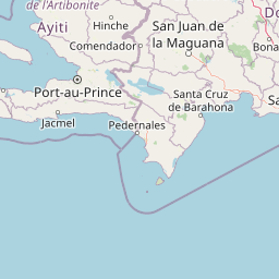
The landscape of La Visite National Park exists within the broader context of Haitian highland communities whose traditional land use practices have shaped, and continue to shape, the surrounding environments. The Massif de la Selle region has historically supported agricultural activities, including coffee cultivation and subsistence farming, in the lower elevation zones. While the core protected area restricts certain activities, the surrounding landscape reflects the interplay between human settlement patterns and natural resources. The park's relative proximity to Port-au-Prince connects it to Haiti's urban center, creating both opportunities for environmental education and challenges related to recreational pressure. The French name Parc National La Visite reflects Haiti's colonial linguistic heritage and remains the official designation alongside the English name.

Top sights and standout views in La Visite National Park

The defining highlights of La Visite National Park include its extensive Hispaniolan pine forests at elevations above 1,700 meters, the dramatic mountain scenery of the Massif de la Selle with peaks reaching 2,275 meters, and the diversity of habitats spanning pine forest, montane broadleaf forest, and grassland. The park offers significant birdwatching opportunities with over 80 species, including threatened endemics. Its status as one of Haiti's two largest national parks and its position only 22 kilometers from Port-au-Prince give it particular accessibility and prominence. The plateau of Morne d'Enfer provides a notable scenic feature within the park's boundaries, showcasing the forest-covered highland terrain that distinguishes this protected area from Haiti's more typical lowland landscapes.

Best time to visit La Visite National Park

The best time to visit La Visite National Park aligns with Haiti's dry season, typically from November through March, when precipitation is reduced and trail conditions are more favorable for exploration. The high-elevation location means that temperatures are cooler than in the lowlands, making the park more comfortable during the warmer months elsewhere in Haiti. The dry season also offers clearer visibility for enjoying the mountain scenery and improved opportunities for wildlife observation. Visitors should be aware that the park's mountain environment can experience fog and cloud cover, particularly in the higher elevations, regardless of season. The timing of visits should consider that the park's remote highland setting requires appropriate preparation and awareness of current conditions.

Park location guide

Geography guide, regional context, and park location map for La Visite National Park

La Visite National Park park geography, regions, and map view in Haiti
Understand where La Visite National Park sits in Haiti through a broader geographic reading of the surrounding landscape, nearby location context, and its mapped position within the national park landscape.

How La Visite National Park fits into Haiti

Haiti is a Caribbean country occupying the western third of Hispaniola Island in the Caribbean Sea. It gained independence from France in 1804 following the Haitian Revolution, becoming the first sovereign state established by a slave revolt and the second independent nation in the Americas. The country is known for its complex political history, economic challenges, and cultural significance in the Caribbean.

Wider geography shaping La Visite National Park in Haiti

Haiti occupies the western third of Hispaniola Island in the Caribbean, sharing the island with the Dominican Republic. The country is positioned in the Caribbean Sea, east of Cuba and south of the Bahamas. Haiti's terrain is predominantly mountainous, with valleys and coastal plains. The country borders the Caribbean Sea on its western, southern, and southwestern coasts.

Map view of La Visite National Park

Use this park location map to pinpoint La Visite National Park in Haiti, understand its exact geographic position, and read its mapped placement within the surrounding landscape more clearly.

Pigeon | © OpenStreetMap contributors
Park atlas

Explore the Regional Protected Landscapes and Comparative Park Geography around La Visite National Park

Discover Nearby National Parks and Protected Areas Beyond La Visite National Park
Continue your exploration of La Visite National Park by browsing other national parks and protected areas mapped across the surrounding regional geography. This atlas view provides valuable context for comparing diverse montane ecosystems and highland conservation efforts within the broader Caribbean protected-area network.
National parkIndependencia Province

La Gran Sabana National Park: National Park Identity and Geographic Mapping

Exploring protected landscapes and regional context.

This detail entry focuses on La Gran Sabana National Park, delineating its identity as a protected national park within Independencia Province. It provides essential context for understanding the park's mapped boundaries, its specific geographic setting, and its role within the natural landscape. Users can explore its atlas-relevant features and understand its place in the broader geography of the Dominican Republic.

Area
219.58 km²
Established
2009
IUCN
II
Relief
Lowland
National parkPedernales Province

Jaragua National Park: Dominican Republic National Park Protected Landscape Atlas

Discover the mapped geography and protected boundaries of Jaragua National Park.

Jaragua National Park stands as a crucial national park within the Dominican Republic, located in Pedernales Province. This entry provides an in-depth, atlas-style examination of the park's protected landscape, focusing on its geographic features and mapped extent. Users can explore the park's position within the regional geography and understand its significance as a conservation area.

Area
1,374 km²
Established
1983
IUCN
II
National parkDominican Republic

José Armando Bermúdez National Park: Dominican Republic National Park Atlas and Landscape Context

Discover the mapped protected area and geographic setting of this Dominican Republic national park.

Gain an understanding of José Armando Bermúdez National Park as a distinct protected landscape within the Dominican Republic. This entry focuses on its role as a national park, providing geographic context and highlighting its mapped boundaries for atlas exploration. Explore the park's specific terrain and its place within the nation's conservation network.

Area
766 km²
Established
1956
IUCN
II
Relief
Mountain
National parkHaiti

Three Bays Protected Area National Park: Haiti's Extensive Marine and Coastal Protected Landscape

Mapped coral reefs, mangrove forests, and unique regional geography.

The Three Bays Protected Area in Haiti is a key national park established to conserve its vital marine and coastal environments. Covering over 75,000 hectares, it is the country's largest protected marine complex, encompassing extensive and healthy coral reefs, critical seagrass beds, and sprawling mangrove forests. This protected landscape provides essential ecosystem services and coastal protection, showcasing a significant portion of Haiti's natural heritage and regional geographic context along its northeastern shoreline.

Area
754.06 km²
Established
2014
IUCN
IV
National parkMonte Cristi Province

Monte Cristi National Park: Dominican Republic National Park Geography and Atlas

Explore mapped boundaries and regional landscape context.

Monte Cristi National Park serves as a vital component of the Dominican Republic's protected lands, located within the Monte Cristi Province. This entry provides essential geographic context and visualizes the park's mapped boundaries, contributing to a comprehensive understanding of its landscape. Delve into the atlas perspective of this national park, examining its terrain and regional significance for structured geographic exploration.

Area
550 km²
Established
1983
IUCN
II
National parkHaiti

Pic Macaya National Park: Haiti's Protected Cloud Forest and Mountain Geography

Explore critical endemic species within Haiti's mountainous protected areas.

Pic Macaya National Park stands as a significant natural sanctuary in Haiti, preserving the island's final remnants of virgin cloud forest within the challenging terrain of the Massif de la Hotte. This protected area is defined by its high-altitude volcanic and karstic landscape, including Pic Macaya, the second-highest peak in Haiti. The park is a crucial stronghold for biodiversity, harboring numerous species endemic to Hispaniola, making it an essential site for conservation and a focal point for understanding regional natural landscapes.

Area
55 km²
Established
1984
IUCN
II
National parkSud

Grand Bois National Park National Park: Protected Mountain Landscape in Sud, Haiti

Discover Haiti's vital primary rainforest and endemic species refuge.

Grand Bois National Park is a critical conservation area in Haiti's Sud region, established to protect the rare primary rainforest ecosystem found on the isolated Morne Grand Bois peak. This national park safeguards approximately 3.7 square kilometers of mountainous terrain above 900 meters, featuring a unique cloud forest environment. It is a vital refuge for endemic species, including rediscovered amphibians and rare flora, making it a significant site for Caribbean biodiversity and landscape conservation. The park's importance lies in preserving one of Haiti's last intact forest ecosystems.

Area
3.7 km²
Established
2015
IUCN
II
National parkDominican Republic

Los Haitises National Park: Dominican Republic Protected Landscape & Park Geography

Mapped terrain and protected area boundaries in the Dominican Republic.

Los Haitises National Park is a vital protected national park in the Dominican Republic, offering unique insights into the region's geography and natural landscapes. This page delves into its mapped boundaries, regional context, and the importance of its protected status for understanding Dominican Republic's conservation areas. Gain a structured view of this important natural landscape and its place within a broader geographic atlas.

Area
826 km²
Established
1976
IUCN
II

Common questions about visiting, size, designation, and location context for La Visite National Park

La Visite National Park FAQs for park facts, access, geography, and protected area context
Find quick answers about La Visite National Park, including protected-area facts, park geography, trail and visitor context, and how the park fits into its surrounding country and regional landscape.
MoriAtlas Explorer

Continue Your Protected Areas Search Across the Global Atlas

Deepen your exploration by continuing the structured search for national parks and protected areas worldwide. Utilize the comprehensive filtering capabilities to compare different conservation landscapes and refine your understanding of global park geography. Discover more about the distribution and characteristics of protected natural areas.

Global natural geography