Mori Atlas logo
National parkOmo National Park

Discover mapped boundaries and exceptional wildlife across this vast savannah wilderness.

Omo National Park: Ethiopia's Remote Protected Landscape and Geographic Atlas

Omo National Park, a vast protected area spanning approximately 4,068 square kilometers in Ethiopia's South Ethiopia Regional State, offers an unparalleled glimpse into remote African savannah and riverine ecosystems. Established in 1980, this park represents a significant conservation territory, characterized by open savannah, woodland corridors along the Omo River, and the rising Maji Mountains. Users can explore its mapped boundaries, understand its regional geographic context within Ethiopia, and discover the rich biodiversity that defines this significant protected landscape.

National ParkSavanna EcosystemWildlife ConservationRemote WildernessEthiopiaRiver Valley

Omo National Park

National park

Park overview

Structured park overview, official facts, and landscape profile for Omo National Park

Omo National Park park facts, protected area profile, and essential visitor context
Review the core facts for Omo National Park, including designation, size, terrain, visitor scale, habitats, and operating context in one park-focused overview.

About Omo National Park

Omo National Park represents Ethiopia's commitment to preserving its natural heritage in one of the most isolated and ecologically significant regions of East Africa. Located on the west bank of the Omo River in the South Ethiopia Regional State, the park stretches 140 kilometers from the Neruze River in the south to the Sharum plain in the north, with a width of up to 60 kilometers near the Park Headquarters. The landscape combines several distinct environments: the Maji Mountains rise in the northwest, the Sai and Sharum plains dominate the western reaches, while the Illibai plains and Dirga Hills characterize the southern sector. The Omo River itself forms a natural eastern boundary, with the Mui River crossing the park's center before joining the main river system. Three hot springs punctuate the park's interior, adding geological variety to the terrain. The park's elevation ranges from 450 meters in the southern valleys to 1,541 meters at the highest peak of the Maji Mountains, though much of the protected area sits around 800 meters above sea level. This combination of elevation variation, river systems, and diverse terrain supports the remarkable biodiversity that makes Omo National Park a conservation priority for Ethiopia and the broader African continent.

Quick facts and research context for Omo National Park

Omo National Park spans 4,068 square kilometers in South Ethiopia Regional State, making it one of Ethiopia's largest protected areas. The park was established in 1980 and is managed by the Ethiopian Wildlife Conservation Authority. Its landscape features the Omo River as a defining eastern boundary, with the Maji Mountains, Savanna plains, and three hot springs characterizing the interior. The park reaches elevations from 450 meters in the southern Neruze River area to 1,541 meters at the highest Maji peak. Visitors will encounter diverse wildlife including large herds of buffalos, zebras, elands, and beisa oryxes, along with rarer species such as elephants, lions, leopards, and black rhinoceros. The park's isolation, combined with limited tourism infrastructure, has preserved its wild character but also created management challenges.

Park context

Deeper park guide and search-rich context for Omo National Park

Omo National Park history, landscape, wildlife, and travel context
Explore Omo National Park through its history, landscape character, ecosystems, wildlife, conservation priorities, cultural context, and seasonal travel timing in a structured park guide built for atlas discovery and search intent.

Why Omo National Park stands out

Omo National Park is best known for its exceptional wildlife viewing opportunities in a remote African savannah setting. The park supports spectacular herds of African buffalo, plains zebra, common eland, and beisa oryx, creating one of Ethiopia's most impressive wildlife spectacles. Its location in the lower Omo Valley places it adjacent to the UNESCO World Heritage Site where the earliest known Homo sapiens fossils were discovered, adding profound human evolutionary significance to its natural value. The park's three hot springs and the Maji Mountains provide additional geological interest, while the presence of riverine woodland along the Omo creates a distinct ecological zone within the broader savannah landscape.

Omo National Park history and protected-area timeline

Omo National Park was established in 1980 as part of Ethiopia's expanding network of protected areas aimed at preserving the nation's natural heritage and biodiversity. The creation of the park reflected growing recognition of the Omo Valley's exceptional ecological and cultural significance. In the years following its establishment, the park gained attention for its remote character, with the Lonely Planet guide describing it as Ethiopia's most remote park, a reputation that persists today. In 2005, formal demarcation of the park boundaries occurred, which subsequently created tensions with local indigenous communities including the Mursi, Suri, Nyangatom, Dizi, and Me'en peoples, who historically used the land for grazing and agriculture. Management of the park was transferred to African Parks, a conservation organization, though this partnership ended in 2008 when African Parks announced withdrawal from Ethiopia, citing challenges in managing parks alongside traditional indigenous land use practices. The Ethiopian Wildlife Conservation Authority now maintains oversight of the park, though significant management challenges remain.

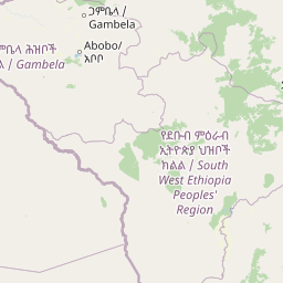
Omo National Park landscape and geographic character

The physical landscape of Omo National Park presents a compelling combination of river systems, mountain terrain, and expansive savannah plains. The Omo River, one of Ethiopia's major waterways, forms the park's eastern boundary and serves as the primary drainage outlet for all interior water systems. The river's western banks support narrow strips of riverine woodland that contrast sharply with the surrounding savannah. To the north and west, the Sharum and Sai plains extend across vast distances, offering sweeping views of flat grassland punctuated by isolated trees and seasonal water courses. The Maji Mountains rise prominently in the northwest corner of the park, reaching 1,541 meters at their highest point and providing dramatic topographic relief. The southern portion of the park features the Illibai plains and the Dirga Hills, with elevations dropping to around 450 meters near the Neruze River. Three hot springs occur within the park boundaries, representing geological activity that adds to the landscape's diversity. The Mui River crosses the central portion of the park before joining the Omo, creating an additional watercourse that supports riparian vegetation and wildlife corridors.

Omo National Park ecosystems, habitats, and plant life

The ecological character of Omo National Park centers on a savannah ecosystem with significant riverine and woodland components. The vegetation pattern consists primarily of open savannah grassland interspersed with thickets and denser woodland areas concentrated along watercourses. Near the western banks of the Omo River, riverine woodland provides more lush vegetation, with species such as Ficus sycomorus creating dense canopy cover. The savannah areas support a characteristic mix of grasses and scattered trees, with species like Acacia mellifera and Ziziphus mauritiana common in drier zones. The park's position in the lower Omo Valley places it within a transition zone between highland and lowland ecosystems, contributing to its ecological diversity. The presence of hot springs indicates ongoing geological activity and creates localized wetland habitats that support additional species. The elevation gradient from 450 to 1,541 meters encompasses multiple habitat zones, from lowland grassland to montane forest patches in the Maji Mountains.

Omo National Park wildlife and species highlights

Omo National Park supports remarkable wildlife diversity, with 73 mammal species and 312 bird species documented within its boundaries. The park is particularly known for its large herds of ungulates, including substantial populations of African buffalo, Burchell's zebra, common eland, and beisa oryx. These species move across the savannah plains in impressive concentrations, creating memorable wildlife viewing opportunities. The antelope family is well represented, with tiangs, Lelwel hartebeests, Grant's gazelles, and dik-diks common throughout the park. Smaller mammals include bushbucks, reedbucks, and oribis. Predatory species present include lions, leopards, cheetahs, hyenas, and African wild dogs, though these are more elusive. Larger mammals such as African elephants and giraffes roam the plains, while black rhinoceros and hippos occur near water sources. Primates including Mantled guerezas, Olive baboons, and De Brazza monkeys inhabit the forested areas. The bird population features ostriches, various eagles, herons, egrets, kingfishers, and the Secretary bird. Reptiles include Nile crocodiles in the rivers and several snake species such as black mambas and puff adders.

Omo National Park conservation status and protection priorities

Omo National Park holds significant conservation importance both for Ethiopia and for global biodiversity preservation. The park protects a substantial area of intact savannah ecosystem in the Omo Valley, one of East Africa's most significant remaining wilderness areas. Its designation as an IUCN Category II protected area reflects its primary purpose of preserving natural landscapes and associated biodiversity. The park's wildlife populations, including elephants, black rhinoceros, and African wild dogs, represent species of conservation concern that benefit from protected status. However, the park faces substantial conservation challenges. Limited tourism infrastructure and extreme remoteness have historically restricted visitor access and limited revenue generation for management. Boundary demarcation in 2005 created conflicts with indigenous communities whose traditional land use practices now intersect with formal protection zones. The departure of African Parks from management in 2008 left gaps in park administration that continue to present challenges. Conservation efforts must balance wildlife protection with the rights and livelihoods of local peoples who have inhabited the region for generations.

Omo National Park cultural meaning and human context

The Omo Valley surrounding the park is home to several indigenous peoples whose cultures are closely tied to the landscape. The Mursi, Suri, Nyangatom, Dizi, and Me'en communities have historically utilized the lands now within the park boundaries for traditional grazing and agricultural purposes. These peoples maintain distinctive cultural practices and remain connected to the territory through historical land use patterns. The region gained international attention in the 20th century due to anthropological studies of these communities and the remarkable fossil discoveries in the Omo Kibish Formation that revolutionized understanding of human origins. The UNESCO World Heritage designation of the lower Omo Valley recognizes both its paleontological significance and the traditional lifeways of its indigenous inhabitants. However, the establishment and enforcement of park boundaries has created complex issues around land rights, with reports that some communities face pressure regarding access to traditional territories. These dynamics reflect broader challenges in balancing conservation goals with indigenous rights in African protected areas.

Top sights and standout views in Omo National Park

Omo National Park offers exceptional wildlife viewing in one of Ethiopia's most pristine savannah environments. The sight of thousands of buffalo, zebra, and eland moving across the plains represents one of East Africa's great wildlife spectacles. The park's paleontological significance, with the discovery site of the earliest Homo sapiens fossils, adds a unique dimension of human history to the natural experience. The Maji Mountains provide opportunities for elevated views and varied terrain exploration, while the three hot springs offer distinctive geological features. The park's extreme remoteness ensures an authentic wilderness experience far from conventional tourism routes, appealing to travelers seeking genuine adventure and untouched landscapes. Bird enthusiasts will find over 300 species, including ostriches, Secretary birds, and numerous raptors. The riverine areas along the Omo and Mui rivers create verdant corridors that contrast beautifully with the surrounding savannah.

Best time to visit Omo National Park

The optimal period to visit Omo National Park falls during the dry seasons, typically from October through March, when wildlife congregates more visibly around remaining water sources and vegetation is less dense, improving viewing opportunities. The park's lowland setting means temperatures remain warm throughout the year, with the hottest conditions occurring from March to May. The short rainy season generally arrives around April to May, followed by the main rainy period from June to September, which can make some roads and areas difficult to access. The dry season's reduced vegetation provides clearer sightlines for wildlife observation, and animals are more likely to gather at rivers and watering holes. However, the park's limited infrastructure means that visits should be planned with awareness that conditions can change rapidly and that self-sufficiency is essential. The extreme remoteness of the park means that access requires careful preparation, and visitors should not expect conventional tourism amenities within the protected area.

Park location guide

Geography guide, regional context, and park location map for Omo National Park

Omo National Park park geography, regions, and map view in Ethiopia
Understand where Omo National Park sits in Ethiopia through a broader geographic reading of the surrounding landscape, nearby location context, and its mapped position within the national park landscape.

How Omo National Park fits into Ethiopia

Ethiopia is a landlocked federal parliamentary republic located in the Horn of Africa. With a population of approximately 135 million people, it is the 14th-most populous country in the world and the most populous landlocked country. The country is known for its ancient history, diverse ethnic groups, and the capital Addis Ababa, which lies near the East African Rift.

Wider geography shaping Omo National Park in Ethiopia

Ethiopia is located in the Horn of Africa, bordered by Eritrea to the north, Djibouti to the northeast, Somalia to the east, Kenya to the south, South Sudan to the west, and Sudan to the northwest. The country sits on the African and Somali tectonic plates, with the East African Rift running through it. The terrain includes highlands, valleys, and lowlands.

Map view of Omo National Park

Use this park location map to pinpoint Omo National Park in Ethiopia, understand its exact geographic position, and read its mapped placement within the surrounding landscape more clearly.

Pigeon | © OpenStreetMap contributors

Location context for Omo National Park

South Ethiopia Regional State
Park atlas

Trace the geographic spread of protected areas and regional park systems near Omo National Park

Explore Other National Parks and Protected Areas Surrounding Omo National Park, Ethiopia
Discover other national parks and protected areas situated in the broader regional context of Omo National Park, mapping their geographic spread across Ethiopia's diverse conservation landscapes. Use this structured view to compare protected-area characteristics, trace ecological corridors, and understand the wider network of natural preservation efforts beyond a single park.
National parkSouth Ethiopia Regional State

Mago National Park: Protected Savanna and Riverine Ecosystems in South Ethiopia

Discover the unique landscapes and wildlife habitats mapped within this national park.

Mago National Park stands as a critical protected landscape within the South Ethiopia Regional State, characterized by its significant riverine forests, acacia savanna, and wetland environments along the Mago and Omo rivers. This national park is integral for understanding the distribution of wildlife and the geographic context of Ethiopia's natural heritage. Its mapped terrain offers insights into a landscape that supports both diverse ecosystems and unique cultural traditions, making it a vital component of the country's conservation network.

Area
2,220 km²
Established
1979
IUCN
II
Relief
Mixed relief
National parkSouth West Ethiopia Peoples' Region

Chebera Churchura National Park: Ethiopia's National Park Protected Landscape Explorer

Mapping the protected area and regional geography of Chebera Churchura.

Chebera Churchura National Park is a key protected landscape in the South West Ethiopia Peoples' Region, designated as a national park. This page provides detailed geographic context and atlas-level information about the park's boundaries and its place within the regional terrain. Engage with the structured data that defines Chebera Churchura National Park's identity as a significant natural area for map-based discovery.

Area
1,250 km²
Established
2006
IUCN
II
Climate
Tropical
National parkEthiopia

Maze National Park: Ethiopia's Essential National Park for Swayne's Hartebeest and Geothermal Wonders

Discover mapped savanna ecosystems and unique montane geography within this protected Ethiopian landscape.

Maze National Park represents a significant protected area within Ethiopia, vital for the conservation of the endangered Swayne's hartebeest. Its diverse terrain includes savanna grasslands and unique geothermal features such as active geysers, all set against a distinctive montane backdrop. This national park offers a deep dive into Ethiopia's natural heritage, providing a clear geographic identity and valuable context for landscape exploration.

Area
210 km²
Established
2005
IUCN
II
Relief
Mixed relief
National parkSouth Ethiopia Regional State

Nechisar National Park: Protected Natural Landscape in South Ethiopia Regional State

Explore the mapped geography and protected area context of this Ethiopian park.

Nechisar National Park is designated as a national park, serving as a critical protected natural area within the South Ethiopia Regional State. This MoriAtlas entry provides detailed geographic context, focusing on the park's mapped boundaries and its place within the regional landscape. Users can explore the park's identity as a protected territory, offering a foundation for understanding Ethiopia's natural protected areas through a geographic lens.

Area
1,030 km²
Established
1974
IUCN
II
Relief
Mixed relief
National parkSouth Sudan

Boma National Park: Protected Landscape in South Sudan's East African Geography

Explore mapped boundaries and regional terrain context.

Boma National Park represents a vital protected landscape within South Sudan. As a national park, it contributes significantly to the geographic understanding of conservation areas in East Africa. Its distinct location and mapped outlines provide essential context for those exploring the regional atlas, highlighting its importance in understanding South Sudan's natural terrain and protected area network.

Area
22,800 km²
Established
1977
IUCN
II
Relief
Lowland
National parkRift Valley Province

Sibiloi National Park: National Park with Mapped Geographic Boundaries

Explore the protected landscape of Rift Valley Province.

Sibiloi National Park is a designated national park offering a distinct protected landscape within the broader geographic region of Rift Valley Province, Kenya. This entry focuses on its mapped boundaries and its identity as a key area for conservation, providing a structured view for geographic atlas exploration. Understand the foundational elements of Sibiloi National Park's protected status and its place within regional natural landscapes.

Area
1,570.85 km²
Established
1973
IUCN
II
Relief
Mixed relief
National parkEthiopia

Didessa National Park: Protected River Valley Landscape in Ethiopia's Western Highlands

Discover dramatic escarpments, forested terrain, and waterfalls.

Explore Didessa National Park, a protected area in western Ethiopia notable for its dramatic topographical features. This national park showcases a striking landscape of steep escarpments flanking the Didessa River valley, supporting lush forest ecosystems. Key features include numerous waterfalls that contribute to the park's distinctive terrain and ecological significance. Understanding Didessa National Park offers insight into Ethiopia's protected lands and their unique geographic attributes.

Area
1,300 km²
Established
2017
IUCN
II
Relief
Lowland
National parkOromia Region

Abijatta-Shalla National Park: Protected National Park within Oromia Region

Mapped landscape and regional geographic context.

Delve into the protected landscape identity of Abijatta-Shalla National Park, a designated national park situated within the Oromia Region. This dedicated detail page offers an atlas-driven perspective, focusing on the park's geographic scope, mapped terrain, and its significance as a protected natural area. Understand its role in the broader context of Ethiopian protected lands and regional geography.

Area
887 km²
Established
1974
IUCN
II
Relief
Mountain

Common questions about visiting, size, designation, and location context for Omo National Park

Omo National Park FAQs for park facts, access, geography, and protected area context
Find quick answers about Omo National Park, including protected-area facts, park geography, trail and visitor context, and how the park fits into its surrounding country and regional landscape.
MoriAtlas Explorer

Continue Your Protected Areas Search Across the Global Atlas

Deepen your exploration by continuing the structured search for national parks and protected areas worldwide. Utilize the comprehensive filtering capabilities to compare different conservation landscapes and refine your understanding of global park geography. Discover more about the distribution and characteristics of protected natural areas.

Global natural geography