Mori Atlas logo
National parkYacurí National Park

Discover a vital protected landscape in Zamora Chinchipe with over 46 high-altitude Andean lakes.

Yacurí National Park: Highland Lakes, Volcanic Terrain, and Inca Heritage in Ecuador

(Parque Nacional Yacurí)

Yacurí National Park represents a significant protected area in Ecuador's southern Andes, encompassing 431 square kilometers of dramatic volcanic terrain and critical headwaters. Established in 2009, this national park safeguards a unique concentration of over 46 high-altitude lakes, including the culturally significant Laguna Negra, and preserves a stretch of the ancient Inca Trail. Users can explore the mapped boundaries and distinct landscape context of this highland wilderness, understanding its role in regional hydrology and cultural preservation.

Andean MountainsHigh-Altitude LakesPáramo EcosystemCloud ForestVolcanic LandscapeWatershed Protection

Yacurí National Park

National park

Park overview

Structured park overview, official facts, and landscape profile for Yacurí National Park

Yacurí National Park park facts, protected area profile, and essential visitor context
Review the core facts for Yacurí National Park, including designation, size, terrain, visitor scale, habitats, and operating context in one park-focused overview.

About Yacurí National Park

Yacurí National Park represents one of Ecuador's most significant recent conservation achievements, established in 2009 to protect a remarkable swath of southern Andean wilderness. The park straddles the provinces of Zamora Chinchipe and Loja, occupying a transitional zone between the Amazon basin to the east and the Pacific-facing dry valleys to the west. This geographic position gives the park extraordinary ecological diversity, encompassing multiple distinct habitat types from páramo grasslands to cloud forests. The park's most striking physical features are its numerous crater lakes and glacial tarns, with more than 46 high-altitude bodies of water distributed throughout its terrain. Laguna Yacurí, the park's largest lake, serves as its namesake, while Laguna Negra has become a site of cultural significance due to its association with traditional healing practices. Beyond its natural wonders, the park contains important segments of the Inca Trail network, providing tangible connections to the pre-Columbian civilizations that once traversed these highland landscapes.

Quick facts and research context for Yacurí National Park

Yacurí National Park lies in the southern Ecuadorian Andes, straddling Zamora Chinchipe and Loja provinces at elevations between roughly 2,200 and 3,600 meters. The park was formally established on December 30, 2009 and forms part of a larger protected forest covering 733 square kilometers. The park contains more than 46 high-altitude lakes including Laguna Negra and Laguna Yacurí, the latter being the park's namesake and largest water body. The park protects critical watersheds serving both the Chinchipe-Mayo and Catamayo-Chira river systems.

Park context

Deeper park guide and search-rich context for Yacurí National Park

Yacurí National Park history, landscape, wildlife, and travel context
Explore Yacurí National Park through its history, landscape character, ecosystems, wildlife, conservation priorities, cultural context, and seasonal travel timing in a structured park guide built for atlas discovery and search intent.

Why Yacurí National Park stands out

Yacurí National Park is best known for its extraordinary concentration of high-altitude Andean lakes set within dramatic volcanic terrain. The park's signature attraction is Laguna Negra, an exceptionally deep crater lake formed within the caldera of an extinct volcano, famed in local tradition for its medicinal waters and visited by traditional medicine practitioners. The park also preserves a significant stretch of the Inca Trail, complete with archaeological remains including petroglyphs, ancient plazas, and burial sites. The combination of endemic biodiversity, sacred natural features, and pre-Columbian cultural heritage makes this park uniquely significant within Ecuador's protected area network.

Yacurí National Park history and protected-area timeline

Yacurí National Park was formally established on December 30, 2009, representing Ecuador's commitment to expanding its protected area network in the southern Andes. The creation of the park fulfilled a growing need to preserve the headwaters of the Chinchipe-Mayo and Catamayo-Chira river systems, which serve as critical water sources for communities in both Ecuador and Peru. Prior to national park designation, the area existed within a broader protected forest of 733 square kilometers, but the elevation to full national park status provided stronger legal protections and institutional support. The park's establishment also recognized the area's cultural significance, particularly its role in the Inca Trail system and the continued traditional use of certain lake sites by local medicine practitioners.

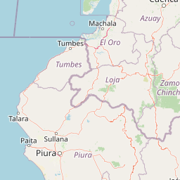
Yacurí National Park landscape and geographic character

The landscape of Yacurí National Park is defined by its volcanic origins and high-altitude setting within the southern Ecuadorian Andes. The terrain is dominated by ancient volcanic edifices, many of which now contain crater lakes formed in their collapsed calderas. The park's elevation range spans from approximately 2,200 meters in the lower valleys to around 3,600 meters at the highest peaks, creating a dramatic backdrop of ridges, cirques, and U-shaped glacial valleys. The park contains over 46 high-altitude lakes, with Laguna Yacurí being the largest and Laguna Negra among the most visited due to its cultural significance. The landscape transitions from steep forested slopes in the lower elevations to open páramo grasslands at higher altitudes, with frequent mist and cloud cover particularly in the cloud forest zones.

Yacurí National Park ecosystems, habitats, and plant life

Yacurí National Park protects a remarkable diversity of Andean ecosystems, with four principal habitat types accounting for the vast majority of its area. Southern Andean Shrub Páramo covers 42.6 percent of the park, representing the unique alpine grassland ecosystem found at high elevations in the northern Andes. Eastern Andean Upper Montane Evergreen Forest accounts for 22 percent of the area, providing habitat for numerous species adapted to the cool, humid conditions of the lower slopes. Southern Andean Dry Montane Shrubland covers 15.1 percent of the park, representing the more xeric conditions found on the western-facing slopes, while Eastern Andean Cloud Forest occupies 14 percent of the area. The park supports 280 documented plant species, of which 32 are endemic to the park alone, demonstrating its exceptional conservation significance at the species level.

Yacurí National Park wildlife and species highlights

The fauna of Yacurí National Park includes 18 mammal species, five of which are considered endangered and face significant conservation threats. The park provides critical habitat for the mountain tapir, the smallest of the world's four tapir species and one that is endemic to the northern Andes, as well as the spectacled bear, the only bear species native to South America. The cougar, also present in the park, represents an apex predator essential for maintaining ecological balance in these highland ecosystems. Bird diversity is particularly notable, with 111 species recorded within the park including four endangered species. The park also supports 11 amphibian species, with four classified as endangered, reflecting the global amphibian crisis that has particularly impacted Andean cloud forest and páramo habitats.

Yacurí National Park conservation status and protection priorities

Yacurí National Park plays a vital role in conserving the biodiversity and watersheds of Ecuador's southern Andes. The park's designation as an IUCN Category II protected area reflects its primary mandate of preserving natural ecosystems while allowing for limited sustainable use. The protection of the headwaters for both the Chinchipe-Mayo and Catamayo-Chira river basins provides immense value beyond the park's boundaries, as these waters support downstream communities and agricultural lands in both Ecuador and Peru. The presence of 32 endemic plant species and numerous endangered mammals, birds, and amphibians underscores the park's importance as a biodiversity reservoir. The park is part of a larger 733-square-kilometer protected forest matrix that enhances connectivity and ecological resilience across the regional landscape.

Yacurí National Park cultural meaning and human context

Yacurí National Park holds significant cultural value beyond its ecological importance, particularly through its association with the ancient Inca civilization. Portions of the famed Inca Trail network pass through the park, providing tangible evidence of the strategic importance these highland routes held for pre-Columbian travel and trade. Archaeological features within the park include petroglyphs, ancient plazas, and cemetery sites that speak to the long human presence in this landscape. The park also maintains living cultural traditions, as Laguna Negra continues to be visited by traditional medicine practitioners who value the lake's waters for their perceived healing properties. This blend of archaeological heritage and ongoing traditional practices gives the park a cultural depth that enhances its overall significance.

Top sights and standout views in Yacurí National Park

Yacurí National Park combines exceptional natural beauty with cultural and ecological significance in a compact highland wilderness. The park's over 46 high-altitude lakes represent one of the densest concentrations of Andean lake systems in Ecuador, with Laguna Negra offering a particularly evocative experience as a deep crater lake with traditional medicinal significance. The Inca Trail corridor passing through the park provides a rare opportunity to experience pre-Columbian heritage within a protected wilderness setting. The park's biodiversity, including endangered species like the mountain tapir and spectacled bear, demonstrates the conservation value of these Andean ecosystems. The dual watershed function, supplying both the Chinchipe-Mayo and Catamayo-Chira basins, underscores the park's importance to regional water security.

Best time to visit Yacurí National Park

The optimal time to visit Yacurí National Park depends on the experience sought, with the dry season from June to September generally offering the most stable conditions for hiking and lake viewing. During these months, clearer skies provide better visibility of the surrounding volcanic peaks and the park's lake systems are more accessible along established trails. The wet season from October to May brings higher precipitation and more frequent fog, particularly in the cloud forest zones, but also results in lusher vegetation and fuller water levels in the park's lakes. Visitors interested in traditional cultural practices at Laguna Negra may find that the dry season allows for more reliable access to the site, though the lake can be visited year-round.

Park location guide

Geography guide, regional context, and park location map for Yacurí National Park

Yacurí National Park park geography, regions, and map view in Ecuador
Understand where Yacurí National Park sits in Ecuador through a broader geographic reading of the surrounding landscape, nearby location context, and its mapped position within the national park landscape.

How Yacurí National Park fits into Ecuador

Ecuador is a presidential republic located in northwestern South America, with Quito as its capital and Guayaquil as its largest city. The country spans 283,561 km² and encompasses the Galápagos Islands, a volcanic archipelago famous for unique wildlife that helped shape Darwin's theory of evolution. Ecuador is a plurinational state with Spanish as the official language, though Kichwa and Shuar are recognized for indigenous peoples.

Wider geography shaping Yacurí National Park in Ecuador

Ecuador is located in northwestern South America along the Pacific coast. It shares borders with Colombia to the north and Peru to the east and south. The country includes the Galápagos Islands, a volcanic archipelago in the Pacific Ocean approximately 1,000 km west of the mainland. The territory encompasses diverse terrain including the Amazon rainforest in the east, the Andean highlands in the center, and coastal plains along the Pacific.

Map view of Yacurí National Park

Use this park location map to pinpoint Yacurí National Park in Ecuador, understand its exact geographic position, and read its mapped placement within the surrounding landscape more clearly.

Pigeon | © OpenStreetMap contributors

Location context for Yacurí National Park

Loja ProvinceZamora Chinchipe
Park atlas

Trace the Mapped Geography of Other Andean Protected Areas and Connected Conservation Landscapes Surrounding Yacurí National Park

Compare National Parks and Protected Areas Near Yacurí National Park: Explore Surrounding Andean Landscapes
Browse additional national parks and protected areas that share similar high-altitude Andean lakes, volcanic terrain, or páramo ecosystems, extending your exploration beyond Yacurí National Park. Compare their distinct conservation landscapes and trace the geographic distribution of protected zones across southern Ecuador's diverse mountain systems, revealing broader regional park context.
National parkEcuador

Podocarpus National Park: Ecuador's Diverse National Park and Protected Landscape

Discover elfin forests, paramo, and over 100 lagoons.

Podocarpus National Park, situated in southeastern Ecuador, stands as a prime example of a protected natural area at a unique biogeographic crossroads. This national park spans dramatic elevational zones, from montane rain forests to high-elevation paramo ecosystems dotted with more than 100 lagoons, offering rich mapped landscape exploration. Its significance lies in the convergence of four distinct ecological systems, contributing to exceptional biodiversity and a rich tapestry of natural terrain.

Area
1,462.8 km²
Established
1982
IUCN
II
National parkPeru

Cerros de Amotape National Park: Peru's Protected Pacific Tropical Forest Atlas

Explore mapped boundaries and diverse terrain of this unique landscape.

Cerros de Amotape National Park stands as a significant protected area within Peru, meticulously preserving remnants of the Tumbes-Piura dry forests and Pacific tropical forests. Situated within the Cordillera de los Amotapes, the park features a dynamic landscape from riverine habitats to elevated mountain terrain. This park detail page offers an atlas-style view, focusing on its geographic context, mapped protected boundaries, and its importance as a conservation corridor for unique biodiversity.

Area
1,515.61 km²
Established
1975
IUCN
II
National parkCajamarca Region

Cutervo National Park: Peru's Oldest National Park Atlas and Protected Landscape

Andean Montane Forests and Mapped Geography of a Pioneering Protected Area

As Peru's oldest national park, established in 1961, Cutervo National Park offers a unique glimpse into the protected geography of the northern Peruvian Andes. Located in the Cajamarca Region, it preserves diverse Andean montane forests and páramo grasslands across a significant elevation gradient from 1,550 to 3,500 meters. This page details the park's landscape, including its role as a headwater conservation area and its position within a critical South American ecoregion, providing rich context for geographic and protected-area exploration.

Area
82.14 km²
Established
1961
IUCN
II
National parkEcuador

Sumaco Napo-Galeras National Park: Ecuador's Volcanic National Park Landscape

Explore protected areas and biodiversity in the Andean-Amazon transition.

Sumaco Napo-Galeras National Park protects a dramatic volcanic landscape in Ecuador, showcasing a significant elevation gradient that supports diverse cloud forest and Amazonian rainforest habitats. This national park is recognized for its endemic species and rich avifauna, offering a compelling case study for understanding protected land geography and ecological transitions within South America.

Area
2,067.49 km²
Established
1994
IUCN
II
National parkPeru

Sierra del Divisor National Park: Peru's Sacred Amazonian Protected Landmark

Explore dramatic mountain terrain and protected lowland rainforest.

Sierra del Divisor National Park in Peru is a vital protected area conserving over 1.35 million hectares of Amazon rainforest. Characterized by the unique Sierra del Divisor mountain range and the sacred pyramid peak of Cerro El Cono, the park offers a distinct landscape within the broader Amazon basin. As one of Peru's newer national parks, it represents a significant commitment to preserving critical biodiversity corridors and understanding the geographic context of protected lands in a region facing environmental pressures.

Area
13,544.8 km²
Established
2015
IUCN
II
National parkPeru

Güeppi-Sekime National Park: Protected National Park Atlas in Peru

Mapped landscape and regional geography of this Amazonian protected area.

Güeppi-Sekime National Park is a prominent protected area in Peru, recognized as a national park safeguarding a substantial expanse of tropical forest. Its landscape is characterized by diverse terrain, including rolling hills and seasonally inundated lowlands, vital for a rich tapestry of flora and fauna. The park's strategic location on the Ecuador border underscores its importance for transboundary conservation and ecological connectivity within the western Amazon basin. This page offers detailed information on its protected area identity, geographic context, and the mapped natural features that define this significant conservation landscape.

Area
2,036 km²
Established
2012
IUCN
II
Protected areaNariño

La Corota Island Flora Sanctuary: A Unique Protected Area within Colombia's Nariño Region

Explore its Andean cloud forest landscape and mapped island geography.

La Corota Island Flora Sanctuary is a critical protected area in Nariño, Colombia, celebrated for its distinctive status as the country's only lake island ecosystem supporting old-growth Andean cloud forest. This compact sanctuary provides a unique landscape context, safeguarding endemic plant species and diverse birdlife within its mapped boundaries. Its presence within Laguna de la Cocha highlights a special convergence of wetland and forest geography, offering insights for atlas exploration of protected lands.

Area
0.152 km²
Established
1977
IUCN
II
National parkPasco Region

Yanachaga, Chemillén National Park: Protected Area in Pasco Region, Peru

Mapped terrain, Pleistocene refuge, and rich biodiversity.

Yanachaga, Chemillén National Park, a national park situated in Peru's Pasco Region, preserves over 122,000 hectares of mountainous cloud forest and rainforest ecosystems. Its landscape is characterized by dramatic canyons and steep forested slopes, creating significant altitudinal variation from 460 to 3,643 meters. Recognized as a Pleistocene refuge, the park shelters ancient forest remnants and harbors exceptional biodiversity, including hundreds of bird species and iconic mammals, offering rich context for geographic and protected-area exploration.

Area
1,220 km²
Established
1986
IUCN
II

Common questions about visiting, size, designation, and location context for Yacurí National Park

Yacurí National Park FAQs for park facts, access, geography, and protected area context
Find quick answers about Yacurí National Park, including protected-area facts, park geography, trail and visitor context, and how the park fits into its surrounding country and regional landscape.
MoriAtlas Explorer

Continue Your Protected Areas Search Across the Global Atlas

Deepen your exploration by continuing the structured search for national parks and protected areas worldwide. Utilize the comprehensive filtering capabilities to compare different conservation landscapes and refine your understanding of global park geography. Discover more about the distribution and characteristics of protected natural areas.

Global natural geography