Mori Atlas logo
National parkBernardo O'Higgins National Park

Discover the vast mapped terrain of Chile's largest national park in Aysén.

Bernardo O'Higgins National Park: Glacial Landscapes & Protected Area Atlas

Bernardo O'Higgins National Park represents a monumental protected landscape in southern Chile, covering over 3.5 million hectares of unparalleled natural beauty. As the nation's largest national park, it encompasses a significant portion of the Southern Patagonian Ice Field, featuring the immense Pío XI Glacier and dramatic granite spires like Mount Fitz Roy. This page offers an atlas-driven exploration of its remote geography, glacial terrain, and vital role in preserving unique Patagonian wilderness.

Glacial landscapesPatagonian AndesSouthern Patagonian Ice FieldMountain climbingWilderness protectionChilean huemul habitat

Bernardo O'Higgins National Park

National park

Park overview

Structured park overview, official facts, and landscape profile for Bernardo O'Higgins National Park

Bernardo O'Higgins National Park park facts, protected area profile, and essential visitor context
Review the core facts for Bernardo O'Higgins National Park, including designation, size, terrain, visitor scale, habitats, and operating context in one park-focused overview.

About Bernardo O'Higgins National Park

Bernardo O'Higgins National Park represents one of the most remote and undeveloped protected areas in Chile. Its territory stretches across a landscape of dramatic contrast, from towering volcanic peaks and extensive ice fields to deep fjords that carve into the mountainous terrain. The eastern-central portion of the park contains an area subject to territorial dispute between Chile and Argentina, reflecting the complex cartographic history of the Patagonian frontier. The park shares boundaries with Argentina's Los Glaciares National Park to the east, while Torres del Paine National Park lies adjacent to the southeast. To the north sits Laguna San Rafael National Park, the Alacalufes National Reserve occupies the southwest, and the Katalalixar National Reserve lies to the northwest. This positioning places the park at the heart of a vast contiguous protected landscape spanning the Patagonian Andes. The park's management by CONAF ensures protection of its extraordinary natural values while maintaining its wild character, with tourism infrastructure remaining minimal due to the extreme remoteness of the region.

Quick facts and research context for Bernardo O'Higgins National Park

Bernardo O'Higgins National Park covers 3,525,901 hectares, making it Chile's largest protected area. It was established on July 22, 1969, and is managed by the Corporación Nacional Forestal (CONAF). The park spans both the Aysén and Magallanes regions of Chile, running approximately between 48° and 51° 38' South latitude. The highest peak within the park is Lautaro volcano at 3,607 meters, while other notable summits include Mount Fitz Roy and Cerro Torre. The park contains the Pío XI Glacier, the largest glacier in the southern hemisphere outside of Antarctica.

Park context

Deeper park guide and search-rich context for Bernardo O'Higgins National Park

Bernardo O'Higgins National Park history, landscape, wildlife, and travel context
Explore Bernardo O'Higgins National Park through its history, landscape character, ecosystems, wildlife, conservation priorities, cultural context, and seasonal travel timing in a structured park guide built for atlas discovery and search intent.

Why Bernardo O'Higgins National Park stands out

Bernardo O'Higgins National Park is best known for its extraordinary glacial and mountain landscapes. The park protects the greater part of the Southern Patagonian Ice Field, and the Pío XI Glacier stands as the largest glacier in the southern hemisphere outside Antarctica, a massive wall of ice that periodically calves enormous blocks into the waters below. The iconic peaks of Mount Fitz Roy and Cerro Torre, with their striking granite spires, rank among the most recognized mountains in the world among climbing and photography enthusiasts. The park also holds significance as one of the last refuges for the Chilean huemul, a threatened deer species that is national heritage.

Bernardo O'Higgins National Park history and protected-area timeline

The earliest known occupants of the Bernardo O'Higgins region were the Alacaluf people, an indigenous group who inhabited the coastal areas and islands of southern Patagonia for centuries before European contact. In 1830, Captain Phillip Parker King aboard HMS Beagle visited the Eyre Fjord, becoming one of the first European explorers to document this remote coastline. The park was officially established on July 22, 1969, recognizing the exceptional natural value of the Patagonian landscape it encompasses. In June 2007, scientists documented a remarkable event when a glacial lake within the park disappeared entirely between March and May of that year, leaving behind a 100-foot-deep crater with only remnant ice blocks on the crater floor. This event was attributed to climate change, illustrating the ongoing transformation of Patagonian glacial systems. In 2014, Chile's National Forestry Corporation created two significant subdivisional natural sites within the park: the Chaltén Mountain Range Natural Site covering the Chilean side of Mount Fitz Roy, and the Pío XI Glacier Natural Site, recognizing their exceptional natural significance.

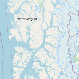
Bernardo O'Higgins National Park landscape and geographic character

The landscape of Bernardo O'Higgins National Park is defined by the Southern Patagonian Ice Field, one of the world's major ice caps, which dominates the park's high-country with vast fields of white and blue ice. The highest summit is Lautaro volcano at 3,607 meters, a prominent peak that rises above the ice field. The northern section of the park features the world-renowned peaks of Mount Fitz Roy and Cerro Torre, whose jagged granite spires create one of the most iconic mountain silhouettes on Earth. The Circo de los Altares and Cerro Riso Patrón add to the dramatic high terrain. In the southern portion of the park, elevations are lower but the scenery remains spectacular, with Mount Balmaceda rising to 2,035 meters and being beautified by the glaciers that descend from its slopes. The narrow fjords penetrate deeply into the mountains, bringing away the drainage from these ice-capped, storm-swept elevations. The coast lacks large rivers, but the intricate fjord system creates a complex waterfront of immense natural beauty.

Bernardo O'Higgins National Park ecosystems, habitats, and plant life

The park falls within the Magellanic subpolar forests ecoregion, one of the world's most distinctive forest ecosystems. The forests are composed of several characteristic tree species including Nothofagus betuloides, commonly known as Antarctic beech or coigue, Nothofagus pumilio known as lenga, Nothofagus antarctica called ñire, and Drimys winteri, the Winter's bark or canelo. These southern beech forests create a remarkable ecological environment adapted to the cool, wet conditions of the Patagonian Andes. The transition between forest and ice creates a dramatic ecological boundary, where vegetation gives way to the stark grandeur of glacial environments. The park's position at the southern limit of the continent creates unique ecological conditions that support species found nowhere else on Earth.

Bernardo O'Higgins National Park wildlife and species highlights

Bernardo O'Higgins National Park provides crucial habitat for several species of conservation significance. The park is one of the last remaining refuges for the Chilean huemul, a species of deer that has been classified as endangered and represents a symbol of Chilean natural heritage. The Andean condor, one of the largest flying birds in the world, can be found soaring on the thermal currents above the mountain peaks. The marine otter, also known as the sea cat, inhabits the coastal waters and fjord systems, while various cormorant species nest along the rocky shores. This assembly of species reflects the park's role as a sanctuary for Patagonian wildlife in one of the most ecologically significant regions of South America.

Bernardo O'Higgins National Park conservation status and protection priorities

As Chile's largest protected area, Bernardo O'Higgins National Park plays a fundamental role in conserving one of the planet's last great wilderness areas. The protection of the Southern Patagonian Ice Field ensures the preservation of critical freshwater resources and maintains natural processes that have shaped Patagonian landscapes for millennia. The park's designation as an IUCN Category II protected area reflects its primary conservation mandate. The creation of the Chaltén Mountain Range Natural Site and Pío XI Glacier Natural Site in 2014 demonstrates ongoing recognition of the park's exceptional natural values. Conservation efforts focus on protecting the Chilean huemul population and maintaining the ecological integrity of the Magellanic subpolar forests. The park also serves as a buffer against logging and development pressures that have affected much of Chile's forestland.

Bernardo O'Higgins National Park cultural meaning and human context

The Alacaluf people, also known as the Alacalufe, were the earliest human inhabitants of the Bernardo O'Higgins region. This indigenous group traditionally lived in the coastal areas and islands of southern Patagonia, maintaining a maritime-based culture that depended on the rich marine resources of the fjords and channels. European exploration began in the early nineteenth century with Captain Phillip Parker King's voyage aboard HMS Beagle in 1830, documenting the region's geography and beginning the process of mapping this remote frontier. The park's naming after Bernardo O'Higgins connects the landscape to Chile's founding history, recognizing the first head of state's role in establishing the independent Republic of Chile.

Top sights and standout views in Bernardo O'Higgins National Park

The Pío XI Glacier stands as the park's most spectacular feature, the largest glacier in the southern hemisphere outside Antarctica, with an ice face approximately 75 meters in height that regularly calves massive ice blocks into the waters below. Mount Fitz Roy and Cerro Torre represent the crown jewels of Patagonian mountaineering, their granite spires attracting climbers and photographers from around the world. The Southern Patagonian Ice Field, extending across much of the park's high country, ranks among Earth's great ice caps and provides a dramatic backdrop to all other features. The park's extreme remoteness ensures a wilderness experience unmatched in South America, accessible only by boat or helicopter.

Best time to visit Bernardo O'Higgins National Park

The optimal time to visit Bernardo O'Higgins National Park corresponds to the Patagonian summer months from November through March, when temperatures are milder and daylight hours are longest. During this period, visitor access is most feasible as conditions allow for travel by boat through the fjord systems. The winter months bring harsh conditions with heavy precipitation, limited daylight, and reduced access options that make visits extremely challenging. Weather in Patagonia is notoriously unpredictable, with rapid changes between sunshine, wind, rain, and even snow possible within a single day regardless of season. The summer season offers the best opportunity to experience the glaciers, mountains, and forest environments that define this remarkable protected landscape.

Park location guide

Geography guide, regional context, and park location map for Bernardo O'Higgins National Park

Bernardo O'Higgins National Park park geography, regions, and map view in Chile
Understand where Bernardo O'Higgins National Park sits in Chile through a broader geographic reading of the surrounding landscape, nearby location context, and its mapped position within the national park landscape.

How Bernardo O'Higgins National Park fits into Chile

Chile is a presidential republic in western South America, extending as a narrow strip along the western edge of the continent between the Andes Mountains and the Pacific Ocean. It is the southernmost country in the world and the closest to Antarctica. The country is bordered by Peru, Bolivia, and Argentina, and administers several Pacific islands including Easter Island. Chile is a major copper producer and has a population of approximately 19.6 million.

Wider geography shaping Bernardo O'Higgins National Park in Chile

Chile occupies a narrow strip of land along the western edge of South America, extending approximately 4,300 km north to south but only about 350 km east to west at its widest point. The country is sandwiched between the Andes Mountains to the east and the Pacific Ocean to the west. It shares borders with Peru to the north, Bolivia to the northeast, and Argentina to the east. Southern Chile borders the Drake Passage. Chile also administers several Pacific islands including Juan Fernández Islands, Isla Salas y Gómez, Desventuradas Islands, and Easter Island, plus the Chilean Antarctic Territory.

Map view of Bernardo O'Higgins National Park

Use this park location map to pinpoint Bernardo O'Higgins National Park in Chile, understand its exact geographic position, and read its mapped placement within the surrounding landscape more clearly.

Pigeon | © OpenStreetMap contributors

Location context for Bernardo O'Higgins National Park

Aysén del General Carlos Ibáñez del Campo RegionMagallanes and Chilean Antarctica Region
Park atlas

Map the regional spread of national parks and conserved wilderness areas adjacent to this vast Patagonian territory.

Bernardo O'Higgins National Park: Compare Nearby Protected Areas and Patagonian Landscapes
From Bernardo O'Higgins National Park, browse other protected areas, national parks, and key conservation landscapes that share its extreme Patagonian geography and glacial environment. This curated selection allows for direct comparison of their unique wilderness characteristics, mapped terrain features, and regional protected-area significance.
National parkSanta Cruz Province

Perito Moreno National Park: Mapped Protected Landscape and Geographic Context in Santa Cruz Province

Explore Argentinian Patagonian mountain terrain and its ecological transition.

Perito Moreno National Park is a vast protected area in Argentina's Santa Cruz Province, known for its dramatic Patagonian mountain landscapes and unique ecological transition zone between wet Magellanic forests and dry Andean steppe. Spanning over 126,830 hectares, the park's geography features an amphitheater-like structure with valleys radiating from central highlands, and peaks reaching nearly 2,800 meters. This national park provides critical insight into the regional natural landscapes and mapped protected areas of Patagonia, offering a detailed view of its terrain and hydrographic features.

Area
1,268.3 km²
Established
1937
IUCN
II
National parkSanta Cruz Province

Monte León National Park: A Protected Coastal Landscape in Argentina's Santa Cruz Province

Explore unique sandstone formations and marine park geography.

Monte León National Park represents a crucial protected landscape, safeguarding a significant stretch of the Patagonian coastline in Argentina's Santa Cruz Province. This area is defined by striking sandstone cliffs, the iconic Lion Head Mount formation, and a dynamic coast with beaches and emergent sandbars. As the nation's first continental marine park, it offers a unique geographic context for understanding steppe and coastal biodiversity, providing an essential atlas entry for those exploring Argentina's natural heritage.

Area
621.68 km²
Established
2004
IUCN
II
National parkAysén del General Carlos Ibáñez del Campo Region

Cerro Castillo National Park: Dramatic Granite Peaks and Patagonian Protected Landscape

Mapped geography and huemul conservation in Chile's Aysén Region.

Cerro Castillo National Park is a premier protected area in southern Chile, celebrated for its iconic Cerro Castillo granite mountain that dominates the landscape. This national park, spanning over 1,700 square kilometers in the Aysén del General Carlos Ibáñez del Campo Region, showcases a dynamic Patagonian terrain shaped by glaciers and rivers. Its significance extends to being a vital corridor for endangered huemul, offering critical habitat within a broader regional conservation strategy and the famous Route of Parks.

Area
1,795.5 km²
Established
1970
IUCN
II
National parkMagallanes Region

Alberto de Agostini National Park: Glacial Landscapes and Cordillera Darwin Geography

Explore a protected national park in Chile's Magallanes Region.

Alberto de Agostini National Park is a significant protected area within the Magallanes Region, defined by the dramatic southern extent of the Andes, including the iconic Cordillera Darwin. This national park is characterized by extensive tidewater glaciers, deep fjords, and unique subpolar forests, offering a profound example of glacial landscape formation. Understanding its geographic setting and mapped boundaries provides critical context for exploring this remote Patagonian wilderness and its ecological significance.

Area
14,600 km²
Established
1965
IUCN
II
National parkAysén del General Carlos Ibáñez del Campo Region

Queulat National Park: Patagonian Andes Glacier and Rainforest Discovery

Mapped protected area in Aysén del General Carlos Ibáñez del Campo Region.

Queulat National Park is a vast protected wilderness in southern Chile, renowned for its dramatic glacial alpine terrain and lush temperate rainforests. The park's geography is defined by steep glacial valleys, ice fields, and the iconic Queulat Hanging Glacier cascading from sheer cliffs. Discover the mapped boundaries of this significant Patagonian national park, offering unparalleled insight into its unique ecosystems and dramatic landscapes shaped by ice and forest.

Area
1,541 km²
Established
1983
IUCN
II
Relief
Mountain
National parkTierra del Fuego Province

Tierra del Fuego National Park: Argentina's Southernmost Protected Landscape and Geography

Subantarctic terrain, glacial valleys, and coastal Patagonian forest.

Tierra del Fuego National Park is a significant protected area at the southern tip of South America, celebrated for its unique subantarctic landscapes. This national park showcases the dramatic intersection of Patagonian forests and Andean terrain, with its mapped boundaries extending along the rugged coastline of the Beagle Channel. Users can explore the park's geographic features, understanding its role within the broader atlas of protected lands and its distinct natural heritage in Tierra del Fuego Province. Discover the park's terrain, from ancient beech forests to glacial valleys, and its ecological significance.

Area
630 km²
Established
1960
IUCN
II
Relief
Mountain
National parkArgentina

Los Alerces National Park: Ancient Alerce Forests and Glacial Terrain in Argentina

Discover the park's protected landscape and regional geography.

Los Alerces National Park in Argentina is a globally significant protected area, celebrated for its ancient alerce forests, some of the longest-living trees on Earth. This national park showcases a dramatic landscape shaped by glaciers, featuring a series of interconnected lakes and rugged Andean terrain. Explore the unique ecosystem and mapped geography of this UNESCO World Heritage site to understand its profound natural and conservation value.

Area
2,599 km²
Established
1937
IUCN
II
National parkNeuquén Province

Los Arrayanes National Park: Neuquén Province's Protected Arrayán Forest Atlas

Explore the ancient arrayán forest and mapped terrain.

Los Arrayanes National Park, nestled in Neuquén Province, is celebrated for its exceptional arrayán forest, one of the world's most concentrated stands of Luma apiculata. This protected area showcases a unique landscape where ancient, gnarled trees with striking cinnamon bark thrive on the Quetrihué Peninsula, overlooking Nahuel Huapi Lake. Its protected status ensures the preservation of this botanical marvel, offering a distinct geographical and ecological profile within the Patagonian region.

Area
17.53 km²
Established
1971
IUCN
II

Common questions about visiting, size, designation, and location context for Bernardo O'Higgins National Park

Bernardo O'Higgins National Park FAQs for park facts, access, geography, and protected area context
Find quick answers about Bernardo O'Higgins National Park, including protected-area facts, park geography, trail and visitor context, and how the park fits into its surrounding country and regional landscape.
MoriAtlas Explorer

Continue Your Protected Areas Search Across the Global Atlas

Deepen your exploration by continuing the structured search for national parks and protected areas worldwide. Utilize the comprehensive filtering capabilities to compare different conservation landscapes and refine your understanding of global park geography. Discover more about the distribution and characteristics of protected natural areas.

Global natural geography