Mori Atlas logo
National parkMonte León National Park

Discover the mapped boundaries and unique natural formations of this Patagonian coastal gem.

Monte León National Park: Protected Landscape and Coastal Geography in Santa Cruz Province

(Parque Nacional Monte León)

Monte León National Park, situated in Argentina's Santa Cruz Province, stands as a vital protected area renowned for its conservation of the Patagonian steppe and coastal ecosystems. This page offers an in-depth look at the park's geography, from its dramatic sandstone cliffs and unique rock formations along the Argentine Sea to its expansive beaches and tidal sandbars. As Argentina's first continental marine park, it safeguards a significant portion of the coastline and its rich biodiversity, providing a unique atlas-style perspective on this remarkable landscape.

PatagoniaCoastal ParkMarine ParkPenguin ColoniesSandstone CliffsGuanacos

Monte León National Park

National park

Park overview

Structured park overview, official facts, and landscape profile for Monte León National Park

Monte León National Park park facts, protected area profile, and essential visitor context
Review the core facts for Monte León National Park, including designation, size, terrain, visitor scale, habitats, and operating context in one park-focused overview.

About Monte León National Park

Monte León National Park occupies a distinctive position in Patagonia's protected area network as both a coastal and steppe ecosystem protector. The park's landscape is dominated by impressive sandstone cliffs that rise above wide, sandy beaches, with narrow bays and exposed sandbars creating a dynamic coastal environment. Inland, the Patagonian steppe extends across the grassland areas where guanaco herds roam. The park represents approximately 1% of Argentina's total mainland coastline, making it a significant conservation area despite its relatively compact marine interface. The combination of terrestrial and marine protected status creates a holistic conservation approach that protects the entire coastal ecosystem from the cliffs to the sea. The park's establishment in 2004 marked a milestone in Argentine conservation history as the country's first continental marine park, demonstrating a commitment to protecting not just terrestrial habitats but the adjacent marine environments that support so much of the region's biodiversity.

Quick facts and research context for Monte León National Park

Monte León National Park covers 62,168 hectares along the Patagonian coast in Santa Cruz Province, Argentina. The park features a cold arid to semi-arid climate with a mean annual temperature of 6.8°C and receives approximately 250mm of rainfall per year, concentrated in fall and winter. The landscape is characterized by towering sandstone cliffs, the prominent Monte Cabeza de León (Lion Head Mount) formation, and extensive beach systems. The park holds Argentina's fourth-largest Magellanic penguin colony with approximately 60,000 individuals and is notable as the only place in the world where pumas feed on penguins. Created in 2004 through a conservation partnership involving the Tompkins Conservation organization, it represents a successful example of private land donation for protected area establishment.

Park context

Deeper park guide and search-rich context for Monte León National Park

Monte León National Park history, landscape, wildlife, and travel context
Explore Monte León National Park through its history, landscape character, ecosystems, wildlife, conservation priorities, cultural context, and seasonal travel timing in a structured park guide built for atlas discovery and search intent.

Why Monte León National Park stands out

Monte León is best known for its remarkable coastal wildlife spectacle, particularly the large Magellanic penguin colonies that dominate the shoreline. The park's most unusual ecological feature is the presence of pumas that actively hunt and feed on penguins, making it the only place in the world where this behavior has been documented. The dramatic sandstone cliff formations, especially the Lion Head Mount (Monte Cabeza de León) that gives the park its name, create a striking visual landmark along the Patagonian coast. As Argentina's first continental marine park, it protects a critical segment of the Patagonian coastline and its associated marine biodiversity, including sea lion colonies, southern right whales, and diverse seabird populations.

Monte León National Park history and protected-area timeline

The Monte León area has a rich human history stretching back 10,000 to 13,000 years, when hunter-gatherer groups utilized the varied coastal environment abundant with food resources. The Tehuelche people, descendants of these first settlers, developed extensive land use practices and established trade relationships with distant groups. European arrival in the 1870s brought significant changes, including guano extraction operations starting in 1876 that became profitable until 1930. The area became the subject of international tension when Chilean forces seized vessels in the region, nearly triggering war between Argentina and Chile. Naturalist Francisco P. Moreno, founder of the Argentine National Park System, and paleontologist Carlos Ameghino explored the area in the late 19th century, while Italian missionary Alberto María De Agostini visited in the early 20th century. The Estancia Monte León operated as a sheep farm under the Southern Patagonia Sheep Farming Company Limited until 1920, when it was sold to the Braun family who continued the operation until 2006. In 1996, the property was proposed for inclusion in Argentina's national park system, leading to acquisition in 2000 through Conservación Patagónica, an NGO founded by Kristine Tompkins. After transfer to Fundación Vida Silvestre Argentina in 2002, the land was donated to the National Parks Administration, culminating in the park's creation on October 20, 2004.

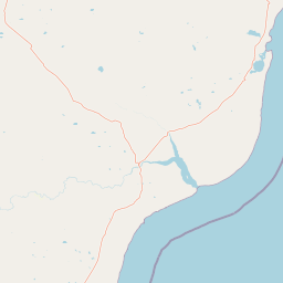
Monte León National Park landscape and geographic character

Monte León's landscape is defined by its dramatic coastal geology, featuring high sandstone cliffs that create a spectacular backdrop to the Patagonian Sea. The most prominent formation is Monte Cabeza de León (Lion Head Mount), the distinctive rock formation after which the park is named. The coastline alternates between wide, sandy beaches and narrow bays, with extensive sandbars that are revealed during low tide. Behind the coastal cliffs, the terrain transitions into the Patagonian steppe, a vast grassland ecosystem characterized by its sparse vegetation and wind-swept character. The park's coastal sector represents about 1% of the entire Argentine mainland shoreline, making it a significant representative of the country's coastal landscapes. Rock formations scattered throughout the area add visual interest and provide habitat for various bird species.

Monte León National Park ecosystems, habitats, and plant life

The Patagonian steppe at Monte León, while appearing barren at first glance, supports a surprising variety of plant species adapted to the harsh desert-like conditions. Pioneer botanist Carlos Spegazzini identified several previously unknown grass species during an 1880 scientific expedition financed by Italy. The park's flora includes calafate, whose resin was traditionally used as chewing gum by indigenous peoples, and wild thyme that remains popular in local cuisine. Several plant species in the park have documented medicinal uses. The harsh winter conditions give way to spectacular wildflower blooms when conditions improve, adding unexpected color to the steppe landscape. The coastal and marine environments support approximately twenty bird species, while the cold offshore waters harbor large populations of fish, creating a rich marine food web.

Monte León National Park wildlife and species highlights

Monte León hosts an extraordinary concentration of wildlife, particularly seabirds and marine mammals. The park contains Argentina's fourth-largest Magellanic penguin colony, with approximately 60,000 individuals forming large breeding colonies along the coast. Three cormorant species inhabit the area: the red-legged cormorant, rock shag, and imperial shag. Large flightless rheas known as ñandús roam the steppe areas. Marine mammals include populous sea lion colonies and southern right whales that visit the coastal waters. The terrestrial mammal community features roaming guanaco herds and pumas, with the park holding the unique distinction of being the only place in the world where pumas have been documented feeding on penguins, likely due to the accessibility of the penguin colonies and the absence of other prey options in this harsh environment.

Monte León National Park conservation status and protection priorities

Monte León represents a landmark in Argentine conservation as the country's first continental marine park, demonstrating a holistic approach to protecting both terrestrial and marine ecosystems. The park was established to preserve a representative sample of Patagonian steppe and coastal biodiversity in good conservation status. Its creation involved an innovative public-private partnership, with land acquired through Conservación Patagónica and ultimately transferred to the Argentine National Parks Administration. The protected area safeguards critical habitat for threatened species including southern right whales and helps maintain the ecological processes that support the remarkable penguin and seabird colonies. The park also preserves several paleontological sites of high scientific value, adding an additional conservation dimension beyond the living biodiversity.

Monte León National Park cultural meaning and human context

The Monte León region has been inhabited by humans for over 10,000 years, with the Tehuelche people being the most recent indigenous group to occupy the area before European settlement. The Tehuelche developed sophisticated hunting and gathering practices that utilized the rich coastal resources, and their traditional uses of local plants, such as calafate resin as chewing gum, have been documented by historical chroniclers. The arrival of European settlers in the 1870s dramatically altered the region's human landscape, introducing sheep farming that would dominate the economy for over a century. The park's name derives from the prominent Monte Cabeza de León (Lion Head Mount), a distinctive sandstone formation that serves as a visual landmark and gives the area its identity. The region's history includes episodes of international tension between Argentina and Chile over territorial claims and resource extraction rights.

Top sights and standout views in Monte León National Park

The park's most distinctive highlight is the dramatic coastal scenery where towering sandstone cliffs meet the cold waters of the Argentine Sea, with the iconic Lion Head Mount forming the park's signature landmark. The massive Magellanic penguin colonies, with approximately 60,000 breeding birds, create one of Patagonia's most impressive wildlife spectacles and represent the fourth-largest colony in Argentina. The unique predator-prey relationship between pumas and penguins offers a rare glimpse into ecological dynamics not found anywhere else on Earth. As Argentina's first continental marine park, Monte León protects a complete coastal ecosystem from the Patagonian steppe to the marine environment, preserving both terrestrial and oceanic biodiversity. The combination of paleontological significance, indigenous heritage, and modern conservation achievement makes this park particularly noteworthy.

Best time to visit Monte León National Park

Monte León experiences a cold Patagonian climate with mean annual temperatures around 6.8°C, making summer months (December to February) the most comfortable for visitors with temperatures that can occasionally exceed 30°C. However, the park can experience strong winds throughout the year, with gusts reaching up to 100 km/h. The shoulder seasons of spring and fall offer fewer visitors but cooler temperatures, while winter brings temperatures that can drop below freezing. Rainfall is concentrated in the fall and winter months, meaning summer typically offers drier conditions for exploring the coastal trails. Visitors should be prepared for the characteristic Patagonian wind and variable weather regardless of when they visit, and should note that the penguin colonies are most active during the breeding season from September through March.

Park location guide

Geography guide, regional context, and park location map for Monte León National Park

Monte León National Park park geography, regions, and map view in Argentina
Understand where Monte León National Park sits in Argentina through a broader geographic reading of the surrounding landscape, nearby location context, and its mapped position within the national park landscape.

How Monte León National Park fits into Argentina

Argentina is a federal republic located in the southern cone of South America, bordering Chile, Bolivia, Paraguay, Brazil, Uruguay, and the Atlantic Ocean. With an area of 2,780,085 km², it is the second-largest country in South America and the eighth-largest globally. The capital and largest city is Buenos Aires, and the official language is Spanish. The country claims sovereignty over the Falkland Islands, South Georgia and the South Sandwich Islands, and a portion of Antarctica.

Wider geography shaping Monte León National Park in Argentina

Argentina occupies the southern portion of South America, sharing the Southern Cone region with Chile to the west. The country borders Bolivia and Paraguay to the north, Brazil to the northeast, Uruguay and the South Atlantic Ocean to the east, and the Drake Passage to the south. The Andes mountain range runs along the western border, while the Pampas plains dominate the central region. Argentina also claims territories in Antarctica.

Map view of Monte León National Park

Use this park location map to pinpoint Monte León National Park in Argentina, understand its exact geographic position, and read its mapped placement within the surrounding landscape more clearly.

Pigeon | © OpenStreetMap contributors

Location context for Monte León National Park

Santa Cruz Province
Park atlas

Compare protected landscapes across southern Argentina, tracing the geographic spread of coastal and steppe ecosystems adjacent to Monte León National Park.

Discover Other National Parks and Protected Areas Near Monte León National Park in Patagonian Argentina
After exploring Monte León National Park's unique coastal ecosystems, browse other protected areas within Argentina's Patagonian region, including adjacent marine and terrestrial conservation zones. Compare park geography, analyze shared ecological features, and understand the regional distribution of these vital conservation landscapes for comprehensive atlas-style exploration.
National parkAysén del General Carlos Ibáñez del Campo Region

Bernardo O'Higgins National Park: Southern Patagonian Ice Field & Glacial Terrain

Chile's largest protected area: a map of vast ice caps and fjords.

Bernardo O'Higgins National Park is a colossal protected landscape in Chile, safeguarding much of the Southern Patagonian Ice Field and its colossal glacial features like the Pío XI Glacier. Explore the dramatic terrain of towering granite peaks and intricate fjord systems that define this remote national park. This page provides essential context for understanding its geography, mapped boundaries, and significance as a vast wilderness preservation.

Area
35,259 km²
Established
1969
IUCN
II
National parkSanta Cruz Province

Perito Moreno National Park: Mapped Protected Landscape and Geographic Context in Santa Cruz Province

Explore Argentinian Patagonian mountain terrain and its ecological transition.

Perito Moreno National Park is a vast protected area in Argentina's Santa Cruz Province, known for its dramatic Patagonian mountain landscapes and unique ecological transition zone between wet Magellanic forests and dry Andean steppe. Spanning over 126,830 hectares, the park's geography features an amphitheater-like structure with valleys radiating from central highlands, and peaks reaching nearly 2,800 meters. This national park provides critical insight into the regional natural landscapes and mapped protected areas of Patagonia, offering a detailed view of its terrain and hydrographic features.

Area
1,268.3 km²
Established
1937
IUCN
II
National parkMagallanes Region

Alberto de Agostini National Park: Glacial Landscapes and Cordillera Darwin Geography

Explore a protected national park in Chile's Magallanes Region.

Alberto de Agostini National Park is a significant protected area within the Magallanes Region, defined by the dramatic southern extent of the Andes, including the iconic Cordillera Darwin. This national park is characterized by extensive tidewater glaciers, deep fjords, and unique subpolar forests, offering a profound example of glacial landscape formation. Understanding its geographic setting and mapped boundaries provides critical context for exploring this remote Patagonian wilderness and its ecological significance.

Area
14,600 km²
Established
1965
IUCN
II
National parkTierra del Fuego Province

Tierra del Fuego National Park: Argentina's Southernmost Protected Landscape and Geography

Subantarctic terrain, glacial valleys, and coastal Patagonian forest.

Tierra del Fuego National Park is a significant protected area at the southern tip of South America, celebrated for its unique subantarctic landscapes. This national park showcases the dramatic intersection of Patagonian forests and Andean terrain, with its mapped boundaries extending along the rugged coastline of the Beagle Channel. Users can explore the park's geographic features, understanding its role within the broader atlas of protected lands and its distinct natural heritage in Tierra del Fuego Province. Discover the park's terrain, from ancient beech forests to glacial valleys, and its ecological significance.

Area
630 km²
Established
1960
IUCN
II
Relief
Mountain
National parkAysén del General Carlos Ibáñez del Campo Region

Cerro Castillo National Park: Dramatic Granite Peaks and Patagonian Protected Landscape

Mapped geography and huemul conservation in Chile's Aysén Region.

Cerro Castillo National Park is a premier protected area in southern Chile, celebrated for its iconic Cerro Castillo granite mountain that dominates the landscape. This national park, spanning over 1,700 square kilometers in the Aysén del General Carlos Ibáñez del Campo Region, showcases a dynamic Patagonian terrain shaped by glaciers and rivers. Its significance extends to being a vital corridor for endangered huemul, offering critical habitat within a broader regional conservation strategy and the famous Route of Parks.

Area
1,795.5 km²
Established
1970
IUCN
II
National parkAysén del General Carlos Ibáñez del Campo Region

Queulat National Park: Patagonian Andes Glacier and Rainforest Discovery

Mapped protected area in Aysén del General Carlos Ibáñez del Campo Region.

Queulat National Park is a vast protected wilderness in southern Chile, renowned for its dramatic glacial alpine terrain and lush temperate rainforests. The park's geography is defined by steep glacial valleys, ice fields, and the iconic Queulat Hanging Glacier cascading from sheer cliffs. Discover the mapped boundaries of this significant Patagonian national park, offering unparalleled insight into its unique ecosystems and dramatic landscapes shaped by ice and forest.

Area
1,541 km²
Established
1983
IUCN
II
Relief
Mountain
National parkArgentina

Los Alerces National Park: Ancient Alerce Forests and Glacial Terrain in Argentina

Discover the park's protected landscape and regional geography.

Los Alerces National Park in Argentina is a globally significant protected area, celebrated for its ancient alerce forests, some of the longest-living trees on Earth. This national park showcases a dramatic landscape shaped by glaciers, featuring a series of interconnected lakes and rugged Andean terrain. Explore the unique ecosystem and mapped geography of this UNESCO World Heritage site to understand its profound natural and conservation value.

Area
2,599 km²
Established
1937
IUCN
II
National parkRío Negro Province

Islote Lobos National Park: Coastal Archipelago National Park in Río Negro Province

Mapping the dynamic intertidal zones and unique Patagonian marine geography.

Islote Lobos National Park is a notable national park on the Atlantic coast of Río Negro Province, Argentina. This protected area preserves a distinctive landscape of six rocky promontories emerging from San Matías Gulf, creating unique island ecosystems. The park's coastal and marine environments, characterized by significant tidal fluctuations and important habitats for marine fauna, are vital to the Patagonian natural heritage. Its mapped geography offers critical insights into regional conservation efforts.

Area
19.079 km²
Established
2020
IUCN
II

Common questions about visiting, size, designation, and location context for Monte León National Park

Monte León National Park FAQs for park facts, access, geography, and protected area context
Find quick answers about Monte León National Park, including protected-area facts, park geography, trail and visitor context, and how the park fits into its surrounding country and regional landscape.
MoriAtlas Explorer

Continue Your Protected Areas Search Across the Global Atlas

Deepen your exploration by continuing the structured search for national parks and protected areas worldwide. Utilize the comprehensive filtering capabilities to compare different conservation landscapes and refine your understanding of global park geography. Discover more about the distribution and characteristics of protected natural areas.

Global natural geography