Mori Atlas logo
National parkIslote Lobos National Park

Mapping the unique archipelago of rocky promontories along Argentina's Patagonian Atlantic coast.

Islote Lobos National Park: Protected Coastal Landscapes of Río Negro Province

Islote Lobos National Park represents a crucial addition to Argentina's protected lands, safeguarding a distinctive cluster of six rocky promontories that rise from San Matías Gulf. Located in Río Negro Province, this National Park protects vital coastal and marine habitats characterized by dynamic intertidal zones and unique island ecosystems. Its establishment ensures the preservation of this significant Patagonian coastal geography, offering an unparalleled opportunity for atlas-driven discovery of its mapped boundaries and natural landscape.

national parkArgentinaPatagoniacoastal reserveAtlantic coastmarine protected area

Islote Lobos National Park

National park

Park overview

Structured park overview, official facts, and landscape profile for Islote Lobos National Park

Islote Lobos National Park park facts, protected area profile, and essential visitor context
Review the core facts for Islote Lobos National Park, including designation, size, terrain, visitor scale, habitats, and operating context in one park-focused overview.

About Islote Lobos National Park

Islote Lobos National Park occupies a distinctive position along the Atlantic coast of Río Negro province, representing one of the newer additions to Argentina's national park system. The park was officially created through national legislation in June 2022, following the province of Río Negro's cession of the territory to the national government in November 2020. This designation elevated what had been a provincial reserve since 1977 to national park status, expanding the scope of protection for this coastal ecosystem. The park encompasses a coastal strip approximately 20 kilometers in length along the shores of San Matías Gulf, extending both across the adjacent land and into the marine environment. The six rocky promontories that give the park its name, including Lobos Islet, La Pastosa, Ortiz Norte, Ortiz Sur, Redondo, and de los Pájaros, form a characteristic landscape of isolated rock formations rising from the sea near the coast. These formations are partially covered with sedimentary material and, during low tide, become connected to the mainland, transforming the visitor experience and exposing extensive intertidal areas. The park's location in Argentine Patagonia places it within a region characterized by dramatic coastlines, strong winds, and a climate that shapes both the terrestrial and marine environments. The proximity to communities like Playas Doradas and Sierra Grande provides context for understanding the park's place within the broader regional landscape of Río Negro's Atlantic coast.

Quick facts and research context for Islote Lobos National Park

Islote Lobos National Park is situated on the Atlantic coast of Río Negro Province in Argentine Patagonia, covering approximately 19 square kilometers across both terrestrial and marine zones. The park is centered around six rocky promontories that lie just offshore in San Matías Gulf. Prior to its elevation to national park status in 2022, the area received provincial protection beginning in 1977 under decree No. 1402/77. The park falls under the management of Argentina's Administración de Parques Nacionales. The coastline features dramatic tidal variations that connect the island promontories to the mainland during low tide, exposing intertidal zones rich with marine life.

Park context

Deeper park guide and search-rich context for Islote Lobos National Park

Islote Lobos National Park history, landscape, wildlife, and travel context
Explore Islote Lobos National Park through its history, landscape character, ecosystems, wildlife, conservation priorities, cultural context, and seasonal travel timing in a structured park guide built for atlas discovery and search intent.

Why Islote Lobos National Park stands out

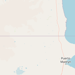
Islote Lobos National Park is best known for its distinctive cluster of coastal rocky promontories that rise from the Atlantic Ocean in San Matías Gulf, creating a unique island ecosystem along the Patagonian mainland. The park protects critical coastal and marine habitats in a region of Argentina where protected coastal areas are relatively scarce. The complex of six islets and rocky outcrops provides important nesting and resting sites for seabirds and marine fauna, while the intertidal zones support diverse marine communities. The park also preserves representative examples of the Patagonian coastal plains and plateau phytogeographic ecoregion, with specialized halophytic vegetation adapted to the saline coastal environment.

Islote Lobos National Park history and protected-area timeline

The protection history of Islote Lobos began in 1977 when the provincial government of Río Negro established the area as a protected reserve through decree No. 1402/77. The original mandate focused on preserving the species and genetic diversity of the region, recognizing the ecological significance of the coastal and marine environments. At the time of its creation, the reserve was estimated to cover approximately 2,400 hectares around a specific coordinate in the area. Over time, the boundaries were more precisely defined, establishing the protected area as a rectangle approximately 8,000 meters long running north-south along the coastline, and about 5 kilometers wide, encompassing roughly 4,000 hectares with 1 kilometer on land and 4 kilometers extending over the marine zone. The current protected area covers 19,079.20 hectares. On July 30, 2020, the provincial government announced a project to convert the reserve into a national park, initiating the process of transferring ownership from the province to the nation. This transition was formalized through a provincial law passed on November 20, 2020, by which Río Negro ceded the territory to the national government. The National Congress accepted this cession and created the new national park through legislation passed on June 16, 2022, marking the formal establishment of Islote Lobos National Park as part of Argentina's Sistema Nacional de Áreas Protegidas.

Islote Lobos National Park landscape and geographic character

The landscape of Islote Lobos National Park is defined by the interaction between the Atlantic Ocean and the Patagonian coastline, where a series of rocky promontories emerge from the sea to form a distinctive cluster of islands and coastal formations. The six main promontories, including the most prominent Lobos Islet, rise from San Matías Gulf at relatively short distances from the shore, creating a characteristic offshore archipelago feel despite their proximity to the mainland. These rocky outcrops are partially covered with sedimentary material, giving them a weathered appearance shaped by centuries of marine erosion and exposure to the elements. The intertidal zones between these promontories and the mainland are dynamic spaces that transform dramatically with the tidal cycle, exposing extensive rocky platforms, sandy areas, tidal pools, and isolated rocks during low tide. The terrestrial portion of the park corresponds to the phytogeographic ecoregion of plains and plateaus that characterizes much of the Patagonian coastal zone, though the vegetation cover is limited due to the harsh coastal conditions and the nature of the rocky substrate. The overall effect is a dramatic seascape where rock, water, and sky meet along a windswept coast.

Islote Lobos National Park ecosystems, habitats, and plant life

The ecological character of Islote Lobos National Park is shaped by its coastal-marine environment, where the intertidal zones and adjacent waters support more biological activity than the relatively sparse terrestrial areas. The vegetation that does exist on the promontories consists of species adapted to the saline and challenging coastal conditions, including perennial glasswort and espartillo as the primary groundcover plants. In the more sheltered inland areas of the islets, these salt-tolerant species alternate with scattered specimens of molle, llaollín, zampa, jume, jarrilla, and white flechilla, representing the limited terrestrial plant diversity of the park. Notably, Lobos Islet itself is completely devoid of vegetation, illustrating the extreme conditions that prevail on some of the promontories. The marine and coastal environment supports richer biodiversity, with the rocky formations and tidal pools providing habitat for various marine invertebrates and serving as important resting and nesting sites for seabirds. The park's location within San Matías Gulf places it within a productive marine area along the Patagonian coast.

Islote Lobos National Park wildlife and species highlights

While the terrestrial vegetation of Islote Lobos National Park is limited, the coastal and marine environments support important wildlife populations, particularly seabirds that utilize the rocky promontories for nesting and resting. The park's name itself references wolves or seals that historically inhabited or frequented the area, though the primary wildlife significance lies in the avian communities that depend on the coastal islands and intertidal zones. The rocky islets provide sheltered sites for ground-nesting seabirds, while the exposed rocky surfaces and tidal pools support feeding opportunities for various bird species. The marine waters of San Matías Gulf contain diverse fish populations and other marine organisms that form the base of the coastal food web. Though detailed species inventories are not extensively documented in available sources, the protected area clearly serves as an important coastal habitat within the Patagonian marine ecosystem, with the rocky promontories providing critical breeding and resting sites that would be vulnerable without protection.

Islote Lobos National Park conservation status and protection priorities

Islote Lobos National Park represents an important addition to Argentina's coastal protected area network, addressing a relative gap in protection along the Atlantic coast of Río Negro province. The elevation of this area from provincial reserve to national park status in 2022 reflects its recognized conservation significance, particularly for coastal and marine ecosystems that were underrepresented in the national protected area system. The park protects biodiversity in a region where the combination of limited precipitation, strong winds, and exposed coastal conditions has resulted in relatively sparse vegetation but important specialized species. The establishment of the national park also contributes to the broader goal of preserving representative examples of Patagonian coastal ecosystems, including both the terrestrial plains and plateaus and the adjacent marine environments of San Matías Gulf. The transition from provincial to national protection also ensures consistent management standards and potentially greater resources for long-term conservation of the area's geological and ecological values.

Islote Lobos National Park cultural meaning and human context

The cultural context of Islote Lobos National Park is tied to its location within the broader Patagonian coastal region of Río Negro province, an area with a history of human settlement focused on fishing, ranching, and more recently, tourism. The park's adjacency to the town of Playas Doradas connects it to contemporary coastal communities that rely on the marine environment for livelihood and recreation. The name Lobos, meaning wolves or potentially referring to sea lions, reflects historical interactions between human communities and marine mammals in the area. The transformation of the reserve to national park status involved formal processes of territorial cession from the provincial government to the national government, reflecting the institutional framework for protected area management in Argentina. The region has been shaped by the broader history of Patagonian colonization and development, though the park itself represents a more recent recognition of the area's natural values worth preserving.

Top sights and standout views in Islote Lobos National Park

The defining highlights of Islote Lobos National Park include its cluster of six rocky promontories rising from San Matías Gulf, which create a distinctive coastal landscape unique within the Patagonian protected area system. The dramatic tidal fluctuations that connect the islets to the mainland during low tide expose extensive intertidal zones with tidal pools and marine life, offering a dynamic visitor experience that changes throughout the day. The park provides protected habitat for coastal bird species and contributes to the conservation of Patagonian coastal and marine ecosystems in a region where such protection has been limited. The recent establishment as Argentina's newest national park in 2022, following decades of provincial protection, marks a significant conservation milestone for the Atlantic coast of Río Negro.

Best time to visit Islote Lobos National Park

The best time to visit Islote Lobos National Park would generally align with the warmer months of the Patagonian summer, from November through March, when temperatures are more comfortable for outdoor exploration and the longer daylight hours allow more time to experience the coastal landscape. However, visitors should be prepared for the unpredictable weather characteristic of the Patagonian coast, where strong winds and rapid changes in conditions can occur throughout the year. The winter months bring colder temperatures and shorter days but may offer a different, more austere experience of the dramatic coastal environment. The tidal cycles significantly affect the character of a visit, as the exposed intertidal zones that connect the islets to the mainland are only accessible during low tide, making timing an important consideration for any planned exploration of the park's coastal features.

Park location guide

Geography guide, regional context, and park location map for Islote Lobos National Park

Islote Lobos National Park park geography, regions, and map view in Argentina
Understand where Islote Lobos National Park sits in Argentina through a broader geographic reading of the surrounding landscape, nearby location context, and its mapped position within the national park landscape.

How Islote Lobos National Park fits into Argentina

Argentina is a federal republic located in the southern cone of South America, bordering Chile, Bolivia, Paraguay, Brazil, Uruguay, and the Atlantic Ocean. With an area of 2,780,085 km², it is the second-largest country in South America and the eighth-largest globally. The capital and largest city is Buenos Aires, and the official language is Spanish. The country claims sovereignty over the Falkland Islands, South Georgia and the South Sandwich Islands, and a portion of Antarctica.

Wider geography shaping Islote Lobos National Park in Argentina

Argentina occupies the southern portion of South America, sharing the Southern Cone region with Chile to the west. The country borders Bolivia and Paraguay to the north, Brazil to the northeast, Uruguay and the South Atlantic Ocean to the east, and the Drake Passage to the south. The Andes mountain range runs along the western border, while the Pampas plains dominate the central region. Argentina also claims territories in Antarctica.

Map view of Islote Lobos National Park

Use this park location map to pinpoint Islote Lobos National Park in Argentina, understand its exact geographic position, and read its mapped placement within the surrounding landscape more clearly.

Pigeon | © OpenStreetMap contributors

Location context for Islote Lobos National Park

Río Negro Province
Park atlas

Explore the diverse coastal and marine protected landscapes of Río Negro province, tracing the unique Patagonian Atlantic coastline.

Discover Other National Parks and Protected Areas Near Islote Lobos National Park in Argentine Patagonia
Continue your exploration of Islote Lobos National Park by browsing other national parks and protected areas across Argentina's Patagonian coast, including marine reserves and coastal landscapes. Comparing these regional protected areas reveals their unique ecosystems and conservation efforts within the broader South American atlas of natural spaces.
National parkNeuquén Province

Lanín National Park: Volcanic Landscapes and Ancient Forests in Neuquén Province

Explore the protected area's mapped terrain and glacial lakes.

Lanín National Park offers a deep dive into the dramatic geography of Argentine Patagonia, centered around the prominent Lanín volcano. This national park preserves ancient araucaria forests, diverse ecosystems, and breathtaking glacial lakes like Huechulafquen and Lácar. Its extensive protected landscape provides critical habitat and opportunities to explore unique Andean terrain through map-driven discovery.

Area
3,790 km²
Established
1937
IUCN
II
National parkNeuquén Province

Los Arrayanes National Park: Neuquén Province's Protected Arrayán Forest Atlas

Explore the ancient arrayán forest and mapped terrain.

Los Arrayanes National Park, nestled in Neuquén Province, is celebrated for its exceptional arrayán forest, one of the world's most concentrated stands of Luma apiculata. This protected area showcases a unique landscape where ancient, gnarled trees with striking cinnamon bark thrive on the Quetrihué Peninsula, overlooking Nahuel Huapi Lake. Its protected status ensures the preservation of this botanical marvel, offering a distinct geographical and ecological profile within the Patagonian region.

Area
17.53 km²
Established
1971
IUCN
II
National parkArgentina

Los Alerces National Park: Ancient Alerce Forests and Glacial Terrain in Argentina

Discover the park's protected landscape and regional geography.

Los Alerces National Park in Argentina is a globally significant protected area, celebrated for its ancient alerce forests, some of the longest-living trees on Earth. This national park showcases a dramatic landscape shaped by glaciers, featuring a series of interconnected lakes and rugged Andean terrain. Explore the unique ecosystem and mapped geography of this UNESCO World Heritage site to understand its profound natural and conservation value.

Area
2,599 km²
Established
1937
IUCN
II
National parkLos Lagos Region

Puyehue National Park: Mapped Boundaries and Volcanic Landscape in Los Lagos Region

Explore Chile's dramatic Andean protected area.

Puyehue National Park is a key protected area in the Los Lagos Region of Chile, recognized for its distinctive volcanic landscapes and geothermal features. This detail page offers an atlas-centric view, highlighting the park's mapped boundaries, the terrain shaped by volcanoes like Puyehue, and its ancient temperate rainforest ecosystems. Understand its geographic context within the Andes and its significance as a protected national park.

Area
1,070 km²
Established
1941
IUCN
II
Visitors
133K annual
National parkLa Araucanía Region

Huerquehue National Park: Ancient Araucaria Forests and Glacial Lakes in La Araucanía

Mapped protected area in the Andean foothills of Southern Chile.

Delve into the protected landscape of Huerquehue National Park, a key component of Chile's southern conservation efforts within the La Araucanía Region. This national park is defined by its ancient araucaria forests, home to the iconic monkey puzzle tree, and a network of clear glacial lakes including Tinquilco Lake. Its mountainous terrain, rising from 720 to 2,000 meters, showcases a vital representative of the Andean-Patagonian forest ecosystem, offering rich context for map exploration and understanding protected-area geography.

Area
125 km²
Established
1967
IUCN
II
National parkAysén del General Carlos Ibáñez del Campo Region

Queulat National Park: Patagonian Andes Glacier and Rainforest Discovery

Mapped protected area in Aysén del General Carlos Ibáñez del Campo Region.

Queulat National Park is a vast protected wilderness in southern Chile, renowned for its dramatic glacial alpine terrain and lush temperate rainforests. The park's geography is defined by steep glacial valleys, ice fields, and the iconic Queulat Hanging Glacier cascading from sheer cliffs. Discover the mapped boundaries of this significant Patagonian national park, offering unparalleled insight into its unique ecosystems and dramatic landscapes shaped by ice and forest.

Area
1,541 km²
Established
1983
IUCN
II
Relief
Mountain
National parkLos Ríos Region

Alerce Costero National Park: Explore Protected Landscapes and Ancient Forests in Los Ríos Region

Discover mapped terrain and unique Valdivian ecosystem geography.

Alerce Costero National Park stands as a significant protected landscape in Chile's Los Ríos Region, celebrated for its ancient Fitzroya trees and as a sanctuary for the Valdivian temperate rainforest. The park's protected boundaries encompass rugged terrain within the Cordillera Pelada, offering insights into unique watershed geography and the resilience of an ancient forest ecosystem. Its diverse landscape, a mosaic of old-growth woods and natural clearings, provides essential habitat and a remarkable geographic context for atlas exploration.

Area
139.75 km²
Established
2010
IUCN
III
National parkAysén del General Carlos Ibáñez del Campo Region

Cerro Castillo National Park: Dramatic Granite Peaks and Patagonian Protected Landscape

Mapped geography and huemul conservation in Chile's Aysén Region.

Cerro Castillo National Park is a premier protected area in southern Chile, celebrated for its iconic Cerro Castillo granite mountain that dominates the landscape. This national park, spanning over 1,700 square kilometers in the Aysén del General Carlos Ibáñez del Campo Region, showcases a dynamic Patagonian terrain shaped by glaciers and rivers. Its significance extends to being a vital corridor for endangered huemul, offering critical habitat within a broader regional conservation strategy and the famous Route of Parks.

Area
1,795.5 km²
Established
1970
IUCN
II

Common questions about visiting, size, designation, and location context for Islote Lobos National Park

Islote Lobos National Park FAQs for park facts, access, geography, and protected area context
Find quick answers about Islote Lobos National Park, including protected-area facts, park geography, trail and visitor context, and how the park fits into its surrounding country and regional landscape.
MoriAtlas Explorer

Continue Your Protected Areas Search Across the Global Atlas

Deepen your exploration by continuing the structured search for national parks and protected areas worldwide. Utilize the comprehensive filtering capabilities to compare different conservation landscapes and refine your understanding of global park geography. Discover more about the distribution and characteristics of protected natural areas.

Global natural geography