Mori Atlas logo
National parkPuyehue National Park

Discover the mapped boundaries and volcanic terrain of Puyehue National Park in Los Lagos Region.

Puyehue National Park: National Park Protected Landscape and Geographic Atlas Entry

Puyehue National Park stands as a significant protected landscape within Chile's Los Lagos Region, offering a detailed exploration of volcanic terrain, geothermal wonders, and ancient temperate rainforests. Established to conserve these unique Andean ecosystems, the park's mapped boundaries encompass dramatic scenery shaped by volcanic activity, including prominent peaks like Puyehue volcano and the Cordón Caulle range. This atlas entry provides structured geographic context, detailing the park's diverse natural features and its role as a key protected area in southern Chile.

Volcanic landscapesTemperate rainforestThermal springsAndes mountainsNational parkChilean Patagonia
Stylized illustration of a mountain landscape with a lake, forests, and cliffs under a sunlit sky

Puyehue National Park

National park

Park overview

Structured park overview, official facts, and landscape profile for Puyehue National Park

Puyehue National Park park facts, protected area profile, and essential visitor context
Review the core facts for Puyehue National Park, including designation, size, terrain, visitor scale, habitats, and operating context in one park-focused overview.

About Puyehue National Park

Puyehue National Park represents one of Chile's most significant protected areas, preserving a remarkable diversity of landscapes shaped by volcanic activity and buffered by the temperate rainforests of the southern Andes. The park's terrain is dominated by the Puyehue volcano and the Cordón Caulle volcanic chain, which create a dramatic backdrop of craters, lava fields, and sulfur deposits. The landscape varies dramatically from the lower elevation evergreen forests to the subalpine zones near the tree line, where pure stands of Nothofagus betuloides and Nothofagus pumilio create seasonal displays of autumn color. The park's three distinct sectors each offer different experiences: Aguas Calientes features the famous thermal baths and accessible recreational trails; Anticura provides access to the Puyehue volcano, ancient forests, and the Pampa de Frutilla strawberry field; while Antillanca offers ski facilities and access to crater lakes and the shores of Lake Rupanco. Chile Route 215 traverses the park, connecting with Argentine Route 231 through the Cardenal Antonio Samoré Pass, making this a key transit corridor between Chile and Argentina.

Quick facts and research context for Puyehue National Park

Puyehue National Park occupies a strategic position in the southern Chilean Andes, where volcanic activity has shaped dramatic landscapes including the Puyehue volcano, Cordón Caulle volcanic range, and the Antillanca Group. The park is administratively divided into three main sectors: Aguas Calientes, Anticura, and Antillanca, each offering distinct recreational opportunities and natural features. The region experiences high year-round precipitation, with a rainy climate supporting the lush temperate rainforests that characterize lower elevations. The park features an extensive network of waterways including the Golgol River, Las Gaviotas River, and several interior lakes such as Constancia, Gris, and Paraíso, plus portions of Lake Rupanco.

Park context

Deeper park guide and search-rich context for Puyehue National Park

Puyehue National Park history, landscape, wildlife, and travel context
Explore Puyehue National Park through its history, landscape character, ecosystems, wildlife, conservation priorities, cultural context, and seasonal travel timing in a structured park guide built for atlas discovery and search intent.

Why Puyehue National Park stands out

Puyehue National Park is renowned for its remarkable combination of volcanic landscapes and geothermal activity. The park contains natural thermal springs reaching temperatures up to 42°C, making it a major destination for thermal bathing and relaxation. The dominating Puyehue volcano and Cordón Caulle range provide dramatic volcanic scenery, while theAntillanca ski center offers winter sports on the slopes of Casablanca volcano. The park protects portions of the Chilean temperate rainforest, featuring ancient coigüe trees estimated at 800 years old, and supports populations of pumas, güiñas ( Oncifelis guigna), and Andean condors.

A wide view of a blue lake surrounded by dense forest and rocky mountain peaks under a clear blue sky
Lago Constancia within Puyehue National Park, Chile

Puyehue National Park history and protected-area timeline

Puyehue National Park was established in 1941 through a supreme decree from the former Ministry of Lands and Colonization, representing one of Chile's earlier protected area designations. The park's territory was subsequently expanded in 1950, and its current boundaries were established in 1981 through another decree issued by the Ministry of National Assets. The park is managed by CONAF (Corporación Nacional Forestal), Chile's national forest corporation, which maintains warden stations in each of the three main sectors. A Center of Environmental Information operates in the Aguas Calientes and Anticura areas, providing visitors with educational resources about the park's flora and fauna. In 2008, a controversial government decision approved a hydroelectric project within the park, raising environmental concerns about development in a protected public area.

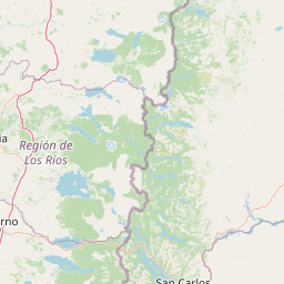
Puyehue National Park landscape and geographic character

The physical landscape of Puyehue National Park is fundamentally shaped by volcanic processes, with the Puyehue volcano, Cordón Caulle range, and Antillanca Group forming the park's most prominent features. The terrain ranges from lower valleys carved by rivers like the Golgol and Las Gaviotas to the crater rims of extinct volcanoes such as Raihuén. The park contains five interior lakes including Constancia, Gris, and Paraíso, plus portions of Lake Rupanco, all fed by the abundant precipitation that characterizes this region. The landscape transitions through distinct vegetation zones as elevation increases, from the dense evergreen rainforests of the lower slopes to the subalpine meadows and finally to the rocky volcanic terrain above the tree line. The 1960 earthquake had a dramatic impact on portions of the park, where lava flows from Puyehue volcano transformed dense forest into sand dunes and lava spillways.

Close-up of yellow-orange Michay (Berberis darwinii) flowers with green leaves on a branch
Michay (Berberis darwinii) flowers in Puyehue National Park, Chile

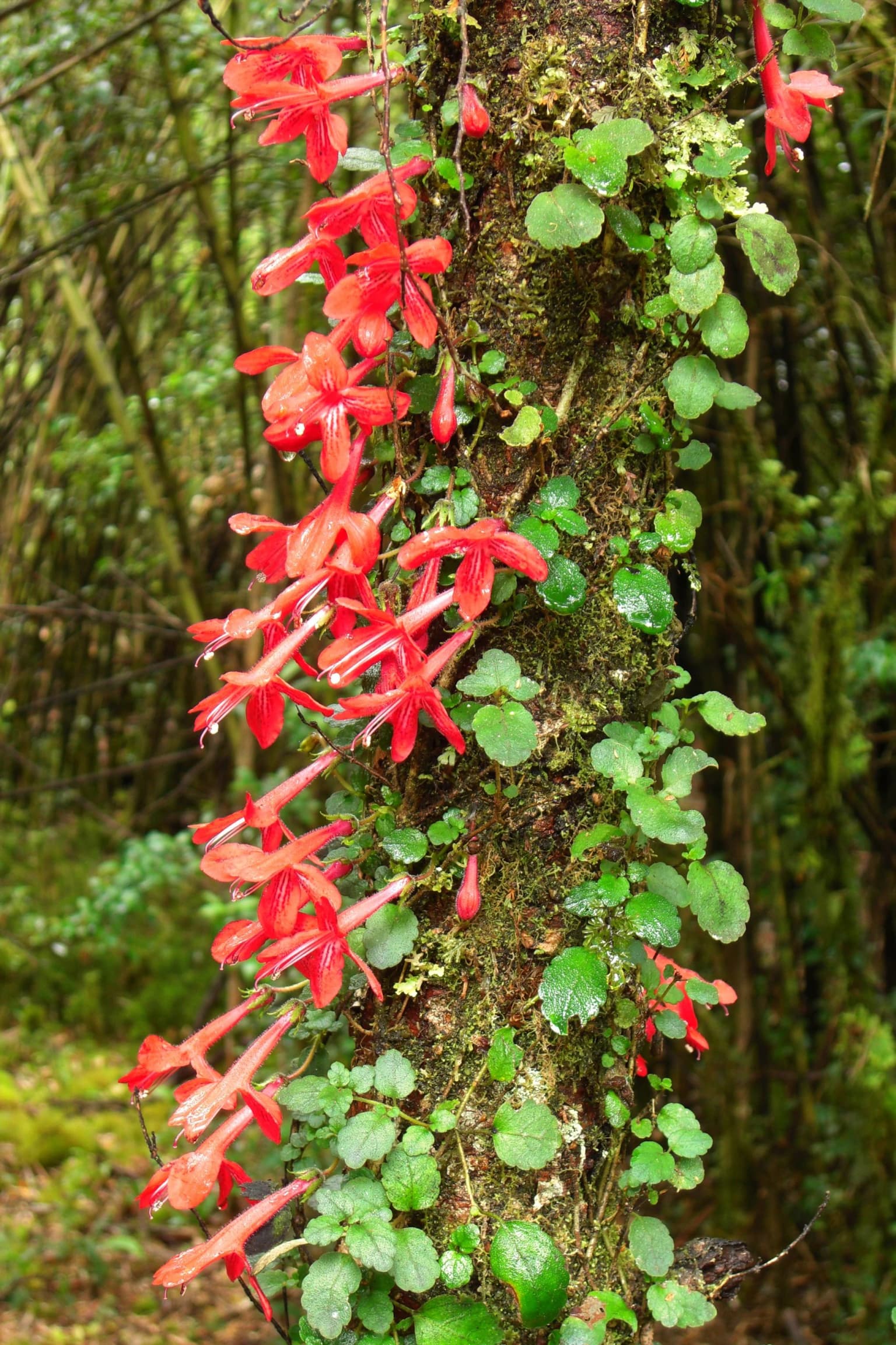
Puyehue National Park ecosystems, habitats, and plant life

The ecological character of Puyehue National Park is defined by the temperate evergreen rainforests of the southern Andes, classified as part of the Valdivia temperate rain forest biome. The lower elevations support forests dominated by coigüe (Nothofagus dombeyi) and common ulmo (Eucryphia cordifolia), along with olivillo (Aextoxicon punctatum) and tineo (Weinmannia trichosperma). The understory in these forests is remarkably rich, with abundant bushes, ferns, mosses, and lichens creating exceptional forest density and biodiversity. At higher elevations, coigüe forests mix with tepa (Laureliopsis philippiana) and mañío (Saxegothaea conspicua), eventually giving way to pure stands of Nothofagus betuloides and Nothofagus pumilio near the tree line. The park also contains marshland communities known locally as mallines, characterized by thick moss cover and unique wetland vegetation.

A small spotted wild cat with brown and black spots standing on a path surrounded by green grass and foliage
A Guigna cat standing on a path amidst green vegetation

Puyehue National Park wildlife and species highlights

Puyehue National Park supports a diverse mammalian fauna adapted to the temperate forest environment. Notable species include the puma (Puma concolor), the gray fox (Pseudalopex griseus), the quique (Galictis cuja), the coypu (Myocastor coypus), the güiña (Oncifelis guigna), and the chingue (Conepatus chinga), a type of skunk. Vizcachas are also present in the higher terrain. The park is particularly significant for birdwatching, with species including the torrent duck, Magellanic woodpecker, Chilean pigeon, hued-hued (huet-huet), Andean condor, great grebe (huala), southern house wren (chercán), and buff-necked ibis (bandurria) regularly observed throughout the park's various habitats.

Red flowers and green leaves of Asteranthera ovata vine climbing a moss-covered tree trunk in a forest
Asteranthera ovata vines with bright red flowers covering a mossy tree trunk in Puyehue National Park

Puyehue National Park conservation status and protection priorities

Puyehue National Park forms part of the Reserve of Temperate Rainy Forest Biospheres of the Southern Andes, a UNESCO-recognized biosphere reserve protecting the distinctive ecosystems of the Chilean Andes. The park's protection extends underground, as it has been designated a place of scientific interest for mining purposes under Article 17 of Chile's Mining Code, with any extractive activities requiring presidential permission. The park's ecosystems represent some of the last remaining tracts of temperate rainforest in South America, making conservation of this area critical for regional biodiversity. The ongoing presence of active volcanic activity, combined with the park's high visitation numbers, creates ongoing management challenges balancing conservation objectives with public access and facility development.

Puyehue National Park cultural meaning and human context

The region surrounding Puyehue National Park has historical connections to the Mapuche people, the indigenous communities of southern Chile. The park's location along the border with Argentina, traversed by Chile Route 215 and the Cardenal Antonio Samoré Pass, has made this a corridor of historical importance for regional trade and movement between countries. The park's name derives from the town of Puyehue, itself reflecting the area's geographic identity. While the park itself does not contain significant pre-Columbian archaeological sites documented in the sources, the broader Osorno Province and Los Lagos Region contain evidence of traditional Mapuche land use patterns that predate the establishment of the protected area.

Close-up view of lichen with gray and brown patches growing on a tree trunk
Close-up of lichen on tree bark in Puyehue National Park

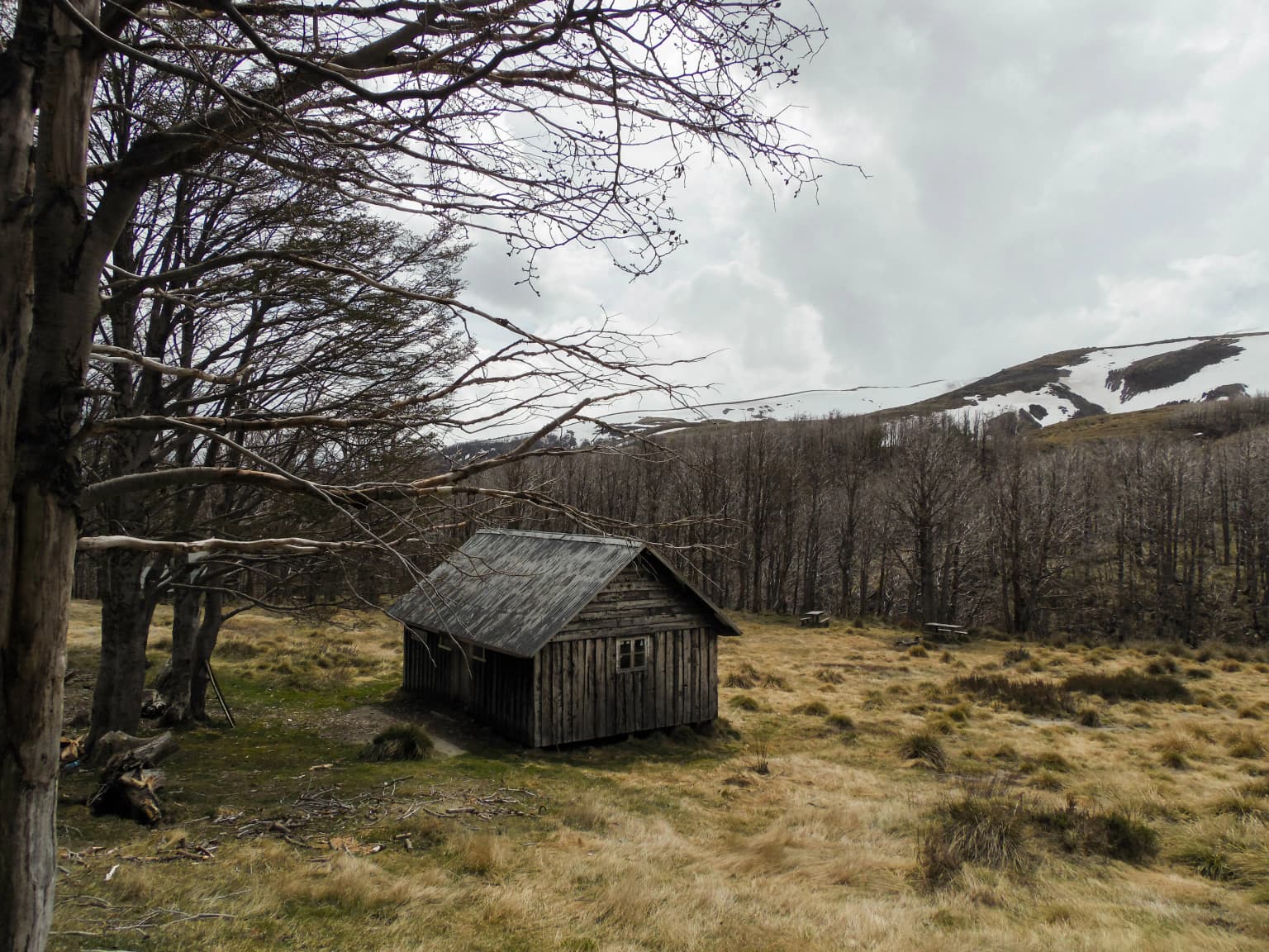
Top sights and standout views in Puyehue National Park

The park's most distinctive features include the natural thermal springs of Aguas Calientes, where visitor facilities allow bathing in waters reaching 42°C; the dramatic volcanic landscape of Puyehue volcano and Cordón Caulle, accessible via multi-day hiking trails; the ancient 800-year-old coigüe forest in the Anticura sector; the crater lakes of the Antillanca area including Raihuén; and the ski facilities on Casablanca volcano providing winter recreation. The network of trails ranges from short interpretive walks like the El Recodo trail to the extensive expedition routes to Puyehue volcano summit spanning two to three days.

Small wooden cabin in a grassy field with bare trees on left, mountains with snow in background, overcast sky.
Wooden refuge structure in Puyehue National Park, Chile.

Best time to visit Puyehue National Park

Puyehue National Park can be visited year-round, though the climate is characterized by consistent rainfall across all seasons with the wettest months falling between March and September. Winter and spring bring snow to higher elevations, making the Antillanca ski area operational during these months and creating dramatic winter landscapes. Summer months from December to February offer warmer temperatures ranging from 10 to 18°C, though rainfall remains possible. The thermal springs at Aguas Calientes are accessible throughout the year and provide a particularly appealing activity during cooler months. Visitors seeking to avoid the busiest periods may want to consider visiting during the shoulder seasons of late autumn or early spring, though the park's status as Chile's most visited national park means significant visitor numbers persist throughout the year.

Park location guide

Geography guide, regional context, and park location map for Puyehue National Park

Puyehue National Park park geography, regions, and map view in Chile
Understand where Puyehue National Park sits in Chile through a broader geographic reading of the surrounding landscape, nearby location context, and its mapped position within the national park landscape.

How Puyehue National Park fits into Chile

Chile is a presidential republic in western South America, extending as a narrow strip along the western edge of the continent between the Andes Mountains and the Pacific Ocean. It is the southernmost country in the world and the closest to Antarctica. The country is bordered by Peru, Bolivia, and Argentina, and administers several Pacific islands including Easter Island. Chile is a major copper producer and has a population of approximately 19.6 million.

Wider geography shaping Puyehue National Park in Chile

Chile occupies a narrow strip of land along the western edge of South America, extending approximately 4,300 km north to south but only about 350 km east to west at its widest point. The country is sandwiched between the Andes Mountains to the east and the Pacific Ocean to the west. It shares borders with Peru to the north, Bolivia to the northeast, and Argentina to the east. Southern Chile borders the Drake Passage. Chile also administers several Pacific islands including Juan Fernández Islands, Isla Salas y Gómez, Desventuradas Islands, and Easter Island, plus the Chilean Antarctic Territory.

Map view of Puyehue National Park

Use this park location map to pinpoint Puyehue National Park in Chile, understand its exact geographic position, and read its mapped placement within the surrounding landscape more clearly.

Pigeon | © OpenStreetMap contributors

Location context for Puyehue National Park

Los Lagos Region

Visually grasp the diverse terrain, unique habitats, and protected-area character of Chile's most visited national park through comprehensive imagery.

Puyehue National Park Photo Gallery: Explore Volcanic Landscapes, Ancient Forests, and Thermal Scenery
Browse a curated collection of Puyehue National Park photos, showcasing its dramatic volcanic formations, lush temperate rainforests, and active geothermal springs, providing a clear visual reference for its defining features. These images help you understand the park's distinct landscape, its varied ecosystems, and the unique environment that characterizes this significant protected area in the Chilean Andes.

A wide view of a blue lake surrounded by dense forest and rocky mountain peaks under a clear blue sky

Waterfall flowing over rocks with forested background in Puyehue National Park

Close-up of yellow-orange Michay (Berberis darwinii) flowers with green leaves on a branch

A small spotted wild cat with brown and black spots standing on a path surrounded by green grass and foliage

Red flowers and green leaves of Asteranthera ovata vine climbing a moss-covered tree trunk in a forest

Snow-covered mountain peaks with a prominent central peak under a clear blue sky

Close-up view of lichen with gray and brown patches growing on a tree trunk

Small wooden cabin in a grassy field with bare trees on left, mountains with snow in background, overcast sky.

Rusty metal sign structure with faded text on a stand, set against sandy terrain with rocky hills in the background under a blue sky with clouds

Snow-covered ski slope with ski lift structure, two people on the slope, and mountain peaks in the distance under a cloudy sky

Park atlas

Discover adjacent protected landscapes, volcanic terrain, and temperate rainforests within the southern Andes region of Chile.

Explore Other National Parks Near Puyehue: Compare Protected Areas in the Chilean Andes
After exploring Puyehue National Park, continue your geographic discovery by browsing other protected areas that share similar volcanic landscapes, thermal springs, and dense temperate rainforests across the Chilean Andes. Compare regional park geography, trace the spread of conservation efforts, and map adjacent protected zones to expand your understanding of this diverse natural environment.
National parkNeuquén Province

Los Arrayanes National Park: Neuquén Province's Protected Arrayán Forest Atlas

Explore the ancient arrayán forest and mapped terrain.

Los Arrayanes National Park, nestled in Neuquén Province, is celebrated for its exceptional arrayán forest, one of the world's most concentrated stands of Luma apiculata. This protected area showcases a unique landscape where ancient, gnarled trees with striking cinnamon bark thrive on the Quetrihué Peninsula, overlooking Nahuel Huapi Lake. Its protected status ensures the preservation of this botanical marvel, offering a distinct geographical and ecological profile within the Patagonian region.

Area
17.53 km²
Established
1971
IUCN
II
Relief
Upland
National parkLos Lagos Region

Vicente Pérez Rosales National Park: Protected Landscape & Regional Geography Atlas

Mapped park boundaries and natural terrain in Los Lagos Region.

Delve into the protected area identity of Vicente Pérez Rosales National Park, a significant national park situated in Chile's Los Lagos Region. This detailed exploration focuses on understanding the park's geographic setting, its mapped landscape features, and its contribution to the regional atlas of protected territories. Discover the natural terrain and boundary context that define this unique Chilean landscape.

Area
2,530 km²
Established
1926
IUCN
II
Visitors
332.3K annual
National parkRío Negro Province

Nahuel Huapi National Park: Protected Area Landscape and Geographic Context in Río Negro

Explore mapped natural terrain and park boundaries within Patagonia.

Nahuel Huapi National Park is a crucial protected area offering a deep dive into the Patagonian landscape. Situated in Argentina's Río Negro Province, this national park provides a detailed view of mapped natural terrain and its environmental context. Users can explore the park's geographic identity and protected boundaries, making it an essential stop for understanding the regional geography and conservation significance of this part of South America.

Area
7,050 km²
Established
1934
IUCN
II
Relief
Mountain
National parkNeuquén Province

Lanín National Park: Volcanic Landscapes and Ancient Forests in Neuquén Province

Explore the protected area's mapped terrain and glacial lakes.

Lanín National Park offers a deep dive into the dramatic geography of Argentine Patagonia, centered around the prominent Lanín volcano. This national park preserves ancient araucaria forests, diverse ecosystems, and breathtaking glacial lakes like Huechulafquen and Lácar. Its extensive protected landscape provides critical habitat and opportunities to explore unique Andean terrain through map-driven discovery.

Area
3,790 km²
Established
1937
IUCN
II
Relief
Mountain
National parkLos Lagos Region

Alerce Andino National Park: Protected Landscape Within Los Lagos Region Geography

Explore the national park's mapped boundaries and regional context.

Delve into the protected landscape of Alerce Andino National Park, a distinct national park entity situated in Chile's Los Lagos Region. This focus provides a clear understanding of its geographic setting, highlighting its importance within regional conservation efforts and offering a detailed view of its mapped terrain. Understand the park's place in the southern Chile geography through this detailed exploration.

Area
393 km²
Established
1982
IUCN
II
Visitors
12.2K annual
National parkLos Ríos Region

Alerce Costero National Park: Explore Protected Landscapes and Ancient Forests in Los Ríos Region

Discover mapped terrain and unique Valdivian ecosystem geography.

Alerce Costero National Park stands as a significant protected landscape in Chile's Los Ríos Region, celebrated for its ancient Fitzroya trees and as a sanctuary for the Valdivian temperate rainforest. The park's protected boundaries encompass rugged terrain within the Cordillera Pelada, offering insights into unique watershed geography and the resilience of an ancient forest ecosystem. Its diverse landscape, a mosaic of old-growth woods and natural clearings, provides essential habitat and a remarkable geographic context for atlas exploration.

Area
139.75 km²
Established
2010
IUCN
III
Relief
Mountain
National parkLos Lagos Region

Hornopirén National Park: Mapped Protected Landscape and Geographic Identity

Explore the national park's mapped boundaries and regional context.

Hornopirén National Park serves as a crucial protected landscape within Chile's Los Lagos Region. This dedicated park page offers detailed insight into its geographic setting, emphasizing mapped boundaries and its identity as a national park. Users can explore how Hornopirén National Park contributes to the regional geography and protected-area framework, providing a grounded point for landscape discovery.

Area
482 km²
Established
1988
IUCN
II
Relief
Mountain
National parkLa Araucanía Region

Huerquehue National Park: Ancient Araucaria Forests and Glacial Lakes in La Araucanía

Mapped protected area in the Andean foothills of Southern Chile.

Delve into the protected landscape of Huerquehue National Park, a key component of Chile's southern conservation efforts within the La Araucanía Region. This national park is defined by its ancient araucaria forests, home to the iconic monkey puzzle tree, and a network of clear glacial lakes including Tinquilco Lake. Its mountainous terrain, rising from 720 to 2,000 meters, showcases a vital representative of the Andean-Patagonian forest ecosystem, offering rich context for map exploration and understanding protected-area geography.

Area
125 km²
Established
1967
IUCN
II
Visitors
35.5K annual

Common questions about visiting, size, designation, and location context for Puyehue National Park

Puyehue National Park FAQs for park facts, access, geography, and protected area context
Find quick answers about Puyehue National Park, including protected-area facts, park geography, trail and visitor context, and how the park fits into its surrounding country and regional landscape.
MoriAtlas Explorer

Continue Your Protected Areas Search Across the Global Atlas

Deepen your exploration by continuing the structured search for national parks and protected areas worldwide. Utilize the comprehensive filtering capabilities to compare different conservation landscapes and refine your understanding of global park geography. Discover more about the distribution and characteristics of protected natural areas.

Global natural geography