Mori Atlas logo
National parkLos Alerces National Park

Explore the mapped boundaries and protected area geography of Argentina's Patagonian wilderness.

Los Alerces National Park: An Ancient Forest and Glacial Landscape Atlas in Argentina

(Parque Nacional Los Alerces)

Los Alerces National Park in Argentina offers a unique glimpse into one of Earth's most ancient forest ecosystems, centered around the remarkable alerce trees that can live for millennia. This protected landscape is carved by dramatic glacial terrain, featuring a spectacular chain of clear lakes and rugged Andean peaks, presenting a rich tapestry for geographic discovery. As a UNESCO World Heritage site, the park's pristine alerce forests and sculpted landforms provide exceptional insight into Patagonia's natural history and conservation value.

National ParkPatagoniaAncient ForestUNESCO World HeritageGlacial LakesAlerce Trees

Los Alerces National Park

National park

Park overview

Structured park overview, official facts, and landscape profile for Los Alerces National Park

Los Alerces National Park park facts, protected area profile, and essential visitor context
Review the core facts for Los Alerces National Park, including designation, size, terrain, visitor scale, habitats, and operating context in one park-focused overview.

About Los Alerces National Park

Los Alerces National Park occupies a remarkable position in the Argentine Patagonia, spanning the transition between the Andes and the Patagonian steppe. The park's western boundary follows the Chilean border through a landscape shaped by glacial activity over millennia, creating a distinctive terrain of u-shaped valleys, terminal moraines, and dramatic cirques. The park is organized around a hydrological system of nine major lakes connected by rivers and streams, beginning at Lake Rivadavia and flowing through Green Lake, the Arrayanes River, Lake Menéndez, Futalaufquen Lake, and Kruger Lake before reaching the Amutui Quimey Reservoir and ultimately the Futaleufú River, which exits the park into Chile. This chain of lakes and rivers forms the entire drainage basin within the park boundaries. The park consists of two management zones: a strictly protected national park covering 187,379 hectares and an adjoining national reserve of 71,443 hectares where most visitor facilities and infrastructure are located. Villa Futalaufquen, the park's administrative center, sits within the protected area and serves as the hub for visitor information and park management operations.

Quick facts and research context for Los Alerces National Park

Los Alerces National Park covers approximately 2,600 square kilometers in the Argentine Patagonia, straddling the border with Chile. The park protects the largest stand of alerce trees in Argentina, with virgin forests spanning over 7,400 hectares around Lake Menéndez. The park features a distinctive chain of nine interconnected lakes fed by mountain streams, descending from Lake Rivadavia through Green Lake, Arrayanes River, Lake Menéndez, Futalaufquen Lake, and Kruger Lake before reaching the Amutui Quimey Reservoir. The highest peak within the park is Cordon de las Pirámides at 2,440 meters elevation, while the tree line sits at approximately 1,400 meters. The park is part of the Andean Norpatagonian Biosphere Reserve and contains strict nature protection zones.

Park context

Deeper park guide and search-rich context for Los Alerces National Park

Los Alerces National Park history, landscape, wildlife, and travel context
Explore Los Alerces National Park through its history, landscape character, ecosystems, wildlife, conservation priorities, cultural context, and seasonal travel timing in a structured park guide built for atlas discovery and search intent.

Why Los Alerces National Park stands out

Los Alerces is best known for its extraordinary alerce forests, which represent one of the most ancient and ecologically significant forest ecosystems in the Southern Hemisphere. The alerce tree (Fitzroya cupressoides), locally called lahuán by the Mapuche people, is the second longest-living tree species in the world, with some individuals exceeding 3,600 years of age. The park contains the largest alerce forest in Argentina, including a 2,600-year-old specimen at Puerto Sagrario on Lake Menéndez that stands 57 meters tall with a 2.2-meter diameter. The pristine condition of these forests, combined with the dramatic glacial landscape of interconnected lakes, moraines, and cirques, makes this park a cornerstone of Patagonian conservation.

Rio Arrayanes view from path
View from a path near the Arrayanes River in Los Alerces National Park.

Los Alerces National Park history and protected-area timeline

Los Alerces National Park was created through decree 105,433 on May 11, 1937, during the presidency of Agustín Pedro Justo, as part of a broader initiative to establish national parks in Patagonia. The original decree designated the territory as a national reserve with the specific purpose of protecting the alerce forests, which by that time had been severely depleted by commercial logging operations that had brought the species to the brink of extinction. In 1945, decree law 9504 transformed the reserve into a national park, a status that was later ratified by law 13,895 in 1949. The park's creation marked a pivotal moment in Argentine conservation history, as it established one of the first protected areas specifically aimed at preserving old-growth forest ecosystems. In 1971, law 19,292 separated the Puelo area to create Lago Puelo National Park. The park was designated as part of the Andean Norpatagonian Biosphere Reserve in 2007, and in 2017 it achieved international recognition as a UNESCO World Heritage Site. A strict nature reserve was formally designated within the park in 1990 under decree 2149/90.

Los Alerces National Park landscape and geographic character

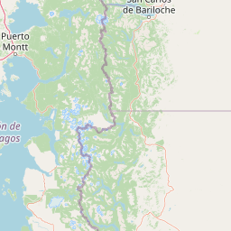
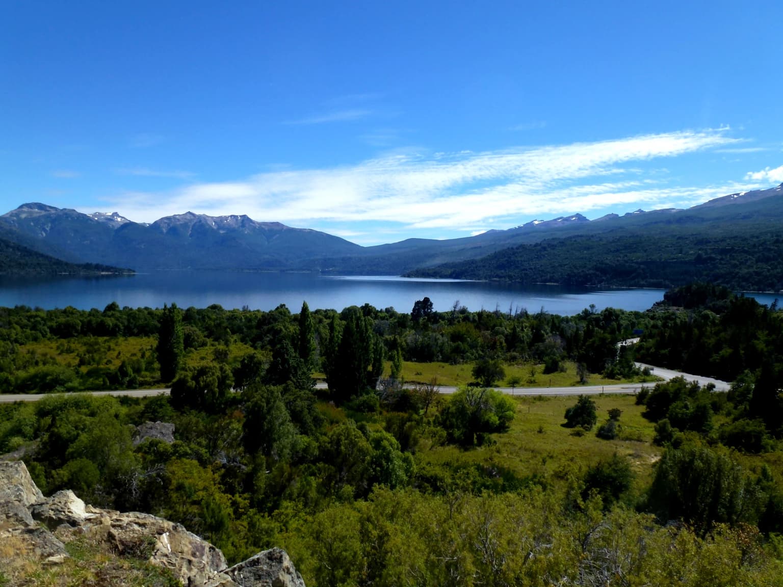
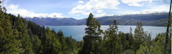
The landscape of Los Alerces National Park is a textbook example of glacial geomorphology, shaped by successive ice ages that carved the terrain into its present form. The park's core features include a spectacular chain of nine major lakes occupying glacial valleys and basins, separated by short, turbulent river segments that create a characteristic stair-step hydrological system. Moraines and glacial cirques dominate the higher terrain, while the lake shores feature outwash plains and alluvial deposits. The highest elevations reach 2,440 meters at Cordon de las Pirámides, where bare rock, permanent snowfields, and sparse alpine vegetation replace the forest cover. The tree line at approximately 1,400 meters marks the upper boundary of the continuous forest, above which the landscape transitions to open alpine meadows and rocky substrate. The eastern edge of the park, in the rain shadow of the Andes, shows a more modest precipitation regime and correspondingly more open vegetation. The Torrecillas glacier occupies the valley between the two arms of Lake Menéndez, providing a visible remnant of the glacial processes that continue to shape the landscape.

Parque Nacional Los Alerces - Argentina
Los Alerces National Park, Argentina

Los Alerces National Park ecosystems, habitats, and plant life

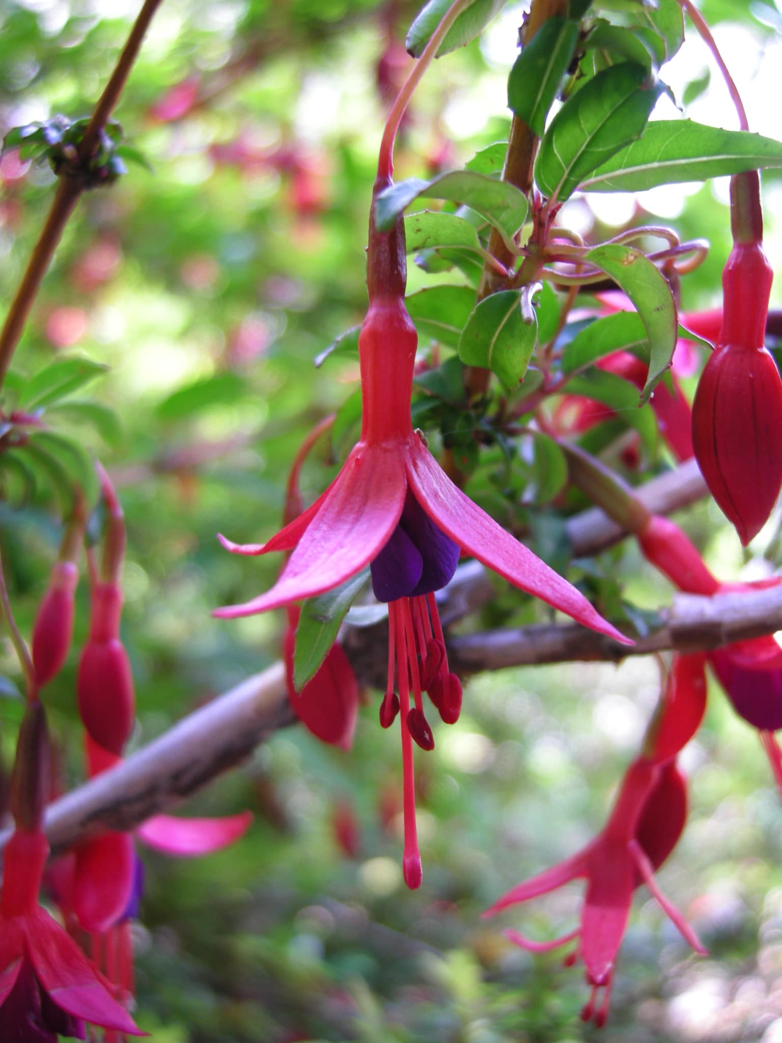
The nature of Los Alerces National Park centers on two distinct but interconnected forest ecosystems. The western portion of the park features the Andean or Valdivian temperate rain forest, characterized by high humidity, dense vegetation, and year-round precipitation reaching 3,000 millimeters annually. This is the realm of the alerce, a massive conifer that can reach 70 meters in height and 5 meters in diameter, growing slowly over millennia in the cool, moist conditions. The alerce forests around Lake Menéndez represent the finest examples of this species in Argentina, with some specimens estimated at 4,000 years old. The eastern portions of the park support Patagonian forest, dominated by coihue (Nothofagus dombeyi) and lenga (Nothofagus pumilio), which transition into more open woodland as precipitation decreases. Arrayán trees (Luma apiculata) line the Arrayanes River, creating a distinctive pink-flowered corridor. The forests provide critical habitat for numerous endemic species and represent some of the last remaining tracts of continuous Patagonian forest in a relatively unmodified state.

Monito del Monte
The monito del monte (_Dromiciops gliroides_) is a marsupial native to Argentina and Chile.

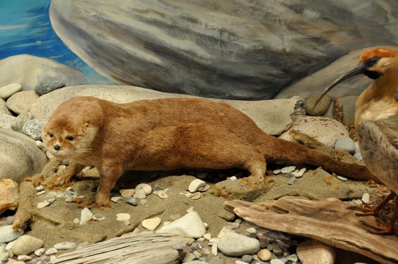
Los Alerces National Park wildlife and species highlights

Los Alerces National Park supports a diverse fauna, with several species of particular conservation significance. The park provides habitat for the huemul (Hippocamelus bisulcus), a species of deer endemic to Patagonia and now endangered, for which Cerro Riscoso has been designated a critical conservation zone. The park also protects the pudú (Pudu puda), one of the smallest deer species in the world, the huillín or Patagonian river otter (Lontra provocax), and the gato huiña (Leopardus geoffroyi), a small wild cat. Puma (Puma concolor) ranges throughout the park. The avifauna includes the Magellanic woodpecker (Campephilus magellanicus), the crested duck, Andean condor (Vultur gryphus), and numerous other bird species including the chucao tapaculo, pitío, austral parakeet, and Patagonian thrush. The lakes and rivers support populations of introduced salmon and trout, which provide recreational fishing opportunities. The park also contains the monito del monte (Dromiciops gliroides), a small marsupial considered a living fossil.

Los Alerces National Park 9.jpg
Los Alerces National Park

Los Alerces National Park conservation status and protection priorities

Los Alerces National Park represents one of the most significant conservation achievements in Patagonia, protecting some of the last remaining tracts of continuous old-growth forest in the region. The park's World Heritage designation in 2017 recognizes both its exceptional natural beauty and its critical role in biodiversity conservation. The alerce forests, once nearly eliminated by commercial logging, are now protected as the primary reason for the park's creation, and the species has been protected from harvesting since 1977. The park forms part of the Andean Norpatagonian Biosphere Reserve, connecting conservation efforts across national boundaries with neighboring Chilean protected areas. However, the park faces ongoing challenges from forest fires, including major incidents in 2015, 2016, 2023, and 2024 that have destroyed significant areas of native forest. Introduced species including deer, wild boar, and American mink also pose threats to native ecosystems.

Los Alerces National Park cultural meaning and human context

The territory of Los Alerces National Park has been inhabited by human communities for over 3,000 years. Archaeological evidence shows that hunter-gatherer groups occupied the Desaguadero River valley, leaving behind stone tools, bone artifacts, and cave paintings featuring geometric motifs and schematic human figures similar to those found throughout northwestern Patagonia. By the sixteenth century, the region was inhabited by Tehuelche peoples and related groups who adopted the horse following European contact, increasing their mobility across the landscape. Chilean settlers began arriving in 1888, establishing the pioneering communities around Futalaufquen. The Mapuche name for the alerce tree, lahuán, reflects the deep cultural connection between indigenous peoples and these ancient forests. The park's name itself derives from the alerce, a tree that held significance for both ecological and cultural reasons. Today, Villa Futalaufquen remains a small community largely composed of park management staff and their families.

Lago Menendez 1.jpg
Lago Menendez from near Puerto Chucao, with Cerro Torrecillas and its glacier in the background.

Top sights and standout views in Los Alerces National Park

The defining experience at Los Alerces is the opportunity to walk among ancient alerce trees that predate most human civilization. The Puerto Sagrario boat dock on Lake Menéndez provides access to the most visited alerce forest stand, where a 2,600-year-old giant serves as the park's flagship specimen. The chain of lakes offers exceptional opportunities for boat excursions, with the Torrecillas glacier visible from the water between Lake Menéndez's two arms. The park maintains over twenty marked hiking trails and numerous roads that allow exploration of the diverse landscapes, from lakeside shores to subalpine meadows. The drive along the eastern shore of Futalaufquen Lake provides scenic access to the park's core areas. Fishing in the lakes and rivers attracts visitors seeking rainbow and brown trout, while the surrounding mountains offer wilderness backcountry experiences.

Lago Menendez
View from a shore of Lago Menendez, showing mountains and clear water.

Best time to visit Los Alerces National Park

The park can be visited year-round, though the characteristic Patagonian climate shapes the experience significantly. The summer months of December through February bring warmer temperatures, with average highs around 24°C at lower elevations, and provide the most accessible conditions for hiking and outdoor activities. However, even summer days can change rapidly, with Pacific moisture bringing sudden weather shifts. The winter months from June through August offer a different character, with snow-covered peaks, quieter trails, and the opportunity to experience the park's moody, rain-swept atmosphere. Precipitation falls throughout the year, with the western portions of the park receiving the heaviest rainfall and the eastern areas experiencing a more moderate climate. The shoulder seasons of spring and autumn provide intermediate conditions and may offer the best balance of accessibility and solitude for visitors seeking a more contemplative experience.

Park location guide

Geography guide, regional context, and park location map for Los Alerces National Park

Los Alerces National Park park geography, regions, and map view in Argentina
Understand where Los Alerces National Park sits in Argentina through a broader geographic reading of the surrounding landscape, nearby location context, and its mapped position within the national park landscape.

How Los Alerces National Park fits into Argentina

Argentina is a federal republic located in the southern cone of South America, bordering Chile, Bolivia, Paraguay, Brazil, Uruguay, and the Atlantic Ocean. With an area of 2,780,085 km², it is the second-largest country in South America and the eighth-largest globally. The capital and largest city is Buenos Aires, and the official language is Spanish. The country claims sovereignty over the Falkland Islands, South Georgia and the South Sandwich Islands, and a portion of Antarctica.

Wider geography shaping Los Alerces National Park in Argentina

Argentina occupies the southern portion of South America, sharing the Southern Cone region with Chile to the west. The country borders Bolivia and Paraguay to the north, Brazil to the northeast, Uruguay and the South Atlantic Ocean to the east, and the Drake Passage to the south. The Andes mountain range runs along the western border, while the Pampas plains dominate the central region. Argentina also claims territories in Antarctica.

Map view of Los Alerces National Park

Use this park location map to pinpoint Los Alerces National Park in Argentina, understand its exact geographic position, and read its mapped placement within the surrounding landscape more clearly.

Pigeon | © OpenStreetMap contributors

Location context for Los Alerces National Park

Chubut Province

A visual atlas of Los Alerces' dramatic glacial terrain, ancient alerce trees, and diverse Patagonian ecosystems for park exploration.

Los Alerces National Park Photography: Explore Ancient Forests and Patagonian Glacial Landscapes
Browse an extensive collection of Los Alerces National Park photos to visually explore its ancient alerce forests, spectacular glacial lakes, and rugged Andean peaks. These images provide a detailed look into the park's unique Patagonian ecosystems, offering insights into its diverse terrain and protected-area character.

Rio Arrayanes view from path

Portada Centro Los Alerces National Park Entrance

Parque Nacional Los Alerces - Argentina

Monito del Monte

Los Alerces National Park 9.jpg

Southern River Otter

Lago Menendez 1.jpg

Lago Menendez

Fuchsia magellanica flower

Ancient Alerce Tree

Los Alerces National Park, Argentina

Futalaufquen Lake

Cerro de los tres picos, Los Alerces National Park

Alerce or Lahuán tree in Los Alerces National Park

Park atlas

Compare Protected Landscapes and Regional Geography in the Patagonian Andes

Explore Nearby National Parks and Protected Areas Beyond Los Alerces National Park
After exploring Los Alerces National Park's ancient alerce forests and dramatic glacial lakes, continue discovering other national parks and protected areas across the Patagonian Andes. Comparing these regional conservation landscapes offers deeper insights into similar forest ecosystems, shared geological formations, and the broader geographic spread of protected terrain.
National parkAysén del General Carlos Ibáñez del Campo Region

Queulat National Park: Patagonian Andes Glacier and Rainforest Discovery

Mapped protected area in Aysén del General Carlos Ibáñez del Campo Region.

Queulat National Park is a vast protected wilderness in southern Chile, renowned for its dramatic glacial alpine terrain and lush temperate rainforests. The park's geography is defined by steep glacial valleys, ice fields, and the iconic Queulat Hanging Glacier cascading from sheer cliffs. Discover the mapped boundaries of this significant Patagonian national park, offering unparalleled insight into its unique ecosystems and dramatic landscapes shaped by ice and forest.

Area
1,541 km²
Established
1983
IUCN
II
Relief
Mountain
National parkNeuquén Province

Los Arrayanes National Park: Neuquén Province's Protected Arrayán Forest Atlas

Explore the ancient arrayán forest and mapped terrain.

Los Arrayanes National Park, nestled in Neuquén Province, is celebrated for its exceptional arrayán forest, one of the world's most concentrated stands of Luma apiculata. This protected area showcases a unique landscape where ancient, gnarled trees with striking cinnamon bark thrive on the Quetrihué Peninsula, overlooking Nahuel Huapi Lake. Its protected status ensures the preservation of this botanical marvel, offering a distinct geographical and ecological profile within the Patagonian region.

Area
17.53 km²
Established
1971
IUCN
II
National parkLos Lagos Region

Puyehue National Park: Mapped Boundaries and Volcanic Landscape in Los Lagos Region

Explore Chile's dramatic Andean protected area.

Puyehue National Park is a key protected area in the Los Lagos Region of Chile, recognized for its distinctive volcanic landscapes and geothermal features. This detail page offers an atlas-centric view, highlighting the park's mapped boundaries, the terrain shaped by volcanoes like Puyehue, and its ancient temperate rainforest ecosystems. Understand its geographic context within the Andes and its significance as a protected national park.

Area
1,070 km²
Established
1941
IUCN
II
Visitors
133K annual
National parkNeuquén Province

Lanín National Park: Volcanic Landscapes and Ancient Forests in Neuquén Province

Explore the protected area's mapped terrain and glacial lakes.

Lanín National Park offers a deep dive into the dramatic geography of Argentine Patagonia, centered around the prominent Lanín volcano. This national park preserves ancient araucaria forests, diverse ecosystems, and breathtaking glacial lakes like Huechulafquen and Lácar. Its extensive protected landscape provides critical habitat and opportunities to explore unique Andean terrain through map-driven discovery.

Area
3,790 km²
Established
1937
IUCN
II
National parkLos Ríos Region

Alerce Costero National Park: Explore Protected Landscapes and Ancient Forests in Los Ríos Region

Discover mapped terrain and unique Valdivian ecosystem geography.

Alerce Costero National Park stands as a significant protected landscape in Chile's Los Ríos Region, celebrated for its ancient Fitzroya trees and as a sanctuary for the Valdivian temperate rainforest. The park's protected boundaries encompass rugged terrain within the Cordillera Pelada, offering insights into unique watershed geography and the resilience of an ancient forest ecosystem. Its diverse landscape, a mosaic of old-growth woods and natural clearings, provides essential habitat and a remarkable geographic context for atlas exploration.

Area
139.75 km²
Established
2010
IUCN
III
National parkAysén del General Carlos Ibáñez del Campo Region

Cerro Castillo National Park: Dramatic Granite Peaks and Patagonian Protected Landscape

Mapped geography and huemul conservation in Chile's Aysén Region.

Cerro Castillo National Park is a premier protected area in southern Chile, celebrated for its iconic Cerro Castillo granite mountain that dominates the landscape. This national park, spanning over 1,700 square kilometers in the Aysén del General Carlos Ibáñez del Campo Region, showcases a dynamic Patagonian terrain shaped by glaciers and rivers. Its significance extends to being a vital corridor for endangered huemul, offering critical habitat within a broader regional conservation strategy and the famous Route of Parks.

Area
1,795.5 km²
Established
1970
IUCN
II
National parkLa Araucanía Region

Huerquehue National Park: Ancient Araucaria Forests and Glacial Lakes in La Araucanía

Mapped protected area in the Andean foothills of Southern Chile.

Delve into the protected landscape of Huerquehue National Park, a key component of Chile's southern conservation efforts within the La Araucanía Region. This national park is defined by its ancient araucaria forests, home to the iconic monkey puzzle tree, and a network of clear glacial lakes including Tinquilco Lake. Its mountainous terrain, rising from 720 to 2,000 meters, showcases a vital representative of the Andean-Patagonian forest ecosystem, offering rich context for map exploration and understanding protected-area geography.

Area
125 km²
Established
1967
IUCN
II
National parkSanta Cruz Province

Perito Moreno National Park: Mapped Protected Landscape and Geographic Context in Santa Cruz Province

Explore Argentinian Patagonian mountain terrain and its ecological transition.

Perito Moreno National Park is a vast protected area in Argentina's Santa Cruz Province, known for its dramatic Patagonian mountain landscapes and unique ecological transition zone between wet Magellanic forests and dry Andean steppe. Spanning over 126,830 hectares, the park's geography features an amphitheater-like structure with valleys radiating from central highlands, and peaks reaching nearly 2,800 meters. This national park provides critical insight into the regional natural landscapes and mapped protected areas of Patagonia, offering a detailed view of its terrain and hydrographic features.

Area
1,268.3 km²
Established
1937
IUCN
II

Common questions about visiting, size, designation, and location context for Los Alerces National Park

Los Alerces National Park FAQs for park facts, access, geography, and protected area context
Find quick answers about Los Alerces National Park, including protected-area facts, park geography, trail and visitor context, and how the park fits into its surrounding country and regional landscape.
MoriAtlas Explorer

Continue Your Protected Areas Search Across the Global Atlas

Deepen your exploration by continuing the structured search for national parks and protected areas worldwide. Utilize the comprehensive filtering capabilities to compare different conservation landscapes and refine your understanding of global park geography. Discover more about the distribution and characteristics of protected natural areas.

Global natural geography