Mori Atlas logo
National parkCerro Castillo National Park

Discover the mapped geography and conservation significance of this Patagonian natural landmark.

Cerro Castillo National Park: Chile's Dramatic Granite Peak Protected Landscape

Cerro Castillo National Park, located in Chile's Aysén del General Carlos Ibáñez del Campo Region, represents a vital protected landscape defined by the imposing Cerro Castillo granite massif. This national park encompasses over 1,700 square kilometers of rugged Patagonian terrain, serving as a crucial hub for huemul conservation and a landmark along the Carretera Austral. Its dramatic mountain scenery, glacial valleys, and unique ecosystems offer a profound geographic context for atlas exploration and understanding the wild character of southern Chile.

PatagoniaMountain ParksNational ParksHuemul ConservationSouthern ChileProtected Areas

Cerro Castillo National Park

National park

Park overview

Structured park overview, official facts, and landscape profile for Cerro Castillo National Park

Cerro Castillo National Park park facts, protected area profile, and essential visitor context
Review the core facts for Cerro Castillo National Park, including designation, size, terrain, visitor scale, habitats, and operating context in one park-focused overview.

About Cerro Castillo National Park

Cerro Castillo National Park occupies a sweeping expanse of Patagonia where towering mountains meet dense forests and crystal-clear rivers carve through the landscape. The park's namesake, Cerro Castillo, rises as a spectacular granite monolith whose jagged spires and vertical walls create one of the most recognizable silhouettes in Chilean Patagonia. This dramatic geography anchors a protected landscape that supports diverse ecosystems ranging from Andean forests to high-altitude grasslands. The Carretera Austral, Chile's legendary scenic highway, passes directly through the park, connecting travelers to one of the most remote corners of South America while providing access to trails that reveal the park's natural wonders. The elevation gradient from valley floors to alpine zones creates varied habitats that support both temperate and cold-adapted species. Visitors approaching the park from the north are greeted by the mountain's imposing form reflected in nearby lakes and rivers, establishing the dramatic character that defines the experience of exploring this protected area.

Quick facts and research context for Cerro Castillo National Park

Cerro Castillo National Park spans 1,795.5 km² in the Aysén del General Carlos Ibáñez del Campo Region of southern Chile, situated along the Carretera Austral highway. The park protects the iconic Cerro Castillo mountain, a prominent granite peak that defines the landscape and attracts visitors. It was designated as a national reserve in 1970 and redesignated as a national park in 2018. The protected area is managed by CONAF (Corporación Nacional Forestal) and forms part of the broader Route of Parks of Patagonia. The northern portion drains into the Aisén River basin while the southern portion feeds into the Ibáñez River system.

Park context

Deeper park guide and search-rich context for Cerro Castillo National Park

Cerro Castillo National Park history, landscape, wildlife, and travel context
Explore Cerro Castillo National Park through its history, landscape character, ecosystems, wildlife, conservation priorities, cultural context, and seasonal travel timing in a structured park guide built for atlas discovery and search intent.

Why Cerro Castillo National Park stands out

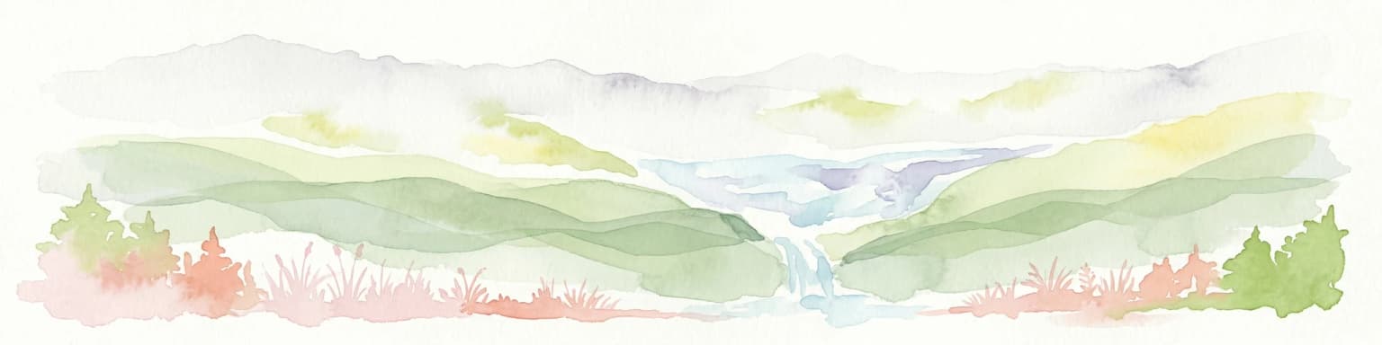
Cerro Castillo National Park is best known for its spectacular mountain scenery centered on the towering granite peak of Cerro Castillo, which rises dramatically above surrounding valleys and forests. The park is critically important as a stronghold for the endangered South Andean deer (huemul), serving as a key component of the National Huemul Corridor initiative that connects protected areas across Patagonia. Its location along the Carretera Austral makes it accessible to travelers exploring Chile's southern frontier while maintaining the wild character that defines the region.

Cerro Castillo National Park history and protected-area timeline

The territory now protected within Cerro Castillo National Park was originally designated as a national reserve in 1970, establishing initial legal protections for the area's forests, mountains, and wildlife. For nearly five decades, the reserve functioned as a protected area while supporting sustainable use of natural resources. A significant transformation occurred in 2018 when the protected area was recategorized from national reserve to national park status as part of a landmark agreement between the Chilean government under President Michelle Bachelet and Tompkins Conservation, a prominent conservation organization. This elevation in protection status reflected both the ecological importance of the area and the successful model of public-private conservation collaboration that has emerged in Chilean Patagonia. The redesignation also aligned Cerro Castillo with the broader Route of Parks of Patagonia initiative, a network of protected areas extending through the Patagonian landscape.

Cerro Castillo National Park landscape and geographic character

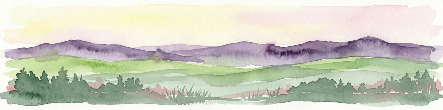
The physical landscape of Cerro Castillo National Park is defined by the dramatic interplay of mountains, forests, and water systems that characterize southern Chilean Patagonia. Cerro Castillo itself rises as a massive granite mountain with steep faces and intricate ridgelines that capture the imagination of all who see it. The terrain ranges from valley floors where rivers have carved deep channels through glacial deposits to alpine zones where exposed rock and sparse vegetation reflect the harshness of the high-altitude environment. The park sits at a transition zone where the Andes reach their most spectacular development in this region, creating a landscape of profound topographical diversity. Glacial valleys, moraines, and outwash plains tell the story of past ice ages that shaped the terrain, while contemporary rivers continue to modify the landscape. The forest cover varies with elevation and aspect, with dense vegetation in lower valleys giving way to more open shrubland and grassland at higher elevations.

Cerro Castillo National Park ecosystems, habitats, and plant life

The ecological character of Cerro Castillo National Park reflects the intersection of temperate and subpolar environments that defines Patagonian biodiversity. The forests are dominated by southern beech species including lenga (Nothofagus pumilio) and ñirre (Nothofagus antarctica), which form extensive stands across the lower elevations. The evergreen coigüe de Magallanes adds diversity to the forest composition, particularly in more sheltered locations. These forests provide critical habitat for numerous species and form the visible green matrix that clothes the mountain slopes. The park's position at a significant latitude and elevation range creates ecological diversity, with different zones supporting distinct communities of plants and animals. The drainage patterns that split the park between the Aisén River basin in the north and the Ibáñez River basin in the south also reflect different climatic and ecological conditions that influence the distribution of species throughout the protected area.

Cerro Castillo National Park wildlife and species highlights

Cerro Castillo National Park supports a notable community of wildlife, with several species of conservation concern relying on this protected landscape. The South Andean deer, known locally as huemul, represents the park's most significant conservation priority as an endangered species that has lost much of its historical range. Guanacos still roam the open terrain and forests, maintaining the connection to wild camelid heritage of the region. Pumas patrol the landscape as apex predators, preying on deer and other available prey. Smaller mammals include the Molina's hog-nosed skunk and various canine species of the genus Lycalopex, which include the culpeo and other Patagonian foxes. The bird community features prominent species including the Andean condor, whose soaring presence above the mountain peaks represents one of the most iconic sights in the park. Black-chested buzzard-eagles hunt in the mountain environments, while smaller birds such as austral parakeets, thorn-tailed rayaditos, and Magellanic woodpeckers animate the forest layers. The ground-dwelling Magellanic tapaculo and chucao tapaculo add to the diversity of forest birdlife.

Cerro Castillo National Park conservation status and protection priorities

Cerro Castillo National Park plays a crucial role in regional conservation efforts, particularly in the protection of the endangered South Andean deer (huemul). The park forms a key component of the National Huemul Corridor, a collaborative initiative that establishes wildlife corridors connecting protected areas along the Route of Parks of Patagonia. This corridor approach recognizes that effective conservation requires landscape-scale connectivity rather than isolated protected islands. The partnership between Rewilding Chile, CONAF, and international conservation organizations has brought resources and expertise to bear on restoring huemul populations in their historic range. The elevation of the protected area from national reserve to national park in 2018 reflects the growing recognition that this landscape warrants the highest level of protection within Chile's protected area system. The park's inclusion in the Route of Parks of Patagonia connects it to a broader vision for conservation across the Patagonian region.

Cerro Castillo National Park cultural meaning and human context

The Aysén Region where Cerro Castillo National Park is located has historically been one of the most sparsely populated areas of Chile, with indigenous peoples including the Tehuelche and other groups having maintained connections to these lands over millennia. The modern landscape bears evidence of more recent human activity including the construction of the Carretera Austral, which opened this remote region to greater access and development. The town of Balmaceda, identified as the nearest city, serves as a gateway community for visitors entering the park. The park's landscape has been shaped by natural processes far more than by human intervention, maintaining a relatively wild character that distinguishes it from more heavily modified landscapes elsewhere in Chile.

Top sights and standout views in Cerro Castillo National Park

The signature experience in Cerro Castillo National Park is the view of Cerro Castillo itself, a mountain of exceptional visual drama whose granite spires rise above the surrounding landscape. The park provides access to trails that approach the mountain from various angles, allowing visitors to appreciate its scale and beauty. The presence of huemul, Chile's national animal and an endangered species, offers wildlife viewing opportunities that draw conservation-minded visitors. The passage of the Carretera Austral through the park provides road-based access that makes this remote landscape reachable without extensive backcountry travel. The connection to broader conservation initiatives, particularly the National Huemul Corridor and the Route of Parks, positions the park as part of a significant continental-scale conservation effort.

Best time to visit Cerro Castillo National Park

The optimal visiting season for Cerro Castillo National Park runs from late spring through early autumn in the Southern Hemisphere, roughly November through March, when temperatures are milder and daylight hours are longest. Summer months offer the most stable weather for trail exploration and mountain viewing, though Patagonian weather can change rapidly in any season. Winter brings snow to higher elevations and more limited access, though the landscape takes on a different character that appeals to some visitors seeking solitude. The shoulder seasons of late spring and early autumn may offer the best combination of reasonable weather and fewer visitors, though visitors should be prepared for variable conditions at any time of year.

Park location guide

Geography guide, regional context, and park location map for Cerro Castillo National Park

Cerro Castillo National Park park geography, regions, and map view in Chile
Understand where Cerro Castillo National Park sits in Chile through a broader geographic reading of the surrounding landscape, nearby location context, and its mapped position within the national park landscape.

How Cerro Castillo National Park fits into Chile

Chile is a presidential republic in western South America, extending as a narrow strip along the western edge of the continent between the Andes Mountains and the Pacific Ocean. It is the southernmost country in the world and the closest to Antarctica. The country is bordered by Peru, Bolivia, and Argentina, and administers several Pacific islands including Easter Island. Chile is a major copper producer and has a population of approximately 19.6 million.

Wider geography shaping Cerro Castillo National Park in Chile

Chile occupies a narrow strip of land along the western edge of South America, extending approximately 4,300 km north to south but only about 350 km east to west at its widest point. The country is sandwiched between the Andes Mountains to the east and the Pacific Ocean to the west. It shares borders with Peru to the north, Bolivia to the northeast, and Argentina to the east. Southern Chile borders the Drake Passage. Chile also administers several Pacific islands including Juan Fernández Islands, Isla Salas y Gómez, Desventuradas Islands, and Easter Island, plus the Chilean Antarctic Territory.

Map view of Cerro Castillo National Park

Use this park location map to pinpoint Cerro Castillo National Park in Chile, understand its exact geographic position, and read its mapped placement within the surrounding landscape more clearly.

Pigeon | © OpenStreetMap contributors

Location context for Cerro Castillo National Park

Aysén del General Carlos Ibáñez del Campo Region
Park atlas

Browse the protected landscapes of Patagonian Chile, comparing geographic features and regional park connections.

Discover Other National Parks and Protected Areas Near Cerro Castillo, Southern Chile
Continue your exploration from Cerro Castillo National Park into adjacent protected areas across Chile's Aysén Region, revealing diverse Patagonian mountain and forest landscapes. Compare mapped park geography and conservation territories to understand the broader network of protected lands connected through this remote, ecologically significant region.
National parkAysén Region

Patagonia National Park, Chile: Exploring Protected Landscape and Regional Geography

Mapped boundaries and natural terrain in Aysén Region.

Patagonia National Park, situated within the Aysén Region of Chile, serves as a significant protected area offering rich opportunities for atlas-based geographic exploration. This national park's specific landscape identity and mapped boundaries provide a clear focal point for understanding regional conservation and natural terrain. Discover the geographic context of this protected land and its place within the broader landscape of southern Chile through structured data and map exploration.

Area
3,045.28 km²
Established
2018
IUCN
II
Relief
Mountain
National park

Patagonia National Park: A National Park Protecting the Argentine Patagonian Steppe Landscape

Explore the mapped boundaries of this semi-arid grassland ecosystem.

Patagonia National Park is a protected national park in Argentina established to preserve the representative Patagonian steppe ecosystem. Covering 528.11 square kilometers, it offers a deep dive into the unique semi-arid grassland environment, known for its rolling plains and wind-shaped terrain. This park provides crucial context for understanding the broader geography of southern Argentina and the conservation of its distinctive natural landscapes.

Area
528.11 km²
Established
2015
IUCN
II
Climate
Arid
National parkAysén del General Carlos Ibáñez del Campo Region

Laguna San Rafael National Park: Explore its Mapped Boundaries and Patagonian Landscape

A National Park within Aysén del General Carlos Ibáñez del Campo Region.

Laguna San Rafael National Park stands as a key protected area within the vast geography of the Aysén del General Carlos Ibáñez del Campo Region. This entry provides an atlas-focused perspective, detailing the park's geographic significance, mapped natural landscapes, and its role as a vital conservation territory. Understand how this national park fits into the broader context of Patagonia's unique terrain and protected areas.

Area
17,420 km²
Established
1959
IUCN
II
Relief
Mountain
National parkAysén del General Carlos Ibáñez del Campo Region

Isla Magdalena National Park: Protected Area and Regional Geography Context

Discover the mapped landscape of this national park.

Delve into the protected landscape of Isla Magdalena National Park, a key national park situated in the Aysén del General Carlos Ibáñez del Campo Region of Chile. This entry provides essential geographic context, focusing on the park's mapped boundaries and its role within the Patagonian environment. Understand its distinct identity as a protected area for structured atlas exploration.

Area
1,576 km²
Established
1983
IUCN
II
Relief
Mountain
Watercolor illustration of rolling hills, a river flowing through a valley, and forested areas
National parkAysén del General Carlos Ibáñez del Campo Region

Queulat National Park: Patagonian Andes Glacier and Rainforest Discovery

Mapped protected area in Aysén del General Carlos Ibáñez del Campo Region.

Queulat National Park is a vast protected wilderness in southern Chile, renowned for its dramatic glacial alpine terrain and lush temperate rainforests. The park's geography is defined by steep glacial valleys, ice fields, and the iconic Queulat Hanging Glacier cascading from sheer cliffs. Discover the mapped boundaries of this significant Patagonian national park, offering unparalleled insight into its unique ecosystems and dramatic landscapes shaped by ice and forest.

Area
1,541 km²
Established
1983
IUCN
II
Relief
Mountain
National park

Perito Moreno National Park: Argentina's Expansive Patagonian Protected Landscape

Explore its mapped terrain and significant protected area geography.

Perito Moreno National Park stands as a cornerstone of Argentinian conservation, safeguarding over 126,000 hectares of striking Patagonian mountain wilderness. This national park protects a rare ecological transition zone, blending wet Andean forests with dry steppe environments across its dramatic amphitheater-like terrain and dual-watershed hydrography. Its mapped boundaries encompass significant natural geography, offering a clear atlas view of protected Patagonian landscapes.

Area
1,268.3 km²
Established
1937
IUCN
II
Relief
Mountain
Watercolor illustration of a mountainous landscape with green fields and forests under a pale sky
National parkAysén Region

Melimoyu National Park: A Key Protected National Park within Chile's Aysén Region

Explore Melimoyu National Park's mapped boundaries and regional geography.

Melimoyu National Park stands as a distinct protected natural area, offering a focused lens for geographic discovery. As a national park situated in the Aysén Region, its mapped boundaries and regional landscape context are crucial for understanding its atlas significance. This entry provides specific details about the park's protected status and its contribution to the mapped terrain of southern Chile, enabling detailed exploration for atlas enthusiasts.

Area
1,055 km²
Established
2018
IUCN
II
Relief
Mixed relief
National park

Bosques Petrificados de Jaramillo National Park: Argentina's Jurassic Petrified Forest Landscape

Explore mapped fossil trees across the Patagonian steppe.

Bosques Petrificados de Jaramillo National Park is a protected national park in Argentina's Santa Cruz Province, celebrated for its extensive collection of Jurassic period fossilized trees. Spanning nearly 80,000 hectares of Patagonian steppe, the park's unique landscape is defined by exposed petrified trunks, some of remarkable size, providing crucial evidence of the region's ancient ecosystems and paleoclimatic history. Discover this extraordinary site through its mapped geography and protected landscape identity.

Area
785.43 km²
Established
2012
IUCN
II
Relief
Mixed relief

Common questions about visiting, size, designation, and location context for Cerro Castillo National Park

Cerro Castillo National Park FAQs for park facts, access, geography, and protected area context
Find quick answers about Cerro Castillo National Park, including protected-area facts, park geography, trail and visitor context, and how the park fits into its surrounding country and regional landscape.
MoriAtlas Explorer

Continue Your Protected Areas Search Across the Global Atlas

Deepen your exploration by continuing the structured search for national parks and protected areas worldwide. Utilize the comprehensive filtering capabilities to compare different conservation landscapes and refine your understanding of global park geography. Discover more about the distribution and characteristics of protected natural areas.

Global natural geography