Mori Atlas logo
National parkPerito Moreno National Park

Explore the mapped terrain and geographic context of this significant national park.

Perito Moreno National Park: Argentinian Patagonia's Dramatic Protected Landscape Atlas

(Parque Nacional Perito Moreno)

Perito Moreno National Park in Argentina's Santa Cruz Province represents a significant expanse of dramatic Patagonian mountain wilderness, established in 1937. This national park spans 126,830 hectares of rugged terrain, characterized by intersecting mountain ranges forming an amphitheater-like valley system and a unique dual watershed feeding both the Pacific and Atlantic basins. Its protected landscape showcases a transition from Andean forests to Patagonian steppe, offering critical habitat and a vital representation of the region's natural geography.

PatagoniaMountain WildernessNational ParkArgentinaProtected AreaForest

Perito Moreno National Park

National park

Park overview

Structured park overview, official facts, and landscape profile for Perito Moreno National Park

Perito Moreno National Park park facts, protected area profile, and essential visitor context
Review the core facts for Perito Moreno National Park, including designation, size, terrain, visitor scale, habitats, and operating context in one park-focused overview.

About Perito Moreno National Park

Perito Moreno National Park represents one of Argentina's most significant protected wilderness areas, preserving a substantial portion of the Patagonian Andes in Santa Cruz Province. The park's establishment in 1937 reflects an early recognition of the need to protect Patagonia's unique ecological heritage, making it among the first wave of national parks created in Argentina. The landscape is defined by impressive mountain ranges that traverse the protected area in both east-west and north-south orientations, creating a spectacular amphitheater-like topography that channels visitors through dramatic valleys and past towering peaks. At roughly 900 meters above sea level, the park occupies an elevation zone where the Patagonian Andes transition from the wet, forested western slopes to the semi-arid eastern plains. This positioning gives the park remarkable ecological diversity within a relatively compact area. The 2013 expansion, made possible through the generous donation of approximately 15,000 hectares by Tompkins Conservation, significantly increased the park's ecological integrity by incorporating private lands that had been targeted for potential development. The Tompkins organization's involvement began when co-founder Doug Tompkins first glimpsed the area during a climbing expedition in 1968, later returning in 1991 with conservation-minded partners to secure lands for rewilding before transferring them to the national parks administration.

Quick facts and research context for Perito Moreno National Park

Perito Moreno National Park occupies 126,830 hectares in the Patagonia region of Argentina, near the Chilean border in Santa Cruz Province. The protected area was established in 1937, making it one of the oldest in Argentina's national park system. The terrain features mountain chains creating a distinctive amphitheater formation, with the highest peak Cerro Heros reaching 2,770 meters. The park contains eight lakes within two major hydrographic basins draining to both the Pacific and Atlantic oceans. Mean annual rainfall ranges from 3,000 millimeters in the western sector to only 400 millimeters in the east. The park was significantly expanded in 2013 through a land donation from Tompkins Conservation, which acquired private property within the park boundaries for restoration and rewilding.

Park context

Deeper park guide and search-rich context for Perito Moreno National Park

Perito Moreno National Park history, landscape, wildlife, and travel context
Explore Perito Moreno National Park through its history, landscape character, ecosystems, wildlife, conservation priorities, cultural context, and seasonal travel timing in a structured park guide built for atlas discovery and search intent.

Why Perito Moreno National Park stands out

Perito Moreno National Park is best known for its dramatic Patagonian mountain landscapes, with the iconic Cerro San Lorenzo (Monte San Lorenzo) visible from the park though located just outside its boundaries, representing Patagonia's second-highest peak at 3,707 meters. The park protects a transition zone between the wet Magellanic forests of the western Andes and the drier Patagonian steppe of the eastern plains. Its eight lakes and extensive river systems drain to both ocean basins, creating a unique hydrographic division. The protected area is notable for its population of endangered small wildcats including the gato pajero (Patagonian pampas cat) and the gato huiña (Kodkod), alongside guanaco, puma, and the Patagonian fox. The park's significance is enhanced by its role as a corridor for migratory species and its representation of the broader Patagonian ecological region.

Perito Moreno National Park history and protected-area timeline

Perito Moreno National Park was established in 1937, placing it among the pioneering protected areas of Argentina's national park system. The park was named in honor of Francisco Moreno, a prominent Argentine explorer and naturalist who played a crucial role in exploring Patagonia during the late 19th and early 20th centuries. Moreno was instrumental in mapping the southern regions of Argentina and contributed significantly to scientific understanding of the Patagonian landscape. For many decades, the park maintained its original boundaries, protecting a core area of Patagonian mountain wilderness. A transformative development occurred in 2013 when Tompkins Conservation, the organization founded by Doug Tompkins (co-founder of The North Face and Patagonia), donated approximately 15,000 hectares of private land to the national park administration. This donation represented the culmination of a longer conservation effort that began when Tompkins first visited the area in 1968 during a climbing expedition. During that journey, he caught his first glimpse of Cerro San Lorenzo, Patagonia's second-highest peak, which would eventually become a central reference point for his conservation vision. Tompkins returned to the park in 1991 with Yvon Chouinard and Rick Ridgeway, and the following year negotiated the purchase of private land within what was then the park boundary. These lands were managed by the organization as wildlife habitat and allowed to undergo natural rewilding before being formally incorporated into the protected area in 2013.

Perito Moreno National Park landscape and geographic character

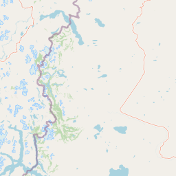
The landscape of Perito Moreno National Park is defined by a spectacular arrangement of mountain ranges that traverse the protected area in roughly perpendicular orientations, creating a distinctive amphitheater-like structure with valleys radiating outward from central highlands. The highest point within the park boundaries is Cerro Heros, reaching 2,770 meters above sea level. Immediately adjacent to the park, but outside its boundaries, rises the imposing Cerro San Lorenzo (Monte San Lorenzo) at 3,707 meters, typically shrouded in clouds and representing the second-highest peak in all of Patagonia. The terrain includes several notable features: Cerro Leon to the north of Lake Belgrano rises to 1,380 meters, while Gorra de Vasco reaches 1,140 meters on the eastern side of the same lake. The Sierra Colorada, or Red Range, attains approximately 1,200 meters and is distinguished by its western slope's dramatic abruptness and the reddish coloration that gives the formation its name. The park sits at approximately 900 meters elevation, which represents the typical altitude of the inhabited valley floors in this portion of Patagonia. Hydrographically, the park is divided between two major basins: the Pacific basin, feeding into lakes Mogote and Volcán that ultimately drain westward, and the Atlantic basin, featuring Lake Burmeister at 932 meters and numerous rivers flowing eastward to the Atlantic Ocean. This dual watershed position is relatively unusual and adds to the park's ecological significance.

Perito Moreno National Park ecosystems, habitats, and plant life

Perito Moreno National Park protects a transition zone between two major Patagonian ecological regions: the humid Magellanic forests of the western Andes and the drier Patagonian steppe that extends across the eastern plains. This positioning creates a mosaic of habitats within the protected area, including Andean forests dominated by lenga (Nothofagus pumilio), subalpine meadows, and expansive areas of Patagonian steppe vegetation. The park's climate gradient from west to east strongly influences vegetation patterns, with precipitation supporting denser forest cover in the western sector while the eastern areas support more open, grass-dominated plant communities. The park lies at an elevation of approximately 900 meters, placing it within a zone that experiences extreme temperature variations. Winter temperatures can plummet below -25 degrees Celsius, while summer averages around 15 degrees Celsius. Persistent strong westerly winds characterize the climate throughout the year, and snowfall can occur in any month. The eight lakes within the park, including the prominent Lake Belgrano, provide important wetland habitats that support additional biodiversity beyond the terrestrial environments.

Perito Moreno National Park wildlife and species highlights

The mammalian fauna of Perito Moreno National Park includes 24 documented species, representing a mix of Patagonian and Andean wildlife. Two species of small wildcats inhabit the park and represent particular conservation concerns: the gato pajero (Lynchailurus pagerso, also known as the Patagonian pampas cat) and the gato huiña (Oncifelis guigna, the Kodkod), both classified as endangered. Larger predators present include the puma (cougar), which ranges across the Patagonian landscape, and the Patagonian fox (culpeo). Herbivores include the guanaco, which remains a characteristic species of the Patagonian steppe, and the south Andean deer (huemul). The park also supports smaller mammals such as the dwarf armadillo (pichi), ferret, skunk, and the subterranean rodent known as tuco-tuco. Avian diversity is particularly notable, with 115 bird species recorded within the park. Raptors are well represented, including the peregrine falcon, various falcon species, and eagles. Waterfowl and wetland species include several duck species, while the distinctive hooded grebe inhabits the park's lakes. The iconic flamingo and the Andean goose also occur in the area, representing the blend of Patagonian and high-Andean bird communities.

Perito Moreno National Park conservation status and protection priorities

Perito Moreno National Park holds significant conservation value as one of Argentina's oldest protected areas and as a representative sample of Patagonian mountain ecosystems. The park's designation as an IUCN Category II protected area reflects its primary purpose of preserving natural ecosystems while allowing for sustainable visitor use. The 2013 expansion through the Tompkins Conservation land donation substantially enhanced the park's ecological integrity by incorporating previously private lands into the protected area, allowing for the continuation of rewilding processes that had been underway since the early 1990s. The protection of the two endangered small wildcat species, the gato pajero and gato huiña, represents a particular conservation priority within the park. The dual hydrographic division of the park, with waters draining to both the Pacific and Atlantic oceans, adds a unique dimension to its conservation significance. The park also functions as a buffer zone for the nearby Monte San Lorenzo, a peak of outstanding conservation importance though outside the protected area boundaries. The transition zone between wet and dry Patagonian ecosystems that the park protects is increasingly vulnerable to climate change impacts, making its long-term protection increasingly important.

Perito Moreno National Park cultural meaning and human context

Perito Moreno National Park is named for Francisco Moreno (1854-1921), a seminal figure in Argentine exploration and scientific investigation of Patagonia. Moreno was a geographer, naturalist, and explorer who led numerous expeditions throughout the southern regions of Argentina and contributed substantially to the mapping and understanding of the Patagonian territory. His explorations often brought him into contact with indigenous communities of the region, and he documented extensively the natural history of areas that would eventually become protected. The park lies within the traditional territory of various indigenous groups who inhabited Patagonia before European settlement, though the source material provides limited detail on these historical connections. The park's location in Santa Cruz Province places it within a region that remains one of the least densely populated areas of Argentina, preserving a sense of remote wilderness character that aligns with the Patagonian identity.

Top sights and standout views in Perito Moreno National Park

The dramatic mountain amphitheater formed by the park's intersecting mountain ranges creates one of Patagonia's most visually striking natural settings, with peaks rising over 2,700 meters within the protected area and the cloud-shrouded Cerro San Lorenzo visible on the horizon. The park's position at the ecological transition between wet Magellanic forests and dry Patagonian steppe provides remarkable habitat diversity within a single protected area. The presence of two endangered small wildcat species, the gato pajero and gato huiña, makes the park particularly significant for feline conservation in South America. The eight lakes and dual watersheds draining to both oceans create a unique hydrographic feature uncommon among protected areas globally. The park's history as one of Argentina's oldest national parks, combined with the successful 2013 expansion through private conservation partnership, demonstrates a model of protected area enhancement.

Best time to visit Perito Moreno National Park

The optimal visiting season for Perito Moreno National Park runs from late spring through early autumn, roughly November through March in the Southern Hemisphere, when average temperatures are more moderate and the likelihood of severe winter conditions is reduced. Summer months offer the most comfortable climate for exploration, with mean temperatures around 15 degrees Celsius, though the famous Patagonian winds persist year-round and can create challenging conditions even during the warmer season. Winter visits are possible but require preparation for extreme cold, as temperatures can fall below -25 degrees Celsius, and snowfall may occur in any month including the summer period. The park's western sector tends to receive significantly more precipitation than the eastern areas, so visitors seeking drier conditions should plan accordingly. The strong and persistent westerly winds that characterize the region throughout the year are an important consideration for any visit, regardless of season.

Park location guide

Geography guide, regional context, and park location map for Perito Moreno National Park

Perito Moreno National Park park geography, regions, and map view in Argentina
Understand where Perito Moreno National Park sits in Argentina through a broader geographic reading of the surrounding landscape, nearby location context, and its mapped position within the national park landscape.

How Perito Moreno National Park fits into Argentina

Argentina is a federal republic located in the southern cone of South America, bordering Chile, Bolivia, Paraguay, Brazil, Uruguay, and the Atlantic Ocean. With an area of 2,780,085 km², it is the second-largest country in South America and the eighth-largest globally. The capital and largest city is Buenos Aires, and the official language is Spanish. The country claims sovereignty over the Falkland Islands, South Georgia and the South Sandwich Islands, and a portion of Antarctica.

Wider geography shaping Perito Moreno National Park in Argentina

Argentina occupies the southern portion of South America, sharing the Southern Cone region with Chile to the west. The country borders Bolivia and Paraguay to the north, Brazil to the northeast, Uruguay and the South Atlantic Ocean to the east, and the Drake Passage to the south. The Andes mountain range runs along the western border, while the Pampas plains dominate the central region. Argentina also claims territories in Antarctica.

Map view of Perito Moreno National Park

Use this park location map to pinpoint Perito Moreno National Park in Argentina, understand its exact geographic position, and read its mapped placement within the surrounding landscape more clearly.

Pigeon | © OpenStreetMap contributors
Park atlas

Compare the diverse mountain terrain and conservation landscapes within Patagonia's protected areas.

Explore Nearby National Parks and Protected Areas Around Perito Moreno, Patagonia
Continue your geographic discovery from Perito Moreno National Park by browsing other national parks and protected areas across Argentina's Patagonian region, encompassing its diverse mountainous terrain and unique ecological zones. Compare varied protected landscapes, understand regional conservation efforts, and trace the distribution of distinct ecosystems, from Andean forests to arid steppe environments.
National parkAysén Region

Patagonia National Park, Chile: Exploring Protected Landscape and Regional Geography

Mapped boundaries and natural terrain in Aysén Region.

Patagonia National Park, situated within the Aysén Region of Chile, serves as a significant protected area offering rich opportunities for atlas-based geographic exploration. This national park's specific landscape identity and mapped boundaries provide a clear focal point for understanding regional conservation and natural terrain. Discover the geographic context of this protected land and its place within the broader landscape of southern Chile through structured data and map exploration.

Area
3,045.28 km²
Established
2018
IUCN
II
Relief
Mountain
National park

Patagonia National Park: A National Park Protecting the Argentine Patagonian Steppe Landscape

Explore the mapped boundaries of this semi-arid grassland ecosystem.

Patagonia National Park is a protected national park in Argentina established to preserve the representative Patagonian steppe ecosystem. Covering 528.11 square kilometers, it offers a deep dive into the unique semi-arid grassland environment, known for its rolling plains and wind-shaped terrain. This park provides crucial context for understanding the broader geography of southern Argentina and the conservation of its distinctive natural landscapes.

Area
528.11 km²
Established
2015
IUCN
II
Climate
Arid
National parkAysén del General Carlos Ibáñez del Campo Region

Laguna San Rafael National Park: Explore its Mapped Boundaries and Patagonian Landscape

A National Park within Aysén del General Carlos Ibáñez del Campo Region.

Laguna San Rafael National Park stands as a key protected area within the vast geography of the Aysén del General Carlos Ibáñez del Campo Region. This entry provides an atlas-focused perspective, detailing the park's geographic significance, mapped natural landscapes, and its role as a vital conservation territory. Understand how this national park fits into the broader context of Patagonia's unique terrain and protected areas.

Area
17,420 km²
Established
1959
IUCN
II
Relief
Mountain
National parkAysén del General Carlos Ibáñez del Campo Region

Cerro Castillo National Park: Dramatic Granite Peaks and Patagonian Protected Landscape

Mapped geography and huemul conservation in Chile's Aysén Region.

Cerro Castillo National Park is a premier protected area in southern Chile, celebrated for its iconic Cerro Castillo granite mountain that dominates the landscape. This national park, spanning over 1,700 square kilometers in the Aysén del General Carlos Ibáñez del Campo Region, showcases a dynamic Patagonian terrain shaped by glaciers and rivers. Its significance extends to being a vital corridor for endangered huemul, offering critical habitat within a broader regional conservation strategy and the famous Route of Parks.

Area
1,795.5 km²
Established
1970
IUCN
II
Relief
Mountain
National park

Los Glaciares National Park: Argentinian National Park with Patagonian Ice Fields

Explore glacial terrain and iconic Andes peaks.

Los Glaciares National Park is a vast protected area in Argentina, dominated by a massive Patagonian ice cap and numerous descending glaciers, including the renowned Perito Moreno Glacier. Its dramatic landscape of ice fields, glacial lakes, and towering granite spires like Mount Fitz Roy provides critical context for understanding regional geography and the formation of glacial terrain. This park exemplifies the unique protected ecosystems of the southern Andes, offering rich detail for atlas-based discovery.

Area
7,269.27 km²
Established
1937
IUCN
II
Visitors
688.8K annual
National parkAysén del General Carlos Ibáñez del Campo Region

Bernardo O'Higgins National Park: Southern Patagonian Ice Field & Glacial Terrain

Chile's largest protected area: a map of vast ice caps and fjords.

Bernardo O'Higgins National Park is a colossal protected landscape in Chile, safeguarding much of the Southern Patagonian Ice Field and its colossal glacial features like the Pío XI Glacier. Explore the dramatic terrain of towering granite peaks and intricate fjord systems that define this remote national park. This page provides essential context for understanding its geography, mapped boundaries, and significance as a vast wilderness preservation.

Area
35,259 km²
Established
1969
IUCN
II
Visitors
36K annual
National park

Bosques Petrificados de Jaramillo National Park: Argentina's Jurassic Petrified Forest Landscape

Explore mapped fossil trees across the Patagonian steppe.

Bosques Petrificados de Jaramillo National Park is a protected national park in Argentina's Santa Cruz Province, celebrated for its extensive collection of Jurassic period fossilized trees. Spanning nearly 80,000 hectares of Patagonian steppe, the park's unique landscape is defined by exposed petrified trunks, some of remarkable size, providing crucial evidence of the region's ancient ecosystems and paleoclimatic history. Discover this extraordinary site through its mapped geography and protected landscape identity.

Area
785.43 km²
Established
2012
IUCN
II
Relief
Mixed relief
National parkAysén del General Carlos Ibáñez del Campo Region

Isla Magdalena National Park: Protected Area and Regional Geography Context

Discover the mapped landscape of this national park.

Delve into the protected landscape of Isla Magdalena National Park, a key national park situated in the Aysén del General Carlos Ibáñez del Campo Region of Chile. This entry provides essential geographic context, focusing on the park's mapped boundaries and its role within the Patagonian environment. Understand its distinct identity as a protected area for structured atlas exploration.

Area
1,576 km²
Established
1983
IUCN
II
Relief
Mountain

Common questions about visiting, size, designation, and location context for Perito Moreno National Park

Perito Moreno National Park FAQs for park facts, access, geography, and protected area context
Find quick answers about Perito Moreno National Park, including protected-area facts, park geography, trail and visitor context, and how the park fits into its surrounding country and regional landscape.
MoriAtlas Explorer

Continue Your Protected Areas Search Across the Global Atlas

Deepen your exploration by continuing the structured search for national parks and protected areas worldwide. Utilize the comprehensive filtering capabilities to compare different conservation landscapes and refine your understanding of global park geography. Discover more about the distribution and characteristics of protected natural areas.

Global natural geography