Mori Atlas logo
National parkTierra del Fuego National Park

Discover the dramatic terrain and subantarctic ecosystems at South America's continental tip.

Tierra del Fuego National Park: Protected Landscape and Southernmost Geography

(Parque Nacional Tierra del Fuego)

Tierra del Fuego National Park represents the protected natural heritage at the southernmost reaches of Argentina, an area where ancient Patagonian forests dramatically meet the Andes mountains. As a unique coastal national park, it offers rich opportunities for understanding regional geography, exploring mapped park boundaries along the Beagle Channel, and appreciating its subantarctic ecosystems. This detailed geographic profile provides a foundation for atlas-based discovery of its distinctive terrain and significant landscape context within Tierra del Fuego Province.

Patagonian forestGlacial lakesBeagle ChannelSubantarctic ecosystemsCoastal protected areaIUCN Category II

Tierra del Fuego National Park

National park

Park overview

Structured park overview, official facts, and landscape profile for Tierra del Fuego National Park

Tierra del Fuego National Park park facts, protected area profile, and essential visitor context
Review the core facts for Tierra del Fuego National Park, including designation, size, terrain, visitor scale, habitats, and operating context in one park-focused overview.

About Tierra del Fuego National Park

Tierra del Fuego National Park occupies a remarkable position at the southernmost tip of South America, protecting a segment of the island of Tierra del Fuego that spans from the Beagle Channel northward to the shores of Lago Fagnano along the Chilean border. The park was established in 1960 as Argentina's first shoreline national park, a designation reflecting its unique combination of terrestrial and marine environments. The landscape bears the unmistakable signature of glacial processes, with erosion having carved the bays, beaches, and steep valleys that define the park's character against a backdrop of rugged mountains. The park encompasses two distinct ecoregions: the Patagonian Forest with its high, jagged mountains, glacier valleys, and semi-deciduous forests, and the Altos Andes characterized by hill ranges and slopes. This geographic diversity supports a rich tapestry of habitats, from coastal shores to subalpine meadows. The park lies approximately 11 kilometers west of Ushuaia, the capital of Tierra del Fuego Province and one of the southernmost cities in the world, making it an accessible destination for visitors seeking to experience the end of the world.

Quick facts and research context for Tierra del Fuego National Park

Tierra del Fuego National Park is Argentina's southernmost national park, situated on Isla Grande de Tierra del Fuego in Tierra del Fuego Province. The park was established on October 15, 1960 and covers roughly 630 square kilometers along the Beagle Channel. It protects a portion of the subantarctic forest and Altos Andes ecoregions, with the park boundaries stretching 60 kilometers northward from the Beagle Channel along the Chilean frontier. Key features include parts of Lago Fagnano and Lago Roca, the popular Senda Costera coastal hiking trail, and the End of the World Train heritage railway. The park contains 20 species of terrestrial mammals and approximately 90 bird species, living among forests of Antarctic beech, lenga beech, and coihue.

Park context

Deeper park guide and search-rich context for Tierra del Fuego National Park

Tierra del Fuego National Park history, landscape, wildlife, and travel context
Explore Tierra del Fuego National Park through its history, landscape character, ecosystems, wildlife, conservation priorities, cultural context, and seasonal travel timing in a structured park guide built for atlas discovery and search intent.

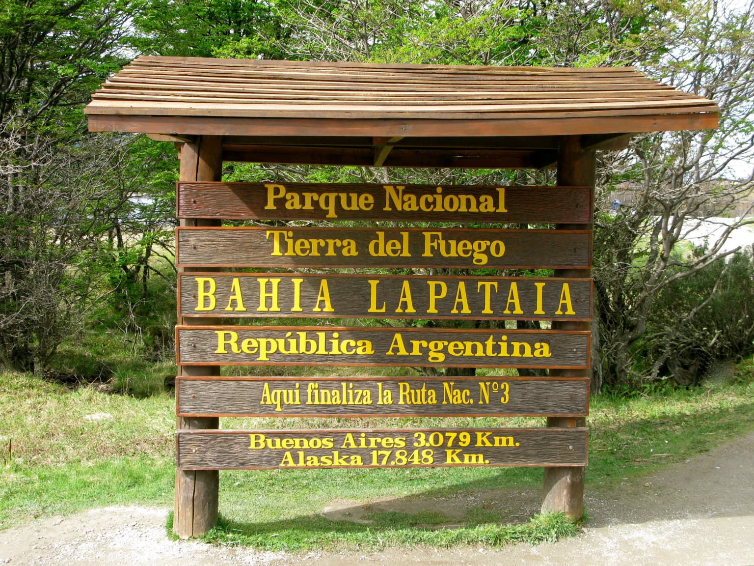
Why Tierra del Fuego National Park stands out

Tierra del Fuego National Park is best known for its dramatic subantarctic scenery combining coastal fjords, glacial valleys, and ancient beech forests at the southern tip of South America. The park protects the southernmost stretches of the Patagonian Forest, with towering stands of lenga and coihue beech creating a distinctive landscape. The Beagle Channel, named after HMS Beagle which carried Charles Darwin through these waters in 1833-34, forms the park's southern boundary and is fringed with rugged coastlines and hidden bays. The Senda Costera trail connecting Ensenada Bay to Lapataia Bay along Lago Roca is a celebrated hiking route. The park also marks the southern terminus of the Pan-American Highway and is accessible via the heritage End of the World Train, adding historical and cultural depth to its natural significance.

Black Necked Swan.jpg
Black Necked Swan in Tierra del Fuego National Park

Tierra del Fuego National Park history and protected-area timeline

The human history of Tierra del Fuego stretches back at least 10,000 years to when the Yaghan people, also known as Yámana, inhabited the region. These indigenous peoples survived in the harsh environment by utilizing the rich resources of the sea, hunting sea lions and collecting shellfish from the beaches and coastal waters. They constructed canoes from lenga beech wood and built shelters from tree branches, clothing themselves in sea lion pelts. The Spanish explorers who first reached this southern tip of South America named the area "Tierra del Fuego" after observing the campfires of native inhabitants along the coast. In 1870, Anglican missionary Wasti H. Stirling began converting Yaghan tribes, and the 1880s brought gold prospectors following rumors of rich fields that proved unfounded. European missionaries introduced diseases such as measles that devastated the Yaghan population, reducing them from approximately 3,000 people in 1880 to fewer than 100 by the 1990s, with the last native speakers passing away in the 2000s. The 1881 Boundary Treaty between Argentina and Chile divided the island, and an Argentine naval base established in 1884 further developed the region. In 1902, President Julio Argentino Roca established a penal colony on Staten Island, with prisoners constructing the city and exploiting the forests that now fall within the park. The Southern Fuegian Railway, known as the End of the World Train, was built between 1909 and 1910 to transport prisoners and logged timber. After the prison closed in 1947 and the railway in 1952, the railway was revived in 1994 as a heritage attraction. The park was definitively created on September 30, 1960 under Law 15.554, with a management plan approved in 2007 and updated in 2021.

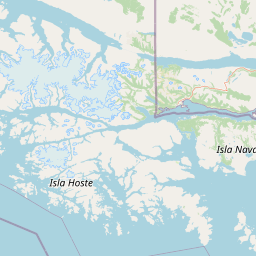
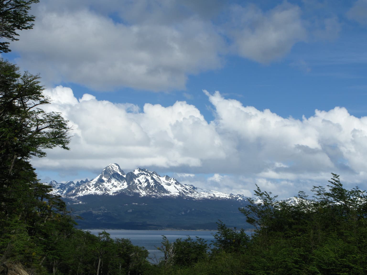
Tierra del Fuego National Park landscape and geographic character

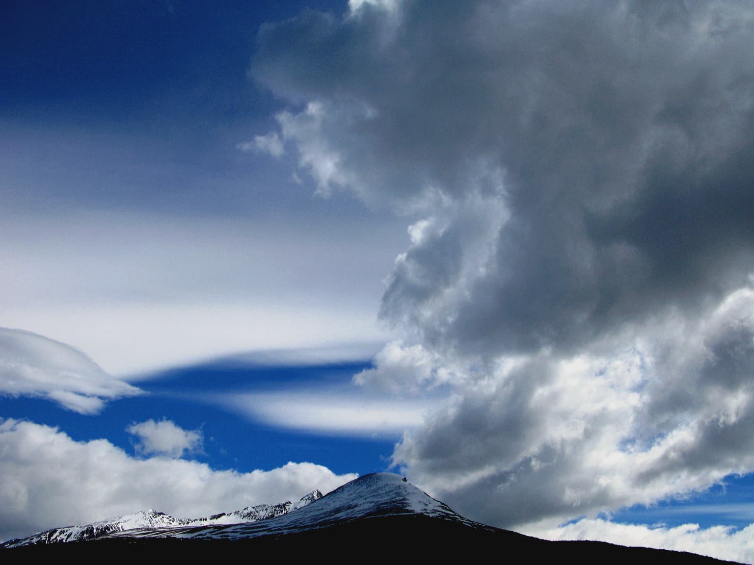
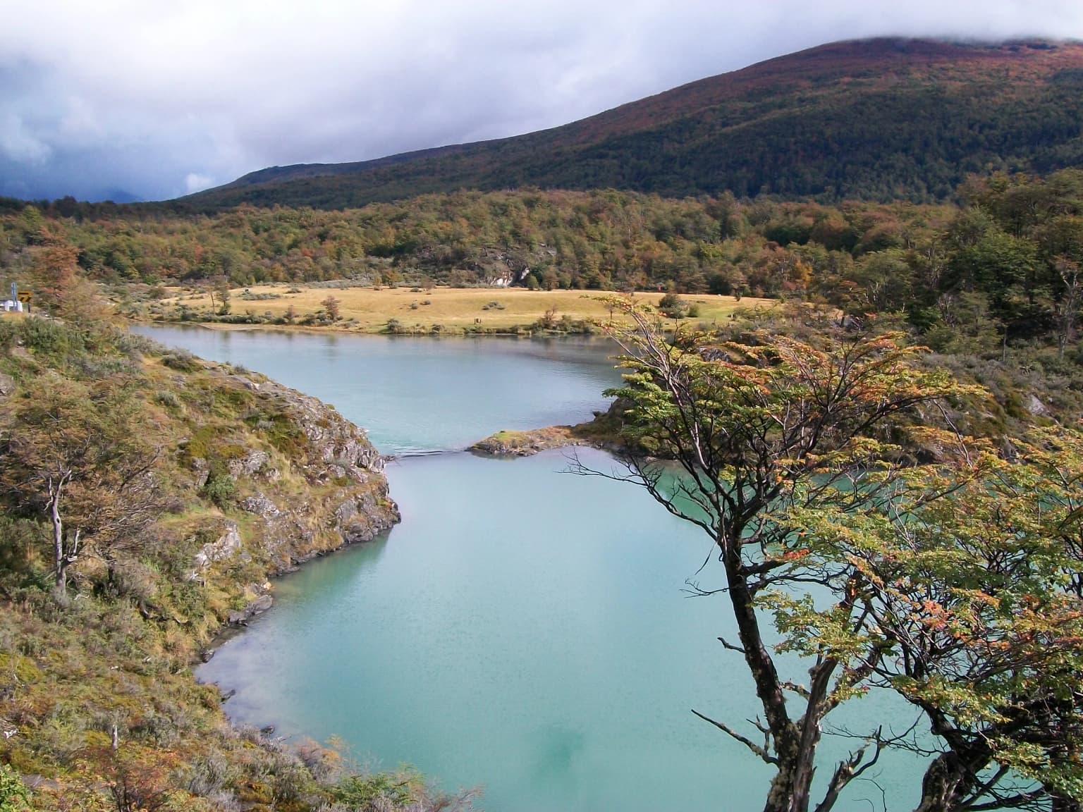
The landscape of Tierra del Fuego National Park results from glacial erosion that has created a dramatic terrain of bays, beaches, and steep valleys against a backdrop of rugged mountains. The park is bounded to the west by the Chilean border, to the north by the vast Lago Fagnano, and to the south by the Beagle Channel, which forms a rugged shoreline with cliffs and hidden coves. The terrain includes mountains, lakes, rivers, and valleys, with elevation ranging from sea level along the Beagle Channel to over 1,400 meters at peaks like Cerro Vinciguerra. The Sierra de Beauvoir forms a notable mountain range in the northern sector. Lago Fagnano, also known as Cami Lake, is the largest lake in Tierra del Fuego and one of the southernmost lakes of its size in the world, extending east-west across the island with its western portion in Chile. The landscape reflects the park's position at the transition between the Patagonian Andes and the subantarctic environment, creating a mosaic of forest-covered slopes, open meadows, and glacial carved waterways.

Beagle Channel penguins
Beagle Channel - Cormorants

Tierra del Fuego National Park ecosystems, habitats, and plant life

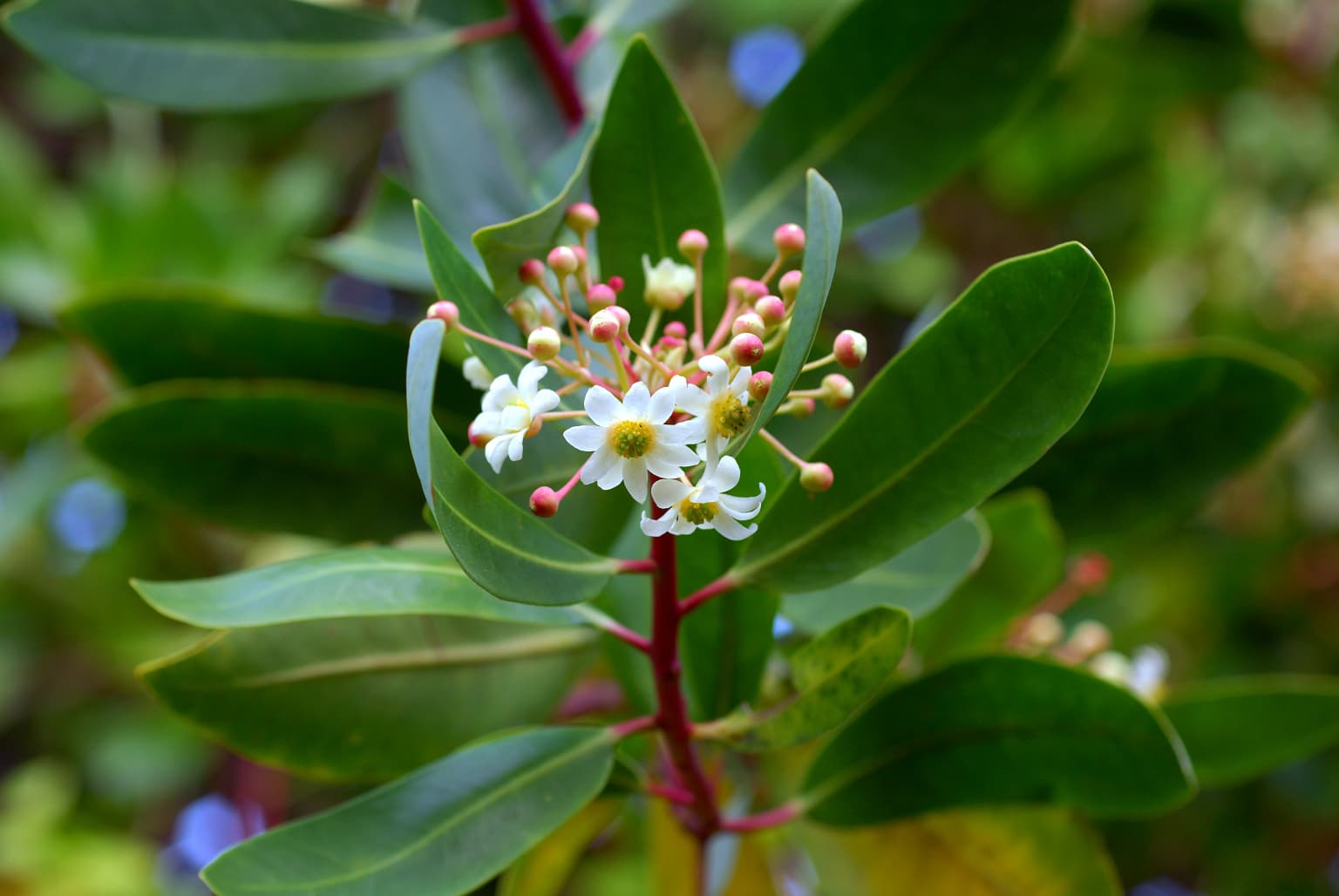
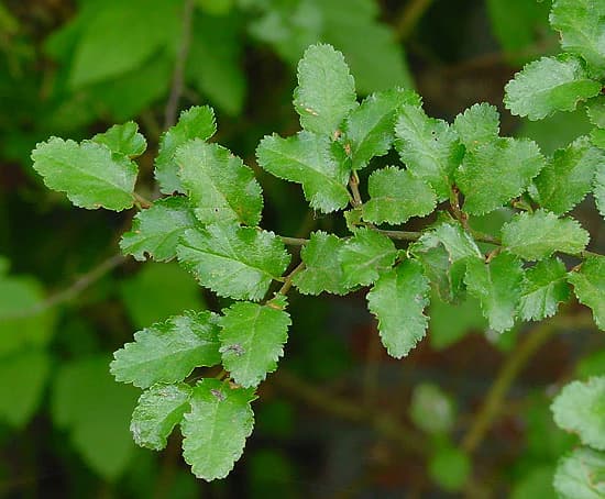
The park protects a significant portion of the subantarctic forest, one of the southernmost forest ecosystems in the world. The vegetation is dominated by southern beech species including coihue, lenga, and Antarctic beech, which form extensive forests that descend from the mountain slopes to the coast. Lenga beech dominates the deciduous forests, while coihue and Antarctic beech occur in the wetter areas, particularly along the Beagle Channel. The understory contains a diverse assembly of shrubs and plants including calafate, chaura, michay, and notro, with delicate ferns and orchids in the shadier spots. Peat bogs are a characteristic feature of the park, formed by sphagnum moss and aquatic grasses in damp valleys where low temperatures prevent decomposition. Above approximately 600 meters elevation, the forest gives way to altoandina vegetation characterized by small bushes, cushion plants, and grasses adapted to harsh conditions. The coastal waters support extensive kelp forests, and the marine environment belongs to the ecoregion of Channels and Fjords of Southern Chile, hosting rich biodiversity.

Drimys winteri var. chilensis
A botanical illustration of Drimys winteri var. chilensis, a plant found in Tierra del Fuego National Park.

Tierra del Fuego National Park wildlife and species highlights

Tierra del Fuego National Park supports a diverse faunal community representing both native Patagonian species and introduced mammals. The park records 20 species of terrestrial mammals, including the guanaco as the largest native mammal, the Andean fox, and introduced species such as the North American beaver, European rabbit, and muskrat. The beaver, introduced in the 1940s, has caused significant environmental damage to the forest ecosystem and is the subject of ongoing eradication efforts. The bird fauna is particularly rich with approximately 90 species, including the kelp goose, torrent duck, austral parakeet, Andean condor, blackish oystercatcher, Magellanic oystercatcher, and the Magellanic woodpecker. The austral parakeet represents the southernmost distributed parrot species in the world. Marine mammals include South American sea lions along the coast. Notable avifauna also includes petrels, albatrosses, several penguin species, the South Andean deer, and the southern river otter. The coastal waters contain diverse fish and invertebrates including scallops, crabs, and various fish species.

Escalonadas Lakes.jpg
Escalonadas Lakes in Tierra del Fuego National Park, Argentina.

Tierra del Fuego National Park conservation status and protection priorities

Tierra del Fuego National Park is designated as an IUCN Category II protected area, reflecting its national park status and conservation significance. The park protects critical habitat at the southernmost limit of the subantarctic forest ecosystem, representing an important transition zone between South American and subantarctic biogeographic provinces. The park's coastal marine environment is part of the Channels and Fjords of Southern Chile ecoregion, supporting significant biodiversity. Management zoning separates the approximately 2,000 hectares open to public use in the southern sector from strict nature reserves covering the remainder of the park. Conservation challenges include managing invasive species, particularly the North American beaver which has caused substantial forest damage, and balancing visitor access with habitat protection. The park participates in broader regional conservation frameworks and is part of Argentina's national protected areas system administered by Administración de Parques Nacionales.

Tierra del Fuego National Park cultural meaning and human context

The cultural context of Tierra del Fuego National Park is deeply connected to the indigenous peoples who inhabited these lands for thousands of years. The Yaghan or Yámana people were the primary inhabitants of the coastal areas around the Beagle Channel, where they lived in continual conflict with the northern Selk'nam. Their shell middens, visible along the beaches, represent the remains of a maritime-based economy centered on hunting sea lions and collecting shellfish. The name "Tierra del Fuego" itself derives from the Spanish observation of native campfires along this coast. The Beagle Channel is named after HMS Beagle, the British ship that carried Charles Darwin during his voyage of discovery in 1833-34. The park's more recent history includes the penal colony era when prisoners constructed roads and exploited forest resources, creating the infrastructure that now serves the heritage railway. The southern terminus of the Pan-American Highway within the park symbolizes the connection between the Americas, adding another layer to the region's cultural significance.

Magellanic Woodpecker Male
Male Magellanic Woodpecker (Campephilus magellanicus) in Tierra del Fuego National Park, Argentina.

Top sights and standout views in Tierra del Fuego National Park

Tierra del Fuego National Park offers visitors multiple outstanding features that define its character as a destination. The Senda Costera coastal path provides a celebrated hiking experience along the shores of Lago Roca from Ensenada Bay to Lapataia Bay. The End of the World Train offers a unique heritage railway journey from Ushuaia into the park, following the route of the former prison railway. The park contains the southern terminus of the Pan-American Highway, marked within the park boundaries at Lapataia Bay. The Beagle Channel provides scenic coastal exploration with opportunities to observe seabirds, marine mammals, and the dramatic shoreline. The forests of lenga and coihue beech create an atmospheric landscape, particularly striking during autumn when the deciduous lenga turns brilliant colors. Lago Fagnano offers panoramic views of the largest lake in Tierra del Fuego, straddling the Argentine-Chile border.

Nothofagus antarctica D.jpg
Antarctic Beech tree

Best time to visit Tierra del Fuego National Park

The best time to visit Tierra del Fuego National Park depends on what visitors hope to experience, with each season offering a different character. The summer months of December through March bring the warmest conditions, with average temperatures around 10 degrees Celsius and extended daylight hours ideal for hiking and outdoor activities. This is the peak visitation period when the Senda Costera and other trails are fully accessible. Winter from June to September transforms the landscape with snow-covered peaks and frozen lakes, though access is more limited and temperatures can drop below freezing. The shoulder seasons of spring and autumn offer changing scenery as the lenga beech forests shift colors, with autumn particularly spectacular as the deciduous canopies turn golden and red. The park experiences a temperate climate with frequent rain, fog, and strong westerly winds throughout the year, so visitors should be prepared for variable conditions regardless of season. The annual rainfall averages around 700 millimeters, distributed fairly evenly across the months with no true dry season.

Park location guide

Geography guide, regional context, and park location map for Tierra del Fuego National Park

Tierra del Fuego National Park park geography, regions, and map view in Argentina
Understand where Tierra del Fuego National Park sits in Argentina through a broader geographic reading of the surrounding landscape, nearby location context, and its mapped position within the national park landscape.

How Tierra del Fuego National Park fits into Argentina

Argentina is a federal republic located in the southern cone of South America, bordering Chile, Bolivia, Paraguay, Brazil, Uruguay, and the Atlantic Ocean. With an area of 2,780,085 km², it is the second-largest country in South America and the eighth-largest globally. The capital and largest city is Buenos Aires, and the official language is Spanish. The country claims sovereignty over the Falkland Islands, South Georgia and the South Sandwich Islands, and a portion of Antarctica.

Wider geography shaping Tierra del Fuego National Park in Argentina

Argentina occupies the southern portion of South America, sharing the Southern Cone region with Chile to the west. The country borders Bolivia and Paraguay to the north, Brazil to the northeast, Uruguay and the South Atlantic Ocean to the east, and the Drake Passage to the south. The Andes mountain range runs along the western border, while the Pampas plains dominate the central region. Argentina also claims territories in Antarctica.

Map view of Tierra del Fuego National Park

Use this park location map to pinpoint Tierra del Fuego National Park in Argentina, understand its exact geographic position, and read its mapped placement within the surrounding landscape more clearly.

Pigeon | © OpenStreetMap contributors

Location context for Tierra del Fuego National Park

Tierra del Fuego Province

Visual Guide to Patagonia's Southernmost Scenery, Glacial Lakes, and Ancient Beech Forest Habitats within the National Park

Tierra del Fuego National Park Photos: Explore Subantarctic Landscapes and Scenic Protected Areas
Visually explore the dramatic landscapes of Tierra del Fuego National Park, from the rugged Beagle Channel coastlines to ancient lenga forests and glacial-carved valleys. The imagery offers a concrete understanding of this southernmost protected area's subantarctic scenery, diverse habitats, and unique terrain.

Black Necked Swan.jpg

Calafate (Berberis buxifolia) plant

Beagle Channel penguins

Drimys winteri var. chilensis

Escalonadas Lakes.jpg

Isla Los Lobos Sea Lions

Magellanic Woodpecker Male

Nothofagus antarctica D.jpg

Nothofagus betuloides

Nothofagus pumilio

Tierra del Fuego National Park, Argentina

Podiceps major.jpg

American Beaver.jpg

Kelp Goose (Chloephaga hybrida)

Tierra del Fuego National Park Entrance

Beagle Channel from Tierra del Fuego National Park

Park atlas

Trace the regional spread of protected areas and compare unique landscapes across southern Patagonia.

Explore Other National Parks and Protected Areas Near Tierra del Fuego, Patagonia
Browse national parks and protected areas near Tierra del Fuego National Park, tracing subantarctic ecosystems, Patagonian forests, and coastal landscapes of this southernmost region. Compare these distinct conservation landscapes to explore regional park geography, mapped glacial terrain, and unique protected-area spread across the South American tip.
National parkMagallanes Region

Alberto de Agostini National Park: Glacial Landscapes and Cordillera Darwin Geography

Explore a protected national park in Chile's Magallanes Region.

Alberto de Agostini National Park is a significant protected area within the Magallanes Region, defined by the dramatic southern extent of the Andes, including the iconic Cordillera Darwin. This national park is characterized by extensive tidewater glaciers, deep fjords, and unique subpolar forests, offering a profound example of glacial landscape formation. Understanding its geographic setting and mapped boundaries provides critical context for exploring this remote Patagonian wilderness and its ecological significance.

Area
14,600 km²
Established
1965
IUCN
II
National parkSanta Cruz Province

Monte León National Park: A Protected Coastal Landscape in Argentina's Santa Cruz Province

Explore unique sandstone formations and marine park geography.

Monte León National Park represents a crucial protected landscape, safeguarding a significant stretch of the Patagonian coastline in Argentina's Santa Cruz Province. This area is defined by striking sandstone cliffs, the iconic Lion Head Mount formation, and a dynamic coast with beaches and emergent sandbars. As the nation's first continental marine park, it offers a unique geographic context for understanding steppe and coastal biodiversity, providing an essential atlas entry for those exploring Argentina's natural heritage.

Area
621.68 km²
Established
2004
IUCN
II
National parkAysén del General Carlos Ibáñez del Campo Region

Bernardo O'Higgins National Park: Southern Patagonian Ice Field & Glacial Terrain

Chile's largest protected area: a map of vast ice caps and fjords.

Bernardo O'Higgins National Park is a colossal protected landscape in Chile, safeguarding much of the Southern Patagonian Ice Field and its colossal glacial features like the Pío XI Glacier. Explore the dramatic terrain of towering granite peaks and intricate fjord systems that define this remote national park. This page provides essential context for understanding its geography, mapped boundaries, and significance as a vast wilderness preservation.

Area
35,259 km²
Established
1969
IUCN
II
National parkSanta Cruz Province

Perito Moreno National Park: Mapped Protected Landscape and Geographic Context in Santa Cruz Province

Explore Argentinian Patagonian mountain terrain and its ecological transition.

Perito Moreno National Park is a vast protected area in Argentina's Santa Cruz Province, known for its dramatic Patagonian mountain landscapes and unique ecological transition zone between wet Magellanic forests and dry Andean steppe. Spanning over 126,830 hectares, the park's geography features an amphitheater-like structure with valleys radiating from central highlands, and peaks reaching nearly 2,800 meters. This national park provides critical insight into the regional natural landscapes and mapped protected areas of Patagonia, offering a detailed view of its terrain and hydrographic features.

Area
1,268.3 km²
Established
1937
IUCN
II
National parkAysén del General Carlos Ibáñez del Campo Region

Cerro Castillo National Park: Dramatic Granite Peaks and Patagonian Protected Landscape

Mapped geography and huemul conservation in Chile's Aysén Region.

Cerro Castillo National Park is a premier protected area in southern Chile, celebrated for its iconic Cerro Castillo granite mountain that dominates the landscape. This national park, spanning over 1,700 square kilometers in the Aysén del General Carlos Ibáñez del Campo Region, showcases a dynamic Patagonian terrain shaped by glaciers and rivers. Its significance extends to being a vital corridor for endangered huemul, offering critical habitat within a broader regional conservation strategy and the famous Route of Parks.

Area
1,795.5 km²
Established
1970
IUCN
II
National parkAysén del General Carlos Ibáñez del Campo Region

Queulat National Park: Patagonian Andes Glacier and Rainforest Discovery

Mapped protected area in Aysén del General Carlos Ibáñez del Campo Region.

Queulat National Park is a vast protected wilderness in southern Chile, renowned for its dramatic glacial alpine terrain and lush temperate rainforests. The park's geography is defined by steep glacial valleys, ice fields, and the iconic Queulat Hanging Glacier cascading from sheer cliffs. Discover the mapped boundaries of this significant Patagonian national park, offering unparalleled insight into its unique ecosystems and dramatic landscapes shaped by ice and forest.

Area
1,541 km²
Established
1983
IUCN
II
Relief
Mountain
National parkArgentina

Los Alerces National Park: Ancient Alerce Forests and Glacial Terrain in Argentina

Discover the park's protected landscape and regional geography.

Los Alerces National Park in Argentina is a globally significant protected area, celebrated for its ancient alerce forests, some of the longest-living trees on Earth. This national park showcases a dramatic landscape shaped by glaciers, featuring a series of interconnected lakes and rugged Andean terrain. Explore the unique ecosystem and mapped geography of this UNESCO World Heritage site to understand its profound natural and conservation value.

Area
2,599 km²
Established
1937
IUCN
II
National parkRío Negro Province

Islote Lobos National Park: Coastal Archipelago National Park in Río Negro Province

Mapping the dynamic intertidal zones and unique Patagonian marine geography.

Islote Lobos National Park is a notable national park on the Atlantic coast of Río Negro Province, Argentina. This protected area preserves a distinctive landscape of six rocky promontories emerging from San Matías Gulf, creating unique island ecosystems. The park's coastal and marine environments, characterized by significant tidal fluctuations and important habitats for marine fauna, are vital to the Patagonian natural heritage. Its mapped geography offers critical insights into regional conservation efforts.

Area
19.079 km²
Established
2020
IUCN
II

Common questions about visiting, size, designation, and location context for Tierra del Fuego National Park

Tierra del Fuego National Park FAQs for park facts, access, geography, and protected area context
Find quick answers about Tierra del Fuego National Park, including protected-area facts, park geography, trail and visitor context, and how the park fits into its surrounding country and regional landscape.
MoriAtlas Explorer

Continue Your Protected Areas Search Across the Global Atlas

Deepen your exploration by continuing the structured search for national parks and protected areas worldwide. Utilize the comprehensive filtering capabilities to compare different conservation landscapes and refine your understanding of global park geography. Discover more about the distribution and characteristics of protected natural areas.

Global natural geography