Mori Atlas logo
National parkBotum Sakor National Park

Discover the mapped boundaries and diverse ecosystems of this critical coastal wilderness.

Botum Sakor National Park: Cambodia's Largest National Park and Protected Landscape

Botum Sakor National Park, Cambodia's largest protected area, spans 1,825.85 square kilometers on the Cardamom Mountains peninsula. This national park encompasses a rich mosaic of gently sloping lowlands, evergreen forests, grasslands, coastal floodplains, mangrove forests, and freshwater swamp forests. As a key component of the region's geography, understanding its mapped extent and diverse habitats is crucial for appreciating its ecological significance.

largest national parkcoastal protected areamangrove forestlowland evergreen forestCardamom MountainsGulf of Thailand

Botum Sakor National Park

National park

Park overview

Structured park overview, official facts, and landscape profile for Botum Sakor National Park

Botum Sakor National Park park facts, protected area profile, and essential visitor context
Review the core facts for Botum Sakor National Park, including designation, size, terrain, visitor scale, habitats, and operating context in one park-focused overview.

About Botum Sakor National Park

Botum Sakor National Park represents Cambodia's premier protected wilderness area, covering the southwestern reaches of the Cardamom Mountains where they extend as a peninsula into the Gulf of Thailand. The park's 1,825.85 square kilometer expanse encompasses three districts of Koh Kong Province, making it not only the largest national park in Cambodia but one of the most significant conservation areas on the Indochinese peninsula. The park's geography is defined by its transitional position between mountainous and coastal ecosystems, creating a complex mosaic of habitats that includes evergreen woodlands, grassland plains, tidal floodplains, and the critical mangrove forests that fringe its shoreline. The Cardamom Mountains form the northeastern boundary, providing the park with a mountainous backdrop while the gentle slopes descending toward the coast support the lowland forest ecosystems that characterize much of the interior. This coastal peninsula configuration makes Botum Sakor unique among Southeast Asian protected areas, as it encompasses both terrestrial and marine-influenced environments within a single management framework.

Quick facts and research context for Botum Sakor National Park

Botum Sakor National Park occupies a coastal peninsula in Koh Kong Province, Cambodia, projecting southwest from the Cardamom Mountains into the Gulf of Thailand. The park covers 1,825.85 square kilometers across three districts and was established in 1993 under the administration of the Cambodian Ministry of Environment. The area experiences a tropical monsoon climate with twice-daily tides of approximately 1.5 meters. The landscape transitions from evergreen woodlands and grasslands in the interior to mangrove forests and coastal floodplains near the shoreline, creating a mosaic of habitats that support remarkable biodiversity despite limited formal research.

Park context

Deeper park guide and search-rich context for Botum Sakor National Park

Botum Sakor National Park history, landscape, wildlife, and travel context
Explore Botum Sakor National Park through its history, landscape character, ecosystems, wildlife, conservation priorities, cultural context, and seasonal travel timing in a structured park guide built for atlas discovery and search intent.

Why Botum Sakor National Park stands out

Botum Sakor is best known as Cambodia's largest national park and a critical stronghold for Indo-Burmese biodiversity. The park contains significant populations of the pileated gibbon, which may represent as much as 10% of the global population, along with endangered species including the white-winged wood duck, Siamese crocodile, and Asian elephant. Its location on the Cardamom peninsula places it at the intersection of continental and maritime ecosystems, supporting coastal mangroves, freshwater swamps, and lowland evergreen forests in a relatively intact landscape that is increasingly rare in mainland Southeast Asia.

Botum Sakor National Park history and protected-area timeline

Botum Sakor National Park was established in 1993 as part of Cambodia's emerging protected area network following the country's political stabilization in the late 1980s and early 1990s. The park was designated to protect the significant natural values of the Cardamom peninsula, which had remained relatively intact due to its remote location and limited infrastructure development during the preceding decades. Administration was assigned to the Cambodian Ministry of Environment's Department of Nature Conservation and Protection. However, shortly after the park's establishment, the government approved a series of economic land concessions within the park boundaries that have since become a major source of controversy. Beginning in 1998, large portions of the park were allocated to agro-industrial projects, including oil palm, acacia, rubber, and tapioca plantations, as well as tourism development initiatives. The largest of these, the Dara Sakor project awarded to Tianjin Union Development Group in 2008, encompasses 36,000 hectares for tourism development including plans for a major airport, cruise ship facilities, and high-speed rail connections. These developments have proceeded despite the park's protected status, representing a significant challenge to Cambodia's conservation framework.

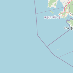
Botum Sakor National Park landscape and geographic character

The landscape of Botum Sakor National Park is characterized by gently sloping lowland terrain that descends from the foothills of the Cardamom Mountains toward the Gulf of Thailand. The park's interior consists predominantly of evergreen woodlands and grasslands, creating a semi-open forest matrix that differs from the dense tropical rainforests found in adjacent mountain areas. As the terrain approaches the coast, the landscape transitions into extensive coastal floodplains marked by mangrove forests and freshwater swamp forests. These tidal wetlands form a critical interface between terrestrial and marine environments, with the park experiencing two high tides per day having a range of approximately 1.5 meters. The southwestern-facing peninsula configuration creates an extensive coastline that exposes the park's mangroves and coastal ecosystems to the Gulf of Thailand. This combination of lowland forests, grasslands, wetlands, and coastal environments makes Botum Sakor one of the most ecologically diverse protected areas in mainland Southeast Asia.

Botum Sakor National Park ecosystems, habitats, and plant life

The ecological character of Botum Sakor National Park reflects its unique position at the intersection of continental and coastal ecosystems in mainland Southeast Asia. The park's habitat mosaic includes evergreen forest, grassland, mangrove forest, and freshwater swamp forest, each supporting distinct ecological communities. The evergreen woodlands of the interior represent the southern extent of Indochinese lowland forest ecosystems, while the coastal mangrove forests rank among the most important in Cambodia for carbon sequestration, coastal protection, and marine fishery support. Despite the park's large size and ecological significance, formal biodiversity research has been limited, with most scientific surveys conducted only between 2005 and 2009. Preliminary findings have revealed exceptional biodiversity value across multiple taxonomic groups, with the park supporting species assemblages characteristic of both the Indochinese and Sundaic biogeographic regions.

Botum Sakor National Park wildlife and species highlights

Botum Sakor National Park supports remarkably rich wildlife, with over 44 mammal species documented within its boundaries, including eight species listed as endangered on the IUCN Red List. The pileated gibbon represents perhaps the park's most significant conservation asset, with estimates suggesting the population may constitute as much as 10% of the global population for this species. Other notable mammals include the Sunda pangolin, Bengal slow loris, Germain's langur, clouded leopard, fishing cat, Asian elephant, and dhole. The park also supports important reptile populations, including a small population of the critically endangered Siamese crocodile in its creeks, along with king cobras and Malayan pit vipers. Bird diversity is exceptional, with the endangered white-winged wood duck among the most significant findings, alongside green peafowl, lesser adjutant, great pied hornbill, and grey-headed fish eagle. The park's lepidopteran diversity is also notable, with 147 species recorded, including 49 species in the Nymphalidae family.

Botum Sakor National Park conservation status and protection priorities

The conservation significance of Botum Sakor National Park is substantial but increasingly threatened. The park represents one of the largest and most intact coastal protected areas in mainland Southeast Asia, providing critical habitat for numerous endangered species and supporting ecosystems of regional importance. The southern portion of the park is included in the Southern Cardamom REDD+ Project, recognizing its role in carbon storage and climate mitigation. However, the park faces severe and escalating threats. Approximately 70% of the park's area has been allocated through economic land concessions for agro-industrial development, including oil palm, rubber, acacia, and tapioca plantations, as well as large-scale tourism infrastructure projects. Satellite imagery has documented extensive clear-cutting within concession areas since 2008, with mangrove forests along the coast nearly eliminated by 2012. Illegal logging continues to degrade the interior forests, with rosewood and other valuable hardwood species targeted by organized criminal networks. Poaching remains rampant, with snare traps and opportunistic hunting for the traditional Chinese medicinal market threatening wildlife populations.

Botum Sakor National Park cultural meaning and human context

Botum Sakor National Park occupies the traditional lands of indigenous communities in Koh Kong Province, though the park's establishment and subsequent land concessions have complicated local land use patterns. The park derives its name from the local Khmer terminology, with the Khmer name ឧទ្យានជាតិបុទុមសាគ reflecting the cultural significance of the area. The coastal communities historically relied on the park's mangrove forests and marine resources, while the interior forests provided traditional livelihoods including non-timber forest product collection. However, the allocation of economic land concessions within the park has displaced traditional land uses and raised concerns about the rights of local communities. Several international conservation organizations work in the area, including Fauna and Flora International, Conservation International, and Wildlife Alliance, supporting biodiversity monitoring and community engagement initiatives.

Top sights and standout views in Botum Sakor National Park

The park's defining features include its status as Cambodia's largest national park, its critical populations of pileated gibbons representing a significant proportion of global numbers, and its diverse habitat mosaic spanning coastal mangroves to lowland evergreen forests. The presence of the critically endangered Siamese crocodile, one of the world's rarest reptiles, in the park's creek systems underscores its conservation importance. The endangered white-winged wood duck, among the rarest waterfowl in Asia, has been documented here, alongside the green peafowl and numerous hornbill species. The park's extensive coastline and mangrove systems support coastal fisheries and provide storm protection for surrounding communities. The Cardamom peninsula location places the park at a biogeographic crossroads, supporting species from both continental Southeast Asia and the Sundaic region.

Best time to visit Botum Sakor National Park

The optimal time to visit Botum Sakor National Park falls during the dry season from November to April, when rainfall is minimal and temperatures are slightly cooler. This period offers the most comfortable conditions for wildlife viewing and forest exploration, though the park's remote character and limited infrastructure mean that access remains challenging year-round. The wet season from May to October brings heavy rainfall that can flood low-lying areas and make interior trails difficult to navigate, but also rejuvenates the park's forests and creates dramatic scenery. Visitors should be aware that the park faces significant access restrictions due to ongoing development projects within concession areas, and travel to the park requires careful planning and local guidance to navigate the complex permitting and access arrangements.

Park location guide

Geography guide, regional context, and park location map for Botum Sakor National Park

Botum Sakor National Park park geography, regions, and map view in Cambodia
Understand where Botum Sakor National Park sits in Cambodia through a broader geographic reading of the surrounding landscape, nearby location context, and its mapped position within the national park landscape.

How Botum Sakor National Park fits into Cambodia

Cambodia is a unitary parliamentary constitutional elective monarchy in Southeast Asia. The country spans 181,035 km² and is characterized by a low-lying plain centered around the Mekong River and Tonlé Sap, Southeast Asia's largest lake. Its capital and largest city is Phnom Penh. The nation has a tropical climate and is home to a predominantly Khmer ethnic population. Cambodia has a history dating back to the Khmer Empire established in 802 AD.

Wider geography shaping Botum Sakor National Park in Cambodia

Cambodia occupies 181,035 km² in Mainland Southeast Asia. It is bordered by Thailand to the northwest, Laos to the north, and Vietnam to the east, with a coastline along the Gulf of Thailand in the southwest. The terrain is dominated by a low-lying central plain centered around the confluence of the Mekong River and Tonlé Sap, Southeast Asia's largest lake. The country has a tropical climate.

Map view of Botum Sakor National Park

Use this park location map to pinpoint Botum Sakor National Park in Cambodia, understand its exact geographic position, and read its mapped placement within the surrounding landscape more clearly.

Pigeon | © OpenStreetMap contributors

Location context for Botum Sakor National Park

Koh Kong province
Park atlas

Trace the geographic spread of Cambodian protected areas and neighboring coastal conservation landscapes.

Compare National Parks and Protected Areas Surrounding Botum Sakor National Park
After exploring Botum Sakor National Park, browse other national parks and protected areas in Cambodia, including additional sites within the Cardamom Mountains and along the Gulf of Thailand coastline. Map their unique geographic contexts, compare diverse lowland evergreen forests and mangrove ecosystems, and understand the broader regional conservation landscape.
National parkKoh Kong province

Southern Cardamom National Park: A Vital Protected Landscape in Koh Kong Province

Explore its mapped boundaries and conservation significance.

Southern Cardamom National Park is a crucial protected area in southwestern Cambodia, encompassing a significant portion of the Cardamom Mountains. This national park serves as a vital atlas point for understanding the regional geography and conservation efforts in Southeast Asia. Its expansive territory is dedicated to safeguarding critical habitats and supporting ambitious wildlife programs, making it a cornerstone of landscape-level conservation and a key element in mapping the protected areas of the region.

Area
4,103.92 km²
Established
2016
IUCN
II
National parkSihanoukville Province

Ream National Park: Protected Coastal Landscape and Marine Biodiversity in Sihanoukville Province

Explore unique mangrove ecosystems and mapped terrain within Cambodia.

Ream National Park is a significant protected area in Cambodia, celebrated for its intricate coastal and terrestrial ecosystems. This national park offers a detailed view of mangrove wetlands, evergreen forests, rolling hills, and marine habitats like coral reefs and sea grass beds. Situated in Sihanoukville Province, its landscape is characterized by rivers flowing through the terrain into the sea, providing vital habitats for diverse species and contributing to its atlas significance for regional geography and protected-area study.

Area
146.76 km²
Established
1993
IUCN
II
National parkKampot Province

Preah Monivong Bokor National Park: An ASEAN Heritage Mountain Park in Kampot Province

Explore diverse forests and colonial history within its mapped terrain.

Preah Monivong Bokor National Park is a protected national park in Kampot Province, Cambodia, distinguished by its mountainous geography within the Dâmrei Mountains. Covering over 1,500 square kilometers, it showcases varied forest ecosystems and is recognized as an ASEAN Heritage Park. The park's landscape combines significant natural biodiversity with remnants of French colonial history, offering a rich context for atlas-based geographic exploration and protected-area understanding.

Area
1,544.58 km²
Established
1993
IUCN
II
National parkKampong Speu Province

Kirirom National Park: Cambodia's Pioneering Protected Mountain Landscape

Explore its mapped terrain and regional geography in Kampong Speu Province

Kirirom National Park stands as Cambodia's foundational national park, safeguarding a significant portion of the eastern Cardamom Mountains. This protected landscape is defined by its elevated terrain and mountain forest ecosystems, offering a distinct geographic character within Kampong Speu Province. Its atlas-style exploration reveals the mapped boundaries and regional context of this pioneering conservation area, providing insight into Cambodia's commitment to preserving its natural heritage.

Area
283.75 km²
Established
1993
IUCN
II
National parkCambodia

Central Cardamom Mountains National Park: Cambodia's Premier Protected Rainforest Landscape

Explore Extensive Rainforest, Diverse Habitats, and Mountain Terrain

Central Cardamom Mountains National Park is Cambodia's largest protected area, a testament to significant rainforest conservation efforts. This national park spans approximately 4,010 square kilometers, showcasing a dynamic mountainous landscape with diverse ecological zones from coastal areas to peaks over 1,500 meters. Discover the geographic distribution of its protected boundaries and the rich tapestry of habitats that define this vital Southeast Asian natural reserve, offering deep context for atlas-based exploration.

Area
4,010.65 km²
Established
1999
IUCN
II
National parkKiên Giang Province

Phú Quốc National Park: Comprehensive Protected Island Landscape and Geography

Explore the mapped terrain and unique ecosystems of this national park.

Phú Quốc National Park offers a unique exploration of a fully protected tropical island ecosystem, encompassing significant landmass and marine territory within Kiên Giang Province. As Vietnam's largest island national park, it showcases a diverse array of landscapes, from dense forests blanketing rolling hills to vital coastal and marine protected areas essential for regional biodiversity. This park provides a focused lens for understanding island protected area management and geographic context within the Gulf of Thailand.

Area
314.22 km²
Established
2001
IUCN
II
National parkKep Province

Kep National Park: Cambodia's Coastal Mountain Protected Landscape

Explore mapped terrain and panoramic viewpoints of this national park.

Kep National Park is a protected national park situated in Kep Province, Cambodia, known for its unique hilly terrain that rises from the coastal lowlands. This protected area offers elevated viewpoints with commanding sights across the Gulf of Thailand, stretching towards Phu Quoc island and the distant Bokor Ranges. Its landscape character is defined by the contrast between its mountainous interior and the surrounding flat coastal regions, making it a significant feature for understanding regional geography and mapped protected areas. The park provides an accessible experience of Cambodia's coastal mountainous ecosystems.

Area
11.52 km²
Established
1993
IUCN
II
National parkRayong Province

Khao Laem Ya, Mu Ko Samet National Park: Marine National Park and Protected Island Geography

Coastal terrain and archipelago mapped within Rayong Province.

Delve into Khao Laem Ya, Mu Ko Samet National Park, a significant marine protected area located in Rayong Province, Thailand. This atlas entry highlights the park's archipelago of islands, including Ko Samet, its mainland coastal features like Khao Laem Ya, and the surrounding Gulf of Thailand waters. Understand the park's role in coastal conservation, its mapped marine environments, and its unique blend of terrestrial and aquatic protected landscapes for geographic discovery.

Area
131 km²
Established
1981
IUCN
II
Visitors
1.6M annual

Common questions about visiting, size, designation, and location context for Botum Sakor National Park

Botum Sakor National Park FAQs for park facts, access, geography, and protected area context
Find quick answers about Botum Sakor National Park, including protected-area facts, park geography, trail and visitor context, and how the park fits into its surrounding country and regional landscape.
MoriAtlas Explorer

Continue Your Protected Areas Search Across the Global Atlas

Deepen your exploration by continuing the structured search for national parks and protected areas worldwide. Utilize the comprehensive filtering capabilities to compare different conservation landscapes and refine your understanding of global park geography. Discover more about the distribution and characteristics of protected natural areas.

Global natural geography