Mori Atlas logo
National parkReam National Park

Discover the diverse mangrove ecosystems, marine biodiversity, and mapped terrain of this national park.

Ream National Park: Cambodia's Vital Coastal Protected Landscape and Atlas Geography

(Preah Sihanouk Ream National Park)

Ream National Park represents a crucial protected landscape in southwestern Cambodia, offering a rich atlas perspective on its unique coastal and terrestrial geography. Located within Sihanoukville Province, this national park spans approximately 147 square kilometers, encompassing a complex mosaic of evergreen forests, extensive mangrove wetlands, beaches, and significant marine environments including coral reefs and sea grass beds. Its ecological character is defined by the integration of rugged hills and freshwater river systems flowing into the Gulf of Thailand, creating distinct habitat zones that support remarkable biodiversity and contribute to its status as a priority conservation area.

Coastal Protected AreaMangrove EcosystemsMarine BiodiversityCambodiaCoral ReefsWetland Habitat

Ream National Park

National park

Park overview

Structured park overview, official facts, and landscape profile for Ream National Park

Ream National Park park facts, protected area profile, and essential visitor context
Review the core facts for Ream National Park, including designation, size, terrain, visitor scale, habitats, and operating context in one park-focused overview.

About Ream National Park

Ream National Park represents Cambodia's commitment to preserving its natural heritage along the rapidly developing southwestern coast. Located in Preah Sihanouk Province, the park occupies a strategic position between the Gulf of Thailand and the mountainous interior, creating a transition zone where coastal lowland ecosystems meet upland forest habitats. The park's establishment in 1993 marked an early step in Cambodia's modern protected area system, coinciding with broader governmental efforts to address environmental protection following a period of significant political upheaval. The park's boundary encompasses both core conservation zones and areas where human communities have traditionally lived, creating ongoing management challenges around balancing protection objectives with sustainable community use. The Ministry of Environment maintains administrative oversight through its Department B, working to coordinate the various stakeholder interests that converge on the park's resources. Visitors to Ream encounter a landscape that remains relatively undeveloped compared to other coastal areas in the region, with the park offering opportunities to explore mangroves by boat, swim at relatively untouched beaches, and observe wildlife in habitats that retain substantial ecological integrity.

Quick facts and research context for Ream National Park

Ream National Park lies on Cambodia's southwestern coast along the Gulf of Thailand, within Preah Sihanouk Province approximately 18 kilometers from Sihanoukville. The park covers an area of about 147 square kilometers, combining roughly 150 square kilometers of terrestrial terrain with 60 square kilometers of marine habitat. The landscape features two primary hills reaching 277 meters and 196 meters in elevation, with the highest point at Phnom Mollou. A central freshwater river called the Prek Teuk Sap flows through the park to the ocean, while the eastern section includes the islands of Koh Thmei and Koh Seh. The park was established in 1993 and is classified as IUCN Category II, reflecting its national park designation.

Park context

Deeper park guide and search-rich context for Ream National Park

Ream National Park history, landscape, wildlife, and travel context
Explore Ream National Park through its history, landscape character, ecosystems, wildlife, conservation priorities, cultural context, and seasonal travel timing in a structured park guide built for atlas discovery and search intent.

Why Ream National Park stands out

Ream National Park is best known for its remarkable diversity of coastal and terrestrial ecosystems contained within a single protected area. The park seamlessly integrates mangrove forests, freshwater wetlands, lowland evergreen forests, beaches, coral reefs, and marine environments, creating a complex ecological mosaic. Its significance is further enhanced by the presence of dugongs, a vulnerable marine mammal that inhabits the park's coastal waters. The park also contains substantial wildlife including populations of rhesus monkeys, several species of sea turtles, dolphins, and impressive birds such as the Sarus crane and various pelican species. The combination of accessible coastal scenery from Sihanoukville with genuine wilderness character makes Ream particularly notable among Southeast Asian protected areas.

Ream National Park history and protected-area timeline

Ream National Park was established in 1993 during a pivotal period in Cambodia's environmental policy development. Following the end of conflict in the early 1990s, the Cambodian government began systematically establishing protected areas as part of broader efforts to rebuild the country's institutions and address environmental concerns that had accumulated during decades of instability. The park was formally designated as a national park under Cambodia's protected area framework, receiving IUCN Category II status that reflects its primary function of protecting natural ecosystems while allowing for sustainable visitor use. In 2011, the government issued a specific legal update addressing land tenure within the park, establishing that approximately 84.5 hectares within Ream commune would be designated as a community area where land title certificates require prior approval from the Ministry of Environment. This legislative action reflects ongoing challenges in managing the interface between protected area boundaries and community land rights, a common issue across Cambodia's protected landscape. The park's management body continues to work with various stakeholders including local communities, conservation partners, and governmental agencies to balance the multiple demands placed on the park's resources.

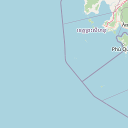
Ream National Park landscape and geographic character

The physical landscape of Ream National Park displays a distinctive combination of coastal lowlands, rolling hills, and marine environments. Two prominent hills dominate the western portion of the park, with the highest peak known as Phnom Mollou rising to 277 meters above sea level while a second hill reaches 196 meters. These hills are separated by the Prek Sampouch watercourse and support evergreen forest cover that contrasts with the lower-lying wetlands below. The central feature of the park is the Prek Teuk Sap, a freshwater river that flows from the interior mountains through the park before entering the Gulf of Thailand through a mangrove-fringed estuary. Between the hills and this estuary lies a narrow belt of wetlands, protected by a thin fringe of degraded mangrove forest. The park's marine component includes sea grass beds and coral reef formations along the coast, while the eastern third of the protected area encompasses the islands of Koh Thmei and Koh Seh. This varied terrain creates distinct habitat zones that support different ecological communities, from hill forest species to mangrove specialists to marine organisms.

Ream National Park ecosystems, habitats, and plant life

The ecological character of Ream National Park is defined by the interaction between terrestrial and marine systems across multiple habitat types. The park contains lowland evergreen forest that covers the hills and higher ground, while Melaleuca forests occupy transitional zones between forest and wetland areas. Mangrove forests, though partially degraded, continue to provide critical ecosystem services along the estuary and coastal fringe, including sediment stabilization, carbon storage, and nursery habitat for marine species. Freshwater wetlands and the river system add additional habitat diversity, while sea grass beds and coral reefs support marine biodiversity in the coastal zone. This mosaic of habitats creates conditions favorable for high species diversity despite the park's relatively modest total area. The park's position along the Gulf of Thailand places it within a broader regional context of coastal ecosystems that support migratory species and maintain ecological connectivity with other protected areas in Southeast Asia.

Ream National Park wildlife and species highlights

Ream National Park supports a diverse assembly of wildlife species across its terrestrial, freshwater, and marine habitats. The park is home to populations of rhesus monkeys that inhabit the forest areas, while the smaller mouse-deer occupies understory habitats in denser vegetation. The marine environment holds particular significance for dugongs, a vulnerable marine mammal that grazes on sea grass beds within the park's boundaries. Sea turtles, including several species, utilize the park's beaches and coastal waters, while dolphins are occasionally observed in the nearshore zone. The bird population includes the impressive Sarus crane, a species of conservation concern, as well as various pelican species that frequent the wetland areas. This combination of terrestrial mammals, marine megafauna, and significant bird populations reflects the ecological richness that results from the park's diverse habitat mosaic. The presence of multiple threatened species underscores the importance of the protected area in maintaining viable populations of wildlife that face pressure from development and habitat loss across the wider region.

Ream National Park conservation status and protection priorities

Ream National Park serves as an important conservation anchor along Cambodia's rapidly developing southwestern coast. The park protects a representative sample of coastal ecosystem types that have become increasingly rare in Southeast Asia as coastal development accelerates. Its combination of mangroves, coral reefs, sea grass beds, and forest habitats provides ecosystem services that benefit both wildlife and human communities in the surrounding area. The presence of dugongs and sea turtles adds particular conservation significance, as these species face significant threats throughout their ranges and require protected habitat areas to maintain viable populations. However, the park faces considerable conservation challenges, including pressure from commercial logging, fishing activities, land speculation, and the needs of approximately 30,000 people living in communities that overlap or border the protected area. Management requires ongoing negotiation between conservation objectives and the legitimate needs of local stakeholders, a challenge common to protected areas throughout the region.

Ream National Park cultural meaning and human context

The landscape around Ream National Park has supported human communities for generations, with traditional livelihoods including fishing, small-scale agriculture, and collection of forest and mangrove products. Approximately 5,500 households spanning five communes live in areas that overlap with or border the park, representing roughly 30,000 people with connections to the land and resources within protected boundaries. The population growth rate of nearly 3 percent creates ongoing pressure for economic development and land use that must be reconciled with conservation objectives. Four communes lie directly on the park's boundary while thirteen villages have land within the designated protected area, creating a complex social landscape where conservation management must account for established community presence and traditional use patterns.

Top sights and standout views in Ream National Park

Ream National Park offers visitors a rare combination of accessible wilderness and ecological diversity along Cambodia's coast. The park's mangrove forests can be explored by boat along the Prek Teuk Sap river, where the interface between freshwater and saltwater creates productive habitat for diverse species. Beach access provides opportunities to experience relatively undeveloped coastline, while the islands of Koh Thmei and Koh Seh offer further exploration potential for those seeking more remote experiences. The presence of dugongs in the park's marine waters represents a particular draw for wildlife enthusiasts, though sightings cannot be guaranteed. The park's hills provide viewpoints over the mixed landscape of forest, wetland, and sea that illustrates the ecological complexity contained within this protected area.

Best time to visit Ream National Park

The optimal time to visit Ream National Park generally corresponds to the cooler, drier months from November through April, when lower rainfall facilitates travel within the park and visibility for wildlife observation tends to be improved. The monsoon season from May through October brings higher rainfall that can affect access to some areas and make certain activities less comfortable, though the wet season also brings lush green landscapes and increased bird activity in wetland areas. Year-round temperatures remain warm given the park's tropical coastal location. Visitors seeking to maximize their chances of encountering marine wildlife such as dugongs and turtles may find the dry season months more favorable, though these species can be present throughout the year and seasonal patterns are not absolute.

Park location guide

Geography guide, regional context, and park location map for Ream National Park

Ream National Park park geography, regions, and map view in Cambodia
Understand where Ream National Park sits in Cambodia through a broader geographic reading of the surrounding landscape, nearby location context, and its mapped position within the national park landscape.

How Ream National Park fits into Cambodia

Cambodia is a unitary parliamentary constitutional elective monarchy in Southeast Asia. The country spans 181,035 km² and is characterized by a low-lying plain centered around the Mekong River and Tonlé Sap, Southeast Asia's largest lake. Its capital and largest city is Phnom Penh. The nation has a tropical climate and is home to a predominantly Khmer ethnic population. Cambodia has a history dating back to the Khmer Empire established in 802 AD.

Wider geography shaping Ream National Park in Cambodia

Cambodia occupies 181,035 km² in Mainland Southeast Asia. It is bordered by Thailand to the northwest, Laos to the north, and Vietnam to the east, with a coastline along the Gulf of Thailand in the southwest. The terrain is dominated by a low-lying central plain centered around the confluence of the Mekong River and Tonlé Sap, Southeast Asia's largest lake. The country has a tropical climate.

Map view of Ream National Park

Use this park location map to pinpoint Ream National Park in Cambodia, understand its exact geographic position, and read its mapped placement within the surrounding landscape more clearly.

Pigeon | © OpenStreetMap contributors

Location context for Ream National Park

Sihanoukville Province
Park atlas

Explore the regional context and diverse protected landscapes surrounding Ream National Park in Cambodia.

Discover Nearby National Parks and Protected Areas Beyond Ream National Park
Explore a curated selection of national parks and other protected areas situated geographically near Ream National Park, tracing their distinct conservation landscapes and ecological spread across Cambodia. Compare the diverse terrain, specific habitats, and conservation priorities of these regional parks to deepen your atlas-based understanding of the country's protected natural assets.
National parkKiên Giang Province

Phú Quốc National Park: Comprehensive Protected Island Landscape and Geography

Explore the mapped terrain and unique ecosystems of this national park.

Phú Quốc National Park offers a unique exploration of a fully protected tropical island ecosystem, encompassing significant landmass and marine territory within Kiên Giang Province. As Vietnam's largest island national park, it showcases a diverse array of landscapes, from dense forests blanketing rolling hills to vital coastal and marine protected areas essential for regional biodiversity. This park provides a focused lens for understanding island protected area management and geographic context within the Gulf of Thailand.

Area
314.22 km²
Established
2001
IUCN
II
National parkKampot Province

Preah Monivong Bokor National Park: An ASEAN Heritage Mountain Park in Kampot Province

Explore diverse forests and colonial history within its mapped terrain.

Preah Monivong Bokor National Park is a protected national park in Kampot Province, Cambodia, distinguished by its mountainous geography within the Dâmrei Mountains. Covering over 1,500 square kilometers, it showcases varied forest ecosystems and is recognized as an ASEAN Heritage Park. The park's landscape combines significant natural biodiversity with remnants of French colonial history, offering a rich context for atlas-based geographic exploration and protected-area understanding.

Area
1,544.58 km²
Established
1993
IUCN
II
National parkKep Province

Kep National Park: Cambodia's Coastal Mountain Protected Landscape

Explore mapped terrain and panoramic viewpoints of this national park.

Kep National Park is a protected national park situated in Kep Province, Cambodia, known for its unique hilly terrain that rises from the coastal lowlands. This protected area offers elevated viewpoints with commanding sights across the Gulf of Thailand, stretching towards Phu Quoc island and the distant Bokor Ranges. Its landscape character is defined by the contrast between its mountainous interior and the surrounding flat coastal regions, making it a significant feature for understanding regional geography and mapped protected areas. The park provides an accessible experience of Cambodia's coastal mountainous ecosystems.

Area
11.52 km²
Established
1993
IUCN
II
National parkCambodia

Botum Sakor National Park: Cambodia's Largest National Park and Coastal Wilderness

Explore its mapped geography and protected landscape features.

Botum Sakor National Park represents Cambodia's largest national park, offering a unique protected landscape where the Cardamom Mountains meet the Gulf of Thailand. The park's diverse geography includes extensive evergreen forests, grasslands, and significant coastal wetland ecosystems, such as mangrove and freshwater swamp forests. Examining its mapped boundaries reveals a critical area for biodiversity and regional ecological context within Southeast Asia's protected lands.

Area
1,825.85 km²
Established
1993
IUCN
II
National parkKampong Speu Province

Kirirom National Park: Cambodia's Pioneering Protected Mountain Landscape

Explore its mapped terrain and regional geography in Kampong Speu Province

Kirirom National Park stands as Cambodia's foundational national park, safeguarding a significant portion of the eastern Cardamom Mountains. This protected landscape is defined by its elevated terrain and mountain forest ecosystems, offering a distinct geographic character within Kampong Speu Province. Its atlas-style exploration reveals the mapped boundaries and regional context of this pioneering conservation area, providing insight into Cambodia's commitment to preserving its natural heritage.

Area
283.75 km²
Established
1993
IUCN
II
National parkKoh Kong province

Southern Cardamom National Park: A Vital Protected Landscape in Koh Kong Province

Explore its mapped boundaries and conservation significance.

Southern Cardamom National Park is a crucial protected area in southwestern Cambodia, encompassing a significant portion of the Cardamom Mountains. This national park serves as a vital atlas point for understanding the regional geography and conservation efforts in Southeast Asia. Its expansive territory is dedicated to safeguarding critical habitats and supporting ambitious wildlife programs, making it a cornerstone of landscape-level conservation and a key element in mapping the protected areas of the region.

Area
4,103.92 km²
Established
2016
IUCN
II
National parkCambodia

Central Cardamom Mountains National Park: Cambodia's Premier Protected Rainforest Landscape

Explore Extensive Rainforest, Diverse Habitats, and Mountain Terrain

Central Cardamom Mountains National Park is Cambodia's largest protected area, a testament to significant rainforest conservation efforts. This national park spans approximately 4,010 square kilometers, showcasing a dynamic mountainous landscape with diverse ecological zones from coastal areas to peaks over 1,500 meters. Discover the geographic distribution of its protected boundaries and the rich tapestry of habitats that define this vital Southeast Asian natural reserve, offering deep context for atlas-based exploration.

Area
4,010.65 km²
Established
1999
IUCN
II
National parkKiên Giang Province

U Minh Thượng National Park: Vietnam's Premier Mekong Delta Wetland Protected Area

Mapping the rich biodiversity and peat swamp ecosystems of Kiên Giang Province.

U Minh Thượng National Park is a key protected wetland in Kiên Giang Province, recognized for its exceptional biodiversity and status as a Ramsar site. Covering vast peat swamp forests and freshwater marshes, this national park offers critical insights into the Mekong Delta's unique ecology and hydrological systems. Its extensive mapped boundaries and distinct landscape character make it a vital point of study for understanding regional protected area networks and the natural geography of Southeast Asia.

Area
80.53 km²
Established
2002
IUCN
II

Common questions about visiting, size, designation, and location context for Ream National Park

Ream National Park FAQs for park facts, access, geography, and protected area context
Find quick answers about Ream National Park, including protected-area facts, park geography, trail and visitor context, and how the park fits into its surrounding country and regional landscape.
MoriAtlas Explorer

Continue Your Protected Areas Search Across the Global Atlas

Deepen your exploration by continuing the structured search for national parks and protected areas worldwide. Utilize the comprehensive filtering capabilities to compare different conservation landscapes and refine your understanding of global park geography. Discover more about the distribution and characteristics of protected natural areas.

Global natural geography