Mori Atlas logo
National parkKep National Park

Discover the mapped boundaries and panoramic viewpoints of this unique Cambodian national park.

Kep National Park: Protected Coastal Mountain Landscape within Kep Province

Kep National Park represents a distinctive protected landscape in Kep Province, Cambodia, offering a rare elevated perspective over the Gulf of Thailand. This national park, covering a small mountainous interior within the otherwise flat coastal region, provides sweeping panoramic views towards Phu Quoc island and the distant Bokor Ranges. Its geographic setting makes it a valuable point for atlas exploration, showcasing coastal elevation and its intersection with regional Cambodian and Vietnamese landscapes. Explore the mapped terrain and protected boundaries of this unique natural area.

Coastal MountainsGulf of ThailandHiking TrailsForest ProtectionScenic ViewpointsIUCN Category II

Kep National Park

National park

Park overview

Structured park overview, official facts, and landscape profile for Kep National Park

Kep National Park park facts, protected area profile, and essential visitor context
Review the core facts for Kep National Park, including designation, size, terrain, visitor scale, habitats, and operating context in one park-focused overview.

About Kep National Park

Kep National Park occupies a unique position in Cambodia's protected area network as a coastal mountain park in the country's southeastern peninsula. The park's terrain is defined by a small but rugged mountain range that rises sharply from the surrounding coastal plains, creating a landscape of significant topographic variation within a compact area. This mountain range serves as an important ecological transition zone, connecting the coastal mangrove and wetland systems of the Gulf of Thailand with the denser forest cover of the interior hills. The establishment of the park in 1993 reflected growing recognition of the need to protect Cambodia's remaining natural landscapes outside the larger northern and southwestern forest complexes. The park remains relatively undeveloped compared to Cambodia's more famous protected areas, offering visitors a more primitive and quiet recreation experience centered on walking trails and scenic viewpoints rather than extensive visitor facilities. The proximity to the town of Kep makes it accessible for day visitors while maintaining a sense of natural seclusion within the park boundaries.

Quick facts and research context for Kep National Park

Kep National Park is located in Kep Province, Cambodia, approximately 5 kilometers inland from the town of Kep. The protected area was officially established in 1993 and covers 11.52 square kilometers of coastal-mountain terrain. The park features a small but distinctive mountain range that rises from the surrounding lowland area, with elevations providing strategic viewpoints across the Gulf of Thailand. The park is classified under IUCN Category II as a national park, reflecting its primary purpose of protecting natural landscapes and ecosystems while allowing for controlled public recreation and environmental education.

Park context

Deeper park guide and search-rich context for Kep National Park

Kep National Park history, landscape, wildlife, and travel context
Explore Kep National Park through its history, landscape character, ecosystems, wildlife, conservation priorities, cultural context, and seasonal travel timing in a structured park guide built for atlas discovery and search intent.

Why Kep National Park stands out

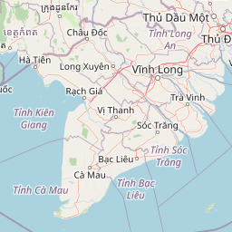
Kep National Park is best known for its panoramic viewpoints that span across the Gulf of Thailand to Phu Quoc island and the Bokor Ranges. The park's elevated mountain terrain provides rare coastal elevation within Cambodia's southern coastal zone, making it a distinctive geographic feature. Visitors come primarily for the views, the hiking trails through mixed forest, and the opportunity to experience a relatively untouched coastal-mountain ecosystem. The park also serves as an ecological corridor connecting coastal wetland habitats with interior forest zones.

Kep National Park history and protected-area timeline

Kep National Park was established in 1993 as part of Cambodia's post-conflict efforts to identify and protect significant natural areas throughout the country. During the decades of conflict that affected Cambodia through the 1970s and 1980s, many protected areas were abandoned or degraded, and the formal recognition of new protected areas became a priority in the 1990s as stability returned. The selection of this particular area for national park status reflected both its scenic qualities and its ecological significance as a coastal mountain environment. The park's establishment also responded to pressures from expanding agriculture and development along Cambodia's southern coast, creating a formal mechanism to retain the mountainous interior as protected land. Management of the park falls under the jurisdiction of Cambodia's Ministry of Environment, with practical management responsibilities handled through provincial authorities.

Kep National Park landscape and geographic character

The landscape of Kep National Park is characterized by a small but distinct mountain range that rises from the coastal lowlands of Kep Province. The mountain terrain creates a hilly interior zone contrasting sharply with the flat coastal plains and wetland areas that surround the park's boundaries. The highest points within the park offer commanding views across the Gulf of Thailand, with clear sightlines to Phu Quoc island visible on the western horizon. To the north and west, the Bokor Ranges provide a distant mountainous backdrop, while the eastern side of the park overlooks the scattered islands belonging to Vietnam's Kiên Giang marine reserve. The combination of elevated viewing positions and coastal proximity gives the park a distinctive landscape character not found in Cambodia's larger mountain parks to the north and west. The vegetation cover ranges from dense forest on the slopes and ridges to more scattered vegetation in the drier lowland transition areas.

Kep National Park ecosystems, habitats, and plant life

The natural environment of Kep National Park reflects its position as a transition zone between coastal and interior ecosystems. The park contains forest communities that differ from both the mangrove wetlands of the immediate coast and the more extensive evergreen forests found in Cambodia's large northern and southwestern protected areas. The vegetation includes mixed deciduous and evergreen species adapted to the slightly drier conditions of this southeastern coastal region. The park's streams and drainage channels flow toward the coast, connecting the interior forest habitats with the downstream wetland areas. Bird life is present in the forest canopy and along the forest edges, with species typical of the Gulf coast region occurring within the park boundaries. The relatively compact size of the park means that the full range of habitats is accessible within a short distance from any trail entry point.

Kep National Park wildlife and species highlights

Wildlife in Kep National Park includes species typical of Cambodia's southeastern coastal forests, though the park's smaller size limits the range of habitats available compared to larger protected areas. Forest-dwelling birds represent the most observable wildlife, with various species present in the canopy and edge habitats throughout the year. Small mammals including several species of squirrel and civet occur in the forest, while larger mammals that may occasionally traverse the area include sambar deer and wild pig, though these are more commonly found in the larger forest complexes to the north. The park's streams support basic aquatic fauna adapted to the seasonal flow patterns of this coastal drainage system. Visitors are most likely to encounter birds and smaller forest animals during trail walks, with the early morning hours offering the best wildlife viewing opportunities.

Kep National Park conservation status and protection priorities

Kep National Park holds IUCN Category II designation, reflecting its classification as a national park with primary conservation objectives. The protected status helps preserve the mountain forest ecosystem as a remnant of the natural vegetation that once covered more of the Kep coastal area before agricultural expansion. The park serves as an important green space within a region that has experienced significant land use change, providing habitat for forest species and protecting the watershed functions of the mountain drainage systems. Conservation challenges include managing visitor impacts from the growing interest in the park as a tourism destination and addressing any pressure from surrounding land use activities. The park also contributes to Cambodia's commitments to maintaining representative protected areas across the country's diverse ecological zones.

Kep National Park cultural meaning and human context

The area surrounding Kep National Park has historical connections to the broader Khmer cultural landscape, though the park itself does not contain significant archaeological sites or religious structures. The town of Kep nearby was developed as a French colonial era coastal retreat in the early twentieth century, establishing the region's role as a destination for relaxation and recreation. The park's establishment in 1993 came during a period of renewed interest in Cambodia's natural heritage following the restoration of political stability. Local communities maintain connections to the broader landscape through traditional land use practices in the surrounding agricultural areas, though the mountain core of the park has historically remained less intensively used than the surrounding lowlands. The park contributes to the regional identity of Kep Province as a destination that combines coastal beach activities with natural landscape exploration.

Top sights and standout views in Kep National Park

The main highlights of Kep National Park center on its panoramic viewpoints that offer sweeping views across the Gulf of Thailand, with clear sightlines to Phu Quoc island, the Bokor Ranges, and the Vietnamese island chain to the east. The hiking trails through the mountain forest provide opportunities to experience a relatively intact coastal forest ecosystem within a compact and accessible protected area. The park's position as an elevated oasis within the flat coastal landscape gives it a distinctive scenic quality not found at other coastal sites in Cambodia. The relatively light visitor pressure compared to more famous Cambodian parks creates a more peaceful and natural recreation experience, with trails that allow for contemplative exploration of the mountain forest environment.

Best time to visit Kep National Park

The best time to visit Kep National Park falls within the dry season from November to April, when rainfall is minimal and trail conditions are most favorable for hiking. The clearer atmospheric conditions during these months also enhance the panoramic views from the mountain viewpoints, making visibility of Phu Quoc island and the distant mountain ranges more consistent. The hot season from March to May can be challenging for midday hiking due to high temperatures, so early morning visits are recommended during this period. The wet season from May to October brings increased rainfall that can make trails slippery and views less reliable, though the forest becomes more lush and green during this period. Year-round visitation is possible, but the dry season months generally offer the most consistent experience for visitors focused on hiking and scenic viewing.

Park location guide

Geography guide, regional context, and park location map for Kep National Park

Kep National Park park geography, regions, and map view in Cambodia
Understand where Kep National Park sits in Cambodia through a broader geographic reading of the surrounding landscape, nearby location context, and its mapped position within the national park landscape.

How Kep National Park fits into Cambodia

Cambodia is a unitary parliamentary constitutional elective monarchy in Southeast Asia. The country spans 181,035 km² and is characterized by a low-lying plain centered around the Mekong River and Tonlé Sap, Southeast Asia's largest lake. Its capital and largest city is Phnom Penh. The nation has a tropical climate and is home to a predominantly Khmer ethnic population. Cambodia has a history dating back to the Khmer Empire established in 802 AD.

Wider geography shaping Kep National Park in Cambodia

Cambodia occupies 181,035 km² in Mainland Southeast Asia. It is bordered by Thailand to the northwest, Laos to the north, and Vietnam to the east, with a coastline along the Gulf of Thailand in the southwest. The terrain is dominated by a low-lying central plain centered around the confluence of the Mekong River and Tonlé Sap, Southeast Asia's largest lake. The country has a tropical climate.

Map view of Kep National Park

Use this park location map to pinpoint Kep National Park in Cambodia, understand its exact geographic position, and read its mapped placement within the surrounding landscape more clearly.

Pigeon | © OpenStreetMap contributors

Location context for Kep National Park

Kep Province
Park atlas

Compare Coastal Mountain Protected Areas with Neighboring Landscapes, Tracing Southeast Asian Park Geography

Explore Nearby National Parks, Protected Areas, and Related Landscapes Beyond Kep National Park
From Kep National Park, browse an atlas of nearby protected areas, including other national parks, wildlife sanctuaries, and significant conservation landscapes across Cambodia and adjacent coastal regions. This geographic view helps trace the spread of protected areas, compare diverse terrain, and understand the regional conservation context beyond a single park.
National parkKiên Giang Province

Phú Quốc National Park: Comprehensive Protected Island Landscape and Geography

Explore the mapped terrain and unique ecosystems of this national park.

Phú Quốc National Park offers a unique exploration of a fully protected tropical island ecosystem, encompassing significant landmass and marine territory within Kiên Giang Province. As Vietnam's largest island national park, it showcases a diverse array of landscapes, from dense forests blanketing rolling hills to vital coastal and marine protected areas essential for regional biodiversity. This park provides a focused lens for understanding island protected area management and geographic context within the Gulf of Thailand.

Area
314.22 km²
Established
2001
IUCN
II
National parkKampot Province

Preah Monivong Bokor National Park: An ASEAN Heritage Mountain Park in Kampot Province

Explore diverse forests and colonial history within its mapped terrain.

Preah Monivong Bokor National Park is a protected national park in Kampot Province, Cambodia, distinguished by its mountainous geography within the Dâmrei Mountains. Covering over 1,500 square kilometers, it showcases varied forest ecosystems and is recognized as an ASEAN Heritage Park. The park's landscape combines significant natural biodiversity with remnants of French colonial history, offering a rich context for atlas-based geographic exploration and protected-area understanding.

Area
1,544.58 km²
Established
1993
IUCN
II
National parkSihanoukville Province

Ream National Park: Protected Coastal Landscape and Marine Biodiversity in Sihanoukville Province

Explore unique mangrove ecosystems and mapped terrain within Cambodia.

Ream National Park is a significant protected area in Cambodia, celebrated for its intricate coastal and terrestrial ecosystems. This national park offers a detailed view of mangrove wetlands, evergreen forests, rolling hills, and marine habitats like coral reefs and sea grass beds. Situated in Sihanoukville Province, its landscape is characterized by rivers flowing through the terrain into the sea, providing vital habitats for diverse species and contributing to its atlas significance for regional geography and protected-area study.

Area
146.76 km²
Established
1993
IUCN
II
National parkKampong Speu Province

Kirirom National Park: Cambodia's Pioneering Protected Mountain Landscape

Explore its mapped terrain and regional geography in Kampong Speu Province

Kirirom National Park stands as Cambodia's foundational national park, safeguarding a significant portion of the eastern Cardamom Mountains. This protected landscape is defined by its elevated terrain and mountain forest ecosystems, offering a distinct geographic character within Kampong Speu Province. Its atlas-style exploration reveals the mapped boundaries and regional context of this pioneering conservation area, providing insight into Cambodia's commitment to preserving its natural heritage.

Area
283.75 km²
Established
1993
IUCN
II
National parkKoh Kong province

Southern Cardamom National Park: A Vital Protected Landscape in Koh Kong Province

Explore its mapped boundaries and conservation significance.

Southern Cardamom National Park is a crucial protected area in southwestern Cambodia, encompassing a significant portion of the Cardamom Mountains. This national park serves as a vital atlas point for understanding the regional geography and conservation efforts in Southeast Asia. Its expansive territory is dedicated to safeguarding critical habitats and supporting ambitious wildlife programs, making it a cornerstone of landscape-level conservation and a key element in mapping the protected areas of the region.

Area
4,103.92 km²
Established
2016
IUCN
II
National parkKiên Giang Province

U Minh Thượng National Park: Vietnam's Premier Mekong Delta Wetland Protected Area

Mapping the rich biodiversity and peat swamp ecosystems of Kiên Giang Province.

U Minh Thượng National Park is a key protected wetland in Kiên Giang Province, recognized for its exceptional biodiversity and status as a Ramsar site. Covering vast peat swamp forests and freshwater marshes, this national park offers critical insights into the Mekong Delta's unique ecology and hydrological systems. Its extensive mapped boundaries and distinct landscape character make it a vital point of study for understanding regional protected area networks and the natural geography of Southeast Asia.

Area
80.53 km²
Established
2002
IUCN
II
National parkCambodia

Botum Sakor National Park: Cambodia's Largest National Park and Coastal Wilderness

Explore its mapped geography and protected landscape features.

Botum Sakor National Park represents Cambodia's largest national park, offering a unique protected landscape where the Cardamom Mountains meet the Gulf of Thailand. The park's diverse geography includes extensive evergreen forests, grasslands, and significant coastal wetland ecosystems, such as mangrove and freshwater swamp forests. Examining its mapped boundaries reveals a critical area for biodiversity and regional ecological context within Southeast Asia's protected lands.

Area
1,825.85 km²
Established
1993
IUCN
II
National parkCà Mau province

U Minh Hạ National Park: Vietnam's Protected Wetland Landscape and Geography

Explore peat swamp forest and seasonal flood dynamics.

U Minh Hạ National Park stands as a crucial protected wetland within Cà Mau province, Vietnam, encompassing a significant expanse of freshwater marsh and peat swamp forest. This national park showcases the complex hydrological patterns of the Mekong Delta, including extensive seasonal flooding that shapes its unique landscape and supports specialized flora and fauna. Its protected status highlights the importance of conserving these rare wetland ecosystems and understanding their geographic context for regional ecological balance.

Area
8,286 km²
Established
2006
IUCN
II

Common questions about visiting, size, designation, and location context for Kep National Park

Kep National Park FAQs for park facts, access, geography, and protected area context
Find quick answers about Kep National Park, including protected-area facts, park geography, trail and visitor context, and how the park fits into its surrounding country and regional landscape.
MoriAtlas Explorer

Continue Your Protected Areas Search Across the Global Atlas

Deepen your exploration by continuing the structured search for national parks and protected areas worldwide. Utilize the comprehensive filtering capabilities to compare different conservation landscapes and refine your understanding of global park geography. Discover more about the distribution and characteristics of protected natural areas.

Global natural geography