Mori Atlas logo
National parkU Minh Thượng National Park

Mapping Vietnam's most biodiverse Mekong Delta protected area and its vital peat swamp ecosystems.

U Minh Thượng National Park: Protected Wetland & Biodiversity Atlas in Kiên Giang Province

(Vườn Quốc Gia U Minh Thượng)

U Minh Thượng National Park represents a critical protected wetland landscape within Kiên Giang Province, Vietnam, situated in the ecologically significant Mekong Delta. Spanning approximately 80.53 square kilometers, this national park showcases low-lying peat swamp forests and freshwater marshes, forming a unique habitat defined by seasonal flooding and extensive water bodies. Its designation as a Ramsar Wetland of International Importance underscores its global ecological value, making it an essential focus for understanding regional geography and protected area distribution.

wetlandMekong DeltaRamsar sitebirdwatchingpeat swamp forestfreshwater ecosystem

U Minh Thượng National Park

National park

Park overview

Structured park overview, official facts, and landscape profile for U Minh Thượng National Park

U Minh Thượng National Park park facts, protected area profile, and essential visitor context
Review the core facts for U Minh Thượng National Park, including designation, size, terrain, visitor scale, habitats, and operating context in one park-focused overview.

About U Minh Thượng National Park

U Minh Thượng National Park represents one of Vietnam's most significant protected wetland ecosystems, situated in the heart of the Mekong Delta region where the great river meets the sea. The park encompasses a complex mosaic of freshwater peat swamp forests, permanent marshes, seasonal floodplains, and interconnected waterways that have developed over millennia in this low-lying coastal landscape. This hydrological regime creates a dynamic environment where plant and animal communities have evolved specialized adaptations to tolerate seasonal fluctuations in water depth, from dry season exposed mudflats to monsoon season flooding that can submerge vast areas under meters of water. The peat soils of U Minh Thượng store substantial carbon reserves and play important roles in regional water regulation, flood mitigation, and sediment retention. The park's designation as a Ramsar Wetland in 2015 acknowledged its international significance as a resting and feeding area for migratory waterbirds traveling along the East Asian-Australasian Flyway, connecting breeding grounds in Siberia and northern Asia with wintering areas in Australia and Southeast Asia. Management of the park falls under the Provincial People's Committee of Kiên Giang, with ongoing efforts to balance conservation objectives with the needs of local communities who have historically depended on the forest's resources. The park serves as a living laboratory for scientists studying tropical wetland ecology, carbon dynamics, and climate change impacts on coastal ecosystems.

Quick facts and research context for U Minh Thượng National Park

U Minh Thượng National Park covers 80.53 square kilometers in Kiên Giang Province, the southernmost province of Vietnam along the Gulf of Thailand. The nearest city is Rạch Giá, the provincial capital. The park was established in January 2002 and achieved Ramsar Wetland status in 2015, recognizing its international importance as a freshwater wetland ecosystem. The area features a complex hydrological system with permanent water bodies and seasonal flooding, creating diverse habitat niches. Its location within the Mekong Delta places it at the terminus of one of the world's largest river systems, where nutrient-rich sediments and tropical climate combine to support extraordinary biological productivity.

Park context

Deeper park guide and search-rich context for U Minh Thượng National Park

U Minh Thượng National Park history, landscape, wildlife, and travel context
Explore U Minh Thượng National Park through its history, landscape character, ecosystems, wildlife, conservation priorities, cultural context, and seasonal travel timing in a structured park guide built for atlas discovery and search intent.

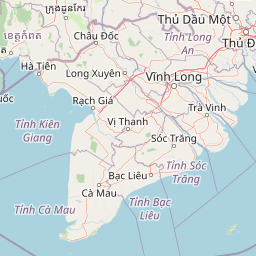
Why U Minh Thượng National Park stands out

U Minh Thượng National Park is renowned as the most biodiverse region in the entire Mekong Delta, boasting over 243 plant species, 32 mammal species, 187 bird species, 39 amphibian species, and 34 fish species. The park is particularly famous for its population of hairy-nosed otters, a rare and endangered species rarely encountered in other Vietnamese protected areas. Its wetlands provide critical habitat for numerous waterbird species including the oriental darter, spot-billed pelican, black-headed ibis, and Asian golden weaver. The park also stands out for its historical significance as a former Viet Minh and Vietcong stronghold during two major wars, adding layers of cultural and historical weight to its natural values.

U Minh Thượng National Park history and protected-area timeline

The forest now protected as U Minh Thượng National Park carries a remarkable and tumultuous modern history that intersects with major geopolitical events of the twentieth century. During the First Indochina War against French colonial rule, the dense U Minh Forest served as a critical Viet Minh stronghold, providing隐蔽 and logistical support for communist forces operating in the southernmost regions of Vietnam. In a notable incident in 1952, a contingent of approximately 500 French paratroopers was dropped into the U Minh Forest in an attempt to attack Viet Minh positions, but the unit was never heard from again, becoming one of the many mysteries of that conflict. The forest's strategic importance continued during the Vietnam War, when the area served as a Vietcong base area and logistical stronghold, benefiting from its impenetrable terrain and extensive network of waterways. Two notable American military officers, Humbert Roque Versace and James N. Rowe, were captured by Vietcong forces during a battle in the U Minh Forest in October 1963, with Rowe later surviving a famous escape. The park was formally established on 14 January 2002 through Decision No. 11/2002/QĐ-TTg signed by Prime Minister Nguyễn Tấn Dũng, transitioning from its previous status as the U Minh Thuong Nature Reserve to full national park protection.

U Minh Thượng National Park landscape and geographic character

The physical landscape of U Minh Thượng National Park is defined by its position at the southern terminus of the Mekong River system, where vast quantities of sediment have created an extremely flat, low-lying terrain barely above sea level. The park's elevation rarely exceeds a few meters above sea level, resulting in a landscape dominated by wetlands, peat bogs, and extensive freshwater marsh systems. The peat soils in the deeper portions of the park have accumulated over thousands of years from decomposing vegetation, creating a spongy substrate that holds large quantities of water and plays a critical role in the regional hydrological cycle. Throughout the park, permanent and seasonal water bodies are interspersed with stands of freshwater swamp forest, where trees such as dipterocarps and palms have adapted to waterlogged conditions. The water regime is governed by both the wet and dry seasons, with monsoon rains causing extensive flooding from approximately May through November, while the dry season exposes larger areas of mudflat and peat. This dynamic hydrological system supports the distinctive zonation of vegetation communities from deep-water species in permanent channels to moisture-tolerant forest species on higher ground.

U Minh Thượng National Park ecosystems, habitats, and plant life

The ecological character of U Minh Thượng National Park centers on its exceptional biodiversity, making it the richest region in the entire Mekong Delta for both plant and animal life. The park supports over 243 plant species spanning diverse families adapted to wetland conditions, including numerous species of palms, ferns, and emergent aquatic vegetation that characterize tropical peat swamp forests. The mammalian community of 32 species includes the endangered hairy-nosed otter, a species that has become increasingly rare across its historic range and finds important refuge in the park's freshwater habitats. However, the park has also experienced significant ecological losses, as both saltwater crocodiles and Siamese crocodiles that once inhabited the area were determined to be locally extinct by a 2002 survey, representing the extinction of species that previously played important roles in the aquatic ecosystem. The 187 bird species recorded in the park include numerous species of global conservation concern, particularly waterbirds that depend on wetlands for breeding, feeding, and staging during migration. The 39 amphibian species and 34 fish species contribute to the overall ecological complexity, with many completing portions of their life cycles within the park's aquatic environments.

U Minh Thượng National Park wildlife and species highlights

U Minh Thượng National Park provides critical habitat for an impressive array of wildlife, with its wetlands supporting populations of both resident and migratory species. The bird fauna is particularly notable, with the park hosting significant populations of the oriental darter, a large diving bird that hunts fish in the park's freshwater channels, and the spot-billed pelican, a species that gathers in feeding flocks across the wetlands. The black-headed ibis and glossy ibis represent iconic wetland birds that forage in the shallow waters, while the greater spotted eagle hunts over open areas within the forest. The Asian golden weaver builds its distinctive hanging nests in reed beds and scrub, demonstrating the diverse nesting strategies present among the park's avifauna. Among mammals, the hairy-nosed otter stands out as a particularly significant species, as this endangered predator relies on the park's fish populations and secluded waterways for survival. While crocodiles have been lost from the ecosystem, the park continues to support populations of other reptiles and amphibians that fill ecological niches in the freshwater systems.

U Minh Thượng National Park conservation status and protection priorities

U Minh Thượng National Park represents an important conservation priority for Vietnam and the broader Southeast Asian region, protected under both national legislation and international agreements. The park's designation as a Ramsar Wetland in 2015 acknowledged its significance within the international wetland conservation framework, providing recognition and support for ongoing protection efforts. As a Category II protected area under the IUCN classification system, the national park designation provides legal framework for habitat protection, species conservation, and ecosystem management. The conservation challenges facing U Minh Thượng include pressures from surrounding agricultural development, water management projects that can alter the natural hydrological regime, and the need to balance human use with ecological protection. The local extinction of crocodile species highlights the vulnerability of large predators in fragmented wetland systems and underscores the importance of maintaining connectivity and habitat quality. Conservation efforts focus on maintaining the natural water regime, preventing illegal exploitation of resources, and protecting the critical habitats that support endangered species populations.

U Minh Thượng National Park cultural meaning and human context

The landscape now protected as U Minh Thượng National Park has been shaped by centuries of human presence and use, though the park's status as a protected area now limits traditional resource extraction activities. The dense forest and extensive waterways provided historical communities with fish, timber, and other forest products, supporting relatively low-density populations that adapted their practices to the seasonal flooding patterns. The forest's modern history is inextricably linked to the major conflicts of the twentieth century, when its secluded location made it strategically important first to the Viet Minh and later to the Vietcong during periods of armed struggle. The capture of American officers in the forest during 1963 represents a specific historical event that connects the natural landscape to broader narratives of the Vietnam War. The Vietnamese name Vườn quốc gia U Minh Thượng translates literally as Upper U Minh National Park, distinguishing this area from the similar U Minh Hạ nature reserve in adjacent Cà Mau Province, with both areas representing remnants of a once-extensive forest ecosystem that covered much of the Mekong Delta region.

Top sights and standout views in U Minh Thượng National Park

U Minh Thượng National Park offers several standout features that distinguish it within Vietnam's protected area network: the richest biodiversity in the Mekong Delta with over 500 documented species across multiple taxonomic groups; Ramsar Wetland designation recognizing its international importance; the presence of hairy-nosed otters, one of Southeast Asia's rarest carnivores; critical habitat for migratory waterbirds along the East Asian-Australasian Flyway; significant populations of spot-billed pelicans, oriental darters, and black-headed ibises; and a powerful historical narrative as a former Viet Minh and Vietcong stronghold during major twentieth-century conflicts. The park provides some of the best wetland birdwatching opportunities in Vietnam and serves as an important reference site for tropical peat swamp ecology. Its location within the Mekong Delta, one of the world's most productive agricultural regions, creates a striking contrast between the protected wetland and the surrounding farmland landscape.

Best time to visit U Minh Thượng National Park

The optimal time to visit U Minh Thượng National Park aligns with the dry season from approximately December through April, when water levels are lower and wildlife becomes more concentrated around remaining water bodies, facilitating easier observation. The months of March and April often represent the best period for birdwatching, as many migratory species are still present before their return to northern breeding grounds. However, the wet season from May through November offers a different experience, with the flooded forest creating a vast wetland landscape where water birds can be observed in their full extent, though access may be more limited. Visitors interested in observing otters and other mammals may find the transition periods between wet and dry seasons particularly rewarding, as animals concentrate around shrinking water sources. The park can be visited year-round, though visitors should be prepared for the intense tropical heat and humidity, particularly during the dry season months.

Park location guide

Geography guide, regional context, and park location map for U Minh Thượng National Park

U Minh Thượng National Park park geography, regions, and map view in Vietnam
Understand where U Minh Thượng National Park sits in Vietnam through a broader geographic reading of the surrounding landscape, nearby location context, and its mapped position within the national park landscape.

How U Minh Thượng National Park fits into Vietnam

Vietnam, officially the Socialist Republic of Viet Nam, is a unitary communist state in Southeast Asia. It occupies roughly 331,000 square kilometres along the eastern edge of Mainland Southeast Asia, with a population exceeding 102 million. The country is bordered by China to the north, Laos and Cambodia to the west, and has maritime boundaries in the Gulf of Thailand and South China Sea.

Wider geography shaping U Minh Thượng National Park in Vietnam

Vietnam occupies the eastern edge of Mainland Southeast Asia, stretching along the Gulf of Thailand to the southwest and the South China Sea to the east. The country is bordered by China to the north, and Laos and Cambodia to the west. It has a diverse landscape ranging from the Red River Delta in the north to the Mekong Delta in the south.

Map view of U Minh Thượng National Park

Use this park location map to pinpoint U Minh Thượng National Park in Vietnam, understand its exact geographic position, and read its mapped placement within the surrounding landscape more clearly.

Pigeon | © OpenStreetMap contributors

Location context for U Minh Thượng National Park

Kiên Giang Province
Park atlas

Compare wetland ecosystems and discover adjacent protected areas throughout Vietnam's Mekong Delta region.

Discover Related National Parks and Protected Areas near U Minh Thượng National Park
Explore national parks and protected areas near U Minh Thượng National Park, identifying other significant wetland ecosystems and conservation landscapes in southern Vietnam. This atlas view allows you to compare regional park geography, trace the spread of protected habitats, and understand ecological connections throughout the Mekong Delta.
National parkCà Mau province

U Minh Hạ National Park: Vietnam's Protected Wetland Landscape and Geography

Explore peat swamp forest and seasonal flood dynamics.

U Minh Hạ National Park stands as a crucial protected wetland within Cà Mau province, Vietnam, encompassing a significant expanse of freshwater marsh and peat swamp forest. This national park showcases the complex hydrological patterns of the Mekong Delta, including extensive seasonal flooding that shapes its unique landscape and supports specialized flora and fauna. Its protected status highlights the importance of conserving these rare wetland ecosystems and understanding their geographic context for regional ecological balance.

Area
8,286 km²
Established
2006
IUCN
II
National parkCà Mau province

Mũi Cà Mau National Park: Vietnam's Southernmost National Park with Extensive Mangrove Wetlands

Explore the mapped geography and protected coastal landscape of Cà Mau province.

Mũi Cà Mau National Park, situated at Vietnam's southernmost tip in Cà Mau province, is a significant protected area dominated by vast mangrove forests and vital coastal wetlands. As a nationally recognized park and an internationally important Ramsar site, it showcases the intricate deltaic geography and the critical ecological functions of mangrove ecosystems. This protected landscape serves as a natural buffer and offers unique opportunities for understanding coastal conservation and the dynamic interplay between land and sea within the Mekong Delta region.

Area
418.62 km²
Established
2003
IUCN
II
National parkKep Province

Kep National Park: Cambodia's Coastal Mountain Protected Landscape

Explore mapped terrain and panoramic viewpoints of this national park.

Kep National Park is a protected national park situated in Kep Province, Cambodia, known for its unique hilly terrain that rises from the coastal lowlands. This protected area offers elevated viewpoints with commanding sights across the Gulf of Thailand, stretching towards Phu Quoc island and the distant Bokor Ranges. Its landscape character is defined by the contrast between its mountainous interior and the surrounding flat coastal regions, making it a significant feature for understanding regional geography and mapped protected areas. The park provides an accessible experience of Cambodia's coastal mountainous ecosystems.

Area
11.52 km²
Established
1993
IUCN
II
National parkKiên Giang Province

Phú Quốc National Park: Comprehensive Protected Island Landscape and Geography

Explore the mapped terrain and unique ecosystems of this national park.

Phú Quốc National Park offers a unique exploration of a fully protected tropical island ecosystem, encompassing significant landmass and marine territory within Kiên Giang Province. As Vietnam's largest island national park, it showcases a diverse array of landscapes, from dense forests blanketing rolling hills to vital coastal and marine protected areas essential for regional biodiversity. This park provides a focused lens for understanding island protected area management and geographic context within the Gulf of Thailand.

Area
314.22 km²
Established
2001
IUCN
II
National parkSihanoukville Province

Ream National Park: Protected Coastal Landscape and Marine Biodiversity in Sihanoukville Province

Explore unique mangrove ecosystems and mapped terrain within Cambodia.

Ream National Park is a significant protected area in Cambodia, celebrated for its intricate coastal and terrestrial ecosystems. This national park offers a detailed view of mangrove wetlands, evergreen forests, rolling hills, and marine habitats like coral reefs and sea grass beds. Situated in Sihanoukville Province, its landscape is characterized by rivers flowing through the terrain into the sea, providing vital habitats for diverse species and contributing to its atlas significance for regional geography and protected-area study.

Area
146.76 km²
Established
1993
IUCN
II
National parkKampot Province

Preah Monivong Bokor National Park: An ASEAN Heritage Mountain Park in Kampot Province

Explore diverse forests and colonial history within its mapped terrain.

Preah Monivong Bokor National Park is a protected national park in Kampot Province, Cambodia, distinguished by its mountainous geography within the Dâmrei Mountains. Covering over 1,500 square kilometers, it showcases varied forest ecosystems and is recognized as an ASEAN Heritage Park. The park's landscape combines significant natural biodiversity with remnants of French colonial history, offering a rich context for atlas-based geographic exploration and protected-area understanding.

Area
1,544.58 km²
Established
1993
IUCN
II
National parkBà Rịa–Vũng Tàu province

Côn Đảo National Park: Island Protected Landscape and Marine Geography

Explore mapped terrain and protected land boundaries.

Côn Đảo National Park presents a rich island geography featuring mountainous terrain, dense forests, and vibrant marine ecosystems. As a protected national park, it safeguards crucial habitats for endangered sea turtles and dugongs, alongside extensive coral reef systems and seagrass beds. This detailed atlas entry offers insight into the park's unique landscape context within Bà Rịa, Vũng Tàu province, highlighting its significance for conservation and geographic exploration.

Area
150.43 km²
Established
1993
IUCN
II
National parkKampong Speu Province

Kirirom National Park: Cambodia's Pioneering Protected Mountain Landscape

Explore its mapped terrain and regional geography in Kampong Speu Province

Kirirom National Park stands as Cambodia's foundational national park, safeguarding a significant portion of the eastern Cardamom Mountains. This protected landscape is defined by its elevated terrain and mountain forest ecosystems, offering a distinct geographic character within Kampong Speu Province. Its atlas-style exploration reveals the mapped boundaries and regional context of this pioneering conservation area, providing insight into Cambodia's commitment to preserving its natural heritage.

Area
283.75 km²
Established
1993
IUCN
II

Common questions about visiting, size, designation, and location context for U Minh Thượng National Park

U Minh Thượng National Park FAQs for park facts, access, geography, and protected area context
Find quick answers about U Minh Thượng National Park, including protected-area facts, park geography, trail and visitor context, and how the park fits into its surrounding country and regional landscape.
MoriAtlas Explorer

Continue Your Protected Areas Search Across the Global Atlas

Deepen your exploration by continuing the structured search for national parks and protected areas worldwide. Utilize the comprehensive filtering capabilities to compare different conservation landscapes and refine your understanding of global park geography. Discover more about the distribution and characteristics of protected natural areas.

Global natural geography