Mori Atlas logo
National parkBudo–Su-ngai Padi National Park

Discover the rugged geography and pristine tropical rainforest of this southern Thailand national park.

Budo–Su-ngai Padi National Park: Mapped Protected Landscape in Narathiwat Province

Budo–Su-ngai Padi National Park represents a vital protected wilderness within Thailand's Narathiwat Province, an integral part of the southern Tenasserim Hills. This national park encompasses rugged mountainous terrain and dense evergreen forests, offering a clear geographic context for its conservation value. Users can explore the mapped boundaries and discover the unique landscape features that define this significant tract of tropical rainforest in peninsular Thailand.

tropical rainforestnational parksouthern ThailandTenasserim Hillsendangered primatesmountain landscapes

Budo–Su-ngai Padi National Park

National park

Park overview

Structured park overview, official facts, and landscape profile for Budo, Su-ngai Padi National Park

Budo, Su-ngai Padi National Park park facts, protected area profile, and essential visitor context
Review the core facts for Budo, Su-ngai Padi National Park, including designation, size, terrain, visitor scale, habitats, and operating context in one park-focused overview.

About Budo, Su-ngai Padi National Park

Budo–Su-ngai Padi National Park protects a critical pocket of biodiversity in Thailand's southern frontier region. The park's location at the southern terminus of the Tenasserim Hills places it at a biogeographic crossroads between mainland Southeast Asia and the Malay Peninsula, resulting in a unique assembly of species. The terrain is dominated by the Budo mountain range, with steep slopes and valleys carved by countless streams and waterfalls that descend from the highland core. The equatorial tropical rainforest here receives abundant rainfall throughout the year, creating conditions of high humidity that support lush vegetation growth across multiple forest strata. This landscape was historically remote and inaccessible, which helped preserve its ecological integrity despite surrounding development pressures in the broader region. The park serves as an important watershed for downstream communities in the three provinces it spans, regulating water flow and protecting against soil erosion in the mountainous terrain.

Quick facts and research context for Budo, Su-ngai Padi National Park

Budo–Su-ngai Padi National Park covers 341 square kilometers across three provinces in far southern Thailand. The protected area is situated within the Sankala Khiri mountains, the southern terminus of the Tenasserim Hills range. The park was officially designated in 1999, evolving from an earlier Pacho Waterfall Park established in 1974. The ecosystem is classified as equatorial tropical rainforest with exceptionally high humidity due to consistent rainfall throughout the year. Notable waterfalls include Pacho, Phu Wae, and Pako, with Pacho being the most accessible and well-known, situated on a high cliff with its name derived from the Malay word pancur meaning waterfall.

Park context

Deeper park guide and search-rich context for Budo, Su-ngai Padi National Park

Budo, Su-ngai Padi National Park history, landscape, wildlife, and travel context
Explore Budo, Su-ngai Padi National Park through its history, landscape character, ecosystems, wildlife, conservation priorities, cultural context, and seasonal travel timing in a structured park guide built for atlas discovery and search intent.

Why Budo, Su-ngai Padi National Park stands out

The park is best known for its pristine tropical rainforest environment and the endangered spectacled langur, a primate species that inhabits the high mountains and deep jungle in social groups. The park is also distinguished by the rare golden-leaved plant known locally as yandao, first discovered within its boundaries in 1988. This vine features distinctive gold-colored leaves with a velvet-like texture that can exceed the size of a human palm. The protected area represents one of the most significant remaining tracts of lowland and montane rainforest in southern Thailand, supporting populations of other rare mammals including rhinoceros, agile gibbons, tapirs, and Sumatran serows.

Budo, Su-ngai Padi National Park history and protected-area timeline

The area that now comprises Budo–Su-ngai Padi National Park was historically known for its remoteness and thick jungle cover. During periods of political instability in Thailand's far south, the mountains served as a refuge for guerrilla forces, making the region largely inaccessible to civilians and outside researchers. Following improvements in the security situation in 1974, the Royal Forest Department moved to establish formal protection for the area by creating Pacho Waterfall Park, one of the earliest conservation designations in the region. This initial protected area focused on preserving the scenic waterfall and surrounding forest. Over the following decades, the protected area was expanded and upgraded in status, eventually achieving full national park designation in 1999 under the name Budo–Su-ngai Padi National Park. The establishment reflected growing recognition of the region's ecological significance and the need to protect its unique biodiversity from logging and agricultural expansion.

Budo, Su-ngai Padi National Park landscape and geographic character

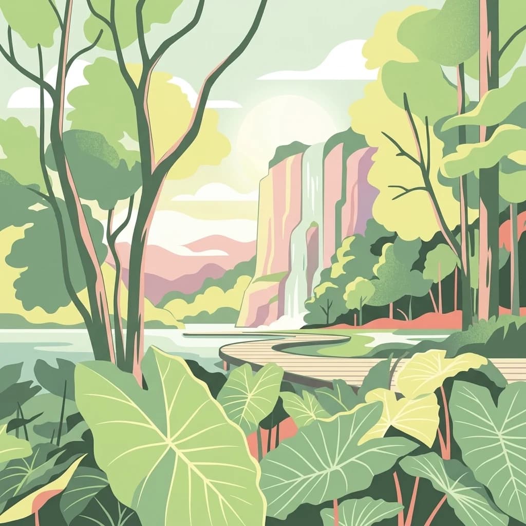
The physical landscape of Budo–Su-ngai Padi National Park is defined by the rugged, forested slopes of the Budo mountains, which form part of the Tenasserim Hills system. This mountain range represents the southernmost extension of the broader Indo-Burman mountain arc and creates a dramatic backdrop of steep ridges, deep valleys, and cascading streams. The terrain rises from lower foothills toward higher peaks in the park's interior, with elevation gradients creating diverse microhabitats across relatively short distances. The forest cover is dense and continuous, characterized by tall canopy trees, abundant epiphytes, and a complex understory. Several perennial waterfalls punctuate the landscape, with Pacho waterfall being the most prominent, dropping over a high cliff face. The combination of monsoonal rainfall, steep terrain, and热带植被 creates a landscape of exceptional visual and ecological richness.

Budo, Su-ngai Padi National Park ecosystems, habitats, and plant life

The ecological character of Budo–Su-ngai Padi National Park is defined by its representation of Indo-Malayan tropical rainforest at the northern edge of the Malay Peninsula. The year-round rainfall and consistently warm temperatures support evergreen forest with high species diversity across multiple canopy layers. The forest exhibits typical tropical rainforest structure with emergent trees, a dense canopy, and a varied understory. Watercourses and riparian zones add further habitat diversity to the protected area. The park falls within a region recognized for its high degree of endemism, where species have evolved in isolation due to geographic barriers created by mountain ranges and river systems. The protected status ensures the continuation of these ecological processes and the维持 of habitat connectivity for wildlife populations moving through the landscape.

Budo, Su-ngai Padi National Park wildlife and species highlights

The wildlife community of Budo–Su-ngai Padi National Park includes several species of significant conservation concern. The spectacled langur represents the park's most notable primate species, living in groups of 30-40 individuals in the high canopy with social structure led by a dominant male. This species ranges across Southeast Asia from southern Myanmar and Thailand through Malaysia and into island habitats. Other rare mammals present include the rhinoceros, agile gibbon, tapir, and Sumatran serow, all species that depend on intact forest habitats. The primate community also includes three other langur species found in Thailand: banded langurs, gray langurs, and northern spectacled langurs, all of which are endangered. The forest provides critical habitat for these species, supporting feeding, breeding, and movement corridors through the mountainous terrain.

Budo, Su-ngai Padi National Park conservation status and protection priorities

Budo–Su-ngai Padi National Park plays a vital role in conserving Thailand's remaining tropical rainforest biodiversity. The protected area shelters several endangered mammal species, with the spectacled langur and its four Thai relatives representing particularly important conservation targets. The park's location within the Tenasserim Hills places it within a recognized biodiversity hotspot, where forest protection contributes to regional conservation goals. The ecosystem provides essential ecological services including watershed protection, soil conservation, and carbon storage. The discovery of the yandao plant within the park boundaries demonstrates that significant biological discoveries continue to emerge from these protected landscapes. The national park designation provides legal framework for managing human activities and ensuring the long-term viability of the forest ecosystem and its dependent species.

Budo, Su-ngai Padi National Park cultural meaning and human context

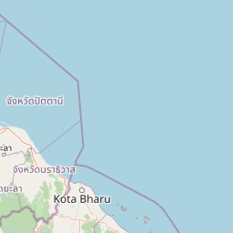
The cultural context of Budo–Su-ngai Padi National Park is influenced by its location in Thailand's far southern region, an area with distinct linguistic and cultural ties to neighboring Malaysia. The park name incorporates elements from both Thai and Malay languages, reflecting the cultural geography of the border region. The waterfall name Pacho derives from the Malay word pancur, illustrating the linguistic connections between the two sides of the border. The local communities in the surrounding provinces maintain cultural traditions that are shared with populations across the Malaysia border, creating a cultural landscape that transcends national boundaries. The region's history of political complexity has shaped both human settlement patterns and the conservation trajectory of the area.

Top sights and standout views in Budo, Su-ngai Padi National Park

The standout features of Budo–Su-ngai Padi National Park include its status as one of Thailand's most significant tropical rainforest protected areas, home to the endangered spectacled langur and other rare mammals. The dramatic mountain landscape of the Budo range offers scenic beauty through its steep forested peaks, deep valleys, and cascading waterfalls. The discovery of the unique golden-leaved yandao plant demonstrates the park's ongoing scientific significance. The protected area represents a critical conservation anchor in the Tenasserim Hills corridor, connecting forest habitats across international boundaries. Visitors can experience the Pacho waterfall and explore trails through pristine rainforest that remains largely undeveloped.

Best time to visit Budo, Su-ngai Padi National Park

The optimal time to visit Budo–Su-ngai Padi National Park coincides with Thailand's dry season, typically from December through April, when rainfall is reduced and trail conditions are more favorable for hiking. However, the park's tropical rainforest environment maintains its lush character year-round due to the monsoon climate. The wet season from May through November brings heavier rainfall, which sustains the waterfalls at their fullest flow but may make some trails more difficult to navigate. The high humidity present throughout the year means visitors should prepare for warm, moist conditions regardless of season. Wildlife viewing opportunities may vary with seasonal patterns, and the dense forest cover means that sightings of arboreal species like the spectacled langur require patience and careful observation.

Park location guide

Geography guide, regional context, and park location map for Budo, Su-ngai Padi National Park

Budo, Su-ngai Padi National Park park geography, regions, and map view in Thailand
Understand where Budo, Su-ngai Padi National Park sits in Thailand through a broader geographic reading of the surrounding landscape, nearby location context, and its mapped position within the national park landscape.

How Budo, Su-ngai Padi National Park fits into Thailand

Thailand is a Southeast Asian nation formerly called Siam, located in mainland Southeast Asia. It operates as a unitary parliamentary constitutional monarchy under King Vajiralongkorn. The country borders Myanmar, Laos, Cambodia, and Malaysia, with maritime boundaries involving Vietnam, Indonesia, and India. Thailand has a population of nearly 66 million and covers approximately 513,120 km². Historically, the Sukhothai Kingdom marks the beginning of Thai history, followed by the powerful Ayutthaya Kingdom.

Wider geography shaping Budo, Su-ngai Padi National Park in Thailand

Thailand occupies mainland Southeast Asia with borders to Myanmar (west/northwest), Laos (east/northeast), Cambodia (southeast), and Malaysia (south). The country has coastline along the Gulf of Thailand to the southeast and the Andaman Sea to the southwest. The territory covers approximately 513,120 km².

Map view of Budo, Su-ngai Padi National Park

Use this park location map to pinpoint Budo, Su-ngai Padi National Park in Thailand, understand its exact geographic position, and read its mapped placement within the surrounding landscape more clearly.

Pigeon | © OpenStreetMap contributors

Location context for Budo, Su-ngai Padi National Park

Narathiwat ProvincePattani ProvinceYala Province
Park atlas

Explore surrounding protected landscapes and compare park geography in Southern Thailand's Tenasserim Hills region.

Discover National Parks and Protected Areas Near Budo–Su-ngai Padi National Park
After exploring Budo–Su-ngai Padi National Park, discover other national parks and protected areas throughout Southern Thailand and its connected Tenasserim Hills mountain range. This geographic comparison reveals the diverse conservation landscapes, traces the regional spread of tropical rainforest ecosystems, and highlights key protected areas.
National parkSatun Province

Thale Ban National Park: Mapped Protected Landscape and Unique Wetland Ecosystem in Satun Province

Explore karst and granite mountains, natural lake geography, and diverse biodiversity.

Thale Ban National Park offers a fascinating study in protected landscape geography, centered around a rare natural lake formed by geological damming. This national park in Satun Province, Thailand, showcases a striking contrast between ancient limestone karst formations and younger granite mountains, contributing to its unique biodiversity and ecosystems. Its position near the Malaysian border highlights its role in regional conservation, making it a key site for understanding mapped terrain and protected natural areas.

Area
196 km²
Established
1980
IUCN
II
National parkKrabi Province

Khao Phanom Bencha National Park: Protected Mountainous Rainforest and Waterfall Landscapes

Explore Krabi Province's unique protected area and its dramatic geographic features.

Khao Phanom Bencha National Park represents a core protected landscape within Krabi Province, Thailand. Dominated by the imposing Khao Phanom Bencha mountain range, its terrain includes steep, forested slopes and intricate valley systems that give rise to impressive waterfalls. This national park is an essential component of the region's protected natural areas, offering a detailed look at its unique ecosystem and geographic character through mapped landscape context and atlas exploration.

Area
50 km²
Established
1981
IUCN
II
National parkNakhon Si Thammarat Province

Hat Khanom, Mu Ko Thale Tai National Park: National Park, Nakhon Si Thammarat Province, Thailand

Discover mapped boundaries and regional landscape context.

Hat Khanom, Mu Ko Thale Tai National Park is a designated national park offering a protected landscape within the geographic scope of Nakhon Si Thammarat Province. This entity provides a structured point for understanding its specific protected-area identity, its mapped terrain, and its contribution to the broader regional geography. Explore its geographic significance and atlas-relevant details to grasp its place in Thailand's natural landscape.

Area
312 km²
IUCN
II
National parkSurat Thani Province

Than Sadet, Ko Pha-ngan National Park: A Royal Heritage Protected Landscape in Surat Thani

Island geography, royal rivers, and mountain terrain exploration.

Delve into Than Sadet, Ko Pha-ngan National Park, a protected area in Surat Thani Province renowned for its fusion of natural beauty and historical significance. This park protects diverse ecosystems, including dense forests, the famous Than Sadet waterfall and river system, and mountainous interiors, culminating in views from Khao Ra. As a key protected landscape, its mapped boundaries reveal a vital natural sanctuary with deep royal connections, inviting exploration of its unique geographic context and heritage within the Thai atlas.

Area
43 km²
Established
2018
IUCN
II
National parkPhuket Province

Sirinat National Park: Phuket Province Protected Coastal Landscape and Marine Atlas

Mapped boundaries, beach forests, and sea turtle nesting sites.

Sirinat National Park offers a unique opportunity to explore a protected coastal geography on Phuket Island. This national park preserves critical beach forest ecosystems, extensive shorelines like Hat Mai Khao, vital sea turtle nesting grounds, and surrounding marine environments including coral reefs and mangrove habitats. Its designation as a protected area provides essential context for understanding the natural landscape and its ecological significance within Thailand's regional geography.

Area
90 km²
Established
1981
IUCN
II
National parkCà Mau province

Mũi Cà Mau National Park: Vietnam's Southernmost National Park with Extensive Mangrove Wetlands

Explore the mapped geography and protected coastal landscape of Cà Mau province.

Mũi Cà Mau National Park, situated at Vietnam's southernmost tip in Cà Mau province, is a significant protected area dominated by vast mangrove forests and vital coastal wetlands. As a nationally recognized park and an internationally important Ramsar site, it showcases the intricate deltaic geography and the critical ecological functions of mangrove ecosystems. This protected landscape serves as a natural buffer and offers unique opportunities for understanding coastal conservation and the dynamic interplay between land and sea within the Mekong Delta region.

Area
418.62 km²
Established
2003
IUCN
II
National parkPhang Nga Province

Khao Lampi, Hat Thai Mueang National Park: Mountain Rainforest and Andaman Coast Atlas

Explore the mapped geography and protected boundaries.

Delve into Khao Lampi, Hat Thai Mueang National Park, a key protected area within Phang Nga Province, Thailand. This unique national park showcases a striking dichotomy: the lush, waterfall-adorned slopes of the Khao Lampi mountains contrast with the pristine Andaman Sea coastline of Hat Thai Mueang beach, a critical site for sea turtle nesting. The park's mapped landscape encompasses dense tropical rainforest, significant mangrove ecosystems, and important natural terrain, offering a comprehensive view of diverse protected environments for atlas exploration.

Area
72 km²
Established
1986
IUCN
II
National parkCà Mau province

U Minh Hạ National Park: Vietnam's Protected Wetland Landscape and Geography

Explore peat swamp forest and seasonal flood dynamics.

U Minh Hạ National Park stands as a crucial protected wetland within Cà Mau province, Vietnam, encompassing a significant expanse of freshwater marsh and peat swamp forest. This national park showcases the complex hydrological patterns of the Mekong Delta, including extensive seasonal flooding that shapes its unique landscape and supports specialized flora and fauna. Its protected status highlights the importance of conserving these rare wetland ecosystems and understanding their geographic context for regional ecological balance.

Area
8,286 km²
Established
2006
IUCN
II

Common questions about visiting, size, designation, and location context for Budo, Su-ngai Padi National Park

Budo, Su-ngai Padi National Park FAQs for park facts, access, geography, and protected area context
Find quick answers about Budo, Su-ngai Padi National Park, including protected-area facts, park geography, trail and visitor context, and how the park fits into its surrounding country and regional landscape.
MoriAtlas Explorer

Continue Your Protected Areas Search Across the Global Atlas

Deepen your exploration by continuing the structured search for national parks and protected areas worldwide. Utilize the comprehensive filtering capabilities to compare different conservation landscapes and refine your understanding of global park geography. Discover more about the distribution and characteristics of protected natural areas.

Global natural geography