Mori Atlas logo
National parkBukit Barisan Selatan National Park

Discover the geographic context and mapped boundaries of this critical national park.

Bukit Barisan Selatan National Park: Sumatra's Vital Protected Landscape and Map

(Taman Nasional Bukit Barisan Selatan)

Bukit Barisan Selatan National Park represents a significant protected landscape within Sumatra, Indonesia, spanning the southern Bukit Barisan mountain range. This extensive national park, covering roughly 3,568 square kilometers, forms a vital, long corridor of tropical rainforest essential for regional biodiversity. Its inclusion in the Tropical Rainforest Heritage of Sumatra World Heritage Site highlights its global importance for conservation, offering a unique focal point for atlas-driven exploration of protected areas and their geographic distribution across the island.

tropical rainforestUNESCO World Heritage Siteendangered species conservationSumatralowland forestmontane forest

Bukit Barisan Selatan National Park

National park

Park overview

Structured park overview, official facts, and landscape profile for Bukit Barisan Selatan National Park

Bukit Barisan Selatan National Park park facts, protected area profile, and essential visitor context
Review the core facts for Bukit Barisan Selatan National Park, including designation, size, terrain, visitor scale, habitats, and operating context in one park-focused overview.

About Bukit Barisan Selatan National Park

Bukit Barisan Selatan National Park represents a cornerstone of Indonesian and global conservation efforts, protecting a substantial portion of Sumatra's remaining tropical rainforest. The park's long, narrow profile follows the Bukit Barisan mountain range, creating a continuous forest corridor that is essential for wildlife movement across the island. Despite its ecological importance, the park faces significant pressures from human encroachment, illegal agriculture, and habitat conversion. The park's terrain varies considerably, with mountainous areas in the north reaching nearly 2,000 meters at Gunung Pulung, while the southern sections extend as a peninsula with more gentle topography. This topographic diversity supports multiple forest types, from coastal mangrove systems through lowland dipterocarp forest to montane vegetation communities. The park's management is overseen by Indonesia's Ministry of Environment and Forestry, though enforcement across such an extensive and remote area remains challenging.

Quick facts and research context for Bukit Barisan Selatan National Park

Bukit Barisan Selatan National Park covers 356,800 hectares along the Bukit Barisan mountain range in southern Sumatra, Indonesia. The park was established in 1982 and designated as a UNESCO World Heritage Site in 2004 as part of the Tropical Rainforest Heritage of Sumatra. It spans three provinces and features diverse habitats including lowland tropical forest, montane forest, coastal forest, and mangrove ecosystems. The northern region reaches elevations of nearly 2,000 meters, while the southern portion extends as a peninsula. The park is recognized as one of the most important conservation areas in Southeast Asia, home to approximately 25% of the remaining Sumatran elephant population and 10% of remaining Sumatran tigers.

Park context

Deeper park guide and search-rich context for Bukit Barisan Selatan National Park

Bukit Barisan Selatan National Park history, landscape, wildlife, and travel context
Explore Bukit Barisan Selatan National Park through its history, landscape character, ecosystems, wildlife, conservation priorities, cultural context, and seasonal travel timing in a structured park guide built for atlas discovery and search intent.

Why Bukit Barisan Selatan National Park stands out

Bukit Barisan Selatan is best known as a critical stronghold for three of the world's most endangered megafauna species: the Sumatran elephant, Sumatran tiger, and Sumatran rhinoceros. The park contains one of the largest remaining lowland tropical rainforest ecosystems in Southeast Asia, protecting a narrow but ecologically vital corridor along the Bukit Barisan mountain range. Its extraordinary plant diversity includes the massive Rafflesia arnoldii, the giant titan arum (Amorphophallus titanum), and the world's largest orchid (Grammatophyllum speciosum). The park's designation as part of the Tropical Rainforest Heritage of Sumatra World Heritage Site underscores its global significance for biodiversity conservation.

Bukit Barisan Selatan National Park history and protected-area timeline

The protection history of Bukit Barisan Selatan dates back to the Dutch colonial period, when the South Sumatra I Nature Reserve was established in 1935 through colonial legislation. This early recognition of the area's ecological value provided initial legal protection for the region's forests and wildlife. The transition to national park status occurred in 1982, formalizing the area's conservation designation under Indonesian law. In 2004, the park achieved international recognition when it was inscribed as part of the Tropical Rainforest Heritage of Sumatra UNESCO World Heritage Site, a complex that also includes Gunung Leuser National Park and Kerinci Seblat National Park. This designation acknowledged the outstanding universal value of Sumatra's remaining rainforests. However, the park was subsequently placed on the List of World Heritage in Danger in 2011 due to ongoing threats from encroachment, illegal logging, and agricultural expansion, particularly coffee cultivation.

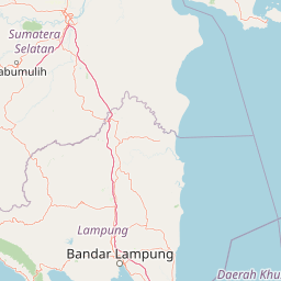
Bukit Barisan Selatan National Park landscape and geographic character

The landscape of Bukit Barisan Selatan is defined by its position along the Bukit Barisan mountain range, a volcanic arc that runs the entire length of Sumatra. The park averages only about 45 kilometers in width but extends approximately 350 kilometers in length, creating a long forest corridor along the island's central highlands. The northern region features rugged mountain terrain with steep eastern slopes descending toward the Sumatran interior, while the western slopes are more gradual toward the Indian Ocean. The highest peak within the park is Gunung Pulung at 1,964 meters. The southern portion of the park extends as a peninsula with more subdued topography. The park encompasses diverse terrain including coastal zones along the Indian Ocean, river valleys, and steep mountainous areas. Geological conditions include volcanic rock formations in the central and northern sections, with alluvial deposits in lower-lying areas.

Bukit Barisan Selatan National Park ecosystems, habitats, and plant life

The ecological character of Bukit Barisan Selatan is defined by its complex of tropical forest ecosystems that represent some of the most biodiverse habitats on Earth. The park contains a complete altitudinal sequence from sea level to nearly 2,000 meters, supporting distinct vegetation zones including coastal mangrove forest, lowland tropical rainforest, hill forest, and montane forest. The lowland forests are dominated by dipterocarp species including Shorea, Dipterocarpus, and Hopea, while montane areas feature Myrtaceae, Lauraceae, and Fagaceae families. The park's botanical diversity is extraordinary, with at least 514 tree species identified, along with 126 orchid species, 26 rattan species, and numerous medicinal plants. The park's dual climate zones, with wetter conditions on the western slopes facing the Indian Ocean and drier conditions on the eastern side, create additional ecological variation that supports diverse species assemblages.

Bukit Barisan Selatan National Park wildlife and species highlights

Bukit Barisan Selatan supports an exceptional concentration of endangered megafauna that makes it one of Asia's most important conservation areas. The park contains approximately 500 Sumatran elephants, representing roughly a quarter of the global population of this critically endangered subspecies. An estimated 17-24 Sumatran rhinoceroses persist in the park, a tiny fraction of the fewer than 100 individuals remaining worldwide. The park also supports around 40 adult Sumatran tigers, approximately 10% of the remaining population of this critically endangered subspecies. Beyond these flagship species, the park hosts the Sumatran striped rabbit, Malayan tapir, siamang, Sumatran surili, sun bear, and lesser mouse-deer. The bird fauna includes over 300 species, with the critically endangered Sumatran ground-cuckoo among the notable inhabitants. The park also supports populations of nine hornbill species and various marine turtle species along its southern and western coastlines.

Bukit Barisan Selatan National Park conservation status and protection priorities

The conservation significance of Bukit Barisan Selatan cannot be overstated, as it protects some of the last remaining lowland rainforest in Sumatra and serves as a critical habitat for three of the world's most endangered large mammal species. The park's inclusion in the Tropical Rainforest Heritage of Sumatra World Heritage Site reflects its outstanding universal value, though its placement on the Danger List since 2011 acknowledges the severe threats it faces. Conservation challenges include significant human encroachment, with an estimated 127,000 squatters occupying portions of the park and approximately 55,000 hectares under illegal cultivation as of 2006. Coffee production has become a particular concern, with over 450 square kilometers of the park reportedly used for coffee cultivation. Between 1972 and 2006, an estimated 63,000 hectares of primary forest were lost. Conservation partners including WWF and WCS work with the Indonesian government on anti-poaching efforts, community engagement, and sustainable land-use planning. The park has been identified as a priority area for Asian Rhino and Elephant Action Strategy (AREAS) and as a Tiger Conservation Unit of global importance.

Bukit Barisan Selatan National Park cultural meaning and human context

Bukit Barisan Selatan occupies a landscape that has been inhabited by local communities for generations, with the park's establishment requiring careful consideration of traditional land use patterns. The park provides essential ecosystem services to surrounding communities, including water catchment functions supported by its network of approximately 23 major rivers and numerous tributaries that flow to downstream communities in Lampung and Bengkulu provinces. The regional economy historically included traditional forest-based activities such as damar resin collection from Shorea javanica and other forest products. However, the expansion of coffee cultivation and other agricultural activities into the park boundary represents a significant challenge, creating tension between conservation objectives and local livelihoods. Conservation programs have sought to promote sustainable alternatives through initiatives like the Conservation Conscious Community Network (3CoNet), which aims to provide environmentally friendly livelihoods for communities surrounding the park.

Top sights and standout views in Bukit Barisan Selatan National Park

Bukit Barisan Selatan stands as one of the last great tropical rainforest wilderness areas in Southeast Asia, protecting a critical corridor of forest along Sumatra's backbone. The park's remarkable concentration of endangered megafauna includes viable populations of Sumatran elephants, tigers, and rhinoceroses, making it essential for the survival of these species. Its botanical treasures include the colossal Rafflesia flower, the towering titan arum, and the world's largest orchid. The park's inclusion in the Tropical Rainforest Heritage of Sumatra World Heritage Site confirms its global significance, though its endangered status since 2011 underscores the urgent conservation challenges it faces. The park's diverse landscapes, from coastal mangroves to montane peaks, support an extraordinary range of ecosystems and species that represent the biological heritage of Sumatra and the broader Indo-Malay region.

Best time to visit Bukit Barisan Selatan National Park

The optimal time to visit Bukit Barisan Selatan coincides with the dry season, typically between April and October, when conditions are more favorable for wildlife viewing and forest exploration. The park experiences a tropical climate with high humidity throughout the year, with average temperatures ranging from 20 to 28 degrees Celsius. Annual rainfall averages around 3,500 mm, with the western side of the park generally receiving more precipitation than the eastern side due to exposure to the Indian Ocean. Visitors should be prepared for frequent rainfall regardless of season, as the rainforest environment maintains high moisture levels year-round. The wetter months from November through March may make some trails more difficult to navigate but also offer the opportunity to experience the forest in its lushest condition.

Park location guide

Geography guide, regional context, and park location map for Bukit Barisan Selatan National Park

Bukit Barisan Selatan National Park park geography, regions, and map view in Indonesia
Understand where Bukit Barisan Selatan National Park sits in Indonesia through a broader geographic reading of the surrounding landscape, nearby location context, and its mapped position within the national park landscape.

How Bukit Barisan Selatan National Park fits into Indonesia

Indonesia is a vast archipelagic nation in Southeast Asia and Oceania, spanning over 17,000 islands between the Indian and Pacific Oceans. As the world's fourth-most populous country with 288 million people, it features extraordinary cultural and biological diversity, withJavanese and Sundanese being the largest ethnic groups. The country gained independence from the Netherlands in 1945 and operates as a unitary presidential republic.

Wider geography shaping Bukit Barisan Selatan National Park in Indonesia

Indonesia is situated in Southeast Asia and Oceania, spanning the equatorial region between the Indian Ocean to the west and the Pacific Ocean to the east. The archipelago includes major islands such as Sumatra, Java, Sulawesi, and parts of Borneo and New Guinea. It borders Papua New Guinea, Timor-Leste, and Malaysia by land, with extensive maritime boundaries throughout the region.

Map view of Bukit Barisan Selatan National Park

Use this park location map to pinpoint Bukit Barisan Selatan National Park in Indonesia, understand its exact geographic position, and read its mapped placement within the surrounding landscape more clearly.

Pigeon | © OpenStreetMap contributors

Location context for Bukit Barisan Selatan National Park

BengkuluLampungSouth SumatraSumatra
Park atlas

Uncover additional protected landscapes and their regional park geography, extending your exploration across Sumatra.

Compare National Parks and Protected Areas Near Bukit Barisan Selatan National Park
Continue your park discovery beyond Bukit Barisan Selatan National Park by exploring other protected areas within Sumatra's vast tropical rainforest heritage. This broader view allows for geographic comparison of different conservation landscapes and a deeper understanding of regional protected area patterns.
National parkLampung

Way Kambas National Park: Mapped Lowland Rainforest and Wetland Ecosystems

Explore the geography and protected landscape of this Indonesian national park.

Way Kambas National Park in Lampung, Indonesia, is a significant protected area characterized by its extensive lowland rainforest and varied wetland habitats. The park's landscape features swamp forests, coastal fringes, and river systems, creating a unique ecological mosaic. It serves as a critical sanctuary for endangered species, offering a vital context for understanding Sumatra's remaining natural landscapes. Explore the mapped boundaries and geographic identity of this important conservation area.

Area
1,300 km²
Established
1989
IUCN
II
National parkBanten

Ujung Kulon National Park: Atlas of Java's Last Lowland Rainforest and Protected Landscapes

Explore the unique geography and critical conservation importance of this vital protected area.

Ujung Kulon National Park, located in Banten, Indonesia, is a crucial protected landscape recognized for its ecological significance. This national park represents the last substantial area of lowland rainforest remaining on Java, making it an indispensable sanctuary. It is globally recognized as the primary and final refuge for the Javan rhinoceros, a critically endangered species. The park's geography encompasses the Ujung Kulon peninsula and mountain ranges, alongside vital marine environments, contributing to its status as a UNESCO World Heritage Site and a cornerstone of regional conservation efforts.

Area
497.59 km²
Established
1992
IUCN
II
National parkJambi

Bukit Duabelas National Park: Jambi's Protected Lowland Tropical Rainforest Landscape

Explore its mapped terrain and vital water catchment geography.

Bukit Duabelas National Park is a protected area in Jambi, Sumatra, safeguarding critical lowland tropical rainforest ecosystems. Its name reflects the hilly terrain that defines its landscape, acting as an essential water catchment for the Batang Hari River. This park offers an atlas-focused view of Sumatra's threatened forest heritage and its importance within regional geography, including unique timber species and the ancestral lands of the Orang Rimba people.

Area
605 km²
Established
2000
IUCN
II
National parkWest Sumatra

Siberut National Park: Isolated Island Ecosystem and Endemic Wildlife Atlas

Discover the mapped geography and unique landscapes of this West Sumatra protected area.

Siberut National Park in West Sumatra, Indonesia, presents a distinct protected landscape forged by long-term geographic isolation. This national park covers a significant portion of Siberut Island, showcasing a rich tapestry of lowland dipterocarp rainforest, swamp forest, and coastal mangrove ecosystems. Explore its unique terrain, river systems, and protected boundaries to understand the extraordinary concentration of endemic species, particularly its globally significant primate populations.

Area
1,905 km²
Established
1992
IUCN
II
National parkKuching Division

Bako National Park: Sarawak's Oldest National Park and Coastal Protected Landscape

Explore diverse ecosystems and dramatic mapped geology near Kuching Division.

Bako National Park, the oldest national park in Sarawak, Malaysia, offers a profound study in ecological concentration and geological drama. Covering a mere 27 square kilometers on the Muara Tebas peninsula, it encapsulates seven distinct ecosystem types, from coastal heath forest to mangrove areas, supporting significant biodiversity. The park's protected landscape is defined by its stunning sandstone coastline, carved by the sea into cliffs, arches, and seastacks, providing a unique geographic context. This makes Bako an essential destination for understanding Borneo's environmental diversity and the mapped boundaries of its conservation areas.

Area
27 km²
Established
1957
IUCN
II
National parkCentral Kalimantan

Bukit Baka Bukit Raya National Park: Central Kalimantan's Protected Montane Rainforest Landscape

Explore the geographic core of Borneo's Schwaner mountain range.

Bukit Baka Bukit Raya National Park is a critical national park situated in Central Kalimantan, Indonesia, recognized for its extensive montane tropical rainforests and rugged topography. The park's landscape is dominated by the Schwaner mountain range, featuring prominent peaks like Bukit Raya, and functions as a vital watershed and biodiversity corridor. This protected area offers a rich subject for understanding regional geography, mapped landscapes, and the significance of Borneo's natural heritage within an atlas context.

Area
1,810 km²
Established
1992
IUCN
II
Relief
Mountain
National parkEast Java

Meru Betiri National Park: Mapped Protected Landscape in East Java

Discover the terrain and geography of this national park.

Meru Betiri National Park in East Java, Indonesia, offers a rich tapestry of mapped landscapes, from its distinctive sandy beaches and mangrove ecosystems along the southern coast to its interior volcanic highlands and tropical rainforests. This protected area is crucial for understanding the regional geography and the distribution of conservation lands across Java. Explore its topographic diversity and unique ecological settings that define this significant national park.

Area
580 km²
Established
1982
IUCN
II
National parkSarawak

Rajang Mangroves National Park: Borneo's Premier Mangrove Protected Landscape

Explore the mapped geography and wetland conservation of this Sarawak national park.

Rajang Mangroves National Park is a significant protected area dedicated to preserving the intricate mangrove swamp ecosystems of Sarawak's Rajang River delta. Encompassing a vast expanse of tidal channels and riverine forests, this national park serves as a critical habitat for unique wildlife and plays a vital role in coastal ecological health. Its landscape is defined by the dynamic interface between riverine and marine environments, offering a prime example of wetland conservation within Borneo's broader natural geography and atlas context.

Area
107 km²
Established
2000
IUCN
II

Common questions about visiting, size, designation, and location context for Bukit Barisan Selatan National Park

Bukit Barisan Selatan National Park FAQs for park facts, access, geography, and protected area context
Find quick answers about Bukit Barisan Selatan National Park, including protected-area facts, park geography, trail and visitor context, and how the park fits into its surrounding country and regional landscape.
MoriAtlas Explorer

Continue Your Protected Areas Search Across the Global Atlas

Deepen your exploration by continuing the structured search for national parks and protected areas worldwide. Utilize the comprehensive filtering capabilities to compare different conservation landscapes and refine your understanding of global park geography. Discover more about the distribution and characteristics of protected natural areas.

Global natural geography