Mori Atlas logo
National parkByfield National Park

Discover the mapped geography and distinct dune ecosystems of this Queensland protected area.

Byfield National Park: Queensland National Park Atlas and Protected Coastal Landscape

Byfield National Park, a protected national park located in Queensland, Australia, offers a distinctive coastal landscape defined by its sprawling pandanus forests and extensive dune systems along 12 kilometers of pristine coastline. Situated northeast of Rockhampton, this park serves as a significant ecological boundary, marking the transition from tropical savanna to subtropical coastal environments. Its relatively low-lying terrain, averaging 48 meters, is shaped by wave action and wind, creating a unique natural setting perfect for atlas-style exploration of Australia's eastern seaboard.

Coastal national parksQueensland protected areasPandanus forestsBeach ecosystemsFour-wheel drive parksSubtropical coast

Byfield National Park

National park

Park overview

Structured park overview, official facts, and landscape profile for Byfield National Park

Byfield National Park park facts, protected area profile, and essential visitor context
Review the core facts for Byfield National Park, including designation, size, terrain, visitor scale, habitats, and operating context in one park-focused overview.

About Byfield National Park

Byfield National Park occupies a distinctive position along the central Queensland coastline, representing a protected landscape where coastal dune ecosystems, beach environments, and surrounding woodland areas converge. The park's establishment in 1988 reflected growing recognition of the ecological and scenic values of this coastal stretch, which had previously remained relatively undeveloped compared to other sections of the Queensland coast. The park's location approximately 70 kilometers north-east of Rockhampton places it within a region that transitions from tropical savanna conditions toward subtropical influences, creating environmental conditions that support species from both climatic zones. The four beaches within the park, accessible primarily via four-wheel drive tracks, offer visitors opportunities to experience relatively undisturbed coastal environments, while the inland areas contain camping facilities that allow for extended exploration of the park's diverse terrain. The park's proximity to Shoalwater Bay to the north and Byfield State Forest to the west creates connections to broader conservation and forested landscapes that extend the ecological value of the protected area beyond its formal boundaries.

Quick facts and research context for Byfield National Park

Byfield National Park covers 87 square kilometers along the central Queensland coast, protecting 12 kilometers of coastline with four beaches. The park lies 70 kilometers north-east of Rockhampton, adjacent to Shoalwater Bay to the north and Byfield State Forest to the west. The terrain averages 48 meters in elevation and features a landscape of coastal dunes, beach systems, and woodland corridors. Established in 1988 under IUCN Category II protection, the park is managed by the Queensland Parks and Wildlife Service and contains several four-wheel drive tracks and designated camping areas for visitors.

Park context

Deeper park guide and search-rich context for Byfield National Park

Byfield National Park history, landscape, wildlife, and travel context
Explore Byfield National Park through its history, landscape character, ecosystems, wildlife, conservation priorities, cultural context, and seasonal travel timing in a structured park guide built for atlas discovery and search intent.

Why Byfield National Park stands out

Byfield National Park is best known for its unspoiled coastal scenery and the extensive stands of Pandanus tectorius that fringe its beaches and shoreline areas. The pandanus palms play a critical ecological role, stabilizing coastal dunes against erosion while providing essential habitat for numerous insect and animal species. The park's four beaches, accessible via four-wheel drive tracks, offer a relatively remote and less-visited coastal wilderness experience compared to more developed sections of the Queensland coast. Water Park Creek, which flows through the park, supports a population of the small freshwater fish Rhadinocentrus ornatus, adding to the park's biodiversity significance.

Byfield National Park history and protected-area timeline

Byfield National Park was established in 1988 through the formal declaration of the area as a protected national park under Queensland conservation legislation. The park's creation represented part of broader efforts during the late 1980s to expand Queensland's protected area network, particularly along coastal zones where development pressures were increasing. Prior to national park designation, the area had been managed as state forest, reflecting a historical approach to land use that prioritized timber production over conservation. The transition to national park status acknowledged the growing understanding of the area's ecological significance, particularly the coastal dune systems, pandanus forests, and the habitat values they supported. The Queensland Parks and Wildlife Service assumed management responsibility for the park upon its declaration, implementing conservation-focused management practices that balanced public access with environmental protection objectives.

Byfield National Park landscape and geographic character

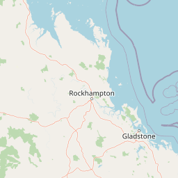
The landscape of Byfield National Park is defined by its coastal setting, featuring a succession of beach environments, dune systems, and subtle inland terrain that rises only modestly above sea level. The park contains approximately 12 kilometers of coastline divided among four distinct beaches, each offering different aspects and character within the overall coastal framework. The average elevation of 48 meters across the park reflects the generally low-lying nature of the terrain, which consists largely of coastal plain and dune formations rather than significant topographic relief. The park's western boundary abuts Byfield State Forest, creating a transition zone between the more exposed coastal environments and the denser woodland vegetation of the forest reserve. To the north, the park approaches Shoalwater Bay, extending the coastal landscape context beyond the protected area itself. The presence of Water Park Creek, which flows through the park, adds a freshwater dimension to the otherwise predominantly coastal landscape, creating riparian habitats that contrast with the surrounding beach and dune environments.

Byfield National Park ecosystems, habitats, and plant life

The ecological character of Byfield National Park reflects its position at the intersection of tropical and subtropical climatic zones, creating conditions that support species assemblages from both domains. The park's vegetation is characterized by the extensive stands of Pandanus tectorius, commonly known as the pandanus or screwpine, which dominate the beachfront and shoreline areas. These palm species play a foundational ecological role within the park, their extensive root systems stabilizing coastal sediments and protecting dune systems from wave action and wind erosion. Beyond their physical stabilizing function, pandanus stands provide critical habitat for numerous invertebrate and vertebrate species, creating vertical complexity and food resources within what might otherwise be relatively exposed coastal environments. The creek systems, particularly Water Park Creek, add freshwater aquatic habitats to the park's ecological repertoire, supporting species such as Rhadinocentrus ornatus, a small freshwater fish that represents an endemic Australian species adapted to these specialized aquatic environments.

Byfield National Park wildlife and species highlights

The wildlife of Byfield National Park is closely tied to the park's dominant habitat types, with the pandanus forests and coastal dune systems providing the primary habitats for most species. The pandanus trees support diverse invertebrate communities, including insects that form the base of the food web supporting larger animal species. Birds utilize the pandanus stands for nesting and foraging, while the diverse insect communities provide food sources for both resident and migratory bird species. The creek systems within the park add aquatic habitat complexity, supporting fish populations and the predators that depend on them. Among the conservation concerns within the park is the pandanus planthopper, a destructive pest that threatens the health of pandanus populations. Management efforts have included biological control using the native wasp Aphanomerus pusillus, which parasitizes the planthopper and helps maintain some level of natural regulation over this invasive threat.

Byfield National Park conservation status and protection priorities

Byfield National Park contributes to the conservation of Queensland's coastal biodiversity by protecting a representative example of the central Queensland coastline ecosystem. The park's protection of pandanus forests is particularly significant, as these communities face pressures from development, altered fire regimes, and the impacts of pest species such as the pandanus planthopper. The park's location at the boundary between tropical savanna and subtropical climates adds conservation value by protecting a transitional ecological zone that supports species from both broader climate domains. The protection of Water Park Creek and its fish populations represents freshwater biodiversity conservation, with Rhadinocentrus ornatus being a species of particular interest due to its limited distribution and specialized habitat requirements. The ongoing management challenge posed by the pandanus planthopper demonstrates the dynamic nature of conservation work within the park, requiring active intervention to protect key habitat-forming species.

Byfield National Park cultural meaning and human context

The cultural context of Byfield National Park reflects the broader history of the central Queensland coast, a region with indigenous heritage spanning thousands of years. While the Wikipedia source does not provide detailed information regarding specific indigenous connections to the park area, the broader region of coastal Queensland contains numerous sites of indigenous significance, and the park's landscapes would have supported traditional uses and cultural practices. European settlement of the area preceded the park's establishment, with the land having previously been managed as state forest before transitioning to protected area status in 1988. The township of Byfield provides a local reference point for the park's identity, with the park and surrounding state forest creating a broader conservation landscape that encompasses the local community context.

Top sights and standout views in Byfield National Park

Byfield National Park offers visitors a relatively undeveloped coastal wilderness experience characterized by its four beaches, extensive pandanus forests, and accessible four-wheel drive touring opportunities. The pandanus-fringed coastline represents one of the park's most visually distinctive features, with these iconic palms creating a recognizable tropical coastal aesthetic along the shoreline. The park's camping areas provide opportunities for extended stays, allowing visitors to explore the various beach environments and interior tracks at a relaxed pace. The proximity to Rockhampton, accessible within a moderate drive, makes the park a feasible destination for both overnight visitors and day-trippers seeking coastal recreation. The park's role as the southern boundary of the tropical savanna climate zone adds atmospheric significance, marking a transition point in the broader regional climate patterns.

Best time to visit Byfield National Park

The best time to visit Byfield National Park is influenced by Queensland's climate patterns, with the cooler winter months from May through September typically offering more comfortable conditions for outdoor activities. During these months, temperatures are moderate and rainfall is generally lower, making beach activities and bushwalking more pleasant than during the hot, humid summer period. The summer months from November through March bring higher temperatures and increased rainfall, which while supporting the park's lush vegetation, can make outdoor exploration less comfortable and may affect access to some tracks. The park's position near the boundary of tropical and subtropical zones means that weather patterns can vary, and visitors should check current conditions before traveling. The dry season generally provides more predictable access and clearer beach conditions, while the wet season can bring lush green landscapes but also higher humidity and potential for track closures.

Park location guide

Geography guide, regional context, and park location map for Byfield National Park

Byfield National Park park geography, regions, and map view in Australia
Understand where Byfield National Park sits in Australia through a broader geographic reading of the surrounding landscape, nearby location context, and its mapped position within the national park landscape.

How Byfield National Park fits into Australia

Australia is a constitutional monarchy and federal parliamentary democracy comprising six states and ten territories. With a population of nearly 28 million, it is one of the world's most urbanised countries, with most people concentrated on the eastern seaboard. The country has a high Human Development Index and is known for its cultural diversity, ancient Aboriginal heritage, and unique wildlife.

Wider geography shaping Byfield National Park in Australia

Australia occupies the entire Australian continent, the island of Tasmania, and numerous smaller islands. It is the world's flattest and driest inhabited continent, featuring vast deserts in the interior (the Outback), tropical rainforests along the eastern coast, and a coastline bordering the Indian and Pacific Oceans.

Map view of Byfield National Park

Use this park location map to pinpoint Byfield National Park in Australia, understand its exact geographic position, and read its mapped placement within the surrounding landscape more clearly.

Pigeon | © OpenStreetMap contributors

Location context for Byfield National Park

Queensland
Park atlas

Discover diverse Queensland protected landscapes, mapping regional park geography and adjacent conservation areas.

Explore Other Coastal National Parks and Protected Areas Near Byfield National Park
Browse additional national parks and protected areas located in the central Queensland coastal region, tracing landscapes that connect to Byfield National Park's unique blend of tropical savanna and subtropical coastal ecosystems. Continue your geographic exploration by comparing these diverse conservation landscapes, gaining broader context on regional park spread and shared ecological features within Australia.
National parkQueensland

Keppel Bay Islands National Park: Queensland's Coastal National Park and Archipelago Discovery

Explore protected islands, mapped coral reefs, and marine ecosystems.

Delve into the geographic identity of Keppel Bay Islands National Park, a significant protected area comprising thirteen islands off the coast of Queensland. This national park showcases a dynamic coastal landscape, featuring distinct island terrains, diverse marine life, and essential coral reef systems. Through its mapped boundaries and conservation focus, the park offers a unique lens for understanding island geography and the importance of marine protected areas within the broader Australian atlas.

Area
7.2 km²
Established
1994
IUCN
II
National parkQueensland

Baga National Park: Unique Volcanic Geography and Protected Landscape in Queensland

Mapped terrain and protected area identity for a distinctive national park.

Baga National Park stands as a notable protected area in central Queensland, Australia, centered around the striking Mount Baga, a trachyte volcanic plug. This geological marvel offers a unique landscape context, showcasing the remnants of ancient volcanic activity within the regional geography. As a national park, it serves to preserve this distinctive natural feature and its associated habitats, providing a compact yet significant destination for atlas-based discovery of Queensland's diverse protected lands.

Area
1.44 km²
Established
1977
IUCN
II
National parkQueensland

Castle Tower National Park: Queensland National Park with Granite Peaks and Woodland

Mapped terrain and protected landscape in the Gladstone Region.

Castle Tower National Park in Queensland represents a significant protected natural area characterized by striking granite peak formations and expansive eucalypt woodlands. Established in 1932, the park's rugged terrain, including Mount Stanley, offers a unique geographic perspective within Central Queensland. This national park provides an opportunity to explore its mapped boundaries and distinctive landscape context, distinguishing it as a notable protected area in the Gladstone Region.

Area
49.8 km²
Established
1932
IUCN
II
National parkQueensland

West Hill National Park: Explore Queensland's National Park Geography and Mapped Protected Boundaries

Central Queensland Protected Landscape and Atlas Context

West Hill National Park represents a key protected area within Queensland's natural environment network. As a national park, it offers insights into the region's geography and landscape character, contributing to a structured understanding of protected lands. Explore the mapped boundaries and discover its specific place within the atlas of Australian parks, providing context for its conservation significance in central Queensland.

Area
10.8 km²
Established
1971
IUCN
II
National parkQueensland

Taunton National Park: Queensland's Vital National Park and Endangered Species Refuge

Mapped brigalow landscapes and semi-arid woodland terrain.

Taunton National Park in Central Queensland is a protected area of immense conservation value, serving as the last known natural habitat for the endangered bridled nail-tail wallaby. This national park protects representative ecosystems of the Northern Brigalow Belt, featuring distinct brigalow vegetation communities and poplar box woodlands across its cracking clay and texture-contrast soils. Understand the park's geographic setting, its mapped terrain, and the critical role it plays in preserving Australia's unique marsupial populations and diverse flora within the wider regional context.

Area
116 km²
Established
1986
IUCN
II
National parkQueensland

Eurimbula National Park: Central Queensland's Diverse Coastal Protected Landscape

Explore mapped terrain and protected ecosystem boundaries.

Eurimbula National Park in Queensland is an exceptional example of a protected coastal wilderness, featuring a remarkable array of habitats including mangroves, littoral rainforests, and extensive paperbark wetlands. Its diverse landscape supports significant biodiversity and offers a clear representation of central Queensland's natural heritage. Understanding Eurimbula National Park's geography through its mapped protected area helps situate its ecological importance within the broader Australian atlas.

Area
125 km²
Established
1977
IUCN
II
National parkMackay Region

Cape Palmerston National Park: Coastal Protected Area and Geographic Context in Mackay Region

Mapped landscape, dune systems, and mangrove ecosystems.

Delve into the protected landscape of Cape Palmerston National Park, a significant national park in Australia's Mackay Region. This page offers detailed insights into its geographic identity, characterized by 28 kilometers of pristine coastline, dynamic sand dunes, and extensive mangrove forests. Understand its position within the Central Mackay Coast bioregion and explore the mapped boundaries of this diverse protected area, from its beaches to the inland woodland habitats and wetland basins, providing essential atlas context for this unique coastal environment.

Area
71.9 km²
Established
1976
IUCN
II
Relief
Mixed relief
National parkQueensland

Cania Gorge National Park: A Distinct Queensland National Park with Dramatic Sandstone Cliff Formations

Explore mapped gorge terrain, rock art sites, and diverse Queensland landscapes.

Cania Gorge National Park represents a significant protected area within Queensland, Australia, distinguished by its dramatic 70-meter sandstone cliffs and the ancient Aboriginal rock art found within its caves. The park's rugged gorge terrain, shaped by Three Moon Creek, offers a unique geographic context and landscape to explore. Its mapped boundaries encompass diverse ecological communities and geological features, making it a focal point for understanding regional park identity and natural heritage within Queensland's broader atlas.

Area
30 km²
Established
1977
IUCN
II

Common questions about visiting, size, designation, and location context for Byfield National Park

Byfield National Park FAQs for park facts, access, geography, and protected area context
Find quick answers about Byfield National Park, including protected-area facts, park geography, trail and visitor context, and how the park fits into its surrounding country and regional landscape.
MoriAtlas Explorer

Continue Your Protected Areas Search Across the Global Atlas

Deepen your exploration by continuing the structured search for national parks and protected areas worldwide. Utilize the comprehensive filtering capabilities to compare different conservation landscapes and refine your understanding of global park geography. Discover more about the distribution and characteristics of protected natural areas.

Global natural geography