Mori Atlas logo
National parkKeppel Bay Islands National Park

Discover distinct island terrain, coral reef systems, and vital marine park boundaries offshore Queensland.

Keppel Bay Islands National Park: Queensland's Mapped Archipelago and Protected Landscape Atlas

Keppel Bay Islands National Park encompasses thirteen protected islands scattered across Keppel Bay, Queensland, Australia. This national park, covering approximately 7.20 square kilometers, offers a crucial conservation landscape showcasing diverse island terrain, coastal vegetation, and vibrant coral reef ecosystems. Situated off the Capricorn Coast, the park provides a vital refuge for marine life and a unique opportunity for atlas-driven exploration of Australian island geography and protected marine environments.

islandscoastal national parkcoral reefsmarine protected areaQueenslandCapricorn Coast

Keppel Bay Islands National Park

National park

Park overview

Structured park overview, official facts, and landscape profile for Keppel Bay Islands National Park

Keppel Bay Islands National Park park facts, protected area profile, and essential visitor context
Review the core facts for Keppel Bay Islands National Park, including designation, size, terrain, visitor scale, habitats, and operating context in one park-focused overview.

About Keppel Bay Islands National Park

Keppel Bay Islands National Park represents an important protected area along Queensland's Capricorn Coast, comprising 13 islands distributed across Keppel Bay. The park's establishment in 1994 formalized protection for these coastal islands, which had previously existed in varying levels of administrative recognition. The protected area encompasses both the terrestrial island environments and surrounding marine zones, creating a comprehensive coastal conservation framework.

The islands vary considerably in size and character, ranging from small rocky islets to more substantial landforms with established vegetation communities. This heterogeneity supports diverse habitat types across the archipelago. The park is administered by the Queensland Parks and Wildlife Service, which manages visitor access, conservation programs, and infrastructure maintenance across the island group.

Visitor engagement with the park centers on nature-based activities that take advantage of the coastal and marine environment. Camping facilities allow overnight stays on selected islands, while the reef systems provide exceptional opportunities for underwater exploration. The contrast between the protected Keppel Bay Islands and the nearby commercially-developed Great Keppel Island highlights the park's role in preserving relatively unmodified island landscapes for future generations.

The park also functions as an educational resource through the Konomie Island Environmental Education Centre, which delivers programs specifically designed for school groups. This educational function extends the park's value beyond pure conservation to include environmental literacy and community engagement with island ecosystems.

Quick facts and research context for Keppel Bay Islands National Park

Keppel Bay Islands National Park protects 13 islands in Keppel Bay along the Capricorn Coast of Queensland, Australia. The park was established in 1994 and covers 7.20 square kilometers of terrestrial and marine environments. It is classified as an IUCN Category II protected area and managed by the Queensland Parks and Wildlife Service. The islands are located 538 kilometers northwest of Brisbane, with the nearest coastal towns being Yeppoon and Emu Park. The park offers activities including camping, reef walking, diving, snorkelling, and wildlife observation. North Keppel Island previously hosted a small resort operation from the 1950s until the park's formal establishment.

Park context

Deeper park guide and search-rich context for Keppel Bay Islands National Park

Keppel Bay Islands National Park history, landscape, wildlife, and travel context
Explore Keppel Bay Islands National Park through its history, landscape character, ecosystems, wildlife, conservation priorities, cultural context, and seasonal travel timing in a structured park guide built for atlas discovery and search intent.

Why Keppel Bay Islands National Park stands out

Keppel Bay Islands National Park is best known for its archipelago of 13 islands protecting diverse coastal and marine environments in Keppel Bay. The park is particularly recognized for its coral reef systems accessible through reef walking, diving, and snorkelling activities. The islands support distinct coastal ecosystems that contrast with the more developed tourism-focused Great Keppel Island nearby. North Keppel Island, with its history as a family-run resort from the 1950s to 1994, provides a unique narrative of human interaction with the island landscape before formal protected area status. The Konomie Island Environmental Education Centre also gives the park a distinctive educational role in environmental awareness for Queensland school groups.

Keppel Bay Islands National Park history and protected-area timeline

The history of Keppel Bay Islands National Park reflects broader trends in Australian protected area establishment during the late twentieth century. Prior to formal national park designation in 1994, the islands existed within various administrative categories, with some areas receiving preliminary protection through state conservation mechanisms. The transition to full national park status in 1994 consolidated protection across the entire island group.

North Keppel Island holds particular historical significance as the site of a small resort operation spanning several decades. From the early 1950s until approximately 1994, a modest facility of about twelve cabins was operated by Mr Walls, a former train driver. The operation represented a common pattern of modest island-based tourism that characterized many coastal areas before the expansion of protected area regulations. Mr Walls was assisted by his daughter Geraldine and her husband, who also resided on the island, while their son Tim Walls operated the boat service, initially with a vessel called the Somerset out of Ross Creek in Yeppoon, and later with the larger Keppel Star from the Roslyn Bay Boat Harbour.

Following the establishment of the national park, management transitioned to the Queensland Parks and Wildlife Service, ending the commercial resort operation. This change reflected the shift toward prioritizing conservation values over tourism infrastructure on the protected islands. The resort's former presence, now removed, adds a human dimension to the island's history and illustrates the evolution of attitudes toward island land use in Queensland.

Keppel Bay Islands National Park landscape and geographic character

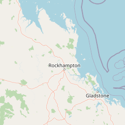
The landscape of Keppel Bay Islands National Park encompasses the physical character of 13 islands distributed across Keppel Bay. The islands rise from the coastal marine environment with varying topographies, from low-lying sandy formations to more elevated terrain with established coastal vegetation. The surrounding waters of Keppel Bay create a marine context that significantly influences the islands' ecological character.

The coastal setting places the islands within a broader landscape of the Capricorn Coast, a region known for its mixed sandy beaches, rocky headlands, and offshore reef systems. Island interiors support coastal shrubland and woodland communities adapted to the island environment, while shoreline areas feature beach formations, tidal zones, and intertidal habitats. The relationship between the islands and the mainland coast, visible from elevated points on the larger islands, reinforces the archipelago's connection to the broader coastal landscape.

The marine environment surrounding the islands includes coral reef communities that represent significant underwater landscape features. These reef systems create complex underwater topography with coral formations, sandy channels, and associated benthic environments. The combination of island terrestrial features and marine reef systems gives the park a distinctive dual landscape character that distinguishes it from purely terrestrial protected areas.

Keppel Bay Islands National Park ecosystems, habitats, and plant life

The nature of Keppel Bay Islands National Park reflects the coastal and island ecosystems characteristic of central Queensland. The islands support vegetation communities adapted to island conditions, including coastal dune species, shrubland associations, and woodland formations on larger islands. These plant communities provide habitat for island-dwelling wildlife and contribute to the overall biodiversity of the protected area.

The marine environment represents a significant component of the park's natural values. Coral reef systems in the surrounding waters support diverse marine communities, with reef-forming corals creating habitat structures for fish, invertebrates, and other marine organisms. The accessibility of these reef systems through activities like snorkelling and diving allows for direct engagement with the marine environment, though the specific species compositions would reflect the tropical to subtropical positioning of the Capricorn Coast.

The islands function as isolated habitats within the marine matrix, which influences the distribution and composition of terrestrial species. The relatively unmodified nature of the protected islands, particularly in contrast to developed neighboring islands, preserves natural ecological processes and species assemblages that might otherwise be impacted by development or altered land use. This conservation focus maintains the ecological integrity of the island group as a coherent natural system.

Keppel Bay Islands National Park wildlife and species highlights

The wildlife of Keppel Bay Islands National Park encompasses both terrestrial and marine species associated with island and coastal environments. Island habitats support bird species that utilize the islands for nesting, feeding, and resting, with seabird colonies likely present on appropriate nesting habitats. Coastal bird species may also frequent the islands as part of their broader coastal range.

The marine environment supports fish communities associated with reef structures, with coral reef systems providing critical habitat for numerous fish species. The clear waters of Keppel Bay allow for observation of marine life during underwater activities, with reef fish, larger predatory species, and smaller forage fish all likely present in appropriate habitat areas. Invertebrate marine life, including various coral species, crustaceans, and mollusks, contributes to the overall marine biodiversity.

Island terrestrial wildlife would include species adapted to island environments, potentially including reptiles, small mammals, and invertebrate groups. The isolation of island habitats influences which species are present and can create distinctive island faunal assemblages. While specific species documentation would require detailed survey data, the general expectation would be coastal and island species typical of the Capricorn Coast region.

Keppel Bay Islands National Park conservation status and protection priorities

The conservation significance of Keppel Bay Islands National Park derives from its protection of island and coastal ecosystems along the central Queensland coast. The national park designation provides legal protection for the 13 islands, preserving terrestrial environments and associated marine zones from development pressures that might otherwise impact these coastal areas. The IUCN Category II classification indicates the park's primary objective of ecosystem conservation and protection.

The protection of island habitats addresses conservation priorities for coastal biodiversity in Queensland. Islands serve as important sites for breeding seabirds, provide refuge for terrestrial species, and maintain genetic connectivity for species that utilize island complexes. The marine environment surrounding the islands, including reef systems, receives protection through the national park framework, contributing to marine conservation in the Keppel Bay region.

The park's educational function through the Konomie Island Environmental Education Centre adds a conservation dimension beyond habitat protection. Environmental education programs for school groups foster awareness and appreciation of island ecosystems, potentially influencing conservation attitudes among younger generations. This educational role enhances the park's overall conservation impact by building community understanding of protected area values.

Keppel Bay Islands National Park cultural meaning and human context

The cultural context of Keppel Bay Islands National Park relates to the historical human relationship with the islands of Keppel Bay. The traditional custodians of these coastal lands would have been Aboriginal peoples with connections to the Capricorn Coast region, though specific information about indigenous use of the Keppel Islands would require more detailed historical sources.

More documented human history involves the resort operation on North Keppel Island from the 1950s to 1994. This period represents a phase of modest tourism development on the island, operated by the Walls family in a manner typical of small-scale island enterprises of that era. The transition to national park status in 1994 ended this commercial use, returning the island to protected status.

The broader Capricorn Coast region, with towns like Yeppoon and Emu Park, provides the human context for the island park. These coastal communities have relationships with the offshore islands that include recreational use, fishing, and tourism. The park exists within this human landscape, balancing conservation with appropriate visitor access that allows people to experience and appreciate the island environments.

Best time to visit Keppel Bay Islands National Park

The best time to visit Keppel Bay Islands National Park aligns with the climatic patterns of central Queensland, where the park can be enjoyed year-round with seasonal variations in conditions. The Queensland coast experiences a subtropical climate with warm temperatures throughout the year, making outdoor activities like reef walking, diving, and camping comfortable in multiple seasons.

The cooler months from approximately May through September typically offer milder temperatures and lower humidity, which can make outdoor exploration more comfortable for some visitors. This period often coincides with clearer water conditions, enhancing visibility for snorkelling and diving activities. The winter months may also see reduced rainfall, contributing to more predictable weather patterns for planning visits.

The warmer months from November through March bring higher temperatures and increased chance of summer rainfall, though these periods also coincide with the peak marine activity season. Water temperatures remain suitable for swimming and underwater activities throughout the year given the subtropical location. Visitors interested in specific activities should consider seasonal patterns when planning trips, though the park's accessible nature allows for meaningful experiences in most conditions.

Park location guide

Geography guide, regional context, and park location map for Keppel Bay Islands National Park

Keppel Bay Islands National Park park geography, regions, and map view in Australia
Understand where Keppel Bay Islands National Park sits in Australia through a broader geographic reading of the surrounding landscape, nearby location context, and its mapped position within the national park landscape.

How Keppel Bay Islands National Park fits into Australia

Australia is a constitutional monarchy and federal parliamentary democracy comprising six states and ten territories. With a population of nearly 28 million, it is one of the world's most urbanised countries, with most people concentrated on the eastern seaboard. The country has a high Human Development Index and is known for its cultural diversity, ancient Aboriginal heritage, and unique wildlife.

Wider geography shaping Keppel Bay Islands National Park in Australia

Australia occupies the entire Australian continent, the island of Tasmania, and numerous smaller islands. It is the world's flattest and driest inhabited continent, featuring vast deserts in the interior (the Outback), tropical rainforests along the eastern coast, and a coastline bordering the Indian and Pacific Oceans.

Map view of Keppel Bay Islands National Park

Use this park location map to pinpoint Keppel Bay Islands National Park in Australia, understand its exact geographic position, and read its mapped placement within the surrounding landscape more clearly.

Pigeon | © OpenStreetMap contributors

Location context for Keppel Bay Islands National Park

Queensland
Park atlas

Expand your view of island and coastal protected areas, comparing them with Keppel Bay Islands National Park across Queensland's Capricorn Coast.

Parks Near Keppel Bay Islands National Park, Queensland: Explore Coastal Protected Areas
Browse other national parks and protected areas near Keppel Bay Islands National Park to compare diverse coastal and island landscapes along Queensland's Capricorn Coast. This broader view allows for atlas-style exploration, helping you understand the regional distribution of conservation efforts and related marine protected areas beyond a single location.
National parkQueensland

Baga National Park: Unique Volcanic Geography and Protected Landscape in Queensland

Mapped terrain and protected area identity for a distinctive national park.

Baga National Park stands as a notable protected area in central Queensland, Australia, centered around the striking Mount Baga, a trachyte volcanic plug. This geological marvel offers a unique landscape context, showcasing the remnants of ancient volcanic activity within the regional geography. As a national park, it serves to preserve this distinctive natural feature and its associated habitats, providing a compact yet significant destination for atlas-based discovery of Queensland's diverse protected lands.

Area
1.44 km²
Established
1977
IUCN
II
National parkQueensland

Byfield National Park: Protected National Park with Coastal Dune Ecosystems in Queensland

Explore its mapped landscape and unique pandanus forests.

Byfield National Park presents a compelling case study in coastal protected-area geography, showcasing a diverse landscape where dune systems meet extensive pandanus forests across 12 kilometers of Queensland coastline. This national park, established in 1988, provides a unique glimpse into the ecological transition zone between tropical savanna and subtropical climates, offering a richly detailed environment for map-based exploration. Its relatively undeveloped terrain and distinct ecosystems make it a valuable entity for understanding regional Australian natural landscapes and conservation efforts.

Area
87 km²
Established
1988
IUCN
II
National parkQueensland

Castle Tower National Park: Queensland National Park with Granite Peaks and Woodland

Mapped terrain and protected landscape in the Gladstone Region.

Castle Tower National Park in Queensland represents a significant protected natural area characterized by striking granite peak formations and expansive eucalypt woodlands. Established in 1932, the park's rugged terrain, including Mount Stanley, offers a unique geographic perspective within Central Queensland. This national park provides an opportunity to explore its mapped boundaries and distinctive landscape context, distinguishing it as a notable protected area in the Gladstone Region.

Area
49.8 km²
Established
1932
IUCN
II
National parkQueensland

Eurimbula National Park: Central Queensland's Diverse Coastal Protected Landscape

Explore mapped terrain and protected ecosystem boundaries.

Eurimbula National Park in Queensland is an exceptional example of a protected coastal wilderness, featuring a remarkable array of habitats including mangroves, littoral rainforests, and extensive paperbark wetlands. Its diverse landscape supports significant biodiversity and offers a clear representation of central Queensland's natural heritage. Understanding Eurimbula National Park's geography through its mapped protected area helps situate its ecological importance within the broader Australian atlas.

Area
125 km²
Established
1977
IUCN
II
National parkQueensland

Taunton National Park: Queensland's Vital National Park and Endangered Species Refuge

Mapped brigalow landscapes and semi-arid woodland terrain.

Taunton National Park in Central Queensland is a protected area of immense conservation value, serving as the last known natural habitat for the endangered bridled nail-tail wallaby. This national park protects representative ecosystems of the Northern Brigalow Belt, featuring distinct brigalow vegetation communities and poplar box woodlands across its cracking clay and texture-contrast soils. Understand the park's geographic setting, its mapped terrain, and the critical role it plays in preserving Australia's unique marsupial populations and diverse flora within the wider regional context.

Area
116 km²
Established
1986
IUCN
II
National parkQueensland

Cania Gorge National Park: A Distinct Queensland National Park with Dramatic Sandstone Cliff Formations

Explore mapped gorge terrain, rock art sites, and diverse Queensland landscapes.

Cania Gorge National Park represents a significant protected area within Queensland, Australia, distinguished by its dramatic 70-meter sandstone cliffs and the ancient Aboriginal rock art found within its caves. The park's rugged gorge terrain, shaped by Three Moon Creek, offers a unique geographic context and landscape to explore. Its mapped boundaries encompass diverse ecological communities and geological features, making it a focal point for understanding regional park identity and natural heritage within Queensland's broader atlas.

Area
30 km²
Established
1977
IUCN
II
National parkQueensland

Bulburin National Park: Central Queensland's Significant Subtropical Rainforest Preserve

Mapped protected landscape and ecological refuge.

Bulburin National Park represents the most substantial remaining area of subtropical rainforest in central Queensland, established as a protected national park. Its dense forest ecosystem provides crucial habitat for numerous species, including endangered marsupials and notable birdlife. Exploring Bulburin National Park reveals a distinct natural landscape within Queensland, offering insights into regional conservation and the geographic distribution of vital protected areas.

Established
2015
IUCN
II
National parkQueensland

West Hill National Park: Explore Queensland's National Park Geography and Mapped Protected Boundaries

Central Queensland Protected Landscape and Atlas Context

West Hill National Park represents a key protected area within Queensland's natural environment network. As a national park, it offers insights into the region's geography and landscape character, contributing to a structured understanding of protected lands. Explore the mapped boundaries and discover its specific place within the atlas of Australian parks, providing context for its conservation significance in central Queensland.

Area
10.8 km²
Established
1971
IUCN
II

Common questions about visiting, size, designation, and location context for Keppel Bay Islands National Park

Keppel Bay Islands National Park FAQs for park facts, access, geography, and protected area context
Find quick answers about Keppel Bay Islands National Park, including protected-area facts, park geography, trail and visitor context, and how the park fits into its surrounding country and regional landscape.
MoriAtlas Explorer

Continue Your Protected Areas Search Across the Global Atlas

Deepen your exploration by continuing the structured search for national parks and protected areas worldwide. Utilize the comprehensive filtering capabilities to compare different conservation landscapes and refine your understanding of global park geography. Discover more about the distribution and characteristics of protected natural areas.

Global natural geography