Mori Atlas logo
National parkDinira National Park

Discover mapped boundaries and highland terrain within Venezuela's Cordillera de Mérida.

Dinira National Park: Protected Andean Watershed Landscape in Venezuela

Dinira National Park represents a crucial protected landscape situated within the Cordillera de Mérida of western Venezuela. This national park, established in 1988, encompasses roughly 45,328 hectares of rugged highland terrain, prioritizing the protection of the upper basin of the Tocuyo River. Its dramatic geography includes the Humocaro Mountains and the Los Nepes páramo zone, offering a detailed view of Andean cloud forests and high-altitude grasslands ideal for atlas-driven geographic discovery.

national parkwatershed protectionAndes mountainscloud forestpáramo ecosystemmountain landscape

Dinira National Park

National park

Park overview

Structured park overview, official facts, and landscape profile for Dinira National Park

Dinira National Park park facts, protected area profile, and essential visitor context
Review the core facts for Dinira National Park, including designation, size, terrain, visitor scale, habitats, and operating context in one park-focused overview.

About Dinira National Park

Dinira National Park occupies a strategic position in the Cordillera de Mérida, the Venezuelan segment of the northern Andes mountain system. The protected area was established specifically to conserve the upper watershed of the Tocuyo River, recognizing that headwater protection is essential for maintaining downstream water quality and quantity for agricultural, domestic, and ecological use across the region. The park's terrain consists of mountainous relief with significant elevation gradients, creating diverse microclimates and habitat zones that transition from cloud forest at lower elevations to páramo grassland and rocky alpine zones at higher altitudes. The protection of this watershed connects Dinira to broader regional conservation efforts, as the Tocuyo River basin forms part of a larger hydrological network that includes the Orinoco, Guanare, Motatán, and Lake Maracaibo basins. Local communities have historically depended on the water resources originating in these highlands, and the park's preservation ensures the continuity of these hydrological services.

Quick facts and research context for Dinira National Park

Dinira National Park encompasses 453.28 square kilometers of mountainous terrain in the Venezuelan Andes, created on November 30, 1988 under IUCN Category II protection. The park safeguards the Tocuyo River's headwaters and multiple tributary streams of regional importance, serving as a critical watershed for surrounding lowland areas. Located at approximately 9.417°N latitude and 70.167°W longitude, the park sits at the intersection of three Venezuelan states and forms part of a larger protected corridor that includes basins draining to the Orinoco River, Guanare River, Motatán River, and Lake Maracaibo. The highland páramo ecosystems and cloud forests within the park represent important altitudinal zones within the northern Andes.

Park context

Deeper park guide and search-rich context for Dinira National Park

Dinira National Park history, landscape, wildlife, and travel context
Explore Dinira National Park through its history, landscape character, ecosystems, wildlife, conservation priorities, cultural context, and seasonal travel timing in a structured park guide built for atlas discovery and search intent.

Why Dinira National Park stands out

Dinira National Park is best known for its role as a protected watershed that sustains downstream agricultural communities and ecological systems across western Venezuela. The park encompasses dramatic highland scenery including the Humocaro Mountains and the Los Nepes páramo zone, which represent the park's most distinctive elevational landscapes. Waterfall features such as Cascada del Vino exemplify the park's hydrological abundance and serve as notable visual landmarks within the protected area. The combination of Andean cloud forests, high-altitude páramo grasslands, and the critical watershed function distinguishes Dinira from lower-elevation savanna parks in Venezuela.

Dinira National Park history and protected-area timeline

Dinira National Park was established on November 30, 1988, through formal governmental designation that recognized the ecological and hydrological importance of the Tocuyo River's upper watershed. The creation of the park reflected growing awareness in Venezuela during the late 1980s of the need to protect critical mountain watersheds from deforestation, agricultural expansion, and unregulated development. The park's establishment also corresponded with broader national efforts to develop a comprehensive protected area network that represented the country's major ecological regions, from coastal ecosystems to Andean highlands. The decision to protect this particular watershed acknowledged that the headwaters of major rivers often face the greatest ecological pressures while providing the most essential water resources to downstream populations.

Dinira National Park landscape and geographic character

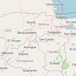
The landscape of Dinira National Park is defined by its position within the Cordillera de Mérida, featuring rugged mountainous terrain with steep valleys, ridges, and numerous stream courses descending from highland collection points. The Humocaro Mountains represent one of the park's most prominent geographical features, offering dramatic scenery with their steep slopes and exposed rock formations. At higher elevations, the Los Nepes area exemplifies the páramo ecosystem characteristic of tropical high-altitude environments above the continuous forest line. The terrain's elevation range supports distinct ecological zones, with cloud forest dominating mid-elevation slopes where moisture-laden clouds from the Caribbean coast interact with the mountain topography. The network of streams and rivulets throughout the park converges to form the headwaters of the Tocuyo River, creating a dendritic drainage pattern characteristic of mountainous catchments.

Dinira National Park ecosystems, habitats, and plant life

The ecological character of Dinira National Park reflects its position in the Venezuelan Andes, encompassing altitudinal zones that transition from premontane cloud forest through to subpáramo and páramo vegetation communities. The cloud forests at mid elevations receive persistent moisture from orographic rainfall and fog interception, supporting dense vegetation with high epiphyte diversity and specialized adaptations to the humid conditions. Above the forest line, páramo grasslands feature bunch grasses and low shrub vegetation adapted to the cool, wet conditions of high-altitude tropical environments. The park's hydrological function as a watershed protection area has shaped its ecological value, as the preservation of forest cover on slopes prevents erosion and maintains water quality for the downstream river system. These ecosystems collectively support biodiversity in a region that represents the northernmost extension of the Andes mountain range.

Dinira National Park wildlife and species highlights

While specific wildlife inventories for Dinira National Park are limited in the available source material, the park's diverse elevational gradients and habitat diversity suggest the presence of species assemblages typical of Andean cloud forest and páramo environments. The cloud forest zone likely supports numerous bird species, including potential representatives of toucanets, tanagers, and hummingbirds that characterize Neotropical mountain forests. Mammal presence probably includes various small to medium-sized species adapted to forest and edge habitats, though detailed species lists would require additional documentation. The páramo zone at higher elevations supports specialized fauna adapted to open grassland environments and cooler temperatures, including perhaps spectacled bear presence in broader Andean contexts, though specific confirmation for Dinira would be needed.

Dinira National Park conservation status and protection priorities

Dinira National Park represents a critical conservation designation for protecting the upper watershed of the Tocuyo River, one of Venezuela's significant river systems draining into Lake Maracaibo. The park's watershed protection function demonstrates how mountain ecosystems provide essential hydrological services beyond their biodiversity value, with forest cover on slopes preventing erosion and maintaining water infiltration that feeds downstream streams. The establishment of the park in 1988 reflected recognition that headwater areas face particular conservation pressures from agricultural expansion, logging, and settlement, making protected area designation essential for long-term watershed health. As part of Venezuela's national park system, Dinira contributes to the country's commitment to preserving representative samples of its major ecological regions, including the Andean mountain systems that form the country's western highland backbone.

Dinira National Park cultural meaning and human context

The name "Dinira" derives from indigenous terminology used by local populations, reflecting the area's historical identity as a water source that feeds and sustains downstream watercourses. This naming tradition connects the landscape to traditional understanding of hydrological systems and the importance of headwater areas in supporting human communities throughout the watershed. The region surrounding Dinira National Park has historically supported agricultural communities that depend on water from the Tocuyo River and its tributaries for irrigation and domestic use. The park's protection ensures that these traditional water uses remain sustainable by maintaining the quality and quantity of water originating in the highland catchments.

Top sights and standout views in Dinira National Park

Dinira National Park's standout features include its critical role as a protected watershed that sustains downstream communities across western Venezuela, its dramatic Andean scenery with prominent mountain features like the Humocaro Mountains, and its ecological diversity spanning cloud forest to páramo ecosystems. The Cascada del Vino waterfall represents a notable visual landmark demonstrating the park's hydrological abundance. The park's location at the intersection of three Venezuelan states positions it as a regional conservation hub within the Cordillera de Mérida. The combination of watershed protection, scenic mountain landscapes, and ecological diversity makes Dinira a distinctive protected area within Venezuela's national park system.

Best time to visit Dinira National Park

The park can be visited year-round given its location in the tropical Andes, though visitors should expect high humidity and frequent precipitation given the area's annual rainfall of up to 1,300 millimeters. The wet season typically brings more dramatic waterfall flows and lush vegetation, while the drier periods may offer slightly easier access to trail areas. The high-elevation páramo zones can be cool and foggy throughout the year, requiring appropriate clothing for visitors exploring those areas. Cloud forest environments maintain persistent moisture regardless of season, creating consistently humid conditions that visitors should prepare for when planning treks through the park's mid-elevation areas.

Park location guide

Geography guide, regional context, and park location map for Dinira National Park

Dinira National Park park geography, regions, and map view in Venezuela
Understand where Dinira National Park sits in Venezuela through a broader geographic reading of the surrounding landscape, nearby location context, and its mapped position within the national park landscape.

How Dinira National Park fits into Venezuela

Venezuela is a country in northern South America with coastline along the Caribbean Sea and Atlantic Ocean. It borders Colombia, Brazil, Guyana, and Trinidad and Tobago. The country has an area of approximately 916,445 km² and a population of about 31.8 million. Caracas is the capital and largest city. Venezuela consists of 23 states and the Capital District.

Wider geography shaping Dinira National Park in Venezuela

Venezuela is located on the northern coast of South America. The continental territory is bordered by the Caribbean Sea and Atlantic Ocean to the north, Colombia to the west, Brazil to the south, and Guyana to the east. Trinidad and Tobago lies to the northeast. The country includes various islands and islets in the Caribbean Sea known as the Federal Dependencies.

Map view of Dinira National Park

Use this park location map to pinpoint Dinira National Park in Venezuela, understand its exact geographic position, and read its mapped placement within the surrounding landscape more clearly.

Pigeon | © OpenStreetMap contributors

Location context for Dinira National Park

LaraPortuguesa
Park atlas

Trace the regional spread of conserved mountain terrain, cloud forests, and critical watersheds across the Venezuelan Andes.

Discover More Protected Areas and National Parks Near Dinira National Park, Venezuela
Browse other national parks and protected areas sharing similar Andean mountain landscapes, vital watershed functions, and cloud forest ecosystems found around Dinira National Park. This regional park atlas allows users to compare conservation profiles, geographic spread, and ecological diversity across Venezuela's highland territories and surrounding protected areas.
National parkLara State

Yacambú National Park National Park: Protected Cloud Forest Landscape in Lara State

Mapped terrain and significant orchid diversity in Venezuela's Andean foothills.

Yacambú National Park is a significant national park in Venezuela's Lara State, protecting crucial humid cloud forest ecosystems in the Andean foothills. The park's terrain is defined by the mountainous topography of the Portuguesa Mountain Range, supporting a rich diversity of flora, including numerous orchid species. Its role in watershed protection for nearby regions underscores its importance as a conserved natural landscape with vital ecological functions.

Area
146 km²
Established
1962
IUCN
II
Relief
Mountain
National parkVenezuela

El Guache National Park: Venezuela's Protected Andean Foothill National Park

Map exploration of vital river basins and natural landscapes.

El Guache National Park is a protected national park in Venezuela, safeguarding the headwaters of five key rivers. Its landscape comprises mountainous terrain within the Andean foothills, crucial for watershed protection and regional biodiversity. This entry provides detailed geographic context, allowing for an atlas-style exploration of the park's mapped boundaries and its role as a vital protected area.

Area
122 km²
Established
1992
IUCN
II
Relief
Mountain
National parkVenezuela

Terepaima National Park: Venezuela's National Park Protected Landscape

Mapped Boundaries and Regional Geography

Terepaima National Park is a designated national park within Venezuela, offering a clear focus for atlas-driven exploration of protected natural areas. This entry highlights the park's significance as a mapped protected landscape, providing essential geographic context and detail for understanding its boundaries and regional setting. It is an integral component for any structured discovery of Venezuela's conservation network.

Area
186.5 km²
Established
1976
IUCN
II
Relief
Mountain
Watercolor painting showing green hills, a river, and distant mountains under a light sky
National parkVenezuela

Sierra Nevada National Park: Venezuela's Majestic Alpine Protected Landscape and Park Boundaries

Explore the highest peaks and glacial terrain of this Venezuelan national park.

Delve into Sierra Nevada National Park, a premier protected area situated in the high Venezuelan Andes. This national park protects a vast expanse of dramatic alpine terrain, including Pico Bolívar and numerous glacial valleys. Understand its mapped boundaries and the unique paramo and cloud forest ecosystems that define this significant natural landscape within Venezuela, offering rich context for atlas-style geographic discovery.

Area
2,764.46 km²
Established
1952
IUCN
II
Relief
Mountain
National parkVenezuela

Sierra La Culata National Park: Protected Landscape Atlas of the Venezuelan Andes

Explore the páramo ecosystems and mapped terrain of this Venezuelan national park.

Sierra La Culata National Park offers a profound look into the unique geography of the Venezuelan Andes. This protected national park is characterized by its expansive páramo ecosystems, dramatic mountain peaks, and glacial lagoons, creating a distinctive high-altitude wilderness. Use this atlas-focused entry to understand the park's mapped boundaries and its significant role within the region's natural landscape context.

Area
2,004 km²
Established
1989
IUCN
II
Relief
Mountain
National parkLara State

Cerro Saroche National Park: A National Park within Lara State's Geography

Explore the protected landscape and mapped boundaries.

Cerro Saroche National Park in Lara State, Venezuela, is a distinct protected area offering a valuable perspective for geographic and atlas exploration. This page provides essential details about its identity as a national park, highlighting its place within the regional landscape. Understanding Cerro Saroche National Park helps in appreciating the distribution of protected lands and their geographical significance across Venezuela.

Area
322.94 km²
Established
1989
IUCN
II
Relief
Mountain
National parkBarinas

Tapo-Caparo National Park: Mapped Boundaries and Geographic Context in Barinas, Venezuela

Explore Venezuela's Tapo-Caparo National Park's protected terrain.

Tapo-Caparo National Park is a vital protected area located in the Barinas region of Venezuela. This page offers an atlas-focused exploration of its mapped natural landscape and geographic significance within the country. Understand the protected boundaries and the specific terrain features that define Tapo-Caparo National Park, providing essential context for regional geography and protected land discovery.

Area
2,050 km²
Established
1992
IUCN
II
Relief
Mountain
National parkVenezuela

Yurubí National Park: A National Park in Venezuela for Protected Landscape Exploration

Explore mapped boundaries and regional geography.

Yurubí National Park represents a distinct protected area within Venezuela, offering valuable data for geographic exploration and atlas-based understanding. This national park's identity is defined by its mapped boundaries and its role in the regional landscape context of northern South America. Delve into its protected territory to gain insights into Venezuela's natural geography and conservation landscapes.

Area
236.7 km²
Established
1960
IUCN
II
Relief
Mountain

Common questions about visiting, size, designation, and location context for Dinira National Park

Dinira National Park FAQs for park facts, access, geography, and protected area context
Find quick answers about Dinira National Park, including protected-area facts, park geography, trail and visitor context, and how the park fits into its surrounding country and regional landscape.
MoriAtlas Explorer

Continue Your Protected Areas Search Across the Global Atlas

Deepen your exploration by continuing the structured search for national parks and protected areas worldwide. Utilize the comprehensive filtering capabilities to compare different conservation landscapes and refine your understanding of global park geography. Discover more about the distribution and characteristics of protected natural areas.

Global natural geography