Mori Atlas logo
National parkSan Esteban National Park

Explore its mapped protected boundaries and unique Caribbean forest landscape.

San Esteban National Park: A Protected National Park in Carabobo's Coastal Mountains

(Parque Nacional San Esteban)

San Esteban National Park in Venezuela's Carabobo region is a vital protected national park safeguarding a distinctive landscape where Caribbean forest ecosystems meet rich colonial-era cultural heritage. Established in 1987, this area encompasses approximately 445 square kilometers of dramatic terrain, stretching from coastal lowlands to mountainous slopes. Its strategic position within the coastal mountain ranges contributes to its diverse natural environments and its role as a protected corridor. Discover the park's mapped boundaries, unique terrain, and its significance as a protected natural and historical landscape within Venezuela's geography.

Caribbean forestColonial heritageArchaeological sitesPetroglyphsCoastal mountainsHistorical parks

San Esteban National Park

National park

Park overview

Structured park overview, official facts, and landscape profile for San Esteban National Park

San Esteban National Park park facts, protected area profile, and essential visitor context
Review the core facts for San Esteban National Park, including designation, size, terrain, visitor scale, habitats, and operating context in one park-focused overview.

About San Esteban National Park

San Esteban National Park represents a unique blend of natural and cultural protection in Venezuela's protected area system. Located in the coastal mountain region of Carabobo state, the park occupies terrain that forms part of the northernmost extensions of the Venezuelan Andes as they descend toward the Caribbean coast. This geographic position creates a mosaic of habitats ranging from lowland tropical forests on the coastal slopes to higher elevation cloud forest zones where moisture from the Caribbean creates lush, biodiverse environments. The park's establishment in 1987 reflected growing recognition in Venezuela of the need to protect not only pristine wilderness areas but also landscapes containing significant human heritage. The combination of natural forest protection with archaeological sites, colonial infrastructure, and historical associations with independence-era figures makes San Esteban distinctive among Venezuelan national parks. The park lies within easy reach of several major Venezuelan cities, with Maracay, Puerto Cabello, and Valencia all located within the broader metropolitan region that borders the protected area, creating both accessibility opportunities and management challenges related to visitor pressure and urban development.

Quick facts and research context for San Esteban National Park

San Esteban National Park spans roughly 445 km² along the northeastern coast of Carabobo state in north-central Venezuela, established on January 14, 1987 under IUCN Category II protection. The park connects with Henri Pittier National Park in Aragua to the west, creating an extended protected corridor across the coastal mountain range. The park is administered by INPARQUES, Venezuela's national parks institute, and encompasses territory within Guacara, Naguanagua, Puerto Cabello, and San Diego municipalities. The park protects both natural Caribbean forest ecosystems and a rich tapestry of historical sites including colonial-era roads, indigenous petroglyph sites, and structures related to Venezuela's independence era.

Park context

Deeper park guide and search-rich context for San Esteban National Park

San Esteban National Park history, landscape, wildlife, and travel context
Explore San Esteban National Park through its history, landscape character, ecosystems, wildlife, conservation priorities, cultural context, and seasonal travel timing in a structured park guide built for atlas discovery and search intent.

Why San Esteban National Park stands out

San Esteban National Park is most distinctive for its unusual combination of protected Caribbean forest ecosystems and remarkable colonial-era cultural heritage within a single national park boundary. The park protects significant archaeological sites including the petroglyphs of Vigirima (Tronconero's Painted Stone), pre-Colonial indigenous rock art that represents important cultural evidence of the region's original inhabitants. The historical artifacts include the colonial road known as 'The Way of the Spaniards' linking Valencia to Puerto Cabello, the Indian Salt Way between Patanemo and Guacara, and Solano Castle at Puerto Cabello, a fortification from the Spanish colonial period. The park also contains the town of San Esteban, associated with national hero Bartolomé Salom, linking the park to Venezuela's independence history.

San Esteban National Park history and protected-area timeline

San Esteban National Park was formally established on January 14, 1987, representing a relatively recent addition to Venezuela's national park system compared to pioneering parks like Henri Pittier, which was created in 1937. The establishment of the park reflected evolving perspectives in Venezuelan conservation, which by the 1980s had begun to incorporate recognition of cultural heritage as an integral component of protected landscape values. The park's territory encompasses areas that have been inhabited for centuries, with indigenous peoples leaving behind the petroglyphs at Vigirima, known also as the Painted Stone of Tronconero, representing tangible evidence of pre-Colonial presence in the region. The colonial period left more extensive marks on the landscape, including the construction of the road between Valencia and Puerto Cabello, a strategically important route for the Spanish colonial administration that connected the inland city of Valencia, one of Venezuela's oldest colonial settlements, with the important port of Puerto Cabello. This route, known as the Way of the Spaniards or Road of the Spaniards, includes significant infrastructure such as arched bridges crossing the mountainous terrain. The park also preserves the Indian Salt Way, an older route connecting Patanemo and Guacara that reflects trade patterns predating European contact. The town of San Esteban within the park boundaries holds historical significance as the home of Bartolomé Salom, a figure in Venezuela's independence movement, with his house preserved as part of the park's cultural heritage inventory.

San Esteban National Park landscape and geographic character

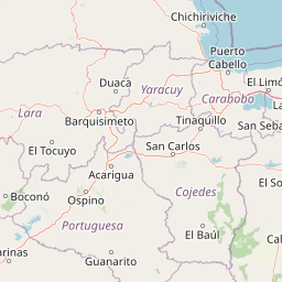
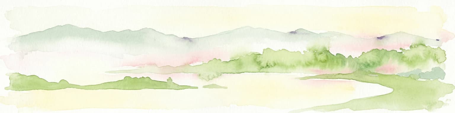
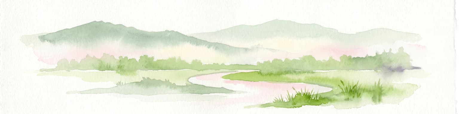
The landscape of San Esteban National Park is characterized by its position in the coastal mountain ranges of north-central Venezuela, where the Venezuelan Andes approach the Caribbean coast. The terrain rises from relatively low coastal elevations toward higher slopes inland, creating a topographically diverse environment within the park's boundaries. The park lies along the Caribbean-facing slopes where moisture-bearing winds from the ocean create humid conditions supporting lush tropical vegetation. The area includes the San Esteban river, which has carved a valley through the mountainous terrain, with the bridge of Paso Hondo representing a historical crossing point. The coastal proximity influences the landscape character, with the park including areas with Caribbean character despite its mountainous interior. The park's landscape encompasses both the natural forested slopes and areas modified by historical human use, including colonial-era roads, agricultural areas, and settlements, creating a cultural landscape where natural and historical elements intermingle.

San Esteban National Park ecosystems, habitats, and plant life

The natural environment of San Esteban National Park reflects its position in the Caribbean coastal forest ecoregion of northern Venezuela. The park lies within a zone of tropical and subtropical moist forest that receives significant precipitation from Caribbean weather systems, creating conditions favorable for dense vegetation cover. As part of the connected protected corridor that includes Henri Pittier National Park, San Esteban contributes to protection of a continuous belt of coastal forest that provides habitat for numerous species. The forest ecosystems of the park include both lowland tropical forest in the lower elevations and higher elevation forest types where cloud forest conditions prevail in the moister zones. This altitudinal variation in forest types supports diverse ecological communities and provides structural complexity that hosts varied wildlife populations.

San Esteban National Park wildlife and species highlights

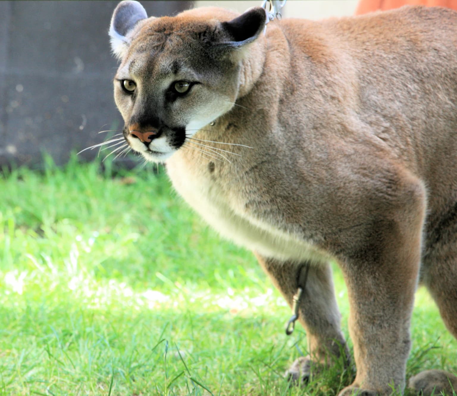
The wildlife of San Esteban National Park is typical of the Caribbean coastal forest region of Venezuela, supporting populations of both common Neotropical species and more specialized forest-dwelling animals. The park lists several notable species including the brown-throated parakeet (Aratinga pertinax), a colorful psittacine bird common in forest edges and semi-open areas throughout northern Venezuela. Reptile presence includes the boa constrictor, one of the largest snake species in the Americas, which inhabits forest floors and occasionally climbs in search of prey. The park also provides habitat for larger mammals including the ocelot, a medium-sized wild cat that hunts in forest understory, and the puma (cougar), a wide-ranging apex predator that requires large territories and intact forest habitat. These larger carnivores indicate that the park maintains relatively healthy ecological conditions capable of supporting viable populations of species requiring extensive home ranges and diverse prey bases.

San Esteban National Park conservation status and protection priorities

San Esteban National Park contributes to Venezuela's protected area network as an IUCN Category II national park, providing formal protection for both natural ecosystems and cultural heritage sites. The park's integration into the broader protected corridor with Henri Pittier National Park enhances conservation effectiveness by creating a larger continuous protected area that allows for wildlife movement and ecosystem processes across a wider landscape. The protection of archaeological sites including the petroglyphs at Vigirima represents conservation of cultural heritage alongside natural values, an approach that has become increasingly recognized as valuable for maintaining connections between human communities and their landscape history. The presence of larger mammal species like puma and ocelot indicates that the park maintains ecological integrity sufficient to support apex predators, generally considered an indicator of ecosystem health.

San Esteban National Park cultural meaning and human context

San Esteban National Park contains significant cultural heritage spanning indigenous pre-Colonial periods through the Spanish colonial era to the independence period of the 19th century. The indigenous heritage is most visibly represented by the petroglyphs at Vigirima, also called Tronconero's Painted Stone, where pre-Colonial peoples created rock art that survives as tangible evidence of the region's original inhabitants. The colonial period left extensive marks on the landscape, including the Road of the Spaniards connecting Valencia to Puerto Cabello, an important route for colonial administration and commerce, with associated infrastructure like arched bridges demonstrating engineering capability of the period. The Indian Salt Way between Patanemo and Guacara reflects older trade routes possibly predating European contact, possibly related to salt trading that was economically important in pre-Colonial times. The town of San Esteban within the park holds historical association with Bartolomé Salom, a general in Simon Bolivar's independence army, whose house is preserved within the park boundaries, connecting the protected area to Venezuela's national identity and independence history. The park also includes Las Trincheras, known for thermal baths and spa facilities that reflect later use of the landscape for recreation and wellness.

Top sights and standout views in San Esteban National Park

San Esteban National Park offers visitors a distinctive combination of natural beauty and historical exploration within a readily accessible location near major Venezuelan cities. The petroglyphs of Vigirima represent one of the park's most unusual attractions, providing direct connection to pre-Colonial indigenous culture through visible rock art in a protected natural setting. Solano Castle at Puerto Cabello provides a colonial-era fortification that reflects the strategic importance of the Caribbean coast during the Spanish colonial period. The preserved sections of the colonial road between Valencia and Puerto Cabello allow visitors to traverse historic infrastructure that connected two important Venezuelan cities during the colonial era. The Ecomuseum Villa Vincencio and the house of General Bartolomé Salom offer additional historical context related to Venezuela's independence period and regional development. The natural forest environments provide hiking and wildlife observation opportunities within a protected area that forms part of a larger forest corridor along Venezuela's Caribbean coast.

Best time to visit San Esteban National Park

The best time to visit San Esteban National Park is generally during the dry season from December through April, when visitor access is easier and trail conditions are more favorable for exploration. The park's location near the Caribbean means that precipitation patterns are influenced by the wet and dry seasons typical of tropical coastal regions, with the dry months offering more predictable weather for outdoor activities. However, the park can be visited year-round, with the wet season from May through November bringing lush green vegetation but potentially more challenging trail conditions. The proximity to the Caribbean coast also means that the park can be affected by tropical weather systems during the wet season, though significant disruptions are relatively uncommon. Visitors interested in wildlife observation may find the dry season more productive as animals concentrate around remaining water sources, while the wet season offers the advantage of fuller vegetation and more active bird activity.

Park location guide

Geography guide, regional context, and park location map for San Esteban National Park

San Esteban National Park park geography, regions, and map view in Venezuela
Understand where San Esteban National Park sits in Venezuela through a broader geographic reading of the surrounding landscape, nearby location context, and its mapped position within the national park landscape.

How San Esteban National Park fits into Venezuela

Venezuela is a country in northern South America with coastline along the Caribbean Sea and Atlantic Ocean. It borders Colombia, Brazil, Guyana, and Trinidad and Tobago. The country has an area of approximately 916,445 km² and a population of about 31.8 million. Caracas is the capital and largest city. Venezuela consists of 23 states and the Capital District.

Wider geography shaping San Esteban National Park in Venezuela

Venezuela is located on the northern coast of South America. The continental territory is bordered by the Caribbean Sea and Atlantic Ocean to the north, Colombia to the west, Brazil to the south, and Guyana to the east. Trinidad and Tobago lies to the northeast. The country includes various islands and islets in the Caribbean Sea known as the Federal Dependencies.

Map view of San Esteban National Park

Use this park location map to pinpoint San Esteban National Park in Venezuela, understand its exact geographic position, and read its mapped placement within the surrounding landscape more clearly.

Pigeon | © OpenStreetMap contributors

Location context for San Esteban National Park

Carabobo
Park atlas

Discover the regional context and connected protected landscapes in Venezuela's Caribbean mountain range, extending beyond San Esteban National Park.

Discover Nearby National Parks and Protected Areas Around San Esteban National Park, Venezuela
Discover additional national parks and protected areas in Venezuela's coastal mountain ranges, closely situated to San Esteban National Park and sharing its unique Caribbean landscapes. Compare these nearby protected entities to understand the broader regional geography, linked forest ecosystems, and colonial heritage that define conservation across north-central Venezuela.
National parkVenezuela

Henri Pittier National Park: Venezuela's Oldest National Park, Coastal Range Geography

Explore protected landscapes, cloud forests, and birdwatching geography.

Henri Pittier National Park is Venezuela's foundational protected area, established in 1937 and spanning over 107,800 hectares within the Venezuelan Coastal Range. This national park is renowned for its exceptional biodiversity, particularly its over 500 bird species and its distinctive cloud forest ecosystems, which include the iconic Gyranthera caribensis tree. The park's geography extends from rugged mountain terrain to coastal bays and beaches, with the Paso de Portachuelo serving as a significant migratory bird corridor. Its mapped boundaries enclose a rich mosaic of natural landscapes vital for understanding regional conservation and protected area geography in northern South America.

Area
1,078 km²
Established
1937
IUCN
II
Relief
Mountain
National parkVenezuela

Morrocoy National Park: Venezuela's Coastal National Park with Distinct Protected Geography

Explore the mapped protected landscape and regional context.

Morrocoy National Park stands as a key protected area within Venezuela, offering a distinct focus for geographic exploration. As a national park, its mapped boundaries delineate a significant natural landscape critical for understanding regional conservation and the country's broader atlas of protected lands. Discover the unique geographic characteristics and the atlas-driven context of this important Venezuelan protected area.

Area
320.9 km²
Established
1974
IUCN
II
National parkVenezuela

El Ávila National Park: Venezuela's Premier Coastal Mountain National Park Exploration

Discover diverse terrain, mapped boundaries, and unique geographic context.

El Ávila National Park offers an exceptional gateway into Venezuela's mountainous protected landscapes. This national park features a dramatic rise from the Caribbean coast into varied terrain, including unique cloud forest and alpine zones. Its mapped geography showcases steep slopes, deep ravines, and remarkable elevation changes, providing a significant atlas-style study of coastal mountain environments. Exploring El Ávila National Park reveals a vital natural barrier and a rich ecosystem supporting diverse flora and fauna, making it a key destination for understanding regional protected areas.

Area
819 km²
Established
1958
IUCN
II
National parkVenezuela

El Guache National Park: Venezuela's Protected Andean Foothill National Park

Map exploration of vital river basins and natural landscapes.

El Guache National Park is a protected national park in Venezuela, safeguarding the headwaters of five key rivers. Its landscape comprises mountainous terrain within the Andean foothills, crucial for watershed protection and regional biodiversity. This entry provides detailed geographic context, allowing for an atlas-style exploration of the park's mapped boundaries and its role as a vital protected area.

Area
122 km²
Established
1992
IUCN
II
National parkLara State

Yacambú National Park National Park: Protected Cloud Forest Landscape in Lara State

Mapped terrain and significant orchid diversity in Venezuela's Andean foothills.

Yacambú National Park is a significant national park in Venezuela's Lara State, protecting crucial humid cloud forest ecosystems in the Andean foothills. The park's terrain is defined by the mountainous topography of the Portuguesa Mountain Range, supporting a rich diversity of flora, including numerous orchid species. Its role in watershed protection for nearby regions underscores its importance as a conserved natural landscape with vital ecological functions.

Area
146 km²
Established
1962
IUCN
II
National parkFalcón State

Médanos de Coro National Park: Venezuela's Unique Arid Landscape and Protected Dune System

Explore the mapped geography of this coastal desert in Falcón State.

Médanos de Coro National Park represents a remarkable protected area within Venezuela's Falcón State, renowned for its spectacular and active sand dune systems. This national park encompasses approximately 91 square kilometers of unique terrain, including large sand formations, salt marshes, and mangrove swamps, contributing to its designation as a key conservation site for arid coastal ecosystems. Users can explore the park's distinctive landscape, understand its geographic context, and discover the patterns of wind-sculpted dunes that define this Venezuelan national park.

Area
91 km²
Established
1974
IUCN
II
National parkCuracao

Christoffelpark National Park: Curacao's Volcanic Terrain and Protected Landscape Atlas

Explore mapped boundaries and unique dry forest ecosystems.

Christoffelpark represents Curacao's most vital protected natural area, offering a deep dive into its unique geography and landscape. This national park preserves the island's highest peak, Christoffelberg, alongside distinctive dry forest ecosystems, endemic species, and the remnants of colonial plantations. Explore the mapped terrain, understand the regional context, and appreciate the rich natural and cultural heritage that defines this important protected landscape on Curacao.

Area
10.4 km²
Established
1978
IUCN
II
Relief
Mixed relief
National parkVenezuela

Dinira National Park: Protected Watershed and Andean Mountain Landscape

Explore its rugged terrain and páramo ecosystem.

Dinira National Park is a significant protected area in Venezuela, covering rugged Andean terrain vital for watershed protection. This national park features dramatic mountain landscapes, including the Humocaro Mountains and the Los Nepes páramo zone, supporting diverse cloud forest and high-altitude ecosystems. Understanding Dinira National Park offers insight into the geographic context of the Cordillera de Mérida and its hydrological importance.

Area
453.28 km²
Established
1988
IUCN
II

Common questions about visiting, size, designation, and location context for San Esteban National Park

San Esteban National Park FAQs for park facts, access, geography, and protected area context
Find quick answers about San Esteban National Park, including protected-area facts, park geography, trail and visitor context, and how the park fits into its surrounding country and regional landscape.
MoriAtlas Explorer

Continue Your Protected Areas Search Across the Global Atlas

Deepen your exploration by continuing the structured search for national parks and protected areas worldwide. Utilize the comprehensive filtering capabilities to compare different conservation landscapes and refine your understanding of global park geography. Discover more about the distribution and characteristics of protected natural areas.

Global natural geography