Mori Atlas logo
National parkEl Ávila National Park

Explore the mapped boundaries and diverse terrain rising steeply from the Caribbean coast.

El Ávila National Park: Venezuela's Dramatic Coastal Mountain Protected Landscape

(Waraira Repano National Park)

El Ávila National Park, situated along Venezuela's Caribbean coast, stands as a significant protected landscape protecting the steep Cordillera de la Costa Central mountain range. Rising dramatically from near sea level to peaks like Pico Naiguatá at 2,765 meters, this national park offers a unique geographic study. Its remarkable elevation changes over short distances create varied terrain, from coastal scrub to cloud forests and alpine zones, defining a rich, mapped environment. Understanding El Ávila National Park's position within Venezuela's atlas reveals a vital ecological corridor and a stunning natural backdrop.

Tropical Mountain ForestCloud ForestPáramoBirdwatchingCoastal MountainsUrban Proximity

El Ávila National Park

National park

Park overview

Structured park overview, official facts, and landscape profile for El Ávila National Park

El Ávila National Park park facts, protected area profile, and essential visitor context
Review the core facts for El Ávila National Park, including designation, size, terrain, visitor scale, habitats, and operating context in one park-focused overview.

About El Ávila National Park

El Ávila National Park represents one of the world's most accessible wilderness areas, rising directly behind a metropolitan region of over four million people. The protected area follows an 80-kilometer mountain range approximately 16 kilometers wide, creating a green spine that separates the Caribbean coastline from the Caracas valley. This dramatic topography generates remarkable ecological diversity within a relatively small footprint, with elevation gradients supporting no fewer than six distinct vegetation zones. The park's establishment in 1958 fulfilled nearly a century of conservation aspiration, as concerns about protecting these forests date to the 19th century. Today, the park serves multiple critical functions: watershed protection for the capital, air purification for urban residents, biodiversity conservation, and urban recreation. The indigenous Cariban name Waraira Repano reflects the mountain's cultural significance to pre-Columbian peoples, though the current official designation maintains this heritage. Visitors can explore numerous trails ranging from accessible family routes to technical climbing paths, or ride the cable car to experience the unique highland environment.

Quick facts and research context for El Ávila National Park

El Ávila National Park spans approximately 81,900 hectares along the central Venezuelan coast, protecting the Cordillera de la Costa mountain range that separates Caracas from the Caribbean Sea. The park's highest point, Pico Naiguatá, reaches 2,765 meters above sea level. It was established on December 12, 1958, governed by INPARQUES, Venezuela's national parks institute. The protected area encompasses portions of Vargas, Capital District, and Miranda states. The mountain is accessible via the iconic cable car system that ascends to Hotel Humboldt, one of the park's historic attractions.

Park context

Deeper park guide and search-rich context for El Ávila National Park

El Ávila National Park history, landscape, wildlife, and travel context
Explore El Ávila National Park through its history, landscape character, ecosystems, wildlife, conservation priorities, cultural context, and seasonal travel timing in a structured park guide built for atlas discovery and search intent.

Why El Ávila National Park stands out

El Ávila is best known for its extraordinary ecological diversity condensed into a compact mountain landscape that rises directly behind Caracas. The park harbors approximately 500 bird species, representing 36 percent of Venezuela's avifauna, along with over 120 mammal species and more than 1,800 plant species. Its vegetation zones transition dramatically from xeric scrub at lower elevations through cloud forests to sub-páramo alpine vegetation near the summit. The mountain serves as a natural divider between the coastal climate and the valley climate of Caracas, creating distinct ecological niches. The park's famous cable car, the longest in the world, provides access to the unique Hotel Humboldt, while the mountain's landmark Cruz de Navidad cross illuminates nightly on the slopes visible across the city.

El Ávila National Park history and protected-area timeline

El Ávila National Park was formally established on December 12, 1958, though interest in protecting this mountain range dates to the 19th century when early conservationists recognized the ecological and watershed value of the forested slopes surrounding Caracas. The creation of the park provided legal protection for the mountains that form the northern boundary of the capital, ensuring these forests would remain as a buffer against urban expansion and pollution. Prior to designation, the mountain had already seen significant development, including the construction of Hotel Humboldt and the cable car system, both completed in 1956. The cable car, once the longest in the world, offered visitors access to the highland environment at elevations exceeding 2,100 meters. After being decommissioned for two decades, the cable car reopened in February 2002, restoring this iconic access route. The park's history reflects ongoing tensions between development pressure from the adjacent metropolitan area and the need to preserve ecological integrity.

El Ávila National Park landscape and geographic character

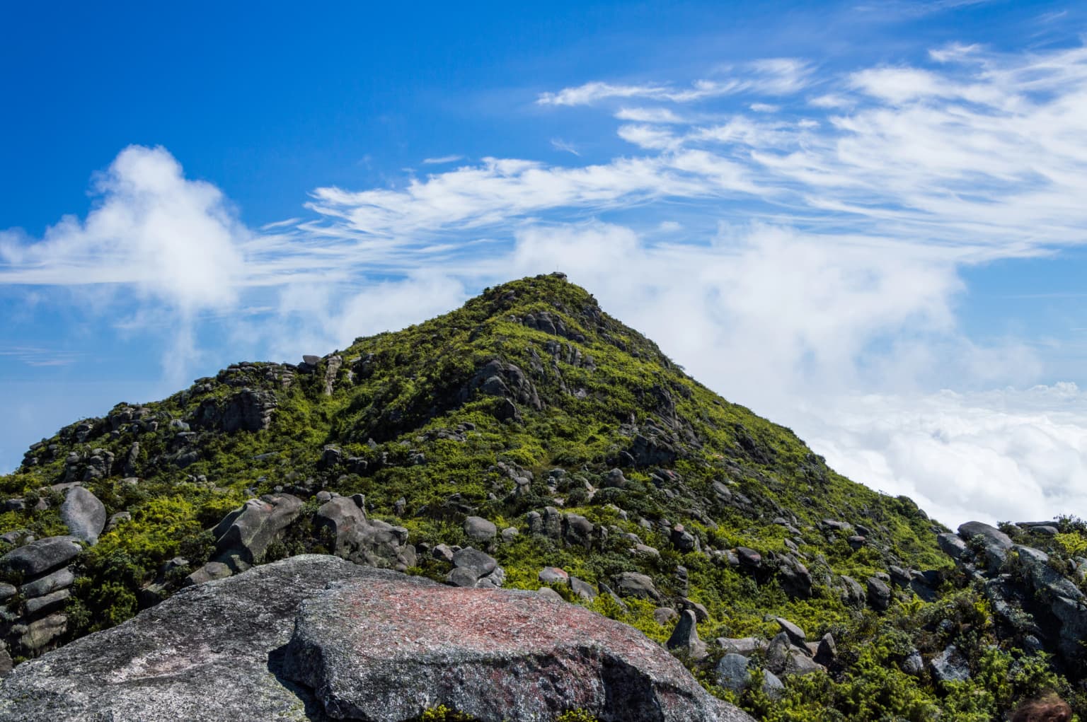
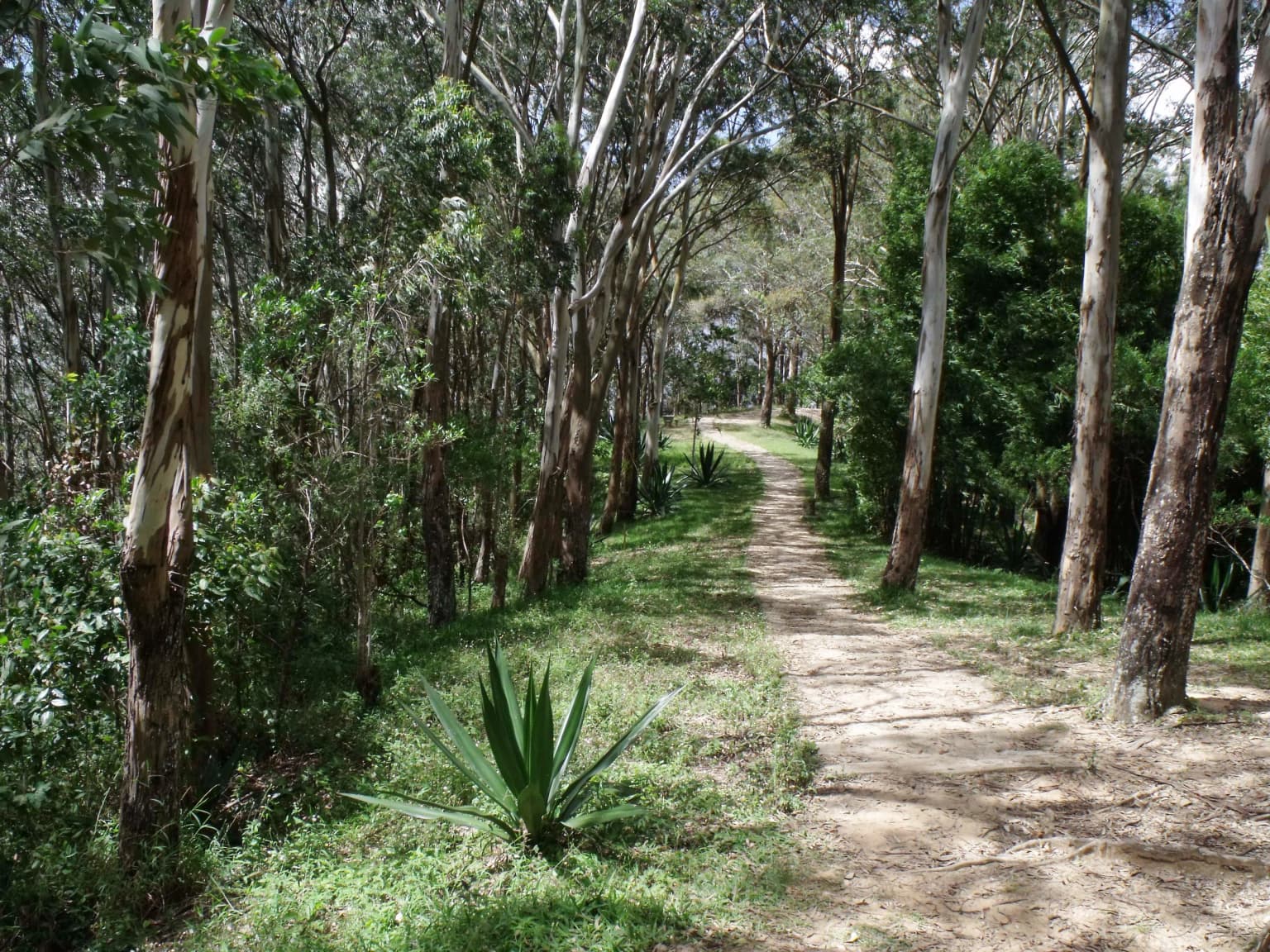
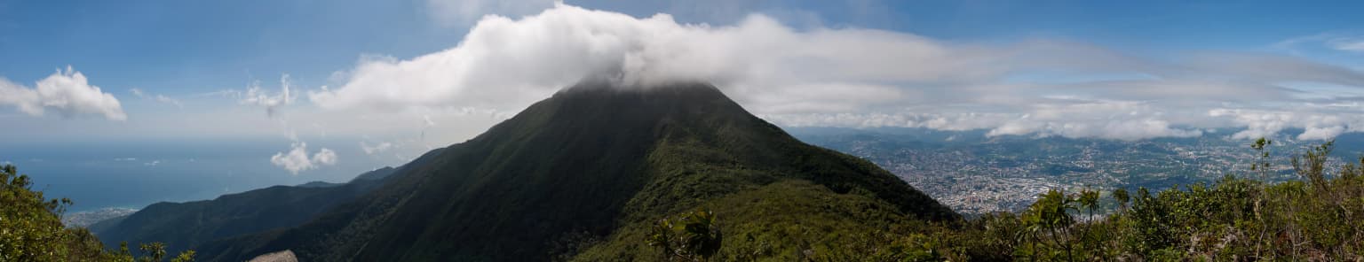
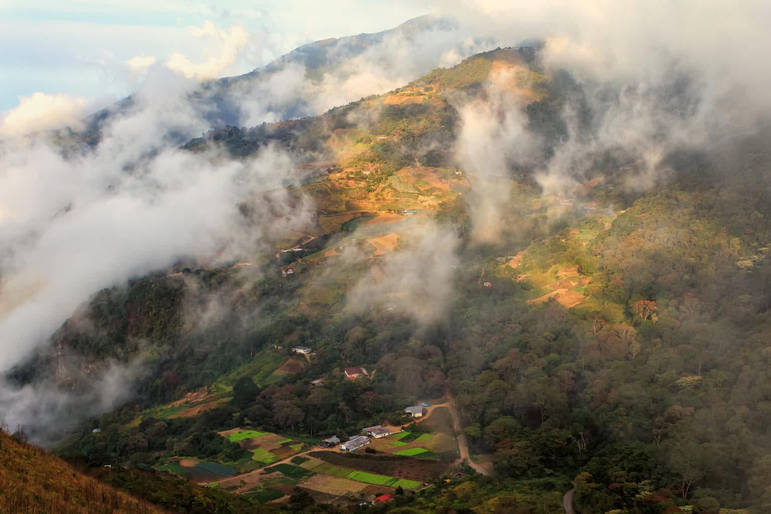
El Ávila National Park occupies a spectacular position along the central Venezuelan coast, where the Cordillera de la Costa rises dramatically from the Caribbean shoreline to form a imposing barrier between the sea and the Caracas valley. The mountain range stretches approximately 80 kilometers in length and reaches widths of about 16 kilometers within the park boundaries. Cerro El Ávila, the peak that gives the park its common name, rises to 2,740 meters above sea level, while the highest point in the protected area, Pico Naiguatá, reaches 2,765 meters. The northern slopes face the trade winds coming off the Caribbean, creating wetter conditions, while the southern slopes within the Caracas valley experience a different microclimate. Numerous watercourses flow down both sides of the mountain, carving deep ravines and supporting riparian forests. The terrain varies from steep cliffs and rock faces to more gentle slopes covered in forest, with elevation changes occurring over remarkably short horizontal distances given the mountain's abrupt rise from the coastal plain.

El Ávila National Park ecosystems, habitats, and plant life

The ecological richness of El Ávila National Park stems from its position at the intersection of multiple biogeographic zones and its dramatic elevation gradient. The vegetation follows a clear zonation pattern based on altitude: xeric forest dominates from sea level to approximately 200-300 meters; semi-deciduous forests occupy the 300-800 meter band; sub-mountain evergreen forests prevail from 800-1,500 meters on northern slopes and 1,200-1,600 meters on southern slopes; cloud forest dominates from 1,500-2,200 meters where constant moisture from trapped clouds supports lush epiphyte growth; and sub-páramo vegetation appears above 2,200 meters. The park supports over 1,800 plant species, including numerous endemics to the Cordillera de la Costa and some species found nowhere else on Earth. Particularly notable is the critically endangered Venezuelan walnut tree, the only remaining natural population of this species. Orchids, ferns, bromeliads, and aroids thrive in the cloud forest zone, while the upper reaches feature characteristic páramo-type shrubs and herbaceous plants adapted to high-altitude conditions.

El Ávila National Park wildlife and species highlights

El Ávila National Park supports remarkable biodiversity, with approximately 120 mammal species, 500 bird species, 30 reptiles, 20 amphibians, and over 100 butterfly species documented within its boundaries. The bird diversity is particularly significant, representing 36 percent of Venezuela's total avifauna, including nine species endemic to Venezuela and three that are considered threatened. The colorful querrequerre stands out as one of the park's most striking avian residents. Mammal species include various primates, anteaters, and porcupines, though sighting opportunities depend on time of day and season. The diverse insect life, particularly butterflies, contributes to the park's ecological dynamics as important pollinators and as part of the food web supporting larger animals. The combination of forest types and elevation gradients creates diverse habitats that support this remarkable concentration of species within an area that remains accessible to a major metropolitan population.

El Ávila National Park conservation status and protection priorities

El Ávila National Park faces significant conservation challenges despite its protected status. The park is classified as vulnerable due to multiple threats that could erode its biodiversity without sustained monitoring and management. The most immediate threats include forest fires, particularly during dry seasons, and illegal settlements that encroach on park boundaries. The concentration of conservation resources near the city has resulted in reduced vigilance on the more remote northern slopes and eastern sectors. Additional pressures include invasive exotic plant species, the presence of the aerial tramway infrastructure, and poaching activities. The park's proximity to Caracas creates constant development pressure while also providing the essential ecosystem services of air purification, watershed protection, and temperature moderation for the capital. Conservation efforts must balance the park's role as a recreation area for urban residents with the need to protect its ecological integrity.

El Ávila National Park cultural meaning and human context

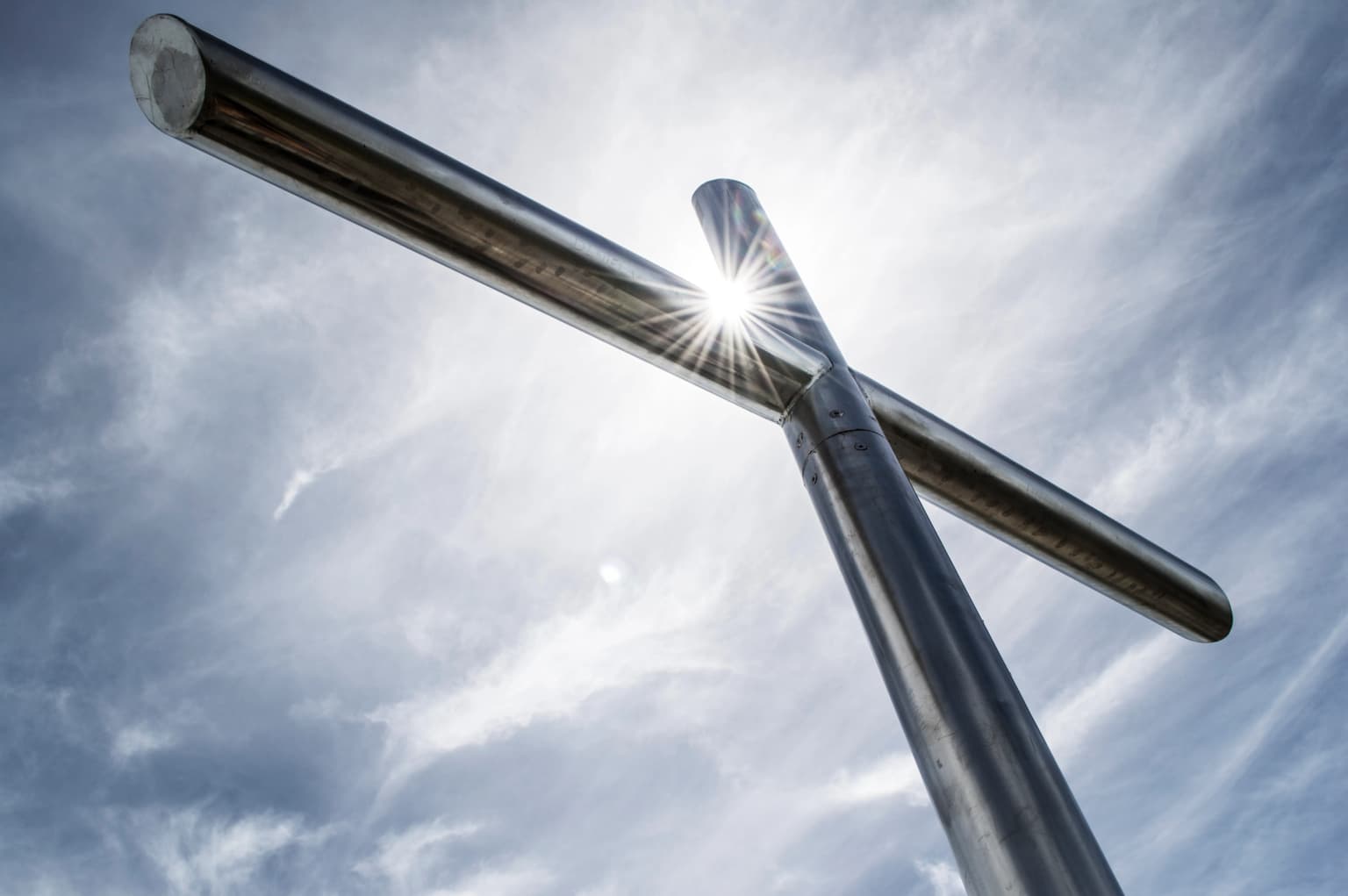
El Ávila holds deep cultural significance for the people of Caracas, transcending its role as a protected area. The mountain is known as el pulmonar de la ciudad, the lungs of the city, a reference to its function in providing clean air and defining the northern boundary of the metropolitan area. The indigenous Cariban name Waraira Repano reflects the mountain's pre-Columbian heritage. Local traditions include the annual illumination of the Cruz de Navidad, a large crucifix visible across the city that appears each December. The legend of Pacheco the flower-picker, a resident of El Galipán village, has become woven into local culture, with the arrival of Pacheco in Caracas each December traditionally signaling the onset of colder weather. The mountain supports a network of restaurants and recreation facilities, including the historic Hotel Humboldt, and serves as a venue for diverse activities from rock climbing to running to cable car rides offering panoramic views of the city below.

Top sights and standout views in El Ávila National Park

El Ávila National Park offers an exceptional combination of accessibility, ecological diversity, and cultural significance within a metropolitan setting. The cable car ride to Hotel Humboldt provides one of the world's most dramatic approaches to a national park, ascending from the Caracas valley to cloud forest environments. The summit area features unique páramo-style vegetation found nowhere else in northern Venezuela. Pico Naiguatá challenges hikers seeking the highest accessible peaks, while numerous trails serve visitors ranging from casual walkers to technical climbers. The park's position between Caribbean coast and capital city creates scenic viewpoints where both sea and metropolitan landscape are visible. The biodiversity, with over 500 bird species and numerous endemics, makes the park a significant destination for naturalists.

Best time to visit El Ávila National Park

The best time to visit El Ávila National Park depends on the experience sought. The dry season from December through April offers clearer skies and more predictable trail conditions, though this period can be popular with visitors. The wet season from May to November brings lusher vegetation and more dramatic cloud formations in the upper forest zones, though trail conditions may be more challenging. The mountain's high elevation means temperatures at the summit hover around 10°C, significantly cooler than the city below. Visitors seeking to spot wildlife may have better success during early morning hours when animals are most active. The cable car operates year-round, though schedule changes may occur, so checking current operations before visiting is advisable.

Park location guide

Geography guide, regional context, and park location map for El Ávila National Park

El Ávila National Park park geography, regions, and map view in Venezuela
Understand where El Ávila National Park sits in Venezuela through a broader geographic reading of the surrounding landscape, nearby location context, and its mapped position within the national park landscape.

How El Ávila National Park fits into Venezuela

Venezuela is a country in northern South America with coastline along the Caribbean Sea and Atlantic Ocean. It borders Colombia, Brazil, Guyana, and Trinidad and Tobago. The country has an area of approximately 916,445 km² and a population of about 31.8 million. Caracas is the capital and largest city. Venezuela consists of 23 states and the Capital District.

Wider geography shaping El Ávila National Park in Venezuela

Venezuela is located on the northern coast of South America. The continental territory is bordered by the Caribbean Sea and Atlantic Ocean to the north, Colombia to the west, Brazil to the south, and Guyana to the east. Trinidad and Tobago lies to the northeast. The country includes various islands and islets in the Caribbean Sea known as the Federal Dependencies.

Map view of El Ávila National Park

Use this park location map to pinpoint El Ávila National Park in Venezuela, understand its exact geographic position, and read its mapped placement within the surrounding landscape more clearly.

Pigeon | © OpenStreetMap contributors

Location context for El Ávila National Park

Capital DistrictMirandaVargas
Park atlas

Trace the regional spread of protected areas and conservation landscapes across Venezuela's central mountain range.

Continue Park Exploration: Discover Protected Areas and National Parks Near El Ávila National Park
Browse other national parks and protected areas located within the diverse coastal mountain geography surrounding El Ávila National Park. Comparing these conservation landscapes allows for a richer atlas-based understanding of regional ecological patterns and adjacent protected territories.
National parkVenezuela

Henri Pittier National Park: Venezuela's Oldest National Park, Coastal Range Geography

Explore protected landscapes, cloud forests, and birdwatching geography.

Henri Pittier National Park is Venezuela's foundational protected area, established in 1937 and spanning over 107,800 hectares within the Venezuelan Coastal Range. This national park is renowned for its exceptional biodiversity, particularly its over 500 bird species and its distinctive cloud forest ecosystems, which include the iconic Gyranthera caribensis tree. The park's geography extends from rugged mountain terrain to coastal bays and beaches, with the Paso de Portachuelo serving as a significant migratory bird corridor. Its mapped boundaries enclose a rich mosaic of natural landscapes vital for understanding regional conservation and protected area geography in northern South America.

Area
1,078 km²
Established
1937
IUCN
II
Relief
Mountain
National parkCarabobo

San Esteban National Park: Discover Carabobo's Protected Caribbean Forest Landscape

Mapped protected area and natural terrain in Venezuela.

San Esteban National Park represents a significant protected area within Venezuela's Carabobo region, offering a unique exploration of Caribbean forest ecosystems and historical cultural sites. Covering approximately 445 square kilometers, the park's terrain spans coastal areas to mountainous interiors, presenting a diverse natural landscape shaped by its position in the coastal mountain ranges. This national park is notable for its archaeological petroglyphs, colonial roads, and fortifications, providing a rich cultural heritage context alongside its natural ecosystems. Its status as a protected national park makes it a key destination for understanding the intersection of natural conservation and historical geography in Venezuela.

Area
445 km²
Established
1987
IUCN
II
National parkVenezuela

Morrocoy National Park: Venezuela's Coastal National Park with Distinct Protected Geography

Explore the mapped protected landscape and regional context.

Morrocoy National Park stands as a key protected area within Venezuela, offering a distinct focus for geographic exploration. As a national park, its mapped boundaries delineate a significant natural landscape critical for understanding regional conservation and the country's broader atlas of protected lands. Discover the unique geographic characteristics and the atlas-driven context of this important Venezuelan protected area.

Area
320.9 km²
Established
1974
IUCN
II
National parkVenezuela

El Guache National Park: Venezuela's Protected Andean Foothill National Park

Map exploration of vital river basins and natural landscapes.

El Guache National Park is a protected national park in Venezuela, safeguarding the headwaters of five key rivers. Its landscape comprises mountainous terrain within the Andean foothills, crucial for watershed protection and regional biodiversity. This entry provides detailed geographic context, allowing for an atlas-style exploration of the park's mapped boundaries and its role as a vital protected area.

Area
122 km²
Established
1992
IUCN
II
National parkCuracao

Christoffelpark National Park: Curacao's Volcanic Terrain and Protected Landscape Atlas

Explore mapped boundaries and unique dry forest ecosystems.

Christoffelpark represents Curacao's most vital protected natural area, offering a deep dive into its unique geography and landscape. This national park preserves the island's highest peak, Christoffelberg, alongside distinctive dry forest ecosystems, endemic species, and the remnants of colonial plantations. Explore the mapped terrain, understand the regional context, and appreciate the rich natural and cultural heritage that defines this important protected landscape on Curacao.

Area
10.4 km²
Established
1978
IUCN
II
Relief
Mixed relief
National parkLara State

Yacambú National Park National Park: Protected Cloud Forest Landscape in Lara State

Mapped terrain and significant orchid diversity in Venezuela's Andean foothills.

Yacambú National Park is a significant national park in Venezuela's Lara State, protecting crucial humid cloud forest ecosystems in the Andean foothills. The park's terrain is defined by the mountainous topography of the Portuguesa Mountain Range, supporting a rich diversity of flora, including numerous orchid species. Its role in watershed protection for nearby regions underscores its importance as a conserved natural landscape with vital ecological functions.

Area
146 km²
Established
1962
IUCN
II
National parkFalcón State

Médanos de Coro National Park: Venezuela's Unique Arid Landscape and Protected Dune System

Explore the mapped geography of this coastal desert in Falcón State.

Médanos de Coro National Park represents a remarkable protected area within Venezuela's Falcón State, renowned for its spectacular and active sand dune systems. This national park encompasses approximately 91 square kilometers of unique terrain, including large sand formations, salt marshes, and mangrove swamps, contributing to its designation as a key conservation site for arid coastal ecosystems. Users can explore the park's distinctive landscape, understand its geographic context, and discover the patterns of wind-sculpted dunes that define this Venezuelan national park.

Area
91 km²
Established
1974
IUCN
II
National parkVenezuela

Dinira National Park: Protected Watershed and Andean Mountain Landscape

Explore its rugged terrain and páramo ecosystem.

Dinira National Park is a significant protected area in Venezuela, covering rugged Andean terrain vital for watershed protection. This national park features dramatic mountain landscapes, including the Humocaro Mountains and the Los Nepes páramo zone, supporting diverse cloud forest and high-altitude ecosystems. Understanding Dinira National Park offers insight into the geographic context of the Cordillera de Mérida and its hydrological importance.

Area
453.28 km²
Established
1988
IUCN
II

Common questions about visiting, size, designation, and location context for El Ávila National Park

El Ávila National Park FAQs for park facts, access, geography, and protected area context
Find quick answers about El Ávila National Park, including protected-area facts, park geography, trail and visitor context, and how the park fits into its surrounding country and regional landscape.
MoriAtlas Explorer

Continue Your Protected Areas Search Across the Global Atlas

Deepen your exploration by continuing the structured search for national parks and protected areas worldwide. Utilize the comprehensive filtering capabilities to compare different conservation landscapes and refine your understanding of global park geography. Discover more about the distribution and characteristics of protected natural areas.

Global natural geography