Why El Guache National Park stands out
El Guache National Park is best known for its role as a strategic water source region, protecting the headwaters of five rivers that flow through the Venezuelan plains below. The park's position at the Andean foothills creates a transition zone between mountain and lowland ecosystems, supporting diverse habitats. The San Miguel waterfall stands as the most recognizable scenic feature, while the protected river basins represent the park's core conservation purpose as a water Catchment and watershed preservation area.
El Guache National Park history and protected-area timeline
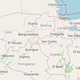
El Guache National Park was established through official decree on June 5, 1992, as part of Venezuela's expanding network of protected areas during the late twentieth century. The decree specifically targeted protection of the high basins feeding the Guache, Ospino, Bocoy, Toco, and Are rivers, recognizing that the forested mountain catchments served as essential water sources for agricultural and civilian use in the surrounding lowland regions. The creation of the park coincided with a broader era of environmental policy development in Venezuela, during which multiple national parks and protected areas were formally designated to preserve ecological diversity and natural resources. The park encompasses territory within both Lara and Portuguesa states, requiring inter-administrative coordination for management. The decision to designate this particular landscape as a national park reflected concerns about deforestation pressures in Andean foothill regions and the need to maintain watershed integrity.
El Guache National Park landscape and geographic character
The landscape of El Guache National Park is characterized by mountainous terrain forming the initial uplifts of the Andes as they extend into Venezuela from Colombia. The terrain features rolling slopes, steep-sided valleys, and ridgelines that channel water into the river systems originating within the park boundaries. The dramatic elevation changes create scenic diversity, with the higher elevations capturing cloud formation and enhanced precipitation that sustains the watershed function. The San Miguel waterfall represents the most visually striking landscape feature, where water from the high terrain cascades dramatically into a lower valley. The surrounding vegetation varies with elevation, transitioning from denser forest cover in the upper catchments to more open terrain in the lower valleys. The rivers originating here including the Guache and Ospino carve valleys that provide both hydrological corridors and scenic corridors through the mountainous terrain.
El Guache National Park ecosystems, habitats, and plant life
The nature of El Guache National Park reflects its position at the ecological transition between the Andes and the Venezuelan plains. The high annual precipitation, ranging from 1,800 to 2,000 millimeters, supports lush vegetation including tropical cloud forest elements in the higher elevations. The protected river basins maintain riparian corridors that connect the mountain and lowland ecosystems, allowing species migration and genetic exchange between different habitat zones. The consistent mild temperatures between 19 and 26 degrees Celsius create favorable conditions for diverse plant communities. The watershed protection function means that the park's natural vegetation plays a critical role in regulating water flow, preventing erosion, and maintaining water quality for downstream users. This ecological service dimension elevates the park's importance beyond simple biodiversity conservation to include functional ecosystem services for the surrounding region.
El Guache National Park wildlife and species highlights
While detailed species inventories are not prominently featured in available sources, the wildlife of El Guache National Park is adapted to the Andean foothill environment and the transitional ecosystems between mountain and tropical lowland habitats. The riparian corridors along the Guache, Ospino, and other rivers provide habitat for aquatic species and attract birdlife moving through the landscape. The forest cover in the higher elevations offers shelter for species adapted to cooler, more humid conditions, while the transitional zones support wildlife adapted to both tropical and temperate environmental regimes. The protected watershed areas maintain natural habitats essential for species persistence in a region where agricultural expansion has reduced natural cover.
El Guache National Park conservation status and protection priorities
El Guache National Park was established specifically to protect the high basins of five major rivers, making watershed conservation the central rationale for its protected area status. The park addresses critical water security needs for agricultural communities in the Lara and Portuguesa regions by preserving the forests and terrain that capture and regulate precipitation. This watershed protection function has made the park an important element in regional environmental planning, as deforestation or degradation in the upper catchments would directly impact water availability downstream. The national park designation provides legal protection against activities that might compromise the integrity of these river source areas, including logging, mining, or agricultural conversion of pristine forest areas.
El Guache National Park cultural meaning and human context
The territory of El Guache National Park lies within the traditional lands of western Venezuela, where rural communities have maintained agricultural traditions in the Andean foothills and adjacent plains. The rivers originating within the park, particularly the Guache River, have historically served as water sources for local farming communities and settlements in the surrounding areas. The establishment of the national park created a framework for balancing local land use traditions with the broader need to protect watershed resources. The park's location spanning two Venezuelan states Lara and Portuguesa also reflects the regional administrative structure that has shaped land management in this frontier region between the mountains and the llanos plains.
Top sights and standout views in El Guache National Park
The San Miguel waterfall stands as the primary scenic highlight within El Guache National Park, offering a dramatic cascade set against the Andean foothill landscape. The park's function as the source region for five major rivers Guache, Ospino, Bocoy, Toco, and Are represents its most significant environmental highlight, emphasizing the watershed protection purpose that justified national park designation. The transition zone between Andean mountain ecosystems and tropical lowland environments creates ecological diversity that distinguishes this park from either purely mountain or purely lowland protected areas. The relatively pristine condition of the upper catchments, maintained under national park protection since 1992, preserves natural forest cover in a region where agricultural expansion has altered much of the surrounding landscape.
Best time to visit El Guache National Park
The climate of El Guache National Park maintains relatively consistent conditions throughout the year, with temperatures ranging from 19 to 26 degrees Celsius. The high annual precipitation between 1,800 and 2,000 millimeters occurs throughout the year, though the wetter months typically see more frequent rainfall events. Visitors interested in experiencing the waterfall at its most impressive may find the period following the wettest months offers the strongest water flow, though the tropical climate means conditions remain green and lush for most of the year. The mild temperature range makes the park comfortable for hiking and exploration during any season, though visitors should be prepared for intermittent rain regardless of when they visit.