Mori Atlas logo
National parkHenri Pittier National Park

Discover the mapped boundaries and diverse ecosystems of Venezuela's foundational protected area.

Henri Pittier National Park: Venezuela's Oldest National Park and Protected Landscape

(Parque Nacional Henri Pittier)

Henri Pittier National Park, established in 1937, stands as Venezuela's oldest national park, safeguarding a significant expanse of the Venezuelan Coastal Range. This protected landscape spans approximately 107,800 hectares, encompassing rugged mountainous interiors, unique cloud forests, and vital coastal zones along the Caribbean. Its geographic significance lies in its extraordinary biodiversity, particularly its over 500 bird species, and its role as a crucial migratory corridor, making it a key destination for understanding protected area geography and natural landscape context in South America.

Cloud ForestsBirdwatchingCaribbean CoastMountain ParksOldest National ParkMigratory Bird Corridor

Henri Pittier National Park

National park

Park overview

Structured park overview, official facts, and landscape profile for Henri Pittier National Park

Henri Pittier National Park park facts, protected area profile, and essential visitor context
Review the core facts for Henri Pittier National Park, including designation, size, terrain, visitor scale, habitats, and operating context in one park-focused overview.

About Henri Pittier National Park

Henri Pittier National Park holds a foundational place in Venezuelan conservation history as the country's first national park, established in 1937 under the original name Rancho Grande. The park was renamed in 1953 to honor Henri Pittier, the Swiss naturalist who became the founder of Venezuela's national park system and who classified more than 30,000 plant specimens during his decades of research in the country. Located in the Central Region of Venezuela, the park occupies most of the northern Aragua state and extends significantly into Carabobo state along the Venezuelan Coastal Range. The protected area encompasses both coastal and mountain ecosystems, transitioning from Caribbean beaches through tropical forests to cloud forest zones at higher elevations. Its nine major rivers drain to both the Caribbean Sea and Lake Valencia, making the park a critical water source for surrounding municipalities. Beyond its ecological significance, the park contains land where some of the world's finest cacao is cultivated, particularly in the village of Chuao, creating a unique intersection of agricultural heritage and environmental protection.

Quick facts and research context for Henri Pittier National Park

Henri Pittier National Park occupies 107,800 hectares along the Venezuelan Coastal Range in north-central Venezuela, spanning Aragua and Carabobo states. The park rises from sea level to 2,346 meters at Pico Cenizo, creating diverse climatic zones from tropical coastal conditions to cool highland environments. It contains nine major rivers that provide water for surrounding communities and supports some of the world's most acclaimed cacao cultivation in the village of Chuao. The park is recognized as an Important Bird Area and an Alliance for Zero Extinction site, reflecting its global significance for biodiversity conservation.

Park context

Deeper park guide and search-rich context for Henri Pittier National Park

Henri Pittier National Park history, landscape, wildlife, and travel context
Explore Henri Pittier National Park through its history, landscape character, ecosystems, wildlife, conservation priorities, cultural context, and seasonal travel timing in a structured park guide built for atlas discovery and search intent.

Why Henri Pittier National Park stands out

Henri Pittier National Park is best known for its extraordinary bird diversity, with over 500 species recorded within its boundaries representing approximately 43 percent of Venezuela's avifauna and about 6 percent of global birdlife. The park's cloud forests shelter the iconic Gyranthera caribensis, known locally as "el niño" or "cucharón," a towering tree reaching heights of 40 meters that serves as a symbol of the park's ecological character. The Paso de Portachuelo mountain pass at 1,136 meters acts as a major migratory corridor for birds traveling between North and South America, with over 79 migratory species passing through annually. The park is also renowned for its biodiversity within the Tropical Andes hotspot, with documented populations of threatened species including the harpy eagle, helmeted curassow, jaguar, and tapir.

Beach Choroni Venezuela
Choroni Beach, Henri Pittier National Park, Venezuela

Henri Pittier National Park history and protected-area timeline

Henri Pittier National Park was established by presidential decree on February 13, 1937, under the administration of General Eleazar López Contreras, making it the first national park in Venezuela. Originally designated as Rancho Grande, the protected area initially covered approximately 90,000 hectares. In 1974, during the presidency of Carlos Andrés Pérez, an additional 17,800 hectares were incorporated, expanding the park to its current extent of 107,800 hectares. The park was renamed Henri Pittier in 1953 to honor the Swiss naturalist who had arrived in Venezuela in 1917 and became instrumental in establishing the nation's national park system. Pittier devoted many years to studying the flora and fauna of the region, documenting thousands of species and advocating for the protection of cloud forest ecosystems. The creation of the park was motivated by the need to preserve the cloud forest and marine-coastal environments of the Venezuelan Coastal Range, which faced threats from burning and agricultural expansion. The Instituto Nacional de Parques de Venezuela (INPARQUES) has managed the park since its establishment, implementing conservation policies aimed at protecting its biodiversity and natural resources.

Henri Pittier National Park landscape and geographic character

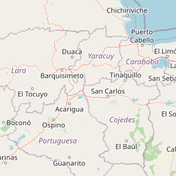
Henri Pittier National Park encompasses a dramatic landscape defined by the steep terrain of the Venezuelan Coastal Range, with elevations ranging from sea level to 2,346 meters at Pico Cenizo. The park's mountainous interior features rugged terrain with steep slopes, while the coastal zone includes bays, beaches, and shoreline environments. A notable geographical feature is the Paso de Portachuelo, a mountain pass at 1,136 meters that serves as a natural corridor for wildlife movement between different elevations and habitats. The geological constitution of the park consists primarily of metamorphic and igneous rocks. The park contains nine major rivers, including the San Miguel, Turiamo, Ocumare, Cata, Cuyagua, Aroa, Cepe, Choroní, and Chuao, all flowing into the Caribbean Sea, while the Guayabita, Colorado, Güey, and Limón drain into Lake Valencia. Coastal features include mangroves at La Ciénaga and Turiamo Bay, while the landscape supports diverse vegetation communities from deciduous forests at lower elevations through gallery forests to cloud forests at higher altitudes.

La Trilla, Rio Ocumare, Aragua, Venezuela
La Trilla, Rio Ocumare, Aragua state, Venezuela. Location within Henri Pittier National Park.

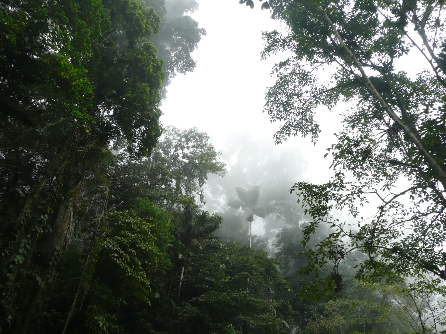
Henri Pittier National Park ecosystems, habitats, and plant life

The park's nature is characterized by exceptional ecological diversity resulting from the variety of habitats encompassed within its boundaries, from coastal mangroves through tropical deciduous forests to cloud forests at higher elevations. The cloud forest represents the most studied plant formation, with up to 150 different tree species recorded in just 0.25 hectares, demonstrating the extraordinary density of vegetation. Characteristic species of lower elevation forests include Curatella americana, Bowdichia virgilioides, Heliocarpus, and Triplaris, while cloud forest indicators include Gyranthera caribensis, various palm species such as Bactris setulosa, and numerous aroids, orchids, bromeliads, and members of the Piperaceae family. The park's vegetation displays four distinct layers typical of cloud forests, ranging from tall canopy trees through medium-height shrubs, herbs, and ground-level mosses, lichens, ferns, and fungi. Climate varies significantly with altitude, with coastal areas averaging 28 degrees Celsius and higher elevations experiencing temperatures between 6 and 12 degrees Celsius, while the rainy season extends from April through November.

Henri Pittier National Park
La Ciénaga located in Ocumare de la Costa, Aragua State, Venezuela

Henri Pittier National Park wildlife and species highlights

Henri Pittier National Park supports remarkable wildlife diversity, with approximately 582 bird species recorded within its boundaries, representing about 43 percent of Venezuela's avifauna and roughly 6 percent of global bird species. This extraordinary avian density, estimated at 5.4 species per square kilometer, ranks among the highest in the world. The park serves as a critical migratory corridor, with the Paso de Portachuelo allowing passage for over 79 species of migratory birds traveling from the northern hemisphere. Notable bird species include the peregrine falcon, swift, harpy eagle, solitary eagle, Wetmore's cock, helmeted curassow, military macaw, and siskin. The park also supports 140 mammal species, representing 47 percent of Venezuela's mammal fauna, including the tapir, peccary, sloth, anteater, howler monkey, giant otter, ocelot, puma, jaguar, and the endangered northern spider monkey. Reptile diversity includes 97 species and 38 amphibians, with the American crocodile found at the mouth of the San Miguel River. Insect diversity is estimated at over one million species, though the total has never been fully cataloged.

Parque nacional Henri Pittier vista.jpg
Henri Pittier National Park view.

Henri Pittier National Park conservation status and protection priorities

Henri Pittier National Park is recognized internationally as an Important Bird Area and an Alliance for Zero Extinction site, reflecting its global significance for preserving endangered species and critical habitats. The park was created to protect cloud forest ecosystems and marine-coastal environments from threats including burning and agricultural activities, with particular emphasis on preserving endemic, rare, vulnerable, and endangered species. The park protects important water resources that supply surrounding towns and serves as a space for research, recreation, and environmental education. However, the park faces significant conservation challenges including damage from fires, human encroachment, excessive hunting, and visitor impacts from solid waste. Conservation efforts are managed by INPARQUES, and the park supports scientific research through the Estación Biológica Rancho Grande operated by the Central University of Venezuela, which has facilitated decades of ecological studies making the park one of the best-documented protected areas in Venezuela.

Henri Pittier National Park cultural meaning and human context

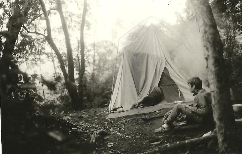
The park intersects with local communities whose cultural traditions and agricultural practices are deeply connected to the landscape. The village of Chuao within the park's boundaries is renowned for producing some of the world's finest cacao, with chocolate cultivation in the region representing a centuries-old tradition that continues today. Communities including Choroní, Cuyagua, Chuao, Cata, Ocumare de la Costa, and Turiamo exist adjacent to or within the park's influence zone, maintaining traditional ways of life while coexisting with the protected area. These communities offer游客 tourist accommodations including cottages and lodges, while INPARQUES permits camping within designated areas of the park. The park's cultural heritage also includes the legacy of Henri Pittier himself, whose work in classifying Venezuelan flora and establishing the national park system represents a foundational chapter in the country's environmental stewardship history.

Turiamo beach
Turiamo beach

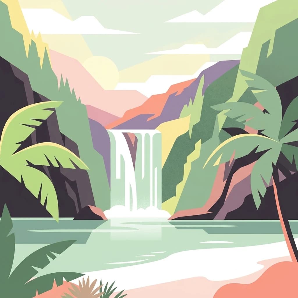
Top sights and standout views in Henri Pittier National Park

Henri Pittier National Park combines extraordinary biodiversity with dramatic landscapes and cultural significance. The park's over 500 bird species make it a globally significant destination for ornithologists and bird enthusiasts, while its cloud forests shelter the iconic 40-meter-tall Gyranthera caribensis tree. The coastal zone offers beaches including Bahía de Cata, Cuyagua (known for surfing), and Choroní, some accessible by road and others only by boat. The Paso de Portachuelo serves as a major migratory bird corridor connecting North and South America. The park's nine rivers provide water for surrounding communities, while the Chuao region's cacao cultivation represents exceptional agricultural heritage. The biological station at Rancho Grande facilitates ongoing scientific research, making this Venezuela's oldest and best-documented national park.

Waterfall in Venezuela
Carretera Maracay-Ocumare de la Costa road in Henri Pittier National Park, Aragua State, Venezuela.

Best time to visit Henri Pittier National Park

The optimal time to visit Henri Pittier National Park depends on the intended activities, with the rainy season from April to November bringing higher precipitation especially at higher elevations, while the dry season offers more predictable conditions for beach activities and coastal exploration. The cloud forest environment maintains its lush character year-round due to consistent moisture at higher elevations, though visitors seeking birdwatching opportunities may find the migratory season particularly rewarding when the Paso de Portachuelo channel's hundreds of species passing through. Coastal areas tend to be warmest with average temperatures around 28 degrees Celsius, while mountain environments can drop to 6 to 12 degrees Celsius, requiring appropriate gear for higher-elevation hikes. Visitors interested in beach activities should consider that the coastal zone experiences different conditions than the interior, and those planning to explore multiple ecosystems within the park should prepare for the temperature variations that result from the dramatic elevation range.

Park location guide

Geography guide, regional context, and park location map for Henri Pittier National Park

Henri Pittier National Park park geography, regions, and map view in Venezuela
Understand where Henri Pittier National Park sits in Venezuela through a broader geographic reading of the surrounding landscape, nearby location context, and its mapped position within the national park landscape.

How Henri Pittier National Park fits into Venezuela

Venezuela is a country in northern South America with coastline along the Caribbean Sea and Atlantic Ocean. It borders Colombia, Brazil, Guyana, and Trinidad and Tobago. The country has an area of approximately 916,445 km² and a population of about 31.8 million. Caracas is the capital and largest city. Venezuela consists of 23 states and the Capital District.

Wider geography shaping Henri Pittier National Park in Venezuela

Venezuela is located on the northern coast of South America. The continental territory is bordered by the Caribbean Sea and Atlantic Ocean to the north, Colombia to the west, Brazil to the south, and Guyana to the east. Trinidad and Tobago lies to the northeast. The country includes various islands and islets in the Caribbean Sea known as the Federal Dependencies.

Map view of Henri Pittier National Park

Use this park location map to pinpoint Henri Pittier National Park in Venezuela, understand its exact geographic position, and read its mapped placement within the surrounding landscape more clearly.

Pigeon | © OpenStreetMap contributors

Location context for Henri Pittier National Park

AraguaCarabobo

Explore the dramatic mountain terrain, unique cloud forest habitats, and diverse Caribbean coastal scenery defining this prominent Venezuelan national park.

Henri Pittier National Park Photos: Visual Guide to Its Coastal Mountains, Cloud Forests, and Protected Landscapes
Browse a curated selection of Henri Pittier National Park photos to visually explore its rugged mountain interior, extensive cloud forests, and vibrant Caribbean coastlines. These images offer essential visual context for comprehending the park's diverse ecosystems, key geographic features, and overall protected-area character.

Beach Choroni Venezuela

Camping Henri Pittier

La Trilla, Rio Ocumare, Aragua, Venezuela

Henri Pittier National Park

Parque nacional Henri Pittier vista.jpg

Cloud forest.jpg

Turiamo beach

Waterfall in Venezuela

Park atlas

Trace the geographic spread of Venezuela's protected landscapes across diverse coastal and mountain systems, comparing parks within the region.

Discover Nearby National Parks and Protected Areas Beyond Henri Pittier National Park
Browse additional national parks and protected areas beyond Henri Pittier National Park, tracing their geographic distribution across Venezuela's diverse coastal and mountain systems. Compare distinct protected landscapes and trace their regional context, revealing how these areas collectively safeguard Venezuela's rich biodiversity across varied terrains.
National parkCarabobo

San Esteban National Park: Discover Carabobo's Protected Caribbean Forest Landscape

Mapped protected area and natural terrain in Venezuela.

San Esteban National Park represents a significant protected area within Venezuela's Carabobo region, offering a unique exploration of Caribbean forest ecosystems and historical cultural sites. Covering approximately 445 square kilometers, the park's terrain spans coastal areas to mountainous interiors, presenting a diverse natural landscape shaped by its position in the coastal mountain ranges. This national park is notable for its archaeological petroglyphs, colonial roads, and fortifications, providing a rich cultural heritage context alongside its natural ecosystems. Its status as a protected national park makes it a key destination for understanding the intersection of natural conservation and historical geography in Venezuela.

Area
445 km²
Established
1987
IUCN
II
National parkVenezuela

El Ávila National Park: Venezuela's Premier Coastal Mountain National Park Exploration

Discover diverse terrain, mapped boundaries, and unique geographic context.

El Ávila National Park offers an exceptional gateway into Venezuela's mountainous protected landscapes. This national park features a dramatic rise from the Caribbean coast into varied terrain, including unique cloud forest and alpine zones. Its mapped geography showcases steep slopes, deep ravines, and remarkable elevation changes, providing a significant atlas-style study of coastal mountain environments. Exploring El Ávila National Park reveals a vital natural barrier and a rich ecosystem supporting diverse flora and fauna, making it a key destination for understanding regional protected areas.

Area
819 km²
Established
1958
IUCN
II
National parkVenezuela

Morrocoy National Park: Venezuela's Coastal National Park with Distinct Protected Geography

Explore the mapped protected landscape and regional context.

Morrocoy National Park stands as a key protected area within Venezuela, offering a distinct focus for geographic exploration. As a national park, its mapped boundaries delineate a significant natural landscape critical for understanding regional conservation and the country's broader atlas of protected lands. Discover the unique geographic characteristics and the atlas-driven context of this important Venezuelan protected area.

Area
320.9 km²
Established
1974
IUCN
II
National parkVenezuela

El Guache National Park: Venezuela's Protected Andean Foothill National Park

Map exploration of vital river basins and natural landscapes.

El Guache National Park is a protected national park in Venezuela, safeguarding the headwaters of five key rivers. Its landscape comprises mountainous terrain within the Andean foothills, crucial for watershed protection and regional biodiversity. This entry provides detailed geographic context, allowing for an atlas-style exploration of the park's mapped boundaries and its role as a vital protected area.

Area
122 km²
Established
1992
IUCN
II
National parkLara State

Yacambú National Park National Park: Protected Cloud Forest Landscape in Lara State

Mapped terrain and significant orchid diversity in Venezuela's Andean foothills.

Yacambú National Park is a significant national park in Venezuela's Lara State, protecting crucial humid cloud forest ecosystems in the Andean foothills. The park's terrain is defined by the mountainous topography of the Portuguesa Mountain Range, supporting a rich diversity of flora, including numerous orchid species. Its role in watershed protection for nearby regions underscores its importance as a conserved natural landscape with vital ecological functions.

Area
146 km²
Established
1962
IUCN
II
National parkFalcón State

Médanos de Coro National Park: Venezuela's Unique Arid Landscape and Protected Dune System

Explore the mapped geography of this coastal desert in Falcón State.

Médanos de Coro National Park represents a remarkable protected area within Venezuela's Falcón State, renowned for its spectacular and active sand dune systems. This national park encompasses approximately 91 square kilometers of unique terrain, including large sand formations, salt marshes, and mangrove swamps, contributing to its designation as a key conservation site for arid coastal ecosystems. Users can explore the park's distinctive landscape, understand its geographic context, and discover the patterns of wind-sculpted dunes that define this Venezuelan national park.

Area
91 km²
Established
1974
IUCN
II
National parkCuracao

Christoffelpark National Park: Curacao's Volcanic Terrain and Protected Landscape Atlas

Explore mapped boundaries and unique dry forest ecosystems.

Christoffelpark represents Curacao's most vital protected natural area, offering a deep dive into its unique geography and landscape. This national park preserves the island's highest peak, Christoffelberg, alongside distinctive dry forest ecosystems, endemic species, and the remnants of colonial plantations. Explore the mapped terrain, understand the regional context, and appreciate the rich natural and cultural heritage that defines this important protected landscape on Curacao.

Area
10.4 km²
Established
1978
IUCN
II
Relief
Mixed relief
National parkVenezuela

Dinira National Park: Protected Watershed and Andean Mountain Landscape

Explore its rugged terrain and páramo ecosystem.

Dinira National Park is a significant protected area in Venezuela, covering rugged Andean terrain vital for watershed protection. This national park features dramatic mountain landscapes, including the Humocaro Mountains and the Los Nepes páramo zone, supporting diverse cloud forest and high-altitude ecosystems. Understanding Dinira National Park offers insight into the geographic context of the Cordillera de Mérida and its hydrological importance.

Area
453.28 km²
Established
1988
IUCN
II

Common questions about visiting, size, designation, and location context for Henri Pittier National Park

Henri Pittier National Park FAQs for park facts, access, geography, and protected area context
Find quick answers about Henri Pittier National Park, including protected-area facts, park geography, trail and visitor context, and how the park fits into its surrounding country and regional landscape.
MoriAtlas Explorer

Continue Your Protected Areas Search Across the Global Atlas

Deepen your exploration by continuing the structured search for national parks and protected areas worldwide. Utilize the comprehensive filtering capabilities to compare different conservation landscapes and refine your understanding of global park geography. Discover more about the distribution and characteristics of protected natural areas.

Global natural geography