Mori Atlas logo
National parkYacambú National Park

Explore the mapped landscape and critical orchid diversity of this Venezuelan protected area.

Yacambú National Park National Park: Protected Cloud Forest in Lara State's Andean Foothills

Yacambú National Park represents a vital protected area within the Andean foothills of Venezuela, located in the southern part of Lara State. Established to safeguard the Yacambú river basin, this national park is characterized by its humid cloud forest ecosystems, notable for exceptional orchid diversity and characteristic tree species like bucare and araguaney. The park's landscape features steep terrain on the southern slopes of the Portuguesa Mountain Range, contributing significantly to regional watershed protection for the Quibor Valley.

cloud forestAndean foothillsorchid diversitywatershed protectionLara StateVenezuela

Yacambú National Park

National park

Park overview

Structured park overview, official facts, and landscape profile for Yacambú National Park

Yacambú National Park park facts, protected area profile, and essential visitor context
Review the core facts for Yacambú National Park, including designation, size, terrain, visitor scale, habitats, and operating context in one park-focused overview.

About Yacambú National Park

Yacambú National Park occupies a significant position in Venezuela's protected area system as a cloud forest preserve in the Andean foothills of the Portuguesa Mountain Range. The park was established in 1962 specifically to protect the Yacambú river basin, whose waters are destined to fill the José María Ochoa Pilé reservoir, an ongoing water infrastructure project of vital importance to the region. The reservoir will serve as a critical water supply source for Barquisimeto, Venezuela's sixth-largest city, and support economic development in the agricultural dry valleys of Quibor. The park's location on the southern slopes of the Andes places it at a biogeographic crossroads, where moisture-laden clouds from the Caribbean coast create the humid conditions necessary for cloud forest development. This ecosystem type, characterized by constant cloud immersion and epiphytic vegetation, supports some of the highest biodiversity in tropical mountain environments. The park's protection extends not only the forest ecosystems but also the watershed services they provide, linking conservation directly to human water security needs in the surrounding region.

Quick facts and research context for Yacambú National Park

Yacambú National Park covers approximately 146 square kilometers in the Andean foothills of Lara State, Venezuela, at coordinates approximately 9°38′N 69°40′W. The park was established on June 12, 1962, making it one of Venezuela's older national parks. Its cloud forest environment supports remarkable botanical diversity, including approximately 60 orchid species representing about 14 percent of all orchid species recorded in Venezuela. The park serves as a critical watershed protection area for the Yacambú river system.

Park context

Deeper park guide and search-rich context for Yacambú National Park

Yacambú National Park history, landscape, wildlife, and travel context
Explore Yacambú National Park through its history, landscape character, ecosystems, wildlife, conservation priorities, cultural context, and seasonal travel timing in a structured park guide built for atlas discovery and search intent.

Why Yacambú National Park stands out

Yacambú National Park is best known for its humid cloud forest vegetation in the Andean foothills of Venezuela, a relatively rare ecosystem type in the country. The park protects significant populations of characteristic cloud forest tree species including bucare, araguaney, and oak. Its exceptional orchid diversity, representing a substantial portion of Venezuela's orchid species, makes it botanically significant. The park also serves as a critical watershed protection area linking water security for Barquisimeto, one of Venezuela's major cities, with conservation of Andean forest ecosystems.

Yacambú National Park history and protected-area timeline

Yacambú National Park was established on June 12, 1962, making it one of the earlier national parks created in Venezuela's modern protected area system. The park's creation was driven by the need to protect the Yacambú river basin, which provides water for the José María Ochoa Pilé reservoir project. This reservoir represents an ambitious infrastructure initiative intended to secure water supplies for Barquisimeto and support irrigation in the Quibor Valley's agricultural zones. The establishment reflected Venezuela's mid-20th century recognition of the need to conserve cloud forest watersheds in the Andean region, combining water resource protection with biodiversity conservation. The park was designated under IUCN Category II, reflecting its status as a national park with primary protection objectives focused on ecosystem conservation while allowing for sustainable use of certain natural resources.

Yacambú National Park landscape and geographic character

The terrain of Yacambú National Park is characterized by the mountainous topography of the Andean foothills in northern Venezuela. The landscape rises from lower elevations on the southern slopes of the Portuguesa Mountain Range, with the park encompassing areas of steep terrain typical of mountain forest environments. The Portuguese Mountain Range forms part of the larger Andean mountain system that extends along the northern edge of South America. The area receives significant moisture from Caribbean weather systems, creating the humid conditions that support cloud forest development. The park's elevation range allows for distinct vegetation zones, with dense forest cover dominating the higher slopes where moisture accumulation is greatest.

Yacambú National Park ecosystems, habitats, and plant life

The ecological character of Yacambú National Park is defined by its humid cloud forest ecosystems, which represent a distinctive habitat type within Venezuela's protected areas. The park's cloud forests are characterized by constant cloud immersion, epiphytic plant growth on tree branches, and a dense understory adapted to low light conditions. Dominant tree species include bucare, araguaney, and oak, which form the forest canopy in the park's higher elevations. The park's botanical significance is underscored by its remarkable orchid diversity, with approximately 60 species recorded, representing about 14 percent of all orchid species known in Venezuela. This orchid concentration reflects the cloud forest's unique combination of humidity, temperature, and elevation conditions that create ideal growing conditions for these specialized plants.

Yacambú National Park wildlife and species highlights

The wildlife community of Yacambú National Park includes several notable mammal species adapted to cloud forest environments. Mammals present in the park include the araguato (howler monkey), deer species including matacan and caramerudo, the cachicamo (armadillo), and the honey bear (kinkajou). The bird community features species such as the guacharaca, a characteristic bird of Andean forest environments. Reptiles including various Viperinae species are also found within the park. The cloud forest habitat provides resources for both arboreal and ground-dwelling species, with the forest structure offering diverse ecological niches for wildlife.

Yacambú National Park conservation status and protection priorities

Yacambú National Park serves important conservation functions as a protected area preserving cloud forest ecosystems in Venezuela's Andean region. The park protects approximately 14 percent of Venezuela's total orchid species within its boundaries, representing a significant concentration of botanical biodiversity. Beyond species protection, the park's establishment was tied directly to watershed conservation, linking forest protection with water security objectives for the Barquisimeto metropolitan area. The cloud forest ecosystems serve critical hydrological functions, capturing moisture from passing clouds and releasing it gradually into the watershed, sustaining water flow during dry periods. This dual function of biodiversity protection and watershed services makes the park significant for both ecological and human community needs.

Yacambú National Park cultural meaning and human context

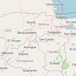
The park is located in Lara State, a region with distinct cultural heritage in Venezuelan history and agriculture. The Quibor Valley, which receives water from the Yacambú watershed, has historically been an important agricultural area in the state. The connection between the park's protected watershed and regional agricultural development reflects the long-standing relationship between local communities and the mountainous environments that provide water and resources. The city of Barquisimeto, as the primary beneficiary of the reservoir project, represents the urban population dependent on the protected watershed.

Top sights and standout views in Yacambú National Park

Yacambú National Park stands out for its cloud forest protection in Venezuela's Andean region, representing one of the country's significant preserves of this ecosystem type. The park's exceptional orchid diversity, with species representing a substantial portion of Venezuela's orchid flora, makes it particularly notable for botanical conservation. The connection between watershed protection and urban water supply creates a clear link between conservation outcomes and human welfare in the Barquisimeto region. The park's location on the southern slopes of the Portuguesa Mountain Range places it in a biogeographically significant position for Andean biodiversity.

Park location guide

Geography guide, regional context, and park location map for Yacambú National Park

Yacambú National Park park geography, regions, and map view in Venezuela
Understand where Yacambú National Park sits in Venezuela through a broader geographic reading of the surrounding landscape, nearby location context, and its mapped position within the national park landscape.

How Yacambú National Park fits into Venezuela

Venezuela is a country in northern South America with coastline along the Caribbean Sea and Atlantic Ocean. It borders Colombia, Brazil, Guyana, and Trinidad and Tobago. The country has an area of approximately 916,445 km² and a population of about 31.8 million. Caracas is the capital and largest city. Venezuela consists of 23 states and the Capital District.

Wider geography shaping Yacambú National Park in Venezuela

Venezuela is located on the northern coast of South America. The continental territory is bordered by the Caribbean Sea and Atlantic Ocean to the north, Colombia to the west, Brazil to the south, and Guyana to the east. Trinidad and Tobago lies to the northeast. The country includes various islands and islets in the Caribbean Sea known as the Federal Dependencies.

Map view of Yacambú National Park

Use this park location map to pinpoint Yacambú National Park in Venezuela, understand its exact geographic position, and read its mapped placement within the surrounding landscape more clearly.

Pigeon | © OpenStreetMap contributors

Location context for Yacambú National Park

Lara State
Park atlas

Compare nearby protected landscapes and trace the geographic spread of cloud forest ecosystems in the region

Discover Other Protected Areas: National Parks Near Yacambú National Park and Venezuela's Andean Foothills
Explore other national parks and protected areas with geographic relevance to Yacambú National Park, mapping similar cloud forest ecosystems and mountainous Andean foothill landscapes. Comparing these protected landscapes offers valuable insight into the regional spread of Venezuela's unique cloud forest environments and broader conservation patterns within the Andean foothills.
National parkVenezuela

El Guache National Park: Venezuela's Protected Andean Foothill National Park

Map exploration of vital river basins and natural landscapes.

El Guache National Park is a protected national park in Venezuela, safeguarding the headwaters of five key rivers. Its landscape comprises mountainous terrain within the Andean foothills, crucial for watershed protection and regional biodiversity. This entry provides detailed geographic context, allowing for an atlas-style exploration of the park's mapped boundaries and its role as a vital protected area.

Area
122 km²
Established
1992
IUCN
II
National parkVenezuela

Dinira National Park: Protected Watershed and Andean Mountain Landscape

Explore its rugged terrain and páramo ecosystem.

Dinira National Park is a significant protected area in Venezuela, covering rugged Andean terrain vital for watershed protection. This national park features dramatic mountain landscapes, including the Humocaro Mountains and the Los Nepes páramo zone, supporting diverse cloud forest and high-altitude ecosystems. Understanding Dinira National Park offers insight into the geographic context of the Cordillera de Mérida and its hydrological importance.

Area
453.28 km²
Established
1988
IUCN
II
National parkVenezuela

Sierra Nevada National Park: Venezuela's Majestic Alpine Protected Landscape and Park Boundaries

Explore the highest peaks and glacial terrain of this Venezuelan national park.

Delve into Sierra Nevada National Park, a premier protected area situated in the high Venezuelan Andes. This national park protects a vast expanse of dramatic alpine terrain, including Pico Bolívar and numerous glacial valleys. Understand its mapped boundaries and the unique paramo and cloud forest ecosystems that define this significant natural landscape within Venezuela, offering rich context for atlas-style geographic discovery.

Area
2,764.46 km²
Established
1952
IUCN
II
National parkVenezuela

Sierra La Culata National Park: Protected Landscape Atlas of the Venezuelan Andes

Explore the páramo ecosystems and mapped terrain of this Venezuelan national park.

Sierra La Culata National Park offers a profound look into the unique geography of the Venezuelan Andes. This protected national park is characterized by its expansive páramo ecosystems, dramatic mountain peaks, and glacial lagoons, creating a distinctive high-altitude wilderness. Use this atlas-focused entry to understand the park's mapped boundaries and its significant role within the region's natural landscape context.

Area
2,004 km²
Established
1989
IUCN
II
National parkVenezuela

Morrocoy National Park: Venezuela's Coastal National Park with Distinct Protected Geography

Explore the mapped protected landscape and regional context.

Morrocoy National Park stands as a key protected area within Venezuela, offering a distinct focus for geographic exploration. As a national park, its mapped boundaries delineate a significant natural landscape critical for understanding regional conservation and the country's broader atlas of protected lands. Discover the unique geographic characteristics and the atlas-driven context of this important Venezuelan protected area.

Area
320.9 km²
Established
1974
IUCN
II
National parkCarabobo

San Esteban National Park: Discover Carabobo's Protected Caribbean Forest Landscape

Mapped protected area and natural terrain in Venezuela.

San Esteban National Park represents a significant protected area within Venezuela's Carabobo region, offering a unique exploration of Caribbean forest ecosystems and historical cultural sites. Covering approximately 445 square kilometers, the park's terrain spans coastal areas to mountainous interiors, presenting a diverse natural landscape shaped by its position in the coastal mountain ranges. This national park is notable for its archaeological petroglyphs, colonial roads, and fortifications, providing a rich cultural heritage context alongside its natural ecosystems. Its status as a protected national park makes it a key destination for understanding the intersection of natural conservation and historical geography in Venezuela.

Area
445 km²
Established
1987
IUCN
II
National parkFalcón State

Médanos de Coro National Park: Venezuela's Unique Arid Landscape and Protected Dune System

Explore the mapped geography of this coastal desert in Falcón State.

Médanos de Coro National Park represents a remarkable protected area within Venezuela's Falcón State, renowned for its spectacular and active sand dune systems. This national park encompasses approximately 91 square kilometers of unique terrain, including large sand formations, salt marshes, and mangrove swamps, contributing to its designation as a key conservation site for arid coastal ecosystems. Users can explore the park's distinctive landscape, understand its geographic context, and discover the patterns of wind-sculpted dunes that define this Venezuelan national park.

Area
91 km²
Established
1974
IUCN
II
National parkVenezuela

Henri Pittier National Park: Venezuela's Oldest National Park, Coastal Range Geography

Explore protected landscapes, cloud forests, and birdwatching geography.

Henri Pittier National Park is Venezuela's foundational protected area, established in 1937 and spanning over 107,800 hectares within the Venezuelan Coastal Range. This national park is renowned for its exceptional biodiversity, particularly its over 500 bird species and its distinctive cloud forest ecosystems, which include the iconic Gyranthera caribensis tree. The park's geography extends from rugged mountain terrain to coastal bays and beaches, with the Paso de Portachuelo serving as a significant migratory bird corridor. Its mapped boundaries enclose a rich mosaic of natural landscapes vital for understanding regional conservation and protected area geography in northern South America.

Area
1,078 km²
Established
1937
IUCN
II
Relief
Mountain

Common questions about visiting, size, designation, and location context for Yacambú National Park

Yacambú National Park FAQs for park facts, access, geography, and protected area context
Find quick answers about Yacambú National Park, including protected-area facts, park geography, trail and visitor context, and how the park fits into its surrounding country and regional landscape.
MoriAtlas Explorer

Continue Your Protected Areas Search Across the Global Atlas

Deepen your exploration by continuing the structured search for national parks and protected areas worldwide. Utilize the comprehensive filtering capabilities to compare different conservation landscapes and refine your understanding of global park geography. Discover more about the distribution and characteristics of protected natural areas.

Global natural geography