Mori Atlas logo
National parkNamtok Chet Sao Noi National Park

Explore the mapped boundaries and distinct terrain of this seven-tiered waterfall national park.

Namtok Chet Sao Noi National Park: Protected Landscape and Geographic Atlas in Saraburi Province

Namtok Chet Sao Noi National Park stands as a significant protected area within Saraburi Province, Thailand, offering a detailed view of tropical rainforest ecosystems and mountain landscapes. This park, notable as the first national park established during the reign of King Rama X, provides an exceptional opportunity to explore its mapped terrain, from the iconic seven-tiered Chet Sao Noi waterfall to the unique Tree Tunnel along Highway 2089. Discover its role in Thailand's expanding protected area network and its unique geographic identity within the Dong Phaya Yen mountain range.

WaterfallTropical RainforestNational ParkCentral ThailandSeven-Tiered WaterfallForest Park

Namtok Chet Sao Noi National Park

National park

Park overview

Structured park overview, official facts, and landscape profile for Namtok Chet Sao Noi National Park

Namtok Chet Sao Noi National Park park facts, protected area profile, and essential visitor context
Review the core facts for Namtok Chet Sao Noi National Park, including designation, size, terrain, visitor scale, habitats, and operating context in one park-focused overview.

About Namtok Chet Sao Noi National Park

Namtok Chet Sao Noi National Park represents a significant addition to Thailand's protected area network, established in late 2016 to preserve a distinctive area of tropical forest and waterfall scenery in the central part of the country. The park occupies a transitional zone between the Bangkok plains and the northeastern plateau, situated within the Dong Phaya Yen mountain range that extends northward from the Khao Yai region. This positioning gives the park a blend of ecosystems and contributes to its ecological significance as a watershed area and wildlife corridor. The park's creation reflected Thailand's ongoing commitment to biodiversity conservation while providing a new destination for environmental education and nature-based recreation in a region already known for several protected areas including the nearby Khao Yai National Park. The park's management falls under Thailand's Department of National Parks, Wildlife and Plant Conservation, which administers all national parks throughout the country.

Quick facts and research context for Namtok Chet Sao Noi National Park

Namtok Chet Sao Noi National Park covers 42 square kilometres in central Thailand's Dong Phaya Yen mountain region, straddling Saraburi and Nakhon Ratchasima provinces. Established on 26 December 2016, it is the 129th national park of Thailand and the first designated during King Rama X's reign. The park's signature feature is the Chet Sao Noi waterfall, a seven-tiered cascade with swimming areas beneath each tier. The area supports tropical rainforest vegetation and diverse wildlife including serow, jackal, marten, civets, and numerous bird species. A notable man-made feature is the Tree Tunnel, a shaded 200-meter stretch along Highway 2089 formed by tree canopies.

Park context

Deeper park guide and search-rich context for Namtok Chet Sao Noi National Park

Namtok Chet Sao Noi National Park history, landscape, wildlife, and travel context
Explore Namtok Chet Sao Noi National Park through its history, landscape character, ecosystems, wildlife, conservation priorities, cultural context, and seasonal travel timing in a structured park guide built for atlas discovery and search intent.

Why Namtok Chet Sao Noi National Park stands out

Namtok Chet Sao Noi National Park is best known for its distinctive seven-tiered waterfall, which gives the park its name and serves as its primary recreational attraction. The waterfall, named Chet Sao Noi or seven little girls waterfall, features approximately four-meter drops at each tier with spacious, shaded swimming areas beneath. The park is also notable for being Thailand's first national park established in the reign of King Rama X, marking a significant milestone in the country's conservation history. The Tree Tunnel along Highway 2089 is another distinctive feature, creating a shaded passage over 200 meters long where the road passes beneath a canopy of trees.

Namtok Chet Sao Noi National Park history and protected-area timeline

Namtok Chet Sao Noi National Park was officially established on 26 December 2016, becoming the 129th national park in Thailand and the first protected area designated during the reign of King Maha Vajiralongkorn (King Rama X). The park was upgraded from its previous status as a forest park, reflecting the Thai government's decision to elevate the area's protection level and provide it with the full institutional framework of a national park. The designation represented part of Thailand's broader strategy to expand and strengthen its protected area network, which had been growing since the establishment of the first national parks in the 1960s. The choice of a waterfall as the central feature for the park followed a tradition in Thai national parks of preserving notable natural landmarks, as waterfalls have historically served as focal points for both recreation and conservation in Thailand. The park's relatively recent establishment means it represents contemporary approaches to protected area management in Thailand, incorporating modern conservation principles while serving as a destination for visitors seeking natural beauty and outdoor recreation.

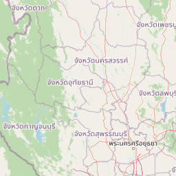
Namtok Chet Sao Noi National Park landscape and geographic character

The landscape of Namtok Chet Sao Noi National Park is characterized by forested hills and valleys within the Dong Phaya Yen mountain range, part of the larger Phanom Dong Rak mountain system that forms a natural boundary between central and northeastern Thailand. The terrain features rolling slopes and stream-cut valleys where the park's numerous waterways have carved their courses through the forest. The standout geographic feature is the Chet Sao Noi waterfall itself, a seven-tiered cascade where water descends through a series of drops, each approximately four meters in height, creating pools and swimming areas at each level. The waterfall is fed by a stream that flows through the park, and the area around the cascade is characterized by lush vegetation and shaded pools that attract both wildlife and visitors. A distinctive man-made landscape element is the Tree Tunnel along Highway 2089, where roadside trees have formed a natural canopy creating a shaded passage over 200 meters in length, connecting the Muak Lek area with Wang Muang.

Namtok Chet Sao Noi National Park ecosystems, habitats, and plant life

The park supports tropical rainforest vegetation across its 42-square-kilometre extent, with the canopy dominated by various tree species adapted to the seasonal monsoon climate of central Thailand. The forest composition includes species such as Pterocarpus macrocarpus, Sterculia foetida, Bombax ceiba, Garuga pinnata, and Fernandoa adenophylla, representing the typical species mix of semi-evergreen and dry dipterocarp forests found in this elevation zone. The park's streams and riparian zones support additional vegetation suited to more moist conditions, while the general forest structure provides habitat for numerous bird and mammal species. The presence of diverse habitats ranging from hill forest to stream corridors contributes to the park's ecological value, supporting both resident species and seasonal visitors that utilize the area as a corridor between larger protected landscapes.

Namtok Chet Sao Noi National Park wildlife and species highlights

The wildlife community in Namtok Chet Sao Noi National Park reflects the tropical forest ecosystems of central Thailand, with the park hosting a mix of mammal, bird, and reptile species adapted to the forested environment. Mammal species recorded in the park include serow, a goat-antelope commonly found in Thai forests, golden jackal, yellow-throated marten, small civet, palm civet, porcupine, Burmese hare, and various squirrel species including ground squirrel, striped squirrel, and flying squirrel. Larger mammals present include mongoose species and the Sunda pangolin, a scaly mammal of conservation concern. The bird population includes species such as black baza, palm swift, and the birdwing butterfly Troides aeacus, a protected swallowtail species. Reptiles recorded in the park include the snail-eating turtle, Tokay gecko, monitor lizards, water monitors, and Burmese python, representing the typical reptile diversity found in Thai forest habitats.

Namtok Chet Sao Noi National Park conservation status and protection priorities

Namtok Chet Sao Noi National Park represents a meaningful addition to Thailand's conservation estate, protecting an area of tropical forest and watershed that contributes to broader ecosystem health in the Dong Phaya Yen region. The park's establishment in 2016 reflected Thailand's commitment to maintaining biodiversity through the national park system, which has been the cornerstone of the country's protected area strategy since the 1960s. The elevation from forest park to national park status provided stronger legal protection and institutional resources for managing the area's natural resources. The park serves as a buffer and connector within a landscape that includes several other protected areas and non-hunting areas, contributing to habitat connectivity for wildlife moving between larger protected zones. The preservation of the Chet Sao Noi waterfall and its surrounding forest also protects watershed values that benefit downstream areas in Saraburi and Nakhon Ratchasima provinces.

Namtok Chet Sao Noi National Park cultural meaning and human context

The name Chet Sao Noi, meaning seven little girls waterfall, reflects the park's connection to local cultural traditions and naming practices common throughout Thailand where natural features are associated with folklore and legend. The seven tiers of the waterfall are the basis for this name, with multiple stories existing in local tradition about the origin of the waterfall's name. The area has been a local recreational destination for some time before its national park designation, with visitors coming to swim in the waterfall pools and enjoy the shaded forest environment. The Tree Tunnel along Highway 2089 represents a local landmark that has become associated with the park area, providing a distinctive travel experience for visitors passing through the region.

Top sights and standout views in Namtok Chet Sao Noi National Park

The seven-tiered Chet Sao Noi waterfall remains the park's primary attraction, offering visitors the opportunity to swim in the pools beneath each tier while surrounded by forest scenery. The Tree Tunnel along Highway 2089 provides a unique driving or walking experience through a natural canopy of trees spanning over 200 meters. Muak Lek Creek offers additional water-based recreation opportunities within the park. The combination of accessible waterfall recreation, forest trails, and the distinctive tree-covered road makes the park a popular destination for both local visitors and tourists exploring the central Thailand region. The park's status as the first national park of King Rama X's reign adds a layer of historical significance for visitors interested in Thailand's conservation chronology.

Best time to visit Namtok Chet Sao Noi National Park

The best time to visit Namtok Chet Sao Noi National Park is during the cool dry season from November to February when temperatures are more comfortable for outdoor activities and the waterfall typically maintains good flow. The wet season from May to October brings heavier rainfall that can increase water volume at the falls but may also create less favorable conditions for some visitors. The period just after the wet season, in October and November, often provides a good balance with refreshed water flow and relatively mild weather. Visitors planning to swim at the waterfall should be aware that water levels vary with seasonal rainfall patterns, and the dry season months typically offer the most consistent swimming conditions. Morning visits generally provide cooler temperatures and the opportunity to enjoy the waterfall before it becomes crowded.

Park location guide

Geography guide, regional context, and park location map for Namtok Chet Sao Noi National Park

Namtok Chet Sao Noi National Park park geography, regions, and map view in Thailand
Understand where Namtok Chet Sao Noi National Park sits in Thailand through a broader geographic reading of the surrounding landscape, nearby location context, and its mapped position within the national park landscape.

How Namtok Chet Sao Noi National Park fits into Thailand

Thailand is a Southeast Asian nation formerly called Siam, located in mainland Southeast Asia. It operates as a unitary parliamentary constitutional monarchy under King Vajiralongkorn. The country borders Myanmar, Laos, Cambodia, and Malaysia, with maritime boundaries involving Vietnam, Indonesia, and India. Thailand has a population of nearly 66 million and covers approximately 513,120 km². Historically, the Sukhothai Kingdom marks the beginning of Thai history, followed by the powerful Ayutthaya Kingdom.

Wider geography shaping Namtok Chet Sao Noi National Park in Thailand

Thailand occupies mainland Southeast Asia with borders to Myanmar (west/northwest), Laos (east/northeast), Cambodia (southeast), and Malaysia (south). The country has coastline along the Gulf of Thailand to the southeast and the Andaman Sea to the southwest. The territory covers approximately 513,120 km².

Map view of Namtok Chet Sao Noi National Park

Use this park location map to pinpoint Namtok Chet Sao Noi National Park in Thailand, understand its exact geographic position, and read its mapped placement within the surrounding landscape more clearly.

Pigeon | © OpenStreetMap contributors

Location context for Namtok Chet Sao Noi National Park

Nakhon Ratchasima ProvinceSaraburi Province
Park atlas

Explore the Connected Geography and Diverse Conservation Landscapes of Central Thailand

Discover Related National Parks and Protected Areas Near Namtok Chet Sao Noi
Continue your park discovery by mapping nearby national parks and protected areas within Central Thailand, comparing diverse conservation landscapes around Namtok Chet Sao Noi National Park. Broaden your understanding of regional park geography, tracing how these interconnected sites contribute to the larger Dong Phaya Yen mountain system's preservation.
National parkSaraburi Province

Namtok Sam Lan National Park: A Mapped Protected Landscape in Saraburi Province

Explore its terrain, waterfalls, and regional geography.

Gain detailed geographic insight into Namtok Sam Lan National Park, a vital protected area situated in Thailand's Saraburi Province. This destination provides a rich atlas view of its landscape, featuring prominent waterfalls and mixed forest ecosystems. Understand the park's specific location, mapped terrain, and its contribution to the regional geography, offering a concrete point for exploration.

Area
45 km²
Established
1981
IUCN
II
Visitors
45.8K annual
National parkNakhon Ratchasima Province

Khao Yai National Park: Explore Protected Landscape and Geographic Context

Nakhon Ratchasima Province's premier national park.

Khao Yai National Park represents a significant protected natural landscape within Nakhon Ratchasima Province, northeastern Thailand. This page facilitates a detailed atlas-style exploration of the park's geographic identity, mapped boundaries, and its role within the regional context of the Khorat Plateau. Gain structured insight into this key national park's place in Thailand's protected land network.

Area
2,166 km²
Established
1962
IUCN
II
Visitors
1.6M annual
National parkThailand

Thap Lan National Park: Mapping Thailand's Protected Landscape Identity

Explore the mapped geography and protected area context.

Thap Lan National Park represents a vital element of Thailand's network of protected lands. This page offers an atlas-focused view of its geographic position and landscape character within the country. Users can uncover details about the park's mapped boundaries and its significance as a protected natural area. Understand its place in the broader context of Thai geography and conservation, enabling structured exploration of its natural terrain.

Area
2,236 km²
Established
1981
IUCN
II
Visitors
57.1K annual
National parkChaiyaphum Province

Pa Hin Ngam National Park: Protected Area Atlas and Geographic Discovery in Chaiyaphum

Explore mapped boundaries and regional landscape context.

Pa Hin Ngam National Park is a significant national park entity located within Chaiyaphum Province, Thailand. This page offers detailed insight into its protected landscape, focusing on its mapped boundaries and how it fits into the regional geography of northeastern Thailand. Understand its identity as a conservation landscape through structured atlas exploration.

Area
100 km²
Established
1994
IUCN
II
Visitors
106.4K annual
National parkChaiyaphum Province

Sai Thong National Park: Protected National Park in Chaiyaphum Province's Geography

Explore mapped landscape and protected area context.

Sai Thong National Park is a designated national park located in Chaiyaphum Province, Thailand, contributing to the region's extensive network of protected areas. Its protected landscape identity is shaped by the geography of northeastern Thailand, offering a unique focus for map-based discovery and understanding the distribution of natural areas. Explore the mapped terrain and regional context of this significant natural landmark.

Area
319 km²
Established
1992
IUCN
II
Visitors
51.2K annual
National parkSa Kaeo Province

Pang Sida National Park: Protected Landscape Atlas in Sa Kaeo Province

Discover its mapped terrain and wildlife habitats.

Pang Sida National Park is a significant protected national park located in Sa Kaeo Province, Thailand, spanning approximately 844 square kilometers of the Sankamphaeng Range. As a critical element of the UNESCO Dong Phayayen-Khao Yai Forest Complex, it provides a vital protected landscape for diverse ecosystems and remarkable biodiversity. Users can explore the park's mountainous terrain, grasslands, and riparian zones, gaining insight into its geographic significance and its role within a larger conservation area.

Area
844 km²
Established
1982
IUCN
II
Visitors
58.4K annual
National parkThailand

Tat Ton National Park: Thailand's National Park Geography and Mapped Landscape

Explore its protected boundaries and natural terrain.

Delve into the specifics of Tat Ton National Park, a protected natural area in Thailand. This page provides a detailed exploration of its mapped boundaries, regional geography, and the character of its natural terrain. Understand its value as a national park for understanding the distribution of protected landscapes and how they contribute to the overall geographic context of Thailand.

Area
217 km²
Established
1980
IUCN
II
Visitors
388.7K annual
Watercolor painting showing green hills, pinkish mountains, and two trees in a scenic landscape
National parkSa Kaeo Province

Ta Phraya National Park: National Park & Protected Landscape Geography in Sa Kaeo Province

Explore the mapped boundaries and regional terrain of this Thai national park.

Ta Phraya National Park stands as a protected national park within the dynamic geography of Sa Kaeo Province, Thailand. This page offers an atlas-centric view, detailing the park's specific geographic footprint and its contribution to the regional landscape. Understanding Ta Phraya National Park's position, its mapped natural terrain, and its designation as a protected area is crucial for grasping Thailand's broader conservation geography.

Area
594 km²
Established
1996
IUCN
II

Common questions about visiting, size, designation, and location context for Namtok Chet Sao Noi National Park

Namtok Chet Sao Noi National Park FAQs for park facts, access, geography, and protected area context
Find quick answers about Namtok Chet Sao Noi National Park, including protected-area facts, park geography, trail and visitor context, and how the park fits into its surrounding country and regional landscape.
MoriAtlas Explorer

Continue Your Protected Areas Search Across the Global Atlas

Deepen your exploration by continuing the structured search for national parks and protected areas worldwide. Utilize the comprehensive filtering capabilities to compare different conservation landscapes and refine your understanding of global park geography. Discover more about the distribution and characteristics of protected natural areas.

Global natural geography