Mori Atlas logo
Marine protected areaPoint Hicks Marine National Park

Discover mapped underwater terrain and unique coastal biodiversity in Victoria

Point Hicks Marine National Park: Victoria's Eastern Marine Protected Area Atlas

Point Hicks Marine National Park in Victoria, Australia, protects a vital transitional marine zone where species from warmer northern waters meet temperate southern fauna. This 4,000-hectare marine protected area, adjacent to Croajingolong National Park, offers a unique look at underwater landscapes featuring kelp forests and rocky reefs. Explore the geographic context of this significant marine protected area and its distinct ecological patterns.

marine protected areaVictoria marine parksEast Gippslandwarm-temperate marine ecosystemsshipwreck heritagekelp forests

Point Hicks Marine National Park

Marine protected area

Park overview

Structured park overview, official facts, and landscape profile for Point Hicks Marine National Park

Point Hicks Marine National Park park facts, protected area profile, and essential visitor context
Review the core facts for Point Hicks Marine National Park, including designation, size, terrain, visitor scale, habitats, and operating context in one park-focused overview.

About Point Hicks Marine National Park

Point Hicks Marine National Park protects a significant section of Victoria's southeastern coastline, established to preserve the unique warmer-temperate marine environment found in the eastern part of the state. The marine park extends from the shoreline outward, encompassing underwater habitats that support diverse communities of fish, invertebrates, and algae. Unlike the cooler western waters of Victoria, this region experiences warmer sea temperatures that allow species from more northerly latitudes to extend their range southward. The park's ecological significance lies in this biogeographic transition zone, where organisms from different climatic regions coexist. The underwater landscape features rocky reef formations, sandy seabed areas, and extensive kelp forests that provide habitat structure and food sources for marine life. Water clarity in this region supports healthy photosynthetic organisms, while the mixing of currents brings nutrients that sustain productive food webs. The park's proximity to Croajingolong National Park creates a unified protected area extending from terrestrial forests into coastal waters, offering ecological connectivity between land and sea ecosystems.

Quick facts and research context for Point Hicks Marine National Park

Point Hicks Marine National Park covers 4,000 hectares (40 square kilometers) of coastal waters in East Gippsland, Victoria. The park was established on 16 November 2002 under the management of Parks Victoria. It represents Victoria's warmer eastern marine environment and contains species that do not occur in the cooler waters to the west. The marine park sits adjacent to Croajingolong National Park and the Point Hicks Lighthouse Reserve, forming a continuous protected coastline. Two historic shipwrecks, the SS Kerangie (1879) and the SS Saros (1937), lie within the park's waters, adding maritime heritage to its conservation values.

Park context

Deeper park guide and search-rich context for Point Hicks Marine National Park

Point Hicks Marine National Park history, landscape, wildlife, and travel context
Explore Point Hicks Marine National Park through its history, landscape character, ecosystems, wildlife, conservation priorities, cultural context, and seasonal travel timing in a structured park guide built for atlas discovery and search intent.

Why Point Hicks Marine National Park stands out

Point Hicks Marine National Park is best known for representing Victoria's warmer eastern marine environment, a transitional zone where temperate and subtropical marine species overlap. The park protects underwater ecosystems containing species absent from cooler waters to the west, making it ecologically significant for understanding marine biogeography along Australia's southern coast. The presence of two historic shipwrecks, the SS Kerangie and SS Saros, also gives the park distinctive maritime heritage value. The marine park forms part of a larger protected coastal corridor including Croajingolong National Park and Point Hicks Lighthouse Reserve.

Point Hicks Marine National Park history and protected-area timeline

Point Hicks Marine National Park was established on 16 November 2002 as part of Victoria's marine protected area network expansion during the early 2000s. The creation of this marine park reflected growing recognition that Victoria's coastal waters required formal protection beyond terrestrial national parks. The park was designated under Victoria's national parks legislation and assigned IUCN Category II status, recognizing its national park-level significance. The establishment process considered the region's ecological values, including the unique warmer marine environment and the presence of species not found elsewhere in Victoria. Management authority was assigned to Parks Victoria, which oversees both terrestrial and marine protected areas in the state. The park's waters contain the remains of two vessels: the steamship Kerangie, lost in 1879, and the SS Saros, lost in 1937. These shipwrecks represent historic maritime activity along this remote section of Victoria's coast and add cultural heritage dimensions to the marine park's values.

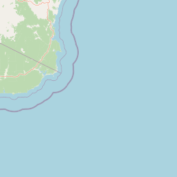
Point Hicks Marine National Park landscape and geographic character

The Point Hicks Marine National Park encompasses underwater terrain typical of Victoria's southeastern coast, characterized by a mix of rocky reef systems and softer sedimentary substrates. The coastal seabed features gradual depth increases offshore, with rocky platforms and boulders providing hard surfaces for attachment by kelp, seaweeds, and filter-feeding invertebrates. Sandy areas between reef formations support different communities of burrowing organisms and bottom-feeding fish. The water column itself forms the primary landscape element, with seasonal variations in temperature, clarity, and nutrient availability shaping the marine environment. Above the water, the park is framed by the forested slopes of Croajingolong National Park and the prominent Point Hicks Lighthouse standing on the headland. The lighthouse, established in 1890, marks the coastline and has historically guided vessels through this section of the Tasman Sea coast. The interface between land and sea creates dramatic scenery where forested headlands meet crashing waves and exposed reef platforms.

Point Hicks Marine National Park ecosystems, habitats, and plant life

The marine park protects ecosystems characteristic of Victoria's warmer eastern waters, which differ substantially from the cooler conditions found along much of the state's coast. Warmer sea temperatures in this region support species assemblages that do not extend into Victoria's western waters, making the area biogeographically significant. Kelp forests dominate rocky substrate areas, with species adapted to the moderate wave exposure and seasonal temperature ranges. These underwater forests provide three-dimensional habitat complexity that supports numerous fish species, invertebrates, and algae. The water column contains diverse fish populations, including species that use the area for feeding and breeding. Invertebrate communities include various mollusks, crustaceans, and echinoderms that occupy different microhabitats within the reef and sediment systems. The mixing of warm and cool water influences in this region creates environmental conditions that support species with different thermal tolerances, enhancing local biodiversity.

Point Hicks Marine National Park wildlife and species highlights

Point Hicks Marine National Park supports diverse marine wildlife adapted to the warmer-temperate conditions of Victoria's eastern coast. Fish communities include both resident species and migratory visitors that move through the area seasonally. Reef areas provide shelter and feeding grounds for numerous fish species that rely on kelp forest and rocky habitat structures. The invertebrate fauna encompasses various species of mollusks, including gastropods and bivalves that inhabit both hard and soft substrates. Crustaceans such as crabs and lobsters occupy crevices and overhangs within the reef system. The waters around Point Hicks also attract marine mammals that may transit through or forage in the area, though specific species presence varies seasonally. Birdlife associated with the coastline includes seabirds that forage in the marine environment and nest on adjacent coastal headlands. The combination of productive waters and diverse habitat types supports wildlife populations that depend on the protection afforded by the marine park status.

Point Hicks Marine National Park conservation status and protection priorities

The establishment of Point Hicks Marine National Park represents Victoria's commitment to protecting marine biodiversity within its coastal waters. The park's conservation significance stems primarily from its representation of the state's warmer eastern marine environment, which supports species assemblages not found in cooler western waters. This ecological distinction makes the area important for maintaining genetic diversity and evolutionary processes across Victoria's marine ecosystems. The marine park contributes to a broader network of protected areas along the East Gippsland coast, linking with Croajingolong National Park and other reserves to provide comprehensive habitat protection from terrestrial environments into the sea. Management focuses on maintaining water quality, protecting critical habitats, and ensuring that human activities within the park remain compatible with conservation objectives. The shipwreck sites within the park also receive consideration as heritage elements requiring appropriate management.

Point Hicks Marine National Park cultural meaning and human context

Point Hicks Marine National Park contains maritime heritage elements that add historical dimension to its natural values. Two shipwrecks lie within the park's waters: the SS Kerangie, a steamship lost in 1879, and the SS Saros, lost in 1937. These vessels represent the maritime history of this remote section of Victoria's coast, where navigation challenges and weather events have claimed ships over more than a century of European shipping activity. The adjacent Point Hicks Lighthouse, established in 1890, stands as a terrestrial heritage feature associated with maritime safety along this coastline. The lighthouse was constructed to assist vessels navigating the southeastern coast of Victoria, where the interaction of currents, weather patterns, and the relatively exposed shoreline created hazards for shipping. The combination of underwater shipwreck heritage and the lighthouse creates a cultural landscape that connects contemporary visitors to the region's maritime past.

Top sights and standout views in Point Hicks Marine National Park

Point Hicks Marine National Park stands out for its representation of Victoria's warmer eastern marine environment, protecting species and ecosystems that cannot be found in the state's cooler western waters. The park's location adjacent to Croajingolong National Park creates a continuous protected corridor from land to sea, providing ecological connectivity that benefits both terrestrial and marine species. The presence of two historic shipwrecks adds maritime heritage interest, with the remains of the SS Kerangie and SS Saros lying in park waters. The underwater landscapes feature kelp forests, rocky reefs, and diverse marine communities that thrive in the transitional conditions between temperate and subtropical influences. The park offers protection to marine ecosystems while maintaining access for activities compatible with conservation objectives.

Best time to visit Point Hicks Marine National Park

Point Hicks Marine National Park can be visited throughout the year, though seasonal conditions influence the marine experience. Warmer months from December through March bring higher water temperatures that make underwater activities more comfortable, though this period also corresponds with greater boat traffic along the coast. The cooler months from June through August offer different conditions, with clearer water often providing better visibility for underwater observation. Weather patterns along this section of Victoria's coast can change rapidly, and visitors should be prepared for variable conditions regardless of season. The adjacent Point Hicks Lighthouse and surrounding headland areas provide coastal viewpoints accessible without watercraft, allowing visitors to appreciate the marine park's setting even when boat access is not practical.

Park location guide

Geography guide, regional context, and park location map for Point Hicks Marine National Park

Point Hicks Marine National Park park geography, regions, and map view in Australia
Understand where Point Hicks Marine National Park sits in Australia through a broader geographic reading of the surrounding landscape, nearby location context, and its mapped position within the national park landscape.

How Point Hicks Marine National Park fits into Australia

Australia is a constitutional monarchy and federal parliamentary democracy comprising six states and ten territories. With a population of nearly 28 million, it is one of the world's most urbanised countries, with most people concentrated on the eastern seaboard. The country has a high Human Development Index and is known for its cultural diversity, ancient Aboriginal heritage, and unique wildlife.

Wider geography shaping Point Hicks Marine National Park in Australia

Australia occupies the entire Australian continent, the island of Tasmania, and numerous smaller islands. It is the world's flattest and driest inhabited continent, featuring vast deserts in the interior (the Outback), tropical rainforests along the eastern coast, and a coastline bordering the Indian and Pacific Oceans.

Map view of Point Hicks Marine National Park

Use this park location map to pinpoint Point Hicks Marine National Park in Australia, understand its exact geographic position, and read its mapped placement within the surrounding landscape more clearly.

Pigeon | © OpenStreetMap contributors

Location context for Point Hicks Marine National Park

Victoria
Park atlas

Trace the regional protected-area geography and compare diverse marine and terrestrial landscapes around Victoria's eastern coast.

Explore Nearby Marine and Coastal Protected Areas Around Point Hicks Marine National Park
Beyond Point Hicks Marine National Park, browse other coastal and marine protected areas, tracing the geographical spread of conservation landscapes across Victoria's eastern region. Compare diverse park features, specific marine ecosystems, and adjacent terrestrial zones to understand the broader protected-area geography of Australia's southeastern coastline.
National parkVictoria

Lind National Park: A Historic National Park Protecting East Gippsland Forest Landscapes

Mapped Protected Area with Early Conservation Significance in Victoria

Lind National Park, designated in 1925, is a notable protected area situated in Victoria's East Gippsland region. Covering 1,370 hectares, it safeguards representative forested terrain characterized by eucalypt woodlands, typical of the area's undulating topography. Its historical status as one of Victoria's earliest national parks underscores its importance for understanding the evolution of conservation in Eastern Australia. The park's accessible location along the Princes Highway provides a straightforward opportunity to experience its natural environment and regional geography.

Area
13.7 km²
Established
1925
IUCN
II
Marine protected areaVictoria

Cape Howe Marine National Park: Victoria's Dramatic Southern Ocean Marine Protected Area

Rugged coastlines and marine ecosystem discovery in East Gippsland.

Delve into Cape Howe Marine National Park, a protected marine area anchoring Victoria's eastern coastline. This park protects a stretch of the Southern Ocean meeting dramatic rocky headlands and exposed shores. Its location at the far eastern tip of Victoria, adjacent to national parks, highlights a significant continuum of protected natural landscapes. Explore the mapped marine geography and the powerful coastal environment that defines this remote protected area.

Area
40.5 km²
Established
2002
IUCN
II
National parkVictoria

Snowy River National Park: Victoria's Deep Gorges and Alpine Wilderness Discovery

Explore the mapped boundaries and geographic context of this protected landscape.

Snowy River National Park in Victoria offers a profound exploration of rugged alpine terrain and striking river gorges, including the remarkable Little River Gorge. As a designated national park and wilderness area, it protects diverse ecosystems and is a vital component of the Australian Alps National Parks. Discover its geographic identity, natural landscapes, and importance as a mapped protected area for understanding Victoria's conservation network.

Area
987 km²
Established
1979
IUCN
II
National parkNew South Wales

Beowa National Park: Protected Landscape and Coastal Geography in New South Wales

Mapped terrain and unique erosion sites within this national park.

Delve into the protected landscape of Beowa National Park, situated in the coastal region of New South Wales. This national park showcases a varied terrain, from heathland headlands to eucalypt woodlands, with the visually dramatic Pinnacles erosion gully as a key highlight. Its geographic setting within Twofold Bay provides a compelling focus for atlas exploration of Australia's protected natural areas.

Area
104.86 km²
Established
1971
IUCN
II
National parkNew South Wales

Mimosa Rocks National Park: Coastal Protected Area Atlas and Geographic Discovery

New South Wales National Park with Mapped Coastal Terrain

Mimosa Rocks National Park offers a compelling glimpse into Australia's protected coastal geography. This national park showcases a dynamic landscape where rocky outcrops and sweeping beaches define the Sapphire Coastline within New South Wales. Engage with its mapped boundaries and understand its role as a vital part of the regional protected area network, perfect for detailed atlas exploration and appreciating natural landscape context.

Area
57 km²
Established
1973
IUCN
II
National parkNew South Wales

Wadbilliga National Park: Exploring New South Wales' Rugged Protected Landscape

Discover its mapped terrain and diverse ecosystem geography.

Wadbilliga National Park in New South Wales is a prime example of a large, remote protected area characterized by its rugged natural terrain and diverse ecosystems. Spanning approximately 985 square kilometres, the park features dramatic geographic contrasts, from deep gorges carved by rivers like the Tuross to expansive plateaus and sheltered gullies supporting varied vegetation communities. Its designation as a national park underscores its importance for conservation and provides a unique opportunity for understanding the mapped landscape context of southeastern Australia.

Area
985.3 km²
Established
1979
IUCN
Ib
National parkNew South Wales

Biamanga National Park: Protected National Park with Volcanic Landscape & Regional Geography

Discover mapped terrain and natural park boundaries.

Biamanga National Park is a significant protected area in New South Wales, Australia, notable for its volcanic mountain landscape dominated by Mumbulla Mountain. This national park provides valuable context for understanding regional geography, offering insights into its unique terrain, granite formations, and creek systems. Explore its protected boundaries and the ecological significance of this distinct natural landscape.

Area
137.49 km²
Established
1994
IUCN
II
Relief
Mountain
National parkNew South Wales

Kooraban National Park: Protected Area Map and Landscape Geography in New South Wales

Explore critical marsupial habitat and transitional terrain.

Kooraban National Park in New South Wales is a protected national park recognized for its role in conserving vulnerable marsupial species and its distinctive transitional landscape. Spanning over 11,500 hectares, the park connects inland tableland environments with coastal ecosystems, defined by the Narira Creek valley and Tuross River system. Its geography supports four distinct vegetation communities, making it a vital area for endangered animal habitats and broader conservation efforts within southeastern Australia. This park provides essential context for understanding regional geography and protected-area networks.

Area
116.26 km²
Established
2001
IUCN
II

Common questions about visiting, size, designation, and location context for Point Hicks Marine National Park

Point Hicks Marine National Park FAQs for park facts, access, geography, and protected area context
Find quick answers about Point Hicks Marine National Park, including protected-area facts, park geography, trail and visitor context, and how the park fits into its surrounding country and regional landscape.
MoriAtlas Explorer

Continue Your Protected Areas Search Across the Global Atlas

Deepen your exploration by continuing the structured search for national parks and protected areas worldwide. Utilize the comprehensive filtering capabilities to compare different conservation landscapes and refine your understanding of global park geography. Discover more about the distribution and characteristics of protected natural areas.

Global natural geography