

Mori Atlas logo
National parkBulburin National Park

Mapped protected landscape and ecological refuge in the heart of Queensland.

Bulburin National Park: Central Queensland's Largest Subtropical Rainforest Remnant

Bulburin National Park stands as a vital protected area, safeguarding the largest remaining fragment of subtropical rainforest in central Queensland. This national park serves as a critical ecological refuge, preserving a unique landscape rich in biodiversity and distinct from surrounding cleared regions. Users can explore its protected boundaries and understand its significance as a mapped natural asset within Queensland's geographic context.

subtropical rainforestcentral Queenslandnational parkprotected areaIUCN Category IImarsupial habitat

Bulburin National Park

National park

Park overview

Structured park overview, official facts, and landscape profile for Bulburin National Park

Bulburin National Park park facts, protected area profile, and essential visitor context

Review the core facts for Bulburin National Park, including designation, size, terrain, visitor scale, habitats, and operating context in one park-focused overview.

About Bulburin National Park

Bulburin National Park serves as a vital ecological sanctuary in central Queensland, protecting what remains of the region's once-extensive subtropical rainforest. The establishment of this protected area in 2015 marked an important milestone in Queensland's conservation efforts, providing formal protection to an ecosystem type that had suffered significant historical clearance across the central highlands and coastal regions. The park's rainforest habitat supports a diversity of species that depend on the complex structure of the forest, from the canopy-dwelling birds to ground-dwelling marsupials. The preservation of this remnant forest patch is particularly significant given the surrounding landscape, which has been largely modified for grazing and other rural land uses. Visitors to the park experience one of central Queensland's most intact forest environments, with the dense vegetation and biodiversity providing a counterpoint to the more open landscapes that dominate much of the region.

Quick facts and research context for Bulburin National Park

Bulburin National Park occupies a significant position in central Queensland's conservation estate as the largest remaining subtropical rainforest tract in the region. The park was formally established in 2015, relatively recently in Australia's protected area history, reflecting growing recognition of the ecological value of central Queensland's remaining forest habitats. It is situated in the broader Gladstone Region and is administered by Queensland's state conservation agency.

Protection and recognition

Reviewing the terrestrial framework, conservation scope, and official record details

Official Protection Status and Conservation Designation of Bulburin National Park

Map-based searchers can evaluate Bulburin National Park through documented data covering its terrestrial conservation status and registered protection footprint. Understanding official designations and boundary classifications provides key geographic context for analyzing regional landscape preservation efforts.

Protection details

Protection scope
Terrestrial
Transboundary protection
No
Park context

Deeper park guide and search-rich context for Bulburin National Park

Bulburin National Park history, landscape, wildlife, and travel context

Explore Bulburin National Park through its history, landscape character, ecosystems, wildlife, conservation priorities, cultural context, and seasonal travel timing in a structured park guide built for atlas discovery and search intent.

Why Bulburin National Park stands out

Bulburin National Park is best known for preserving the largest remnant of subtropical rainforest in central Queensland. This forest ecosystem represents a critical habitat for numerous species, including several that are threatened or endangered. The park provides refuge for notable bird species such as wompoo pigeons and regent bowerbirds, as well as mammals including red-necked and red-legged pademelons. The endangered long-nosed potoroo also inhabits the park, along with distinctive amphibians like the red-eyed tree frog.

Bulburin National Park history and protected-area timeline

Bulburin National Park was formally established in 2015, making it one of Queensland's more recently declared national parks. The park's creation reflected increased recognition of the conservation importance of central Queensland's remaining forest remnants. The area had previously existed in some form of informal protection or was managed for multiple use before receiving national park status. The declaration of the park as a national park provided enhanced legal protection and formalized management under the Queensland Parks and Wildlife Service, ensuring that the rainforest ecosystem and its resident wildlife would be preserved for future generations.

Bulburin National Park landscape and geographic character

The park is characterized by subtropical rainforest vegetation growing on the undulating terrain of central Queensland. The forest creates a dense, humid environment distinct from the surrounding eucalypt woodlands and open grazing lands. The terrain provides varied microhabitats within the forest, from slopes to drainage lines, supporting the diverse plant and animal communities that depend on these different conditions. This rainforest remnant stands as a green enclave within a landscape that has been significantly altered by human activity.

Bulburin National Park ecosystems, habitats, and plant life

Bulbulrin National Park protects an ecologically significant subtropical rainforest ecosystem in central Queensland. The forest supports a complex community of plants and animals adapted to the warm, humid conditions. The biodiversity present includes species from both northern tropical lineages and temperate austral species, reflecting the transitional nature of the region's position. The forest structure provides multiple ecological niches, from the canopy where birds move through the foliage to the forest floor where mammals forage among the leaf litter.

Bulburin National Park wildlife and species highlights

The wildlife of Bulburin National Park reflects the rainforest's importance as a habitat refuge in central Queensland. Bird species including wompoo pigeons and regent bowerbirds are notable inhabitants, the latter being particularly associated with the park's intact forest understory. Marsupials represented include red-necked pademelons and red-legged pademelons, which graze on the forest floor in the twilight hours. The endangered long-nosed potoroo, a small ground-dwelling marsupial, finds refuge in the park's protective vegetation. Amphibians such as red-eyed tree frogs inhabit the forest, utilizing the moisture and shelter provided by the rainforest environment.

Bulburin National Park conservation status and protection priorities

The protection of Bulburin National Park represents an important conservation outcome for central Queensland. By preserving the largest remaining subtropical rainforest in the region, the park maintains habitat for species that have declined across much of their former range. The endangered long-nosed potoroo population demonstrates the park's significance for species of conservation concern. The forest also contributes to broader landscape connectivity, serving as a reference ecosystem for understanding how central Queensland's environments functioned before extensive European modification. The national park status provides the highest level of terrestrial protection available under Queensland law.

Top sights and standout views in Bulburin National Park

The largest subtropical rainforest remnant in central Queensland stands as the park's defining feature, providing habitat for endangered species and serving as a living demonstration of the region's ecological heritage. The birdlife, particularly the colorful regent bowerbird and wompoo pigeon, offers rewarding observation opportunities for visitors. The presence of the long-nosed potoroo underscores the park's conservation significance at a state and national level.

Best time to visit Bulburin National Park

The subtropical climate of central Queensland influences visiting conditions throughout the year, with the warmer and more humid months supporting active wildlife activity in the forest. The cooler winter months from June to August typically offer more comfortable conditions for walking among the dense rainforest vegetation.

Monthly climate preview

Analyzing long term temperature ranges and monthly precipitation averages in Queensland

Monthly Climate Normals and Average Temperatures for Bulburin National Park

Average monthly temperatures climb to over 25 degrees Celsius in peak months and drop to around 14 degrees Celsius during cooler periods, while precipitation peaks at over 4.6 millimeters per day. Examining the complete twelve month profile provides deeper insights into seasonal precipitation shifts and thermal ranges.
Annual mean21 °C
15 °C25 °C
Jan25°
Feb25°
Mar23°
Apr21°
May18°
Jun15°
Jul15°
Aug16°
Sep19°
Oct22°
Nov23°
Dec25°
Warmest month
January

25.3 °C

Coolest month
July

14.7 °C

Wettest month
February

4.6 mm/day

Driest month
July

0.8 mm/day

Park location guide

Geography guide, regional context, and park location map for Bulburin National Park

Bulburin National Park park geography, regions, and map view in Australia

Understand where Bulburin National Park sits in Australia through a broader geographic reading of the surrounding landscape, nearby location context, and its mapped position within the national park landscape.

How Bulburin National Park fits into Australia

Australia is a constitutional monarchy and federal parliamentary democracy comprising six states and ten territories. With a population of nearly 28 million, it is one of the world's most urbanised countries, with most people concentrated on the eastern seaboard. The country has a high Human Development Index and is known for its cultural diversity, ancient Aboriginal heritage, and unique wildlife.

Wider geography shaping Bulburin National Park in Australia

Australia occupies the entire Australian continent, the island of Tasmania, and numerous smaller islands. It is the world's flattest and driest inhabited continent, featuring vast deserts in the interior (the Outback), tropical rainforests along the eastern coast, and a coastline bordering the Indian and Pacific Oceans.

Map view of Bulburin National Park

Use this park location map to pinpoint Bulburin National Park in Australia, understand its exact geographic position, and read its mapped placement within the surrounding landscape more clearly.

Pigeon | © OpenStreetMap contributors

Location context for Bulburin National Park

Queensland
Natural feature types

Discover the Natural Features and Geographic Landmarks of Bulburin National Park

Deepen your understanding of Bulburin National Park by mapping its diverse natural features and terrain characteristics. MoriAtlas provides a clear, structured view of the significant environmental markers that define this critical subtropical rainforest refuge in central Queensland.
Recorded earthquake history

Examine Historical Earthquake Records Associated with Bulburin National Park

Review the history of recorded seismic activity in the vicinity of Bulburin National Park through the MoriAtlas catalogue. Use this structured data to analyze the geographic relationship between local seismic events and this significant subtropical rainforest protected area.

Bulburin National Park Earthquake Records

Catalogued events

2 events

Strongest magnitude

Magnitude 4.4

Most recent event

Jan 16, 2004

This history includes earthquakes recorded inside the park or within 50 km of its borders

Park atlas

Browse adjacent conservation landscapes and compare protected area geography across the region surrounding Bulburin National Park.

Explore More National Parks and Protected Areas Near Bulburin National Park in Central Queensland

Continue your park discovery beyond Bulburin National Park by exploring other significant national parks and protected areas mapped within central Queensland's varied geography. Compare distinct rainforest fragments, eucalypt woodlands, and conservation landscapes, gaining deeper insight into regional protected area spread and ecological connections.
National parkQueensland
6.9 km away#1 closest

East

Warro National Park National Park: Queensland's Protected Landscape Geography

Explore mapped boundaries and regional context within Queensland.

Warro National Park stands as a significant protected area within Queensland, Australia, recognized for its national park status. This page provides a detailed view of its geographic identity, helping users understand its placement within the broader atlas of protected lands. Examine the park's role as a mapped landscape feature and its contribution to Queensland's regional geography, essential for any structured exploration of Australia's natural areas.

Area
60.32 km²
Established
2006
IUCN
II
Relief
Upland
National parkQueensland
About 8 km away#2 closest

North

Mount Colosseum National Park: Queensland's Premier Protected Landscape Discovery

Mapped natural terrain and regional geographic context.

Mount Colosseum National Park offers a detailed view into Australia's protected natural areas, specifically within the state of Queensland. This entry focuses on its identity as a national park, providing essential context for its mapped boundaries, surrounding regional geography, and the unique character of its natural landscape. It serves as a key reference for understanding the park's protected status and geographic significance.

Area
8.4 km²
Established
1977
IUCN
II
Relief
Mountain
National parkQueensland
8.2 km away#3 closest

Northwest

Castle Tower National Park: Queensland National Park with Granite Peaks and Woodland

Mapped terrain and protected landscape in the Gladstone Region.

Castle Tower National Park in Queensland represents a significant protected natural area characterized by striking granite peak formations and expansive eucalypt woodlands. Established in 1932, the park's rugged terrain, including Mount Stanley, offers a unique geographic perspective within Central Queensland. This national park provides an opportunity to explore its mapped boundaries and distinctive landscape context, distinguishing it as a notable protected area in the Gladstone Region.

Area
49.8 km²
Established
1932
IUCN
II
Relief
Mountain
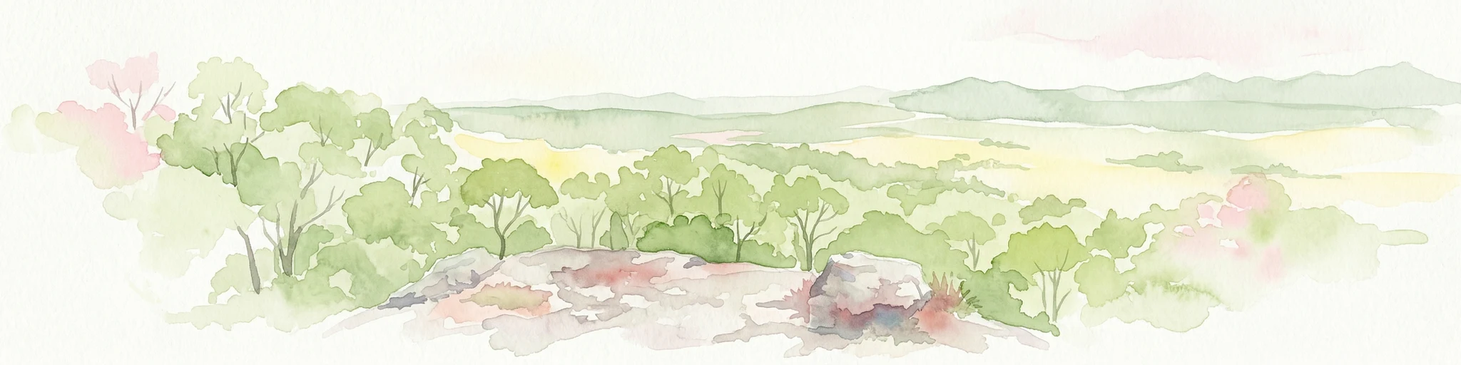
Watercolor illustration showing green trees and distant hills under a pastel sky
National parkQueensland
15 km away#4 closest

Northeast

Eurimbula National Park: Central Queensland's Diverse Coastal Protected Landscape

Explore mapped terrain and protected ecosystem boundaries.

Eurimbula National Park in Queensland is an exceptional example of a protected coastal wilderness, featuring a remarkable array of habitats including mangroves, littoral rainforests, and extensive paperbark wetlands. Its diverse landscape supports significant biodiversity and offers a clear representation of central Queensland's natural heritage. Understanding Eurimbula National Park's geography through its mapped protected area helps situate its ecological importance within the broader Australian atlas.

Area
125 km²
Established
1977
IUCN
II
Relief
Lowland
National parkQueensland
30 km away#5 closest

East

Littabella National Park: Queensland National Park Atlas and Geographic Context

Mapped protected area and natural landscape details.

Littabella National Park offers a distinct perspective on Queensland's protected areas. As a designated national park, its mapped boundaries and geographic setting are crucial for understanding Australia's conservation landscapes. Explore this entity for its regional context, mapped terrain features, and its role within the larger atlas of protected lands.

Area
83.8 km²
Established
1980
IUCN
II
Relief
Lowland
National parkQueensland
32 km away#6 closest

West

Kroombit Tops National Park: Protected Landscape and Queensland Geography Atlas

Explore mapped terrain and regional park context in Australia.

This entry for Kroombit Tops National Park details its role as a protected natural area within Queensland, Australia. Users can engage with its geographic setting, understand its mapped boundaries, and explore its place within the regional landscape. This resource supports discovery through an atlas lens, focusing on the park's specific terrain and its contribution to the broader protected areas of northeastern Australia. It is designed for users interested in the geographic identity and mapped context of natural conservation areas.

Area
74.6 km²
Established
1974
IUCN
II
Relief
Upland
Marine protected areaQueensland
33 km away#7 closest

Northwest

Great Barrier Reef Marine Park: Atlas and Geographic Context for Queensland Protected Waters

Exploring the reef system and marine conservation zones in northeastern Australia

The Great Barrier Reef Marine Park stands as an internationally significant marine protected area. By spanning a massive stretch of the Queensland coast, this protected landscape provides a critical framework for marine governance and reef conservation. Users can examine the unique zoning and distribution of coral reef habitats that define this extensive tropical ecosystem.

Area
343,966 km²
Established
1975
Climate
Tropical
Scope
Marine
National parkQueensland
34 km away#8 closest

North

Wild Cattle Island National Park: Queensland National Park and Protected Landscape Discovery

Mapped boundaries and regional geographic context for exploration.

Wild Cattle Island National Park, situated in Queensland, Australia, is identified as a national park focused on preserving its natural landscape. This page provides a detailed view of its protected area status and geographic placement within the broader Australian context. Users can explore the park's specific mapped boundaries and its relation to Queensland's diverse terrain, supporting structured discovery for those interested in protected lands and their regional atlas representation.

Area
5.8 km²
Established
1992
IUCN
II
Relief
Lowland

Common questions about visiting, size, designation, and location context for Bulburin National Park

Bulburin National Park FAQs for park facts, access, geography, and protected area context

Find quick answers about Bulburin National Park, including protected-area facts, park geography, trail and visitor context, and how the park fits into its surrounding country and regional landscape.
MoriAtlas Explorer

Continue Your Protected Areas Search Across the Global Atlas

Deepen your exploration by continuing the structured search for national parks and protected areas worldwide. Utilize the comprehensive filtering capabilities to compare different conservation landscapes and refine your understanding of global park geography. Discover more about the distribution and characteristics of protected natural areas.

Global natural geography
