Por qué destaca Parque Nacional de Chimanimani
El Parque Nacional de Chimanimani es conocido principalmente por proteger el pico más alto de Mozambique, el Monte Binga, y el ecosistema de tierras altas más significativo del país. El parque forma el núcleo del Parque Transfronterizo Chimanimani, una iniciativa de conservación transfronteriza con Zimbabue que permite la protección de un paisaje montañoso continuo que trasciende las fronteras nacionales. El área alberga especies raras, incluido el acentor de cabeza roja y el murciélago de Welwitsch, y conserva un importante patrimonio cultural a través de pinturas rupestres y prácticas tradicionales mantenidas por las comunidades locales.
Historia de Parque Nacional de Chimanimani y cronología del área protegida
La zona de Chimanimani ha sido reconocida por su potencial de conservación desde mediados del siglo XX, con el establecimiento de las reservas forestales de Moribane, Mpunga y Maronga en 1953 para proteger porciones del ecosistema circundante de bosque montano. Estas primeras áreas protegidas sentaron las bases para un reconocimiento más amplio de la conservación de la región. En 2003, la zona montañosa central fue designada como reserva nacional, proporcionando protección formal a las montañas de Chimanimani y sus ecosistemas únicos. La transición de reserva a parque nacional en 2020 reflejó tanto la gestión exitosa del área como el compromiso de Mozambique de expandir su red de parques nacionales totalmente protegidos. Esta progresión representa una tendencia más amplia en la política de conservación mozambiqueña hacia el fortalecimiento de los marcos de áreas protegidas y el aumento de la representatividad ecológica del sistema de parques de la nación.
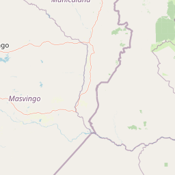
Paisaje y carácter geográfico de Parque Nacional de Chimanimani
Las Montañas de Chimanimani forman un dramático paisaje de tierras altas caracterizado por escarpadas cordilleras, profundos valles y formaciones rocosas expuestas. El Monte Binga, el pico dominante con 2.436 metros, se eleva prominentemente sobre el terreno circundante y sirve como un punto de referencia geográfico visible en gran parte del este de Mozambique. El paisaje montañoso transita de pastizales subalpinos y afloramientos rocosos en las elevaciones más altas, a través de matorrales ericoides cada vez más boscosos, hasta bosques y selvas de menor altitud en las zonas de amortiguación circundantes. La proximidad del parque a la frontera con Zimbabue crea un paisaje donde la división montañosa sirve tanto de corredor biológico como de frontera internacional. Varios ríos se originan en estas tierras altas, fluyendo hacia afuera para desembocar en sistemas fluviales más amplios que atraviesan las tierras bajas circundantes. La combinación de altitud, diversidad geológica y la yuxtaposición de diferentes zonas de vegetación crea un paisaje visualmente distintivo dentro del contexto del sur de África.
Ecosistemas, hábitats y flora de Parque Nacional de Chimanimani
El parque protege un ecosistema montano que representa una de las áreas ecológicamente más significativas de Mozambique. Las Montañas de Chimanimani forman un punto caliente de biodiversidad donde se cruzan especies de las regiones florísticas del sur de África, África Oriental y Afrotropical. La vegetación varía con la altitud, presentando pastizales y comunidades de brezales en las altitudes más altas, que transitan a través de matorrales ericoides hasta un bosque continuo en las laderas bajas y valles. Las reservas forestales incorporadas al área de protección más amplia, incluidas Moribane, Mpunga, Maronga y Zomba, contienen parte de la última cobertura forestal importante que queda en el este de Mozambique. Estos bosques montanos albergan altos niveles de endemismo y proporcionan hábitats críticos para especies adaptadas a las condiciones frescas y húmedas de los entornos de alta elevación. La presencia de especies raras como el acentor de cabeza roja y el murciélago de Welwitsch indica la importancia ecológica de estos hábitats y la significancia de su protección.
Vida silvestre y especies destacadas de Parque Nacional de Chimanimani
La fauna del Parque Nacional de Chimanimani refleja la diversidad de hábitats presentes en el paisaje montañoso. Los bosques montanos y pastizales albergan una variedad de especies de aves, incluyendo el papamoscas cabecirrojo, que habita en el sotobosque de las zonas boscosas. El murciélago de Welwitsch, una especie que lleva el nombre del célebre botánico austriaco Friedrich Welwitsch, ocupa lugares de descanso dentro del entorno forestal. Más allá de estas especies mencionadas específicamente, las variadas zonas de elevación y los tipos de hábitat sustentan diversas comunidades de mamíferos y aves, típicas de los ecosistemas de las tierras altas de África meridional. El contexto transfronterizo con el parque adyacente de Zimbabue permite el posible movimiento de especies a través de la frontera internacional, lo que apoya el intercambio genético entre poblaciones y mantiene los procesos ecológicos que operan a escalas espaciales más grandes. Las reservas forestales circundantes aportan una complejidad de hábitat adicional y aumentan el valor de conservación general del paisaje protegido más amplio.
Estado de conservación y prioridades de protección de Parque Nacional de Chimanimani
El Parque Nacional de Chimanimani representa una piedra angular de la red de áreas protegidas de Mozambique, particularmente para la protección de ecosistemas de tierras altas y montanos. La transición de reserva nacional a parque nacional en 2020 demuestra el creciente énfasis en la gestión eficaz de la conservación y el reconocimiento de la importancia ecológica del área. La inclusión de múltiples reservas forestales dentro del marco de protección más amplio, incluidas áreas establecidas en 1953, indica un compromiso a largo plazo para mantener la cobertura forestal y los servicios ecológicos que proporcionan estos ecosistemas. El acuerdo transfronterizo con Zimbabue crea oportunidades para una gestión coordinada de la conservación a través de un límite internacional, lo que permite una protección más eficaz de las especies y los procesos ecológicos que operan más allá de las jurisdicciones administrativas de un solo país. La zona de amortiguación del parque, de 1.723 kilómetros cuadrados, proporciona espacio adicional para los procesos ecológicos y ayuda a proteger el área central de las presiones humanas en los paisajes circundantes.
Significado cultural y contexto humano de Parque Nacional de Chimanimani
La zona de Chimanimani tiene una importancia cultural significativa para las comunidades locales que han habitado la región durante generaciones. Los residentes locales conservan pinturas rupestres que representan evidencia tangible de la presencia humana en este paisaje a lo largo de períodos de tiempo prolongados. Estas expresiones artísticas, junto con antiguas tradiciones y creencias, contribuyen a la identidad cultural del área y crean una conexión significativa entre las comunidades contemporáneas y los paisajes que habitan. La preservación de estos elementos culturales dentro del marco del parque nacional reconoce que las áreas protegidas en Mozambique, al igual que en otros lugares, existen dentro de paisajes culturales humanos en lugar de ser áreas naturales aisladas divorciadas de la historia y la práctica humana.
Lugares imprescindibles y vistas destacadas de Parque Nacional de Chimanimani
El Parque Nacional de Chimanimani ofrece la experiencia de naturaleza salvaje de tierras altas más accesible de Mozambique, anclada en la oportunidad de visitar el pico más alto del país en el Monte Binga. El estatus transfronterizo del parque con Zimbabue crea un área protegida internacional única en el sur de África, que ofrece oportunidades para la conservación internacional coordinada. El paisaje montañoso proporciona un escenario espectacular, distinto del terreno costero y de las tierras bajas más típico de Mozambique, mientras que las reservas forestales circundantes añaden profundidad ecológica al área protegida. La presencia de pinturas rupestres y prácticas culturales tradicionales mantenidas por las comunidades locales añade una dimensión humana a los valores naturales del parque.
Mejor época para visitar Parque Nacional de Chimanimani
La mejor época para visitar el Parque Nacional de Chimanimani es durante la estación seca, de abril a octubre, cuando las precipitaciones son mínimas y las condiciones de los senderos son más favorables para explorar el terreno montañoso. Durante este período, la visibilidad suele ser excelente y las oportunidades de observar la fauna se ven mejoradas, ya que los animales se concentran en las fuentes de agua restantes. Las temperaturas más frescas en las altitudes más elevadas durante los meses de invierno, de junio a agosto, hacen que este sea un período especialmente cómodo para el senderismo y la exploración. La estación húmeda, de noviembre a marzo, trae consigo mayores precipitaciones a las montañas, lo que puede hacer que los senderos sean resbaladizos y el acceso más difícil, aunque el paisaje se vuelve verde y el caudal de las cascadas aumenta.