Por qué destaca Parque Nacional de las Aguas Termales de Mado
El Parque Nacional de las Aguas Termales de Mado es conocido principalmente por su manantial geotérmico, valorado tradicionalmente por sus propiedades medicinales y terapéuticas. La piscina natural de agua caliente en el centro del parque atrae a visitantes que buscan los supuestos beneficios para la salud de sus aguas termales ricas en minerales. La combinación del manantial, la piscina natural y las instalaciones de un complejo turístico desarrollado crea un área protegida distintiva que combina la preservación de los recursos naturales con el uso recreativo para el bienestar.
Historia de Parque Nacional de las Aguas Termales de Mado y cronología del área protegida
El Parque Nacional Aguas Termales de Mado fue establecido el 25 de septiembre de 1939, mediante la Proclamación No. 456 emitida por el gobierno nacional. Esta designación puso las aguas termales y las tierras circundantes bajo protección formal como parque nacional, convirtiéndolo en una de las primeras áreas protegidas establecidas en Filipinas durante el período colonial estadounidense. La proclamación reconoció tanto la importancia natural como el valor recreativo del área de las aguas termales. A lo largo de las décadas, el parque ha sido administrado por el Departamento de Medio Ambiente y Recursos Naturales como parte del sistema nacional de áreas protegidas. La continuidad histórica del estatus de protección del parque abarca múltiples administraciones políticas y ha proporcionado un reconocimiento continuo del carácter especial del recurso geotérmico dentro del marco de protección ambiental filipino.
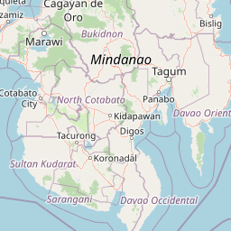
Paisaje y carácter geográfico de Parque Nacional de las Aguas Termales de Mado
El paisaje del Parque Nacional de las Aguas Termales de Mado se caracteriza por sus características geotérmicas en lugar de un relieve topográfico dramático. El terreno en el área circundante consiste en tierras onduladas suaves, típicas de la cuenca central de Mindanao, utilizadas principalmente con fines agrícolas. En el núcleo del parque, el manantial termal crea un paisaje distintivo donde el agua mineral tibia brota a la superficie para formar una piscina natural. El área alrededor del manantial ha sido desarrollada con infraestructura básica para acomodar a los visitantes, incluido un complejo turístico de salud. A diferencia de las áreas protegidas montañosas o boscosas, el paisaje de este parque está definido por sus características geológicas e hidrológicas, y las aguas termales crean un entorno ambiental único dentro del paisaje tropical más amplio de Maguindanao.
Ecosistemas, hábitats y flora de Parque Nacional de las Aguas Termales de Mado
La naturaleza del Parque Nacional de las Aguas Termales de Mado está definida principalmente por su entorno geotérmico, en lugar de los ecosistemas terrestres más típicos de los parques de bosques montañosos. El sistema de manantiales termales crea un hábitat único caracterizado por agua cálida que emerge de fuentes subterráneas. Las aguas termales contienen minerales que contribuyen a la reputación terapéutica del manantial. El área circundante del parque incluye vegetación tropical típica del entorno de tierras bajas de Mindanao. Si bien el parque no es conocido principalmente por la conservación de la biodiversidad, su estatus protegido ayuda a preservar el sistema de aguas termales y sus alrededores inmediatos. La naturaleza geotérmica del sitio representa una categoría distinta de área protegida dentro del paisaje filipino, preservando una característica geológica de importancia natural.
Estado de conservación y prioridades de protección de Parque Nacional de las Aguas Termales de Mado
El Parque Nacional de las Aguas Termales de Mado contribuye a la red de áreas protegidas de Filipinas bajo la Categoría II de la UICN, lo que refleja su designación como parque nacional centrado en la protección y preservación del ecosistema. Aunque la importancia principal del parque radica en su recurso geotérmico más que en la biodiversidad, el estatus de protegido garantiza que el sistema de aguas termales y las tierras circundantes permanezcan a salvo de presiones de desarrollo que de otro modo podrían degradar el recurso. La designación de parque nacional proporciona un marco para la gestión continua por parte del Departamento de Medio Ambiente y Recursos Naturales y garantiza que el manantial termal terapéutico siga estando disponible para las generaciones presentes y futuras. El parque representa un ejemplo temprano de protección ambiental filipina, establecido cuando el concepto de parques nacionales aún era relativamente nuevo en el país.
Significado cultural y contexto humano de Parque Nacional de las Aguas Termales de Mado
El Parque Nacional de las Aguas Termales de Mado se encuentra en Maguindanao del Norte, una provincia de la Región Autónoma de Bangsamoro en Mindanao Musulmana. La región circundante está habitada predominantemente por el pueblo Maguindanao, un importante grupo étnico musulmán en Filipinas con profundas tradiciones culturales ligadas a la tierra. Es probable que el manantial haya tenido importancia para las comunidades locales durante generaciones, y las propiedades terapéuticas de las aguas cálidas forman parte del conocimiento y las prácticas tradicionales. El área existe dentro de un paisaje cultural más amplio donde la agricultura y el asentamiento han moldeado la relación ser humano-medio ambiente a lo largo de los siglos. El establecimiento del parque en 1939 ocurrió en un contexto colonial, pero se basó en el reconocimiento local de las cualidades especiales del manantial.
Lugares imprescindibles y vistas destacadas de Parque Nacional de las Aguas Termales de Mado
El principal atractivo del Parque Nacional de las Aguas Termales de Mado es su manantial terapéutico, que produce aguas cálidas ricas en minerales que los visitantes han utilizado durante generaciones por sus supuestos beneficios para la salud. La piscina natural formada por el manantial ofrece una experiencia de baño única dentro de un entorno natural protegido. La importancia histórica del parque como uno de los primeros parques nacionales de Filipinas, establecido en 1939, añade profundidad a su identidad más allá del simple valor recreativo. La accesibilidad desde la ciudad de Cotabato y la proximidad al aeropuerto de Awang lo convierten en una atracción natural conveniente para los viajeros del centro de Mindanao.
Mejor época para visitar Parque Nacional de las Aguas Termales de Mado
El Parque Nacional de las Aguas Termales de Mado puede visitarse durante todo el año, dada su ubicación en el clima tropical de Mindanao. El manantial ofrece una atracción constante independientemente de la estación, ya que las cálidas aguas no dependen de las precipitaciones estacionales ni de las variaciones de temperatura. La estación seca, de marzo a mayo, suele ofrecer un clima más predecible para las actividades al aire libre, mientras que la estación húmeda, de junio a febrero, trae consigo lluvias ocasionales que pueden afectar la planificación de las visitas. Los visitantes que busquen baños termales pueden encontrar la experiencia consistente durante todo el año, aunque siempre es recomendable consultar las condiciones locales antes de viajar.