Mori Atlas logo
National parkNyerere National Park

Discover the geographic scope and mapped boundaries of this expansive national park in Tanzania.

Nyerere National Park: Tanzania's Vast Protected Landscape and Premier Wildlife Sanctuary

Nyerere National Park, Tanzania's largest national park, stands as a vast protected sanctuary covering approximately 30,893 square kilometers in southeastern Tanzania. This expansive territory, largely unaltered by human activity, encompasses diverse ecosystems defined by the mighty Rufiji River system, its extensive delta mangrove forests, and classic savanna landscapes. As a premier destination for atlas exploration, the park offers a unique perspective on regional geography and protected area distribution within East Africa.

national parkwildlife sanctuarysavanna ecosystemriver deltabig fiveendangered species

Nyerere National Park

National park

Park overview

Structured park overview, official facts, and landscape profile for Nyerere National Park

Nyerere National Park park facts, protected area profile, and essential visitor context
Review the core facts for Nyerere National Park, including designation, size, terrain, visitor scale, habitats, and operating context in one park-focused overview.

About Nyerere National Park

Nyerere National Park represents Tanzania's commitment to preserving some of East Africa's most significant wilderness areas. Located in the southeastern part of the country, the park encompasses a diverse landscape that includes riverine forests, savanna grasslands, woodland habitats, and coastal mangrove systems. The park's creation in 2019 marked a significant expansion of Tanzania's national park system, elevating protection status for a critical wildlife corridor that had previously been managed as a game reserve. The decision to establish a dedicated national park was driven by the need to enhance tourism development and strengthen conservation protections in the face of persistent poaching pressures. The park remains largely undeveloped, with extensive areas existing in a completely wild state that has not been significantly altered by human activities.

Quick facts and research context for Nyerere National Park

Nyerere National Park covers 30,893 square kilometers in southeastern Tanzania, making it the country's largest national park and one of the biggest protected areas in Africa. The park was established in 2019 through the excision of the northern section of Selous Game Reserve and is named after Julius Nyerere, Tanzania's first president. The park encompasses portions of four administrative regions and is characterized by the Rufiji River, which flows through its center. The area supports exceptional biodiversity with populations of lions, leopards, giraffes, wildebeest, zebras, black rhinos, and notably large herds of endangered African wild dogs.

Park context

Deeper park guide and search-rich context for Nyerere National Park

Nyerere National Park history, landscape, wildlife, and travel context
Explore Nyerere National Park through its history, landscape character, ecosystems, wildlife, conservation priorities, cultural context, and seasonal travel timing in a structured park guide built for atlas discovery and search intent.

Why Nyerere National Park stands out

Nyerere National Park is most renowned for its substantial population of endangered African wild dogs, which represent one of the park's most significant conservation assets. The park is also celebrated for its dramatic river ecosystems centered on the Rufiji River, one of Tanzania's most important water systems, which harbors large populations of Nile crocodiles and hippopotamuses. The park's vast savanna landscapes support classic African megafauna including lions, leopards, Masai giraffes, and substantial herds of wildebeest and plains zebra. The delta region of the Rufiji River contains one of the world's largest mangrove forests, creating a unique marine-coastal ecosystem within the protected area.

Nyerere National Park history and protected-area timeline

The origins of Nyerere National Park trace to the establishment of Selous Game Reserve in 1896, when the German Governor of Tanganyika proclaimed this vast area as a protected wildlife hunting reserve. In 1922, the reserve was formally named after Frederick Selous, a prominent big game hunter who later became a wildlife conservationist. For more than a century, the Selous Game Reserve served as one of Africa's most significant protected wilderness areas. In 2019, the Government of Tanzania decided to excise the northern portion of the reserve to form a new national park, officially named Nyerere National Park in honor of Mwalimu Julius Kambarage Nyerere, the first President of Tanzania. This designation elevated the area's protection status and placed it under the administration of the Tanzania National Parks Authority, aligning it with the country's other national parks and bringing enhanced management resources and tourism infrastructure.

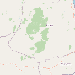
Nyerere National Park landscape and geographic character

The physical landscape of Nyerere National Park is defined by the presence of the Rufiji River, Tanzania's largest river, which flows through the heart of the protected area. The river system creates a complex network of channels, floodplains, and islands that support diverse habitats throughout the park. The Rufiji River delta, where the river meets the Indian Ocean, contains one of the largest mangrove forest systems in the world, representing a unique coastal ecosystem within the park's boundaries. The surrounding terrain consists primarily of savanna grasslands and woodland habitats, with areas of denser forest along the river corridors. The park's vast extent encompasses a variety of topographical features including plains, rolling hills, and marshland areas that are seasonally flooded.

Nyerere National Park ecosystems, habitats, and plant life

The ecological character of Nyerere National Park encompasses a remarkable diversity of habitats that support significant populations of Africa's most iconic wildlife species. The park's riverine ecosystems, centered on the Rufiji River system, create productive environments that sustain large concentrations of aquatic and semi-aquatic species. The mangrove forests at the river delta represent an internationally significant coastal habitat that supports marine life, provides critical breeding grounds for fish species, and serves as a buffer against coastal erosion. The savanna and woodland habitats that dominate the park's interior support the movement of large herbivore herds and provide hunting territories for apex predators. The combination of protected river systems, extensive wetlands, and intact savanna landscapes makes this area one of Tanzania's most ecologically significant protected areas.

Nyerere National Park wildlife and species highlights

Nyerere National Park supports exceptional wildlife diversity with populations of most iconic African species present within its boundaries. The park is home to significant populations of lions and leopards, the large predators that define the African safari experience. Herds of Masai giraffes move through the savanna alongside massive aggregations of wildebeest and plains zebra during seasonal migrations. Black rhinoceroses, though reduced in numbers from historical populations, remain present in the park. The Rufiji River harbors one of Tanzania's largest concentrations of hippopotamuses and Nile crocodiles, creating spectacular wildlife viewing opportunities along the water's edge. The park is particularly notable for its population of endangered African wild dogs, which represent a flagship conservation species. Additional species include impala, Thomson's gazelle, spotted hyenas, and diverse assemblages of birds, reptiles, amphibians, and smaller mammals.

Nyerere National Park conservation status and protection priorities

Nyerere National Park carries significant conservation importance as Tanzania's largest national park and a critical stronghold for East Africa's wildlife populations. The park's designation as a national park in 2019 reflected the Tanzanian government's commitment to strengthening protections for this wilderness area, particularly in response to severe poaching pressures that dramatically reduced elephant and rhino populations in recent decades. Historical elephant populations in the region exceeded 100,000 individuals in the mid-1970s, but declined by approximately 66 percent between 2009 and 2013, leaving only around 13,000 animals. The elevation to national park status provides enhanced enforcement capabilities and conservation resources through the Tanzania National Parks Authority. The park also contributes to the protection of the Rufiji River ecosystem and its extensive mangrove forests, which represent globally significant coastal habitats.

Nyerere National Park cultural meaning and human context

Nyerere National Park is named in honor of Mwalimu Julius Kambarage Nyerere, Tanzania's first President, who led the country from independence in 1961 until his retirement in 1985. The naming reflects the park's significance within Tanzania's national identity and the government's recognition of wilderness preservation as a core national priority. The park occupies traditional lands that have been inhabited by local communities for generations, and the establishment of the protected area has implications for local communities who historically relied on the land for pastoral and agricultural activities. The park is located in a region of southeastern Tanzania that has experienced relatively limited development compared to other parts of the country, allowing for the preservation of extensive natural landscapes in their near-pristine condition.

Top sights and standout views in Nyerere National Park

The Rufiji River and its delta represent one of Nyerere National Park's most distinctive features, offering opportunities for boat-based wildlife viewing and access to one of the world's largest mangrove forest systems. The park's population of endangered African wild dogs provides exceptional wildlife viewing opportunities for visitors seeking to observe these elusive predators. The vast savanna landscapes support dramatic wildlife interactions including predator-prey encounters and seasonal migrations of wildebeest and zebra herds. The park's relative remoteness and limited development compared to Tanzania's more famous northern parks offer a wilder, more off-the-beaten-path safari experience.

Best time to visit Nyerere National Park

The optimal time to visit Nyerere National Park is during the dry season from June to October, when wildlife congregates around water sources and vegetation is less dense, making animal spotting easier. The dry season coincides with cooler temperatures and lower humidity, enhancing visitor comfort during game drives. Thewet season from November to May brings lush green landscapes and excellent birdwatching opportunities, though some areas may become difficult to access due to flooding. The park can be visited year-round, though the dry season months generally offer the most reliable wildlife viewing experiences.

Park location guide

Geography guide, regional context, and park location map for Nyerere National Park

Nyerere National Park park geography, regions, and map view in Tanzania
Understand where Nyerere National Park sits in Tanzania through a broader geographic reading of the surrounding landscape, nearby location context, and its mapped position within the national park landscape.

How Nyerere National Park fits into Tanzania

Tanzania, officially the United Republic of Tanzania, is a presidential republic in East Africa within the African Great Lakes region. It was formed in 1964 through the unification of Tanganyika and Zanzibar. The country is known for its diverse wildlife, national parks including Serengeti and Ngorongoro, and significant archaeological sites with important hominid fossils.

Wider geography shaping Nyerere National Park in Tanzania

Tanzania is located in East Africa within the African Great Lakes region. It is bordered by Uganda to the northwest, Kenya to the northeast, the Indian Ocean to the east, Mozambique and Malawi to the south, Zambia to the southwest, and Rwanda, Burundi, and the Democratic Republic of the Congo to the west. The country includes the mainland and the Zanzibar Archipelago.

Map view of Nyerere National Park

Use this park location map to pinpoint Nyerere National Park in Tanzania, understand its exact geographic position, and read its mapped placement within the surrounding landscape more clearly.

Pigeon | © OpenStreetMap contributors

Location context for Nyerere National Park

Lindi RegionMorogoro Region
Park atlas

Map surrounding protected areas and compare their geography, extending outward from Nyerere National Park.

Explore Related National Parks and Protected Areas Near Nyerere National Park, Tanzania
Continue your exploration of Tanzania's protected areas after Nyerere National Park, browsing a curated list of nearby national parks and significant protected landscapes. A geographic lens helps compare diverse terrains, river systems, and savanna ecosystems, highlighting the regional spread of conservation efforts.
National parkMorogoro Region

Mikumi National Park: East African Savannah Protected Landscape in Morogoro Region

Mapped boundaries and regional geography for a key Tanzanian national park.

Mikumi National Park, a vital protected area in Tanzania's Morogoro Region, offers a classic savannah experience with iconic baobab trees and diverse wildlife populations. This national park is distinguished by its extensive alluvial plains, shaped by the Mkata River basin, and its significant role as a wilderness corridor connecting with the larger Selous Game Reserve. The park's terrain includes Malundwe Mountain and views of the Uluguru Mountains, providing a rich geographic backdrop for understanding East African protected lands and their atlas-style distribution.

Area
3,230 km²
Established
1964
IUCN
II
Nature reserveMozambique

Niassa Reserve Nature Reserve: Mozambique's Expansive Protected Wilderness

Mapping the vast miombo woodlands and endemic species.

Niassa Reserve, a sprawling nature reserve in northern Mozambique, represents one of the largest miombo woodland ecosystems on Earth. Its diverse terrain encompasses dense forests, open savannahs, and riparian zones, making it a vital habitat for unique wildlife and a significant landmark in regional geography. The reserve's protected status and immense scale offer unparalleled opportunities for atlas-style exploration of its landscape and conservation importance.

Area
42,000 km²
Established
1954
IUCN
IV
National parkCabo Delgado Province

Quirimbas National Park: Coastal Protected Landscape and Island Archipelago Atlas

Discover marine conservation and inselberg terrain in Cabo Delgado.

Quirimbas National Park, located in Cabo Delgado Province, Mozambique, is a key protected area defined by its exceptional combination of marine and terrestrial environments. The park's geography includes eleven islands, extensive mangrove forests, and vibrant coral reefs, alongside a mainland characterized by striking inselberg formations. This national park is a vital site for understanding coastal landscape diversity, marine ecosystems, and protected-area geography within East Africa.

Area
1,430 km²
Established
1971
IUCN
II
National parkKenya

Kisite-Mpunguti Marine National Park: Kenya's Coastal Protected Marine Landscape

Mapped coral reefs and diverse marine ecosystems.

As Kenya's foremost marine national park, Kisite-Mpunguti Marine National Park presents an unparalleled opportunity to explore a thriving underwater world. Its protected boundaries encompass remarkable coral formations and a rich tapestry of marine species, including diverse fish populations, sea turtles, and dolphins. This park is a cornerstone of coastal conservation, offering valuable insights into marine geography and ecosystem health for those seeking detailed landscape context.

Area
39 km²
Established
1973
IUCN
II
Relief
Lowland
National parkTanzania

Mkomazi National Park: Tanzania's Vast Protected Savanna Landscape and Wildlife Geography

Explore its mapped terrain and conservation significance within East Africa.

Mkomazi National Park is a critical protected landscape in Tanzania, spanning over 3,200 square kilometers of classic East African semi-arid savanna woodland. This national park offers a unique atlas-style view into conservation success, particularly for its black rhinoceros sanctuary and African wild dog programs. Its landscape is characterized by rolling terrain and Acacia-Commiphora vegetation, forming a vital transboundary conservation area with Kenya that supports significant wildlife migration corridors and provides a distinct geographic context within the broader regional atlas.

Area
3,234 km²
Established
2006
IUCN
II
National parkMalawi

Lake Malawi National Park: UNESCO Protected Landscape and Endemic Fish Habitat

Discover mapped terrain, island geography, and evolutionary wonders.

Lake Malawi National Park offers unparalleled insight into freshwater biodiversity and landscape dynamics within Malawi's Great Rift Valley. As a UNESCO World Heritage Site, it is celebrated for its spectacular evolutionary radiation of cichlid fish, a phenomenon studied globally. The park's protected territory includes the mountainous Nankumbu Peninsula and thirteen islands, providing a rich context for understanding the interplay between aquatic ecosystems, terrestrial terrain, and unique island geography.

Area
94 km²
Established
1980
IUCN
II
National parkArusha Region

Lake Manyara National Park: Protected Landscape & Rift Valley Geography in Arusha Region

Unique habitats from groundwater forests to alkaline lake shores.

Lake Manyara National Park is a distinct protected landscape situated within the Great Rift Valley of Tanzania's Arusha Region. The park's geography is shaped by the imposing escarpment wall and the alkaline Lake Manyara, creating a mosaic of habitats including rare groundwater forests, acacia woodlands, and saline grasslands. Its unique environment supports diverse wildlife and offers a prime example of regional landscape context and protected area dynamics.

Area
648 km²
Established
1960
IUCN
II
Visitors
178.5K annual
National parkCentral Region

Kasungu National Park: Protected Landscape and Central Region Geography Details

Explore the mapped boundaries and protected area identity.

Kasungu National Park is a protected natural area in Malawi's Central Region, serving as a vital point for geographic study and atlas-driven exploration. This entry focuses on understanding the park's specific identity as a national park, detailing its mapped boundaries and the surrounding regional geography. Users can gain insight into the landscape context and protected-area characteristics that define Kasungu National Park, enriching their understanding of Malawi's natural heritage.

Area
2,316 km²
Established
1970
IUCN
II

Common questions about visiting, size, designation, and location context for Nyerere National Park

Nyerere National Park FAQs for park facts, access, geography, and protected area context
Find quick answers about Nyerere National Park, including protected-area facts, park geography, trail and visitor context, and how the park fits into its surrounding country and regional landscape.
MoriAtlas Explorer

Continue Your Protected Areas Search Across the Global Atlas

Deepen your exploration by continuing the structured search for national parks and protected areas worldwide. Utilize the comprehensive filtering capabilities to compare different conservation landscapes and refine your understanding of global park geography. Discover more about the distribution and characteristics of protected natural areas.

Global natural geography