Mori Atlas logo
National parkSerpentine National Park

Discover the mapped geography and natural terrain of this significant national park near Perth.

Serpentine National Park: Waterfall & Wildflower Protected Landscape in Western Australia

Serpentine National Park offers a unique protected landscape within Western Australia, celebrated for its namesake cascading waterfalls and spectacular spring wildflower displays. Situated on the Darling Scarp, this national park presents an accessible opportunity to explore undulating terrain, jarrah forests, and the striking Serpentine Falls, making it a key destination for geographic discovery near Perth.

WaterfallJarrah ForestWildflower DisplayWestern AustraliaDarling RangeNational Park

Serpentine National Park

National park

Park overview

Structured park overview, official facts, and landscape profile for Serpentine National Park

Serpentine National Park park facts, protected area profile, and essential visitor context
Review the core facts for Serpentine National Park, including designation, size, terrain, visitor scale, habitats, and operating context in one park-focused overview.

About Serpentine National Park

Serpentine National Park occupies a prominent position in the Darling Range, protecting a section of the Serpentine River as it descends from the upland plateau toward the Swan Coastal Plain. The park's main attraction, Serpentine Falls, comprises a series of cascading drops through a forested gorge, with a large pool at the base that has long served as a recreation area for Perth residents. The surrounding landscape features open jarrah and marri woodland on laterite-derived soils, with dense shrub understory that flourishes in spring. The park's boundary encompasses the Serpentine Dam, a major water storage facility managed by the Water Corporation, creating an unusual juxtaposition of protected natural area with infrastructure. The park was proclaimed in 1957 and has been expanded several times since, most notably in the 2000s when additional land to the north of the Serpentine River was incorporated, including areas formerly managed as State Forest and Regional Parks by the local shire. This expansion connected previously separated conservation parcels into a more coherent protected landscape.

Quick facts and research context for Serpentine National Park

Serpentine National Park sits on the Darling Scarp, an elevated geological plateau forming part of the Perth region's eastern hill country. The park protects the upper catchment of the Serpentine River and its prominent waterfall system. The area supports jarrah and marri forest communities on lateritic soils typical of the southwestern Australian landscape. The park was expanded northward in the 2000s through incorporation of former state forest and regional parkland. The park overlaps the North Dandalup Important Bird Area, recognizing its significance for bird conservation.

Park context

Deeper park guide and search-rich context for Serpentine National Park

Serpentine National Park history, landscape, wildlife, and travel context
Explore Serpentine National Park through its history, landscape character, ecosystems, wildlife, conservation priorities, cultural context, and seasonal travel timing in a structured park guide built for atlas discovery and search intent.

Why Serpentine National Park stands out

Serpentine National Park is best known for its namesake waterfall, a multi-tiered cascade that creates a popular swimming and photography destination. The park is also celebrated for its spectacular spring wildflower displays, when the understory bursts into color with numerous orchid species including spider orchids and greenhoods, alongside triggerplants, giant sundew, dryandras and grevilleas. The combination of accessible waterfall scenery with outstanding botanical displays makes this park a distinctive nature destination within the Perth region.

Serpentine National Park history and protected-area timeline

Serpentine National Park was officially proclaimed in 1957, establishing formal protection for the Serpentine Falls area and surrounding bushland. The park's creation reflected growing post-war interest in conserving Western Australia's natural landscapes near population centres. In the mid to late 2000s, the park underwent significant expansion to the north of the Serpentine River, incorporating land that had previously been managed as State Forest and Regional Parks by the Shire of Serpentine Jarrahdale, as well as land under the management of the Water Corporation. This consolidation brought the total area to its current extent of 4,387 hectares. The Gooralong Camping and Day Use Area was closed in the mid-2000s as part of these management changes. The park continues to be managed by the WA Department of Parks and Wildlife as part of the state's protected area network.

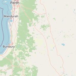
Serpentine National Park landscape and geographic character

The park sits on the Darling Scarp, a steep geological escarpment forming the eastern margin of the Swan Coastal Plain. The terrain is characterized by laterite-capped ridges and valleys, with the Serpentine River cutting a prominent course through the landscape. The river descends via a series of waterfalls, with Serpentine Falls being the most prominent, cascading over granite and laterite steps into a large natural pool. The surrounding terrain supports open woodland of jarrah and marri trees, with a diverse shrub layer. The presence of the Serpentine Dam and smaller Pipehead Dam within the park boundary introduces constructed water bodies into the landscape, though these are largely obscured by surrounding forest when viewed from the falls area.

Serpentine National Park ecosystems, habitats, and plant life

The park's vegetation reflects the southwestern Australian floristic region, supporting jarrah and marri woodland with an understory of shrubs and herbs. The area is notable for its spring wildflower display, when numerous species bloom across the forest floor. Common floral species include several orchid varieties such as spider orchids and greenhoods, along with triggerplants, the carnivorous giant sundew, dryandras and various grevillea species. The diverse plant communities support a range of invertebrate and vertebrate fauna typical of the jarrah forest ecosystem. The park's inclusion within the North Dandalup Important Bird Area highlights its significance for bird conservation in the region.

Serpentine National Park wildlife and species highlights

The jarrah forest environment of Serpentine National Park supports diverse wildlife, though the Wikipedia source provides limited specific species detail. The park's designation as part of the North Dandalup Important Bird Area indicates significance for bird populations, particularly species associated with woodland and forest habitats. The variety of habitats present, from riparian zones around the waterfalls to upland woodland, supports fauna communities typical of the Perth region's bushland areas.

Serpentine National Park conservation status and protection priorities

Serpentine National Park is designated as IUCN Category II, reflecting its status as a national park with primary conservation objectives. The park protects representative samples of Darling Scarp vegetation communities and the Serpentine River catchment. Its inclusion in the North Dandalup Important Bird Area recognizes the site's significance for bird biodiversity conservation. The 2000s expansion increased habitat connectivity and consolidated protection of the upper catchment area. The park's proximity to Perth also serves an important conservation education function, providing residents with accessible natural landscape experience.

Serpentine National Park cultural meaning and human context

The Serpentine National Park area lies within the traditional lands of the Noongar people, the Indigenous custodians of the southwestern Western Australian landscape. While the Wikipedia source does not detail specific cultural heritage information, the park's location on the Darling Scarp places it within a region of significance to Noongar heritage. The Serpentine River and its waterfalls would have held cultural and practical importance for local Indigenous communities historically.

Top sights and standout views in Serpentine National Park

Serpentine Falls remains the park's standout feature, a series of cascading waterfalls on the Serpentine River that create a scenic swimming destination. The spring wildflower season transforms the park's understory with abundant orchid displays and colorful blooming shrubs. The accessible location, less than an hour's drive from Perth, makes this one of the most visited national parks in Western Australia. The combination of waterfall scenery, jarrah forest atmosphere, and botanical displays creates a distinctive nature experience.

Best time to visit Serpentine National Park

The park offers year-round appeal, though spring from September to November represents the most visually spectacular period when wildflowers bloom across the forest floor. Summer months can be warm, making the waterfall pool a popular cooling destination. Autumn and winter bring quieter visitation and different atmospheric qualities as the forest takes on seasonal character. The waterfall flows are most reliable during the winter and spring wet season, though the falls maintain some flow throughout the year.

Park location guide

Geography guide, regional context, and park location map for Serpentine National Park

Serpentine National Park park geography, regions, and map view in Australia
Understand where Serpentine National Park sits in Australia through a broader geographic reading of the surrounding landscape, nearby location context, and its mapped position within the national park landscape.

How Serpentine National Park fits into Australia

Australia is a constitutional monarchy and federal parliamentary democracy comprising six states and ten territories. With a population of nearly 28 million, it is one of the world's most urbanised countries, with most people concentrated on the eastern seaboard. The country has a high Human Development Index and is known for its cultural diversity, ancient Aboriginal heritage, and unique wildlife.

Wider geography shaping Serpentine National Park in Australia

Australia occupies the entire Australian continent, the island of Tasmania, and numerous smaller islands. It is the world's flattest and driest inhabited continent, featuring vast deserts in the interior (the Outback), tropical rainforests along the eastern coast, and a coastline bordering the Indian and Pacific Oceans.

Map view of Serpentine National Park

Use this park location map to pinpoint Serpentine National Park in Australia, understand its exact geographic position, and read its mapped placement within the surrounding landscape more clearly.

Pigeon | © OpenStreetMap contributors

Location context for Serpentine National Park

Western Australia
Park atlas

Explore connected protected landscapes and regional park geography around the Darling Scarp and Perth metropolitan area.

Discover Other National Parks Near Serpentine National Park, Western Australia
Continue your park exploration beyond Serpentine National Park to discover other protected areas, mapping their terrain and conservation features across Western Australia's unique landscapes. Compare regional park geography, trace the spread of protected zones on the Darling Scarp, and find new natural areas for atlas-style browsing and comparison.
National parkPerth metropolitan region

Midgegooroo National Park: Jarrah Forest Protected Landscape and Regional Geography

Explore its mapped boundaries and terrain near Perth.

Midgegooroo National Park offers a distinct protected landscape characterized by its expansive jarrah forest terrain within the Perth metropolitan region. This national park provides valuable context for understanding regional geography, mapped natural features, and the distribution of protected lands. Explore the park's unique topography and conservation boundaries, vital for comprehensive atlas-based geographic discovery.

Area
24.92 km²
Established
2004
IUCN
II
National parkWestern Australia

Korung National Park: Protected Landscape and Map Context in Western Australia

Discover its unique dual bioregion geography.

Korung National Park is a protected national park in Western Australia, noted for its position along the Darling Scarp overlooking the Swan Coastal Plain. This reserve provides accessible natural experiences and showcases the ecological transition between two major southwest Australian bioregions. Its mapped landscapes offer a clear example of regional protected area planning and its importance for biodiversity conservation in the Perth metropolitan area.

Area
63.54 km²
Established
2004
IUCN
II
National parkWestern Australia

Kalamunda National Park: Explore Darling Scarp Woodland & Western Australia's Natural Terrain

A protected national park with distinct mapped landscape features.

Kalamunda National Park is an essential protected area located on the western slopes of the Darling Scarp, offering a clear representation of southwestern Australia's characteristic eucalypt woodland ecosystems. Its geography is defined by the escarpment's terrain, supporting tall marri, jarrah, and wandoo forests with a diverse understorey. As a national park, it provides critical habitat and contributes to the regional landscape context within Western Australia, making it a valuable point for atlas-driven discovery of protected natural areas.

Area
3.75 km²
Established
1964
IUCN
II
National parkWestern Australia

Beelu National Park: Exploring Western Australia's Protected Jarrah-Marri Forest Landscape

Mapped Geographic Context & Natural Terrain Discovery

Beelu National Park, situated in Western Australia's Darling Range, offers an immersive experience within old-growth jarrah-marri forests. This protected area provides a vital glimpse into the region's natural landscapes, characterized by rolling hills and the Helena River valley. Users can explore the park's geographic setting, its mapped boundaries, and the unique ecological context it preserves. It stands as a significant natural reserve contributing to the understanding of Western Australia's conservation efforts and diverse terrain.

Area
46.17 km²
Established
1995
IUCN
II
National parkWestern Australia

Yanchep National Park: Explore Its Unique Limestone Caves and Protected Bushland Geography

Discover the subterranean formations and coastal plain landscapes.

Yanchep National Park offers a singular opportunity for atlas-driven exploration of Western Australia's natural and cultural heritage. Situated on the Swan Coastal Plain, this national park is celebrated for its extensive network of limestone caves, including the notable Crystal Cave, providing a rare glimpse into subterranean geological processes. Beyond its underground wonders, the park encompasses diverse native bushland, supporting iconic koala colonies and offering insights into the region's ecological distinctiveness. Its deep Nyoongar heritage further enriches the understanding of this mapped protected landscape.

Area
28.76 km²
Established
1957
IUCN
II
National parkWestern Australia

Wellington National Park: Protected Jarrah Forest & Collie River Landscape

Explore the mapped boundaries and regional geography.

Wellington National Park offers a deep dive into Western Australia's protected landscapes, characterized by extensive old-growth jarrah forests and the scenic Collie River valley. This national park provides a vital study of the region's unique geography, mapped terrain, and ecological significance within the Yilgarn craton. Understand the park's protected area identity and its place in the wider natural context of Western Australia through its detailed landscape features.

Area
170 km²
Established
2000
IUCN
II
National parkSouth West

Yelverton National Park: South West Australia's Biodiversity Conservation Area

Mapped protected lands and regional landscape context.

Yelverton National Park offers a focused look at a protected area in Western Australia's South West, distinguished by its commitment to rare species and varied vegetation. Established from former timber reserve lands, it serves as a crucial habitat refuge. The park's geography exemplifies the ecological richness of the South-West Australian forest region, providing valuable context for understanding protected landscape distribution and conservation efforts within the mapped terrain.

Area
7.29 km²
Established
2004
IUCN
II
National parkSouth West

Wiltshire-Butler National Park: Protected Jarrah Forest Landscape in Western Australia

Mapping the protected area and its regional geographic context.

Wiltshire-Butler National Park is a designated National Park in Western Australia's South West region, established in 2004 to protect significant jarrah forest ecosystems. This Class A reserve offers a clear example of protected landscape conservation, with its mapped boundaries defining a vital area within the Jarrah Forest bioregion. Users exploring this park can understand its role in the regional geography and appreciate the characteristics of its temperate forest terrain, contributing to a broader atlas of natural heritage.

Area
116.45 km²
Established
2004
IUCN
II
Relief
Highland

Common questions about visiting, size, designation, and location context for Serpentine National Park

Serpentine National Park FAQs for park facts, access, geography, and protected area context
Find quick answers about Serpentine National Park, including protected-area facts, park geography, trail and visitor context, and how the park fits into its surrounding country and regional landscape.
MoriAtlas Explorer

Continue Your Protected Areas Search Across the Global Atlas

Deepen your exploration by continuing the structured search for national parks and protected areas worldwide. Utilize the comprehensive filtering capabilities to compare different conservation landscapes and refine your understanding of global park geography. Discover more about the distribution and characteristics of protected natural areas.

Global natural geography