Mori Atlas logo
National parkShisiwani National Park

Discover the unique mapped boundaries and diverse ecosystems of this Comoros national park.

Shisiwani National Park: Anjouan National Park, Protected Landscape, and Marine Atlas

(Parc National Shisiwani)

Shisiwani National Park represents a significant protected landscape on Anjouan, Comoros, offering a comprehensive atlas view of its combined coastal, marine, and terrestrial environments. This national park, established to safeguard diverse ecosystems, encompasses dramatic peninsular terrain, vital mangrove forests, and surrounding coral reefs. Its unique geography, including saddle island connections and offshore islets, makes it a key site for understanding island conservation and protected area dynamics in the Indian Ocean. Explore the mapped extent and rich biodiversity of Shisiwani National Park.

Marine protected areaCoral reef ecosystemMangrove forestIsland conservationLemur habitatBirdwatching destination

Shisiwani National Park

National park

Park overview

Structured park overview, official facts, and landscape profile for Shisiwani National Park

Shisiwani National Park park facts, protected area profile, and essential visitor context
Review the core facts for Shisiwani National Park, including designation, size, terrain, visitor scale, habitats, and operating context in one park-focused overview.

About Shisiwani National Park

Shisiwani National Park protects a remarkable stretch of Anjouan's eastern coastline, where the Sima Peninsula extends into the Indian Ocean creating a distinctive western arm of the island. The park's boundaries encompass terrestrial slopes descending to the coast, coastal marshes and mangrove systems, and adjacent marine waters containing living coral reef communities. This integrated approach to protection reflects contemporary conservation thinking that recognizes coastal and marine ecosystems as fundamentally interconnected. The park's establishment in 2016 marked a significant milestone in Comoros's environmental policy, representing the nation's commitment to comprehensive biodiversity conservation. The selection of this particular area reflects its ecological importance, with the coral reefs providing marine biodiversity habitat while the mangroves serve as nurseries for fish species and provide natural coastal defense. The terrestrial portions shelter forest-dwelling species including the island's characteristic lemur populations, which represent an endemic primate lineage found nowhere else on Earth.

Quick facts and research context for Shisiwani National Park

Shisiwani National Park occupies the Sima Peninsula on Anjouan, one of the three main islands comprising the Union of Comoros in the Indian Ocean. The park encompasses both coastal terrestrial zones and adjacent marine waters, making it a mixed-use protected area that guards coral reef ecosystems, mangrove forests, and the island's western-facing shores. Operated by the Comoros National Parks Agency, the park was designated in 2016 and represents a relatively recent addition to Comoros's protected area network. The park's location near Bimbini provides a focal point for regional conservation efforts in the archipelago, which is recognized as a biodiversity hotspot in the western Indian Ocean.

Park context

Deeper park guide and search-rich context for Shisiwani National Park

Shisiwani National Park history, landscape, wildlife, and travel context
Explore Shisiwani National Park through its history, landscape character, ecosystems, wildlife, conservation priorities, cultural context, and seasonal travel timing in a structured park guide built for atlas discovery and search intent.

Why Shisiwani National Park stands out

Shisiwani National Park is distinguished by its remarkable combination of marine and terrestrial habitats within a single protected area. The park contains significant coral reef formations along its coastline, supporting diverse marine life in the clear waters of the Indian Ocean. Inland, the mangrove forests provide critical habitat for numerous species and serve important ecological functions in coastal protection and nutrient cycling. The park is home to several notable wildlife species including lemurs, giant tortoises, and exceptional bird diversity, making it a key location for observing Comoros's unique fauna. The presence of both the saddle island connection and the offshore Ile de la selle adds geological and visual distinction to the park's character.

Shisiwani National Park history and protected-area timeline

Shisiwani National Park was established in 2016 through a formal announcement by the Comoros government as part of a broader national initiative to dramatically expand the country's protected area network. The creation of the park aligned with Comoros's stated objective to protect 25% of its national territory by 2021, reflecting international commitments to biodiversity conservation and ecosystem preservation. The park was placed under the management of the Comoros National Parks Agency, the governmental body responsible for overseeing the nation's protected areas. The establishment of Shisiwani represented a recognition that Anjouan's eastern coastline and adjacent marine environments contained exceptional natural values deserving formal protection. Prior to national park designation, the area had various levels of informal protection, but the 2016 designation elevated its conservation status and provided a formal framework for long-term management and enforcement.

Shisiwani National Park landscape and geographic character

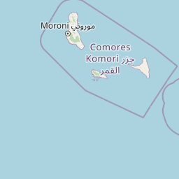
The physical landscape of Shisiwani National Park is defined by the dramatic topography of Anjouan's Sima Peninsula, where volcanic hills descend steeply to meet the Indian Ocean. The park encompasses the peninsula's western arm, characterized by rugged coastal terrain transitioning to flatter coastal plains and marshy areas near the shoreline. A distinctive geological feature is the saddle island formation, where a narrow land connection links elevated terrain to the main island body. Off the peninsula's tip lies Ile de la selle, a small offshore island that forms part of the protected area boundaries. The coastal zone features mixed sandy and rocky shores, with coral reef formations extending offshore into the clear tropical waters. Inland, the terrain rises through forested slopes, creating a vertically layered landscape from sea level to the peninsula's higher points.

Shisiwani National Park ecosystems, habitats, and plant life

The ecological character of Shisiwani National Park encompasses multiple distinct habitat types that together create a rich natural environment. The marine component features coral reef ecosystems that support high marine biodiversity, with reef-building corals providing structure for fish populations, invertebrates, and other marine organisms. The mangrove forests along the coast represent critical过渡 ecosystems between terrestrial and marine environments, providing sheltered nursery areas for juvenile fish and crustaceans while also stabilizing coastlines and filtering sediments. Terrestrial habitats include humid forest areas on the peninsula slopes, where vegetation ranges from lowland forest to more open coastal scrub. The combination of elevation changes, coastal exposure, and island isolation has created conditions supporting unique ecological communities with high endemism, reflecting the broader pattern of exceptional biodiversity found throughout the Comoros archipelago.

Shisiwani National Park wildlife and species highlights

Shisiwani National Park supports significant wildlife populations, with several species of particular conservation importance. The park provides habitat for lemurs, the iconic primates of Madagascar and the Comoros that represent an ancient evolutionary lineage unique to these islands. Giant tortoises, likely introduced historically but now naturalized, inhabit certain areas of the park and contribute to its distinctive fauna. Perhaps most notably, the park hosts countless bird species, both resident populations and migratory visitors that utilize the coastal and marine environments. The coral reefs and mangrove systems support diverse marine life including numerous fish species, crustaceans, and other invertebrates. The combination of terrestrial forest, coastal wetland, and marine environments creates a mosaic of habitats supporting this wildlife diversity, making the park a key location for biodiversity conservation in Comoros.

Shisiwani National Park conservation status and protection priorities

The establishment of Shisiwani National Park represents a significant contribution to Comoros's conservation landscape and reflects the nation's recognition of its environmental responsibilities. The park was created as part of an ambitious target to protect a quarter of Comoros's national territory, acknowledging the country exceptional biodiversity and the pressures facing its natural environments. The mixed marine-terrestrial designation acknowledges that effective conservation requires protecting entire ecosystems rather than isolated components. The coral reefs within the park face threats from climate change, ocean acidification, and local pressures, making formal protection increasingly important. The mangrove forests provide ecosystem services beyond biodiversity, including coastal protection, carbon storage, and fisheries support, multiplying the conservation value of the protected area. Management by the Comoros National Parks Agency provides institutional support for long-term conservation of the park's natural values.

Shisiwani National Park cultural meaning and human context

Shisiwani National Park exists within the cultural landscape of Anjouan, one of the traditionally populated islands of the Comoros archipelago. The local communities, particularly those in the vicinity of Bimbini, maintain connections to the coastline and marine environments that have shaped traditional livelihoods and resource use patterns. The park's establishment required balancing conservation objectives with community needs, a common challenge in island conservation contexts. Anjouan has a distinctive cultural identity within Comoros, with its own linguistic and historical characteristics. The coastal areas have historically supported fishing communities whose relationship with the marine environment predates formal protection efforts. Understanding these cultural dimensions informs the park's management approach and helps ensure conservation outcomes are sustainable for local populations.

Top sights and standout views in Shisiwani National Park

Shisiwani National Park offers a rare combination of Indian Ocean marine conservation and island terrestrial protection within a single protected area. The park's coral reefs provide accessible underwater environments for observing tropical marine biodiversity, while the mangrove forests offer opportunities to explore unique coastal ecosystems. The presence of lemurs and giant tortoises provides terrestrial wildlife viewing opportunities uncommon in most African protected areas. The park's location on the dramatic Sima Peninsula creates scenic coastal landscapes with dramatic topography. The relatively recent establishment of the park in 2016 means it represents one of the more contemporary additions to the global network of marine-protected areas. The park's inclusion of both a saddle island connection and the offshore Ile de la selle provides geological interest and diverse coastal environments within its boundaries.

Best time to visit Shisiwani National Park

The optimal time to experience Shisiwani National Park corresponds to Comoros's dry season, typically running from May through October, when lower humidity and reduced rainfall create more comfortable conditions for terrestrial exploration. Marine activities such as reef snorkeling are generally more enjoyable during this period when water clarity tends to be better and seas are calmer. The warm tropical climate means that even outside the dry season, temperatures remain consistently warm throughout the year. Visitors interested in wildlife observation may find different species more active during certain seasons, though the park's diverse habitats support wildlife year-round. The monsoon-influenced climate means the wet season from November to April brings more frequent rainfall, which can affect trail conditions and visibility but also brings the landscape to life with vegetation.

Park location guide

Geography guide, regional context, and park location map for Shisiwani National Park

Shisiwani National Park park geography, regions, and map view in Comoros
Understand where Shisiwani National Park sits in Comoros through a broader geographic reading of the surrounding landscape, nearby location context, and its mapped position within the national park landscape.

How Shisiwani National Park fits into Comoros

Comoros is an island nation in the Indian Ocean located at the northern end of the Mozambique Channel. It consists of three main islands: Grande Comore, Anjouan, and Mohéli. The country gained independence from France in 1975 and is a member of the Arab League, African Union, and Organisation of Islamic Co-operation. It has three official languages: Comorian, French, and Arabic.

Wider geography shaping Shisiwani National Park in Comoros

Comoros is situated in the Indian Ocean at the northern end of the Mozambique Channel, between Madagascar and the African mainland. The country consists of three main volcanic islands: Grande Comore, Anjouan, and Mohéli. The islands are part of the Comoro Islands archipelago.

Map view of Shisiwani National Park

Use this park location map to pinpoint Shisiwani National Park in Comoros, understand its exact geographic position, and read its mapped placement within the surrounding landscape more clearly.

Pigeon | © OpenStreetMap contributors

Location context for Shisiwani National Park

Anjouan
Park atlas

Compare coastal national parks and island conservation landscapes surrounding Shisiwani National Park.

Shisiwani National Park: Explore Nearby Protected Areas and Regional Park Geography
Browse other national parks and marine protected areas found in the Comoros, including additional island conservation landscapes and coastal zones adjacent to Shisiwani National Park. This regional view allows for direct geographic comparison of diverse protected terrains, tracing how conservation efforts extend across the archipelago's unique marine and terrestrial ecosystems.
National parkAnjouan

Mount Ntringui National Park: Protected Volcanic Landscape and Highland Geography on Anjouan

Explore its dramatic peaks, crater lake, and remnant montane forests.

Mount Ntringui National Park is a significant protected area situated in the rugged volcanic highlands of Anjouan. This national park preserves the island's highest peaks, Mount Ntringui and Mount Trindrini, alongside the unique Dzialandzé crater lake and the crucial Moya Forest. It stands as a vital refuge for endemic species and represents the last substantial tract of montane forest on Anjouan, offering deep insights into the region's unique ecology and mapped natural terrain.

Area
79.14 km²
Established
2010
IUCN
II
Relief
Mountain
National parkCabo Delgado Province

Quirimbas National Park: Coastal Protected Landscape and Island Archipelago Atlas

Discover marine conservation and inselberg terrain in Cabo Delgado.

Quirimbas National Park, located in Cabo Delgado Province, Mozambique, is a key protected area defined by its exceptional combination of marine and terrestrial environments. The park's geography includes eleven islands, extensive mangrove forests, and vibrant coral reefs, alongside a mainland characterized by striking inselberg formations. This national park is a vital site for understanding coastal landscape diversity, marine ecosystems, and protected-area geography within East Africa.

Area
1,430 km²
Established
1971
IUCN
II
Nature reserveMozambique

Niassa Reserve Nature Reserve: Mozambique's Expansive Protected Wilderness

Mapping the vast miombo woodlands and endemic species.

Niassa Reserve, a sprawling nature reserve in northern Mozambique, represents one of the largest miombo woodland ecosystems on Earth. Its diverse terrain encompasses dense forests, open savannahs, and riparian zones, making it a vital habitat for unique wildlife and a significant landmark in regional geography. The reserve's protected status and immense scale offer unparalleled opportunities for atlas-style exploration of its landscape and conservation importance.

Area
42,000 km²
Established
1954
IUCN
IV
National parkTanzania

Nyerere National Park: Tanzania's Immense Protected Area and Rufiji River Landscape

Explore the savanna and river delta geography of this national park.

Nyerere National Park represents one of Tanzania's most significant protected areas, sprawling across southeastern regions and offering a glimpse into largely untouched wilderness. The park's identity is deeply intertwined with the Rufiji River and its expansive delta, home to one of the world's largest mangrove forest systems. As a national park, its vastness and diverse terrain provide critical habitat, making it a key point for understanding protected land distribution and regional landscape context within Tanzania.

Area
30,893 km²
Established
2019
IUCN
II
National parkAlaotra-Mangoro

Analamazaotra National Park: Protected Rainforest Ecosystem and Mapped Landscape in Alaotra-Mangoro

Explore Madagascar's Eastern Highlands protected area geography.

Analamazaotra National Park, situated in Madagascar's Alaotra-Mangoro region, represents a critical segment of the island's protected eastern rainforests. This national park is mapped as a vital conservation area, offering insights into its unique ecosystems and natural terrain. Understanding Analamazaotra National Park's geographic placement and protected boundaries provides essential context for regional landscape exploration and atlas-based geographic discovery within Madagascar.

Area
26.53 km²
Established
2015
IUCN
II
Relief
Highland
National parkMorogoro Region

Mikumi National Park: East African Savannah Protected Landscape in Morogoro Region

Mapped boundaries and regional geography for a key Tanzanian national park.

Mikumi National Park, a vital protected area in Tanzania's Morogoro Region, offers a classic savannah experience with iconic baobab trees and diverse wildlife populations. This national park is distinguished by its extensive alluvial plains, shaped by the Mkata River basin, and its significant role as a wilderness corridor connecting with the larger Selous Game Reserve. The park's terrain includes Malundwe Mountain and views of the Uluguru Mountains, providing a rich geographic backdrop for understanding East African protected lands and their atlas-style distribution.

Area
3,230 km²
Established
1964
IUCN
II
National parkKenya

Kisite-Mpunguti Marine National Park: Kenya's Coastal Protected Marine Landscape

Mapped coral reefs and diverse marine ecosystems.

As Kenya's foremost marine national park, Kisite-Mpunguti Marine National Park presents an unparalleled opportunity to explore a thriving underwater world. Its protected boundaries encompass remarkable coral formations and a rich tapestry of marine species, including diverse fish populations, sea turtles, and dolphins. This park is a cornerstone of coastal conservation, offering valuable insights into marine geography and ecosystem health for those seeking detailed landscape context.

Area
39 km²
Established
1973
IUCN
II
Relief
Lowland
National parkMalawi

Lake Malawi National Park: UNESCO Protected Landscape and Endemic Fish Habitat

Discover mapped terrain, island geography, and evolutionary wonders.

Lake Malawi National Park offers unparalleled insight into freshwater biodiversity and landscape dynamics within Malawi's Great Rift Valley. As a UNESCO World Heritage Site, it is celebrated for its spectacular evolutionary radiation of cichlid fish, a phenomenon studied globally. The park's protected territory includes the mountainous Nankumbu Peninsula and thirteen islands, providing a rich context for understanding the interplay between aquatic ecosystems, terrestrial terrain, and unique island geography.

Area
94 km²
Established
1980
IUCN
II

Common questions about visiting, size, designation, and location context for Shisiwani National Park

Shisiwani National Park FAQs for park facts, access, geography, and protected area context
Find quick answers about Shisiwani National Park, including protected-area facts, park geography, trail and visitor context, and how the park fits into its surrounding country and regional landscape.
MoriAtlas Explorer

Continue Your Protected Areas Search Across the Global Atlas

Deepen your exploration by continuing the structured search for national parks and protected areas worldwide. Utilize the comprehensive filtering capabilities to compare different conservation landscapes and refine your understanding of global park geography. Discover more about the distribution and characteristics of protected natural areas.

Global natural geography