

Mori Atlas logo
National parkWhite Desert National Park

Discover the mapped boundaries and protected landscape identity of this unique Egyptian national park.

White Desert National Park: An Atlas of Surreal Chalk Formations and Desert Geography

(Sahara el Beyda)

White Desert National Park, located in Egypt's New Valley Governorate, is a protected national park renowned for its otherworldly landscape dominated by extraordinary white chalk rock formations. These natural sculptures, carved by wind erosion over millennia, create a surreal terrain of towering pillars and mushroom-shaped rocks against the backdrop of the Sahara's golden dunes. This page offers an atlas-style exploration of the park's geography, mapped boundaries, and its significance as a protected area within the stark beauty of the Western Desert.

Desert landscapesChalk rock formationsWildlife refugeSahara ecosystemsGeological wonderProtected area

White Desert National Park

National park

Park overview

Structured park overview, official facts, and landscape profile for White Desert National Park

White Desert National Park park facts, protected area profile, and essential visitor context

Review the core facts for White Desert National Park, including designation, size, terrain, visitor scale, habitats, and operating context in one park-focused overview.

About White Desert National Park

White Desert National Park occupies a remarkable position in Egypt's system of protected areas, preserving a landscape of such striking visual character that it has become one of the country's most recognizable natural destinations. The park is located within the Farafra depression, a vast natural basin in the Western Desert that sits at the edge of the Great Sand Sea, the extensive dune field that stretches across the border into Libya. The white chalk formations that define the park's identity were formed from the skeletal remains of marine organisms that lived in an ancient sea that covered this region millions of years ago. Over geological time, the softer rock layers eroded away while the harder chalk remained, leaving behind the dramatic spires and formations visible today.

The park's ecological significance extends far beyond its aesthetic appeal. Despite the extreme desert conditions, the protected area supports a surprising diversity of wildlife that has adapted to survive in one of Earth's harshest environments. The presence of endangered rhim gazelle and vulnerable dorcas gazelle populations demonstrates the conservation value of this protected area, as these species face significant pressures across their ranges from hunting and habitat loss. The park's wadis and oasis pockets provide critical water sources that sustain these animal populations through the long, hot desert seasons.

Access to the park typically involves traveling from Qasr Al Farafra, the nearest settlement, which serves as the gateway for visitors seeking to experience this unique desert landscape. The remote location and challenging terrain contribute to the park's sense of isolation and wilderness, offering visitors an experience far removed from Egypt's better-known Nile Valley attractions.

Quick facts and research context for White Desert National Park

White Desert National Park covers 300 square kilometers in Egypt's New Valley Governorate, situated in the Farafra depression approximately 45 kilometers north of the town of Qasr Al Farafra. The park was established as a protected area in 2002 and is also known by its Arabic name Sahara el Beyda, meaning White Sahara. The landscape is defined by its signature white chalk rock formations sculpted by wind erosion, rising dramatically from the desert floor alongside sand dunes, wadi channels, and small oasis pockets. Elevation within the park ranges from 353 meters at El Qess Abu Said down to 32 meters at Wadi Hennis. The park provides crucial habitat for endangered species including the rhim gazelle and vulnerable dorcas gazelle, as well as barbary sheep, multiple fox species, and the sand cat.

Protection and recognition

Verifying the documented conservation framework and terrestrial management boundaries.

White Desert National Park Protection Status and Conservation Geography

Factual database records outline the terrestrial protection status and established geographical boundaries of White Desert National Park. Users can examine documented conservation parameters and management scopes to understand how the arid reserve aligns with global geographic reporting standards.

Protection details

Protection scope
Terrestrial
Transboundary protection
No
Park context

Deeper park guide and search-rich context for White Desert National Park

White Desert National Park history, landscape, wildlife, and travel context

Explore White Desert National Park through its history, landscape character, ecosystems, wildlife, conservation priorities, cultural context, and seasonal travel timing in a structured park guide built for atlas discovery and search intent.

Why White Desert National Park stands out

White Desert National Park is renowned for its extraordinary white chalk rock formations, a geological phenomenon created by wind and sand erosion that has produced an almost lunar landscape of white limestone pillars, mushroom-shaped rocks, and fantastical natural sculptures scattered across the desert floor. This surreal terrain, often compared to a natural sculpture garden, represents one of the Sahara's most visually striking and photographically compelling landscapes. The park also sits at the edge of the Great Sand Sea, where vast dune fields meet the chalk plateau, creating a dramatic visual transition between stark white rock and golden sand. Beyond its geological wonder, the park is significant for supporting viable populations of endangered desert species in an environment of extreme aridity.

White Desert National Park history and protected-area timeline

White Desert National Park was established as a protected area in 2002, representing Egypt's commitment to preserving the unique desert landscapes of the Western Desert region. The creation of the park reflected growing recognition that the extraordinary chalk formations and the fragile desert ecosystem they support warranted formal protection against the various pressures that could threaten their integrity. Prior to formal protection, the area had long been known to local Bedouin communities who traversed the harsh desert terrain and understood the ecological significance of the oases and wadis that punctuate this arid landscape.

The establishment of the park came during a period of increased attention to Egypt's protected area network, which has expanded to encompass diverse ecosystems from the Mediterranean coast to the Red Sea mountains and the deep desert interior. The White Desert was designated not only for its geological significance but also for its ecological value as a habitat for species that have evolved remarkable adaptations to desert life. The park's creation acknowledged that even seemingly barren desert landscapes can harbor significant biodiversity and warrant conservation attention.

The park's relatively recent establishment means its management history is still being written, with ongoing efforts to balance conservation objectives with sustainable tourism access to this remarkable landscape.

White Desert National Park landscape and geographic character

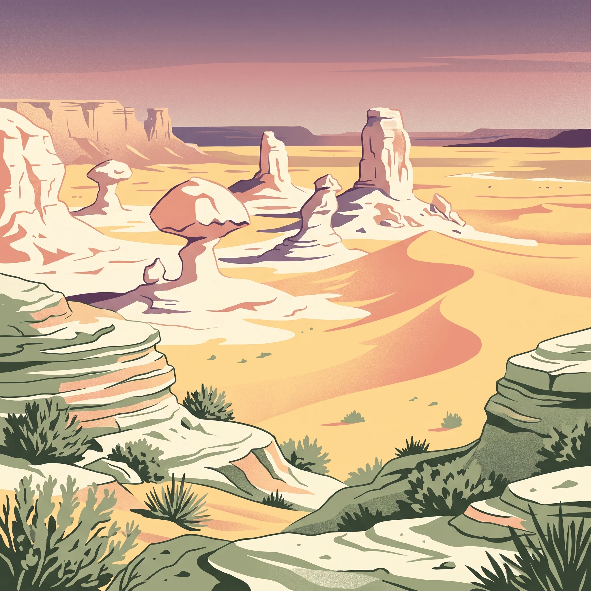
The landscape of White Desert National Park presents one of the Sahara's most visually extraordinary terrains, characterized by its signature white chalk rock formations that rise unexpectedly from the desert floor like a forest of natural monuments. These formations, ranging from towering spires to delicate mushroom-shaped rocks, have been sculpted by wind-driven sand erosion over countless centuries, creating shapes that often resemble organic forms and occasionally invite anthropomorphic interpretation. The chalk's pure white color creates a stark contrast with the surrounding golden sand, producing an almost surreal visual effect under the desert sun.

Beyond the chalk formations, the park encompasses diverse desert landforms including dramatic cliffs along the northern edge of the Farafra depression, extensive sand dunes that represent the western edge of the Great Sand Sea, and deeply incised wadi channels that carry seasonal water flows through the terrain. The park's elevation range of over 320 meters between its highest and lowest points creates visual diversity and contributes to the formation of distinct microhabitats. Wadi Hennis, the lowest point in the park, represents a natural drainage corridor that occasionally carries water from rare desert rainstorms, supporting vegetation and wildlife that cannot survive on the open desert plateau.

White Desert National Park ecosystems, habitats, and plant life

The nature of White Desert National Park reflects the resilience of life in extreme desert conditions, where sparse rainfall and scorching temperatures create challenging circumstances for any organism attempting to survive. The park's ecological character is defined by the interaction between the white chalk landscape, the sand dunes of the Great Sand Sea, and the scattered oases that provide crucial water sources. Vegetation is necessarily sparse and adapted to drought resistance, with plants concentrated around the oasis areas and along wadi channels where moisture accumulates.

The park's habitats include the open chalk desert plateau, active sand dune areas, cliff faces that provide shelter and nesting sites, and the vegetated corridors around springs and oasis pools. This diversity of microhabitats supports the surprisingly rich wildlife community that persists despite the harsh conditions. The contrast between the stark white rock formations and the patches of green vegetation around water sources creates a distinctive visual signature for the park, where life clusters in the limited places where water is available.

White Desert National Park wildlife and species highlights

White Desert National Park supports a remarkable community of desert-adapted wildlife, demonstrating that even extreme desert environments can sustain viable populations of specialized species when their habitats are protected. The park serves as a crucial refuge for the rhim gazelle, also known as the slender-horned gazelle, which is classified as endangered due to population declines across its range from hunting and habitat degradation. The dorcas gazelle, listed as vulnerable, also maintains populations within the park, representing both species' ability to survive in this arid landscape by utilizing the sparse vegetation and accessing water at the oases.

The park is home to several fox species adapted to desert life, including Rüppell's fox, the common red fox, and the distinctive fennec fox with its enormous ears adapted for heat dissipation. The barbary sheep, also known as aoudad, navigates the rocky terrain and cliff areas with remarkable agility. The elusive sand cat, one of the smallest wild cat species, hunts small rodents and insects in the desert, using its specialized adaptations for surviving in an environment where water is rarely available. Jackals also occur in the park, utilizing the diverse habitats for foraging and shelter. This collection of species represents a functional desert ecosystem that has evolved over millennia to cope with the challenges of extreme aridity.

White Desert National Park conservation status and protection priorities

White Desert National Park represents an important conservation priority in Egypt's protected area network, preserving both extraordinary geological values and critical habitat for species that face significant threats across their ranges. The park's designation in 2002 reflected a growing understanding that desert ecosystems, despite their apparent barrenness, harbor significant biodiversity and represent irreplaceable natural heritage worthy of protection. The presence of endangered rhim gazelle and vulnerable dorcas gazelle populations demonstrates the park's importance for species that have suffered substantial range contractions due to hunting, competition with domestic livestock, and habitat modification.

The conservation challenges in this desert environment include managing the impacts of any human activity in an ecosystem where recovery from disturbance is extremely slow due to the limited moisture and biological productivity. The park's relatively recent establishment means that ongoing monitoring and adaptive management will be important for ensuring that protective measures effectively sustain the values that justified the designation. The unique geological formations also require protection from any activities that could damage the chalk structures, ensuring that future generations can experience the same sense of wonder that the landscape inspires today.

White Desert National Park cultural meaning and human context

White Desert National Park has entered popular culture as a location of significant visual appeal, featured as a natural wonder in the 2019 Civilization VI: Gathering Storm expansion pack where it represents one of the game's distinctive natural wonders that players can incorporate into their strategic gameplay. This digital representation reflects the broader recognition of the park's remarkable landscape as something that transcends simple scenic beauty to achieve cultural significance.

The park also gained international attention through its use as a filming location in the Bollywood film "Kabhi Khushi Kabhi Gam," where the otherworldly white chalk formations provided a dramatic backdrop for portions of the musical production. This connection to Indian cinema demonstrates the global reach of the park's visual appeal and its ability to convey a sense of exotic desert grandeur to international audiences. The local Bedouin communities who have lived in this region for generations maintain traditional relationships with the desert landscape, understanding its patterns of water availability, seasonal changes, and the routes that allow safe passage through this challenging terrain.

Top sights and standout views in White Desert National Park

White Desert National Park offers visitors an extraordinary desert experience defined by its iconic white chalk rock formations that create an almost extraterrestrial landscape unlike anywhere else in Egypt or the Sahara. The park's location at the edge of the Great Sand Sea provides dramatic vistas where white rock meets golden dunes, offering exceptional photography opportunities and a sense of remoteness that contrasts sharply with Egypt's crowded tourist sites. The presence of endangered desert wildlife including rhim gazelle and multiple fox species demonstrates that even extreme desert environments can sustain remarkable biodiversity when properly protected. The elevation range from the high chalk plateau down to the wadi bottoms creates diverse experiences within a single protected area, while the relatively recent establishment of the park means it remains less-visited than Egypt's more famous heritage sites.

Best time to visit White Desert National Park

The optimal time to visit White Desert National Park is during the cooler months from October through April, when daytime temperatures are more comfortable for exploration and the risk of extreme heat is reduced. Winter months offer particularly pleasant conditions, with mild daytime temperatures making sustained outdoor activity feasible, though nights can be cold in the desert environment. Summer visitation is challenging due to extreme heat that can exceed 40 degrees Celsius and make any outdoor activity dangerous. The park can be visited year-round, but the shoulder seasons of spring and autumn offer a good balance between comfortable temperatures and the park's characteristic clear skies and desert light that make the white formations particularly striking.
Park guides

Essential reference materials addressing seasonal timing and desert terrain conditions

White Desert National Park Focused Guides and Protected Area Research

Selected reference materials provide structured answers to key logistical questions about protected desert terrain. Published guides examine seasonal timing factors for navigating limestone formations.
Monthly climate preview

Long term temperature and precipitation cycles in New Valley Governorate

White Desert National Park Climate Normals and Monthly Weather Trends

Representative measurements from New Valley Governorate reveal a hyper arid environment where daily precipitation remains near zero alongside average high temperatures peaking above forty degrees Celsius. Exploring the monthly climatology dataset provides the precise minimum and maximum ranges needed to analyze the park's extreme desert temperature swings.
Annual mean22 °C
11 °C30 °C
Jan11°
Feb13°
Mar17°
Apr22°
May26°
Jun29°
Jul30°
Aug30°
Sep28°
Oct23°
Nov17°
Dec13°
Warmest month
August

30.2 °C

Coolest month
January

11.2 °C

Wettest month
February

0.1 mm/day

Driest month
May

0 mm/day

Park location guide

Geography guide, regional context, and park location map for White Desert National Park

White Desert National Park park geography, regions, and map view in Egypt

Understand where White Desert National Park sits in Egypt through a broader geographic reading of the surrounding landscape, nearby location context, and its mapped position within the national park landscape.

How White Desert National Park fits into Egypt

Egypt is a transcontinental country bridging Northeast Africa and Southwest Asia via the Sinai Peninsula. With over 107 million inhabitants, it is the most populous country in the Arab world and third-most populous in Africa. The country features a rich historical heritage dating back to ancient civilizations along the Nile Delta, with Cairo as its capital and largest city.

Wider geography shaping White Desert National Park in Egypt

Egypt occupies a strategic position in Northeast Africa, extending into Southwest Asia through the Sinai Peninsula. It is bordered by the Mediterranean Sea to the north, Palestine and Israel to the northeast, the Red Sea to the east, Sudan to the south, and Libya to the west. The Gulf of Aqaba in the northeast separates Egypt from Jordan and Saudi Arabia. The country features the Nile Delta and Valley as its main fertile region, surrounded by desert terrain.

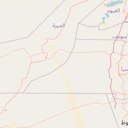
Map view of White Desert National Park

Use this park location map to pinpoint White Desert National Park in Egypt, understand its exact geographic position, and read its mapped placement within the surrounding landscape more clearly.

Pigeon | © OpenStreetMap contributors

Location context for White Desert National Park

New Valley Governorate
Park atlas

Trace the diverse desert geographies and unique conservation landscapes surrounding this iconic Egyptian national park.

Discover Other Protected Areas Near White Desert National Park in Egypt's Western Desert

Browse a curated list of national parks and protected areas geographically close to White Desert National Park, exploring the broader sweep of Egypt's Western Desert. Comparing these conservation landscapes provides valuable context on regional geology, unique desert ecosystems, and the spread of critical wildlife habitats across this arid domain.
Protected areaLibya
About 452 km away#1 closest

Northwest

Al Jaghbub Oasis Protected Area: Mapping the Libyan Desert Basin and Fossil Landscapes

A distinct sub sea level ecosystem within the Sahara

The Al Jaghbub Oasis encompasses a significant protected landscape in northeastern Libya, set within a rare depression below sea level. Its geography is characterized by layered limestone and sandstone formations containing a wealth of marine fossils. This isolated desert refuge supports a specialized brackish water habitat, contrasting sharply with the surrounding arid expanse of the North African plateau.

Relief
Lowland
Climate
Arid
Access
Access unknown
Scope
Terrestrial
National parkNew Valley Governorate
About 457 km away#2 closest

Southwest

Gilf Kebir National Park: Sahara Wilderness with Prehistoric Rock Art and Silica Glass

Explore the geography of this vast Egyptian national park and its ancient landscapes.

Gilf Kebir National Park offers a profound exploration of a remote Saharan environment within Egypt's New Valley Governorate. This protected national park is distinguished by its hyper-arid desert landscape, encompassing portions of the Great Sand Sea and the dramatic Gilf Kebir plateau dissected by ancient wadis. It is globally recognized for its rich concentration of prehistoric rock art, providing a direct connection to early human history in the Sahara, alongside the scientifically unique Silica Glass area.

Area
48,533 km²
Established
2007
IUCN
II
Relief
Mixed relief
National parkEgypt
About 585 km away#3 closest

East

Saint Katherine Protectorate National Park: Egypt's Protected Landscape and Geographic Identity

Mapped boundaries and regional terrain discovery for this Egyptian protected area.

Saint Katherine Protectorate is a key national park in Egypt, representing a significant protected landscape within the Sinai Peninsula. This page offers a detailed atlas view of its protected boundaries and geographic context. Users can explore its position within Egypt's broader geography and understand its role as a vital protected area for regional landscape study.

Established
1983
Relief
Mountain
Climate
Alpine
Access
Moderate access
Protected areaEgypt
About 588 km away#4 closest

Southeast

Saluga and Ghazal Protectorate Protected Area: Mapped Boundaries and Egyptian Geography

Explore the protected landscape and regional geographic setting.

Delve into the specifics of the Saluga and Ghazal Protectorate, a designated protected area contributing to Egypt's natural landscape mosaic. This entry focuses on its mapped boundaries and geographic significance, providing essential context for atlas exploration. Understand the protectorate's terrain and its place within the national geography for a structured discovery experience.

Established
1986
Relief
Lowland
Access
Easy access
Scope
Terrestrial
National parkSouth Sinai Governorate
About 596 km away#5 closest

East

Ras Muhammad National Park: South Sinai Protected Landscape and Geographic Atlas

Discover the mapped boundaries of this Egyptian national park.

Ras Muhammad National Park is a crucial protected area within the South Sinai Governorate, offering insights into Egypt's natural landscapes. This page facilitates an atlas-style exploration of the park, highlighting its geographic significance and protected status. Users can investigate its mapped terrain and understand its context within the regional geography of the Sinai Peninsula for structured geographic discovery.

Area
480 km²
Established
1983
Relief
Mixed relief
Climate
Arid
Protected areaSouth Sinai Governorate
About 619 km away#6 closest

East

Nabq Protected Area: South Sinai Governorate Protected Landscape and Regional Geography

Explore its mapped terrain and protected area context.

Nabq Protected Area offers a distinct view into Egypt's protected landscapes, situated within the South Sinai Governorate. This detailed page provides an atlas-style perspective on its geographic setting, allowing for structured exploration of its mapped boundaries and its role within the regional context. Understand the unique natural terrain and protected area characteristics that define this significant Egyptian site.

Area
600 km²
Established
1992
IUCN
VI
Relief
Mountain
National parkIsrael
About 742 km away#7 closest

Northeast

Makhtesh Ramon National Park: Israel's Premier Erosion Cirque & Geological Wonder

Discover dramatic desert terrain and ancient, colorful rock formations.

Makhtesh Ramon National Park in Israel's Negev Desert is the world's largest erosion cirque, a vast 40-kilometer depression revealing millions of years of geological history. Its striking landscape features colorful clay hills, ancient volcanic remnants, fossil beds, and unique sandstone formations, making it an unparalleled destination for understanding Earth's past through its protected natural terrain. Explore the mapped boundaries and regional context of this extraordinary desert formation.

Relief
Mountain
Climate
Arid
Access
Moderate access
Scope
Terrestrial
National parkIsrael
About 742 km away#8 closest

Northeast

Shivta National Park National Park: An Atlas View of Israel's Protected Landscapes

Mapped terrain and regional geographic context for Shivta National Park.

Shivta National Park represents a key protected area, offering a focused entry into Israel's broader geographic and landscape atlas. This page provides specific details about the park's identity as a national park, its mapped terrain, and its placement within the regional context of the country. Users can explore the structured information that defines Shivta National Park's role as a protected landscape, contributing to a deeper understanding of its geographic significance and mapped features.

Climate
Arid
Access
Easy access
Scope
Terrestrial
Water
No major water

Common questions about visiting, size, designation, and location context for White Desert National Park

White Desert National Park FAQs for park facts, access, geography, and protected area context

Find quick answers about White Desert National Park, including protected-area facts, park geography, trail and visitor context, and how the park fits into its surrounding country and regional landscape.
MoriAtlas Explorer

Continue Your Protected Areas Search Across the Global Atlas

Deepen your exploration by continuing the structured search for national parks and protected areas worldwide. Utilize the comprehensive filtering capabilities to compare different conservation landscapes and refine your understanding of global park geography. Discover more about the distribution and characteristics of protected natural areas.

Global natural geography

