Mori Atlas logo
National parkComoé National Park

Map the geographic transitions and unique gallery forests of this vast West African national park.

Comoé National Park: Ivory Coast's Premier Protected Landscape and Biodiverse Savanna Ecosystem

Comoé National Park represents a globally exceptional savanna ecosystem, spanning over 11,500 square kilometers in northeastern Ivory Coast. This protected national park is defined by its remarkable ecological crossroads, transitioning from humid Guinea savanna in the south to a drier Sudanian zone in the north. Its diverse habitats include savanna plains, gallery forests along the Comoé River, and unique plant communities, offering a rich context for atlas-based geographic discovery and understanding protected landscapes.

National ParkUNESCO World Heritage SiteBiosphere ReserveSavanna EcosystemWest AfricaGallery Forest

Comoé National Park

National park

Park overview

Structured park overview, official facts, and landscape profile for Comoé National Park

Comoé National Park park facts, protected area profile, and essential visitor context
Review the core facts for Comoé National Park, including designation, size, terrain, visitor scale, habitats, and operating context in one park-focused overview.

About Comoé National Park

Comoé National Park stands as a landmark of West African conservation, representing both the ecological richness and the conservation challenges of the region. Established in 1968 when the area west of the Comoé River was added to the existing protected zone, the park was later designated a UNESCO World Heritage Site in 1983 and recognized as a Biosphere Reserve in the same year. The park's global significance stems from its unique position at the intersection of multiple ecological zones, creating a complex mosaic of habitats that supports remarkable biodiversity. The Comoé River and its tributaries, including the Iringou, Bavé, and Kongo, form the primary drainage system, creating floodplains and seasonal wetlands that provide critical habitat for hippopotamus, waterbirds, and numerous fish species. Despite its ecological importance, the park has faced significant challenges, including periods of instability during the Ivorian civil wars that led to increased poaching and habitat degradation. However, sustained conservation efforts by the Office Ivorien des Parcs et Reserves and international partners have enabled recovery, culminating in the park's removal from the World Heritage in Danger list in 2017.

Quick facts and research context for Comoé National Park

Comoé National Park is the largest protected area in West Africa, covering 11,500 square kilometers in north-eastern Ivory Coast. It was established as a national park in 1968 and designated a UNESCO World Heritage Site in 1983, later becoming a Biosphere Reserve in 1983. The park was listed as a World Heritage Site in Danger from 2003 to 2017 due to civil unrest and conservation challenges but was removed from the danger list following significant recovery efforts. The park features a steep north-south climatic gradient supporting diverse habitats from Guinea savanna to Sudanian zone, with the Comoé River serving as the primary watercourse flowing through the park for approximately 230 kilometers.

Park context

Deeper park guide and search-rich context for Comoé National Park

Comoé National Park history, landscape, wildlife, and travel context
Explore Comoé National Park through its history, landscape character, ecosystems, wildlife, conservation priorities, cultural context, and seasonal travel timing in a structured park guide built for atlas discovery and search intent.

Why Comoé National Park stands out

Comoé National Park is best known for being the most biodiverse savanna in the world, supporting an extraordinary range of habitats and species within a single protected area. The park is particularly notable for its gallery forests along the Comoé River, which contain tropical rainforest elements typically found hundreds of kilometers further south. It represents the northern limit for many animal species including the yellow-backed duiker and bongo antelope, and contains significant populations of chimpanzees, hippopotamus, and over 500 bird species. The park's 36 of 38 iconic Sudan-Guinean savanna bird species and its designation as an Important Bird Area by BirdLife International further underscore its exceptional ornithological significance.

Papilio demoleus Linnaeus, 1758, Lime Swallowtail
Butterfly in Comoe National Park

Comoé National Park history and protected-area timeline

The area surrounding Comoé National Park has historically remained sparsely populated due to several factors: relatively infertile soils unsuitable for agriculture, the prevalence of river blindness (onchocerciasis) along the Comoé River, and the high density of tsetse flies that transmit sleeping sickness. These challenging conditions inadvertently contributed to the region's ecological preservation. The first formal protection came in 1926 when the area between the Comoé River and Bouna was declared the "Refuge Nord de la Côte d'Ivoire." This protected status was expanded in 1942 and again in 1953, becoming the "Réserve de Faune de Bouna" and providing rudimentary wildlife protection. On February 9, 1968, the area west of the Comoé River was incorporated, and the property was elevated to National Park status with its current area of 11,500 square kilometers, making it one of the fifteen largest national parks in the world and the largest in West Africa. In 1983, the park was pronounced a Biosphere Reserve and confirmed as a UNESCO World Heritage Site. Following the outbreak of the First Ivorian Civil War, the park was added to the List of World Heritage in Danger in 2003 due to poaching, absence of management, and overgrazing by cattle. After the Second Ivorian Civil War ended in 2011, conservation efforts intensified, and the 41st World Heritage Committee Session in 2017 decided to remove the park from the danger list following documented improvements in fauna and habitat conservation.

Comoé National Park landscape and geographic character

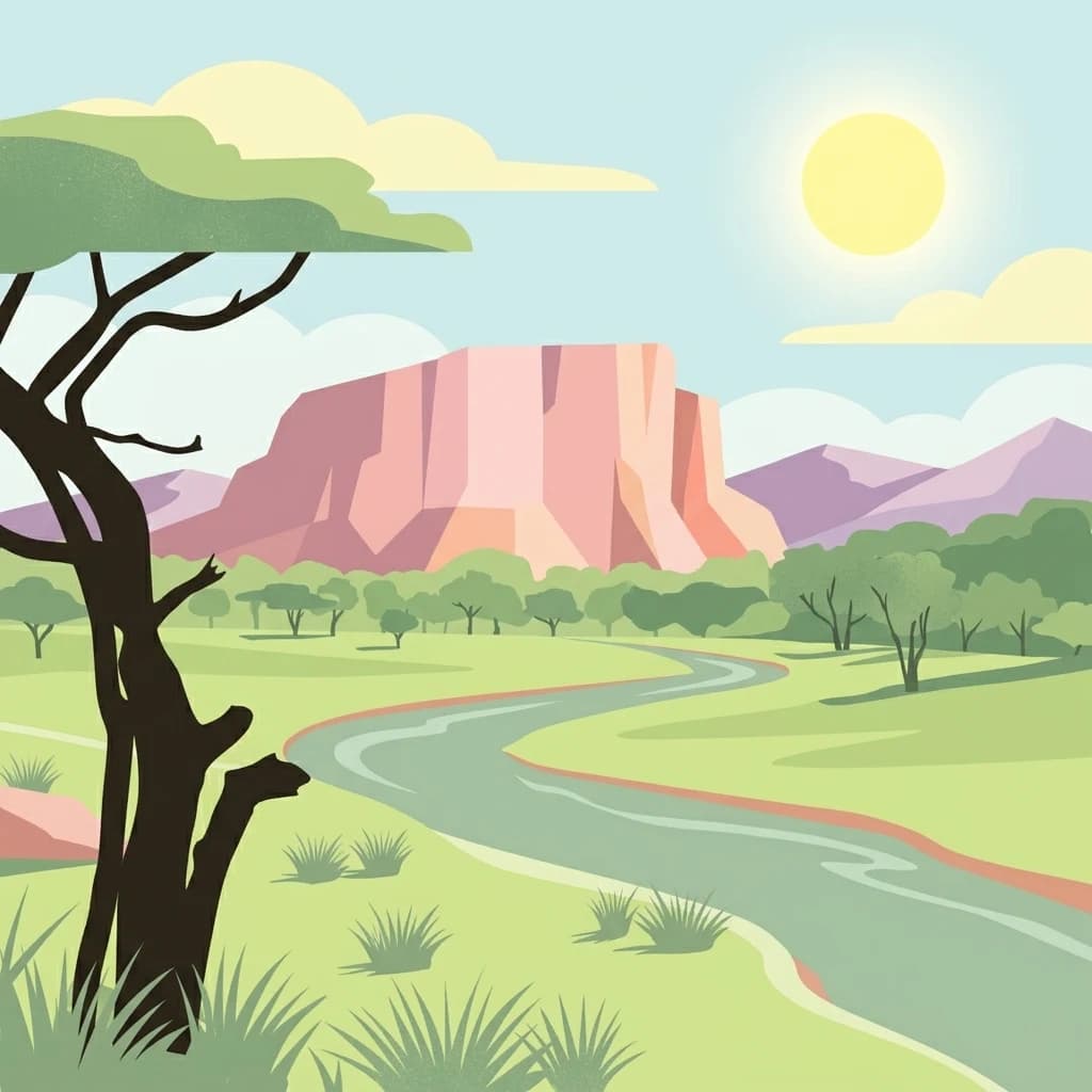
The landscape of Comoé National Park is characterized by vast, well-eroded plains through which the Comoé River and its tributaries flow, creating a diverse topography across its 11,500 square kilometer extent. The park sits in a transitional zone between the humid Guinea savanna to the south and the dry Sudanian zone to the north, with this steep climatic gradient directly influencing the distribution of habitats across the property. Granite inselbergs rise up to 600 meters within the park, providing dramatic relief against the otherwise flat terrain. The Comoé River, flowing through the park for approximately 230 kilometers, serves as the primary drainage system, with watercourses also draining eastward to the Volta River system. Numerous permanent and semi-permanent ponds are distributed throughout the park, though most dry out during the long dry season. The soils are predominantly infertile and unsuitable for cultivation, which has historically limited human settlement and agricultural development, inadvertently contributing to the park's ecological integrity. The combination of these geological, hydrological, and climatic elements creates a landscape of exceptional diversity, with gallery forests hugging riverbanks while extensive savannas dominate the broader terrain.

Kob antelope.jpg
Kob antelope in Comoé National Park

Comoé National Park ecosystems, habitats, and plant life

The ecological character of Comoé National Park is defined by its remarkable diversity of habitats arising from the steep north-south climatic gradient spanning from the Guinea savanna to the Sudanian zone. Approximately 90 percent of the park consists of various savanna types, while gallery forests, open forests, and riparian grasslands occur in association with the river system and its tributaries. The park contains around 620 plant species, including 191 ligneous species (62 trees, 129 shrubs and vines) and 429 herbaceous species, with 104 grasses documented. Gallery forests are dominated by Cynometra, while dry forest islands feature species such as Anogeissus leiocarpus, Antiaris africana, Isoberlinia doka, and Cola cordifolia. The floodplains support Hyparrhenia rufa as the most common grass species. The presence of the Comoé River allows plant associations typically found in more southerly tropical regions to exist within the park, including patches of dense gallery forest. This transitional ecological character makes the park an ideal example of how habitats shift across climatic zones, providing conditions suitable for species from both Guinea and Sudanian biogeographic regions.

Comoé Researchstation Lab and solar panels.jpg
Research station laboratory and solar panels in Comoé National Park.

Comoé National Park wildlife and species highlights

Comoé National Park harbors exceptional wildlife diversity, with 135 mammal species, over 500 bird species, 60 fish species, 35 amphibian species, and 71 reptile species documented. The park forms the northern limit for many animal species, including the yellow-backed duiker and bongo antelope. Eleven primate species are present, including the chimpanzee, olive baboon, green monkey, lesser spot-nosed monkey, mona monkey, black and white colobus, olive colobus, and white-collared mangabey. Seventeen carnivore species are recorded, though cheetah, wild dog, and lion have apparently become locally extinct. Twenty-one artiodactyl species include hippopotamus, bushpig, bongo, warthog, buffalo, kob, red-flanked duiker, bushbuck, waterbuck, roan antelope, and oribi. The bird population includes over 500 species, with roughly 20 percent being inter-African migratory birds and another 5 percent palearctic migrants. Notable species include Denham's bustard, yellow-casqued hornbill, brown-cheeked hornbill, hammerkop, black-winged stilt, various raptors, four of the six West African stork species, and five vulture species. The park contains 36 of the 38 iconic Sudan-Guinean savanna bird species. Reptile diversity includes three crocodile species: the dwarf crocodile, West African crocodile, and critically endangered slender-snouted crocodile.

Comoe savannah.jpg
Savannah landscape in Comoe National Park, featuring a rainbow.

Comoé National Park conservation status and protection priorities

Comoé National Park holds global conservation significance as a UNESCO World Heritage Site and Biosphere Reserve, representing one of the most biodiverse savanna ecosystems in the world. The park's importance stems from its role as a critical refuge for species at the northern limits of their ranges and its representation of transitional habitats across the Guinea-Sudanian ecological boundary. The park was listed as a World Heritage Site in Danger from 2003 to 2017 due to poaching, lack of management, and overgrazing following the First Ivorian Civil War. Following the end of the Second Ivorian Civil War, the Office Ivorien des Parcs et Reserves resumed management activities and implemented recovery programs funded in part by the Rapid Response Facility. Conservation challenges include combating poaching, reducing agricultural pressures on park boundaries, and maintaining access control through road infrastructure. Current efforts focus on establishing efficient surveillance systems and developing participatory management approaches with local communities to reduce peripheral pressures and create sustainable income sources for surrounding villages. The Comoé Chimpanzee Conservation Project has been active since 2014, focusing on research and conservation of the savanna chimpanzee population.

Comoé National Park cultural meaning and human context

The area around Comoé National Park has historically remained sparsely populated due to challenging environmental conditions including infertile soils, the presence of river blindness disease along the Comoé River, and high densities of tsetse flies that transmit sleeping sickness. These factors limited traditional settlement and agricultural development, indirectly contributing to the preservation of the park's natural state. The region falls within the Zanzan and Savanes districts of north-eastern Ivory Coast, an area with traditional pastoralist communities. The establishment of the park required the recognition of these sparse population patterns and the creation of protected area status that acknowledged the limited human presence in the region. Contemporary conservation efforts emphasize cooperation with local communities through participatory management approaches and sustainable livelihood programs designed to reduce pressures on park boundaries.

Comoe river with wetlands.jpg
Comoe River with adjoining wetlands

Top sights and standout views in Comoé National Park

Comoé National Park represents the pinnacle of West African conservation, being the largest protected area in the region and one of the most biodiverse savanna ecosystems globally. The park's gallery forests along the Comoé River contain tropical rainforest elements found nowhere else in West Africa at this latitude. With 135 mammal species and over 500 bird species, including 36 of the 38 iconic Sudan-Guinean savanna bird species, the park supports exceptional faunal diversity. The presence of 11 primate species, including significant chimpanzee populations studied by the ongoing Comoé Chimpanzee Conservation Project, adds to the park's scientific value. The research station, established in 1989 by Professor Karl Eduard Linsenmair, remains one of Africa's most modern field stations and has facilitated decades of ecological research despite disruptions from civil conflict. The successful recovery from the World Heritage in Danger status in 2017 demonstrates the resilience of both the ecosystem and conservation management when given adequate support.

Comoe river
River within Comoé National Park

Best time to visit Comoé National Park

The best time to visit Comoé National Park depends on the type of experience sought. The dry season, typically from November to March, offers easier wildlife viewing as animals congregate around remaining water sources and vegetation is less dense. This period is particularly favorable for viewing large mammals such as elephants, hippopotamus, and various antelope species. The wet season, from April to October, transforms the landscape into lush green and is ideal for birdwatching, as migratory birds arrive and resident species become more active. The transition periods at the start and end of the rainy season offer a balance, with the landscape still accessible but showing the renewed vitality of recent rainfall. Visitors should note that access and facilities may be limited, and the park's remote location requires careful planning regardless of when to visit.

Park location guide

Geography guide, regional context, and park location map for Comoé National Park

Comoé National Park park geography, regions, and map view in Ivory Coast
Understand where Comoé National Park sits in Ivory Coast through a broader geographic reading of the surrounding landscape, nearby location context, and its mapped position within the national park landscape.

How Comoé National Park fits into Ivory Coast

Ivory Coast, officially the Republic of Côte d'Ivoire, is a West African country with a coastline on the Gulf of Guinea. It gained independence from France in 1960 and is now a presidential republic. The country is a major producer of cocoa and coffee, with Abidjan serving as its largest city and economic hub, while Yamoussoukro is the official capital.

Wider geography shaping Comoé National Park in Ivory Coast

Ivory Coast is situated on the southern coast of West Africa along the Gulf of Guinea. It borders Guinea to the northwest, Liberia to the west, Mali to the northwest, Burkina Faso to the northeast, Ghana to the east, and the Atlantic Ocean to the south. The terrain includes coastal plains, interior highlands, and forested regions.

Map view of Comoé National Park

Use this park location map to pinpoint Comoé National Park in Ivory Coast, understand its exact geographic position, and read its mapped placement within the surrounding landscape more clearly.

Pigeon | © OpenStreetMap contributors

Location context for Comoé National Park

Savanes DistrictZanzan District

Gain visual insights into Comoé National Park's diverse savanna ecosystems, gallery forests, and unique riverine habitats.

Comoé National Park Photos: Explore Landscapes, Habitats, and Protected Area Scenery
Browse comprehensive imagery of Comoé National Park to visually grasp its vast West African savanna landscapes, unique gallery forests, and diverse transitional habitats. Understanding these visual details reveals the park's rich ecological gradient, from humid Guinea savanna to drier Sudanian zones, offering a deeper perspective on this exceptional protected area.

Papilio demoleus Linnaeus, 1758, Lime Swallowtail

Macrodipteryx longipennis male

Kob antelope.jpg

Comoé Researchstation Lab and solar panels.jpg

Comoe savannah.jpg

Comoe roan antelope.jpg

Comoe river with wetlands.jpg

Comoe river

Comoe raptor.jpg

Comoe bird.jpg

Comoe Savannah fire.jpg

Comoe Savannah 2.jpg

Comoe Green monkey.jpg

Comoe Bushbuck.jpg

Park atlas

Trace the Regional Park Geography and Connected Protected Landscapes of West Africa

Discover Nearby National Parks and Protected Areas Beyond Comoé National Park
Continue your exploration of West African protected areas by comparing national parks and reserves located near Comoé National Park. Map the distinct savanna ecosystems, gallery forests, and transitional habitats of adjacent conservation landscapes to understand their regional geographic context and biodiversity.
National parkGhana

Bui National Park: Protected Savanna Landscape and Black Volta River Geography in Ghana

Explore the mapped boundaries and unique ecosystems of this national park.

Bui National Park, a protected national park in Ghana, offers a rich geographic discovery of savanna ecosystems bisected by the Black Volta River. Its vast mapped area provides a unique setting for understanding riparian corridors, woodland savanna, and mountainous terrain. The park is critically important for its significant hippopotamus population and its designation as an Important Bird Area, showcasing its ecological value. Exploration of Bui National Park provides insight into Ghana's protected landscapes and their strategic position within West African geography, serving as a key entity for any natural atlas.

Area
1,820 km²
Established
1971
IUCN
II
National parkSavannah Region

Mole National Park: A Premier Protected Landscape in Ghana's Savannah Region

Explore mapped boundaries and Guinea savannah ecosystems.

Mole National Park represents a significant protected landscape within Ghana's Savannah Region, serving as the country's largest national park and a crucial conservation area for West African wildlife. The park's geography is defined by extensive Guinea savannah, characterized by grasslands with scattered woodlands and a prominent escarpment along its southern edge. Its vast expanse offers a unique opportunity to study mapped park boundaries and understand the ecosystem's role in regional conservation efforts. Discover the unique landscape context and protected area identity of this major West African wildlife refuge.

Area
4,840 km²
Established
1958
IUCN
II
National parkBurkina Faso

Deux Balés National Park: Burkina Faso's Elephant Sanctuary and Savanna Protected Landscape

Explore mapped terrain and key geographic features of this protected area.

Deux Balés National Park serves as a vital protected area within Burkina Faso, acclaimed for harboring the largest elephant population in West Africa. This national park's protected landscape is defined by undulating granitic plains, lateritic plateaux, and distinct gallery forests lining the Black Volta River. The presence of ancient African baobab trees adds a unique visual character to the savanna ecosystem. Investigating this park reveals its significance for regional conservation, its mapped geographic boundaries, and its role within the broader context of protected lands in West Africa.

Area
810 km²
Established
1937
IUCN
II
Relief
Lowland
National parkWestern North Region

Bia National Park: Ghana's Vital Protected Forest Landscape with West Africa's Tallest Trees

Explore the unique mapped geography and biodiversity of this key conservation area.

Bia National Park serves as a crucial protected landscape in Ghana's Western North Region, celebrated for harboring some of West Africa's tallest trees and a rich diversity of wildlife. This detailed entry provides context on its mapped boundaries and ecological significance as one of the last relatively untouched forest remnants in the region. Understand the park's place within Ghana's geography and its value for conservation research, showcasing its unique transitional forest ecosystem and the documented species it protects.

Area
563 km²
Established
1974
IUCN
II
Climate
Tropical
National parkBurkina Faso

Kaboré Tambi National Park: Burkina Faso's Largest National Park and Protected Landscape

Explore the mapped savanna and birdwatching geography of this vital West African area.

Kaboré Tambi National Park represents a critical protected area in Burkina Faso, spanning a considerable expanse of Sudan-Guinea savanna. The park's geography is defined by the Nazinon River and a mosaic of woodland and grassland ecosystems, making it a significant site for understanding regional protected lands and landscape ecology. It offers a valuable point of reference for atlas-based exploration of West African natural areas.

Area
1,555 km²
Established
1976
IUCN
II
Relief
Lowland
National parkAbidjan

Banco National Park National Park: Primary Forest Landscape and Abidjan Geography

Explore mapped boundaries and urban conservation.

Banco National Park is a globally significant protected area, uniquely preserving dense primary tropical forest within the urban sprawl of Abidjan, Ivory Coast. This national park offers critical insights into urban conservation, featuring rare tree species and providing essential ecosystem services like water supply and carbon sequestration for the surrounding region. Its landscape, characterized by the Gbangbo River and rare mahogany and avodire trees, forms a vital geographic element within the metropolitan atlas.

Area
30 km²
Established
1953
IUCN
II
National parkBono East Region

Digya National Park: Ghana's Oldest National Park, Bordering Lake Volta

Explore its unique geography and mapped protected boundaries.

Digya National Park is a significant protected area in Ghana, renowned as the nation's oldest, established in 1900 and gazetted as a national park in 1971. Occupying 3,743 square kilometers in the Bono East Region, it is distinctively bordered on three sides by the vast Lake Volta, creating an unparalleled terrestrial-aquatic habitat interface. This national park represents a key point in Ghana's geographic atlas, situated in a transitional zone between forest and savanna ecosystems, and is a vital hub for wildlife conservation and the study of its unique landscape character.

Area
3,743 km²
Established
1971
IUCN
II
National parkGhana

Nini-Suhien National Park: Ghana's Coastal Forest Protected Landscape and Avian Sanctuary

Explore mapped boundaries of vital tropical forest habitat.

Nini-Suhien National Park in Ghana is recognized for its protected coastal forest, a habitat type critically endangered across West Africa. Established in 1976, this national park spans 160 square kilometers, serving as a key component of the Ankasa Conservation Area and a vital corridor for wildlife. Its designation as an Important Bird Area highlights its global importance for birdlife, offering a unique geographic and ecological study within the nation's atlas of protected lands.

Area
160 km²
Established
1976
IUCN
II
Relief
Lowland

Common questions about visiting, size, designation, and location context for Comoé National Park

Comoé National Park FAQs for park facts, access, geography, and protected area context
Find quick answers about Comoé National Park, including protected-area facts, park geography, trail and visitor context, and how the park fits into its surrounding country and regional landscape.
MoriAtlas Explorer

Continue Your Protected Areas Search Across the Global Atlas

Deepen your exploration by continuing the structured search for national parks and protected areas worldwide. Utilize the comprehensive filtering capabilities to compare different conservation landscapes and refine your understanding of global park geography. Discover more about the distribution and characteristics of protected natural areas.

Global natural geography