Por qué destaca Parque Nacional Gunung Leuser
Gunung Leuser es reconocido internacionalmente como uno de los últimos bastiones del orangután de Sumatra, una especie clasificada como en peligro crítico por la UICN. La población de orangutanes del parque se estudia en la Estación de Investigación de Ketambe, establecida en 1971 por Herman Rijksen como un área de investigación dedicada al comportamiento y la ecología de los primates. El parque también es célebre por su espectacular terreno montañoso, ofreciendo lo que se promociona como la mayor área de naturaleza salvaje del Sudeste Asiático con excepcionales oportunidades de senderismo a través de selvas tropicales prístinas. La presencia de otras especies icónicas, incluyendo el tigre de Sumatra, el elefante de Sumatra, el rinoceronte de Sumatra y el siamang, cimenta aún más la importancia del parque como un punto caliente de biodiversidad de importancia mundial.
Historia de Parque Nacional Gunung Leuser y cronología del área protegida
El Parque Nacional Gunung Leuser fue establecido oficialmente en 1980 como parte del compromiso de Indonesia para proteger sus ecosistemas de selva tropical restantes. El parque recibió su nombre del monte Leuser, un pico prominente en la cordillera de Barisan que sirve como importante punto de referencia geográfico y divisor de aguas. El establecimiento de la Estación de Investigación de Ketambe en 1971, antes de la designación formal del parque, marcó el inicio del estudio científico sistemático de las poblaciones de orangutanes del parque y su ecología forestal. En 2004, el parque fue inscrito como componente del Patrimonio de la Selva Tropical de Sumatra, un sitio serial del Patrimonio Mundial que también incluye los Parques Nacionales Bukit Barisan Selatan y Kerinci Seblat, reconociendo su valor universal excepcional como punto caliente de biodiversidad. El parque ha enfrentado importantes desafíos de gestión, particularmente durante finales de los años 90 y principios de los 2000, cuando la tala ilegal y la expansión de la palma aceitera invadieron el área protegida. En 1998, un controvertido decreto excluyó el enclave de Sapo Padang del estatus legal de parque, permitiendo la construcción de carreteras y una mayor destrucción forestal a pesar de los desafíos legales de ONG locales. El parque fue incluido en la Lista del Patrimonio Mundial en Peligro en 2011 debido a las amenazas continuas de tala ilegal, invasión agrícola y caza furtiva, un estatus que mantiene hasta el día de hoy. En diciembre de 2010, el gobierno indonesio comenzó a reubicar a colonos ilegales del parque, trasladando a 26 familias a Sumatra del Sur, aunque miles de personas continúan habitando el área ilegalmente.
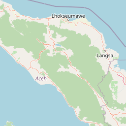
Paisaje y carácter geográfico de Parque Nacional Gunung Leuser
El Parque Nacional Gunung Leuser ocupa un espectacular paisaje montañoso dentro de las Montañas Barisan, la cordillera volcánica que recorre toda la longitud de Sumatra. El parque se extiende aproximadamente 150 kilómetros de norte a sur y abarca más de 100 kilómetros en su punto más ancho, abarcando una diversa gama de terrenos, desde escarpadas y accidentadas tierras altas hasta valles de tierras bajas más suaves. Aproximadamente el 40% del parque consta de terreno escarpado que supera los 1.500 metros de altitud, especialmente en la porción noroeste, mientras que aproximadamente el 12% del parque en las tierras bajas del sur se encuentra por debajo de los 600 metros sobre el nivel del mar. El parque contiene once picos que se elevan por encima de los 2.700 metros, con el Monte Leuser alcanzando los 3.119 metros como el tercer pico más alto en la Cordillera de Leuser. El pico más alto, el Monte Tanpa Nama, se eleva a 3.466 metros y representa el segundo punto más alto de Sumatra después del Monte Kerinci. El paisaje presenta densa selva tropical que cubre las laderas de las montañas, los fondos de los valles y las crestas, volviéndose la vegetación más achaparrada y dominada por musgo a mayores altitudes. Los ríos que se originan en las tierras altas del parque proporcionan recursos hídricos vitales para las comunidades río abajo y las áreas agrícolas, aunque la deforestación ha afectado cada vez más los patrones de flujo de agua y la disponibilidad estacional.
Ecosistemas, hábitats y flora de Parque Nacional Gunung Leuser
El parque protege uno de los ecosistemas forestales más biodiversos del Sudeste Asiático, albergando aproximadamente 10.000 especies de plantas dentro de sus diversas zonas elevacionales y tipos de hábitat. Las selvas tropicales de tierras bajas representan las áreas más ricas en especies, presentando árboles imponentes, doseles densos y una compleja estratificación vertical que crea nichos de hábitat para innumerables organismos. Los bosques pantanosos de turba en las áreas de menor altitud almacenan cantidades significativas de carbono y proporcionan condiciones ecológicas únicas que sustentan especies de plantas y animales especializadas. A medida que aumenta la altitud, el bosque transita por zonas montanas y subalpinas, con vegetación cada vez más achaparrada dominada por coníferas, rododendros y abundantes musgos epífitos. Las vías fluviales del parque, incluidos ríos y arroyos más pequeños, sustentan ecosistemas acuáticos y proporcionan hábitat crítico para especies de peces y otros organismos de agua dulce. Los diversos hábitats dentro del parque sustentan una notable biodiversidad en múltiples grupos taxonómicos, sirviendo el parque como un refugio crítico para especies que han sido eliminadas de gran parte de sus rangos históricos debido a la deforestación y la presión de caza en las tierras bajas de Sumatra.
Vida silvestre y especies destacadas de Parque Nacional Gunung Leuser
El Parque Nacional Gunung Leuser es conocido por su excepcional fauna mamífera, siendo especialmente relevante como uno de los dos únicos hábitats restantes para el orangután de Sumatra, en peligro crítico. La Estación de Investigación de Ketambe ha facilitado décadas de estudio sobre el comportamiento, la ecología y la conservación de los orangutanes, proporcionando conocimientos fundamentales sobre esta especie emblemática. El parque alberga importantes poblaciones de otros grandes mamíferos, incluidos el elefante de Sumatra, el tigre de Sumatra y el rinoceronte de Sumatra, todos ellos clasificados en peligro crítico y que se enfrentan a graves amenazas por la pérdida de hábitat y la caza furtiva. El siamang, una especie de gibón endémica de Sumatra, se encuentra comúnmente en los bosques del parque, mientras que el serao de Sumatra y el ciervo sambar representan especies adicionales de ungulados presentes en el parque. Los gatos leopardos y otros carnívoros más pequeños también habitan los diversos hábitats del parque. La avifauna es excepcionalmente diversa, con casi 600 especies registradas, incluyendo numerosas especies de cálaos, pájaros carpinteros y pitas. El parque también alberga aproximadamente 100 especies de anfibios y reptiles, incluidas diversas especies de ranas, pitones y el varano de agua asiático. Las encuestas con trampas de cámara realizadas en 2011 documentaron una pequeña población de rinocerontes de Sumatra, estimando menos de 27 individuos dentro del parque y una población total de alrededor de 200 en Sumatra y Malasia.