Mori Atlas logo
National parkPendjari National Park

Discover the mapped geography and savanna wilderness of this critical West African protected area.

Pendjari National Park: Benin's Premier National Park and Protected Landscape

(Parc National de la Pendjari)

Pendjari National Park represents a significant protected landscape in Benin, encompassing approximately 2,800 square kilometers of vital West African wilderness. As a key component of the transboundary WAP Complex, this national park offers a unique opportunity to explore one of the region's last intact savanna ecosystems. Users can delve into the park's mapped boundaries, understand its diverse terrain ranging from river valleys to rugged cliffs, and appreciate its critical role in regional conservation and geographic context.

National ParkUNESCO World Heritage SiteSavanna EcosystemElephant HabitatWest AfricaBirdwatching

Pendjari National Park

National park

Park overview

Structured park overview, official facts, and landscape profile for Pendjari National Park

Pendjari National Park park facts, protected area profile, and essential visitor context
Review the core facts for Pendjari National Park, including designation, size, terrain, visitor scale, habitats, and operating context in one park-focused overview.

About Pendjari National Park

Pendjari National Park represents the pinnacle of Benin's protected area system and stands as one of West Africa's most important conservation landscapes. Located in the remote northwestern corner of Benin, the park adjoins Arli National Park in Burkina Faso, forming part of the contiguous WAP Complex that spans three countries and represents the largest and most intact protected savanna ecosystem in the region. The park's name derives from the Pendjari River, which courses through its center and supports lush riparian forests that contrast sharply with the surrounding savanna plains. The landscape is defined by the presence of the Atakora mountain range, whose hills and cliffs create a dramatic backdrop and diverse microhabitats supporting unique plant communities. Pendjari's ecological significance cannot be overstated: it contains some of the last viable populations of large mammals in West Africa, a region that has otherwise experienced severe wildlife declines across most of its historic range. The park's inclusion as a UNESCO World Heritage Site recognizes both its outstanding natural value and its role as a critical refuge for biodiversity that has vanished from much of the continent's western reaches.

Quick facts and research context for Pendjari National Park

Pendjari National Park spans roughly 2,755 square kilometers in northwestern Benin, forming the core of the WAP Complex that extends across three countries. The park features a transition between Sudanian and Guinean savanna ecosystems, with the Pendjari River providing critical riparian habitat through its forested corridors. Annual rainfall averages approximately 1,100 millimeters, supporting diverse vegetation including Burkea africana, Isoberlinia doka, and Afzelia africana woodlands. The park is managed under IUCN Category II protection and operates as a critical refuge for West African wildlife, with the WAP Complex supporting the largest elephant population in western Africa exceeding 3,800 individuals.

Park context

Deeper park guide and search-rich context for Pendjari National Park

Pendjari National Park history, landscape, wildlife, and travel context
Explore Pendjari National Park through its history, landscape character, ecosystems, wildlife, conservation priorities, cultural context, and seasonal travel timing in a structured park guide built for atlas discovery and search intent.

Why Pendjari National Park stands out

Pendjari National Park is renowned as one of the last strongholds of big game in West Africa. The park hosts the largest concentration of African elephants in western Africa and supports viable populations of lions, hippopotamus, African buffalo, and numerous antelope species including roan antelope, kob, and western hartebeest. It is also famous for its remarkable bird diversity, with approximately 300 species recorded including the hooded vulture, African fish eagle, and Pel's fishing-owl. The park's dramatic landscapes of rocky cliffs, escarpments, and savanna make it a singular wilderness destination in the region.

Pendjari National Park history and protected-area timeline

Pendjari National Park was established as part of Benin's commitment to preserving its natural heritage and the outstanding biodiversity of the WAP region. The park was originally designated as a protected area reflecting the ecological importance of the Pendjari River basin and the surrounding savanna ecosystems. In 1996, Pendjari was inscribed as a UNESCO World Heritage Site as part of the initial W-Arly-Pendjari Complex designation, recognizing its exceptional natural value. The park underwent significant expansion of its protected status in July 2017 when it was included in a transnational extension of the World Heritage Site, reflecting enhanced international cooperation for the conservation of this critical ecosystem. The park is now managed in partnership with African Parks, a conservation organization that has assumed management responsibility to ensure effective protection and sustainable stewardship of this irreplaceable wilderness area.

Pendjari National Park landscape and geographic character

The landscape of Pendjari National Park presents a striking combination of savanna plains, forested river valleys, and mountainous terrain that defines the character of this protected area. The Pendjari River runs through the park's center, bordered by dense riparian forests that provide a lush green corridor through the generally drier savanna landscape. Along the park's northern and western boundaries, the rugged hills and dramatic cliffs of the Atakora range rise from the surrounding terrain, creating scenic vistas and diverse microclimates. The deeper soils found on some summit areas and along the escarpment support more varied plant communities compared to the surrounding slopes, where vegetation is sparser and dominated by Burkea africana, Detarium microcarpum, and Sterculia setigera. The savanna regions of the park feature grasslands punctuated by stands of Acacia sieberiana and Terminalia macroptera, creating the classic West African savanna scenery that characterizes much of the park's extent.

Pendjari National Park ecosystems, habitats, and plant life

Pendjari National Park occupies a critical position at the intersection of two major African biomes, encompassing elements of both Sudanian and Guinean forest-savanna mosaic ecosystems. This ecological transition creates a mosaic of habitats that supports remarkable biodiversity. The park's vegetation reflects this diversity, with rocky cliff areas hosting sparse woodland of Burkea africana, Detarium microcarpum, Lannea acida, Sterculia setigera, and Combretum ghasalense, while deeper soils on the Atakora escarpment support richer communities including Isoberlinia doka and Afzelia africana. The Pendjari River corridor supports distinct riparian forest that provides critical habitat for numerous species. Annual rainfall of approximately 1,100 millimeters sustains these diverse plant communities, with the wet season from June to November bringing heavy precipitation that can render certain areas inaccessible.

Pendjari National Park wildlife and species highlights

Pendjari National Park harbors exceptional wildlife populations that represent some of the last substantial assemblages of large mammals in West Africa. The African forest elephant population, estimated at more than 800 individuals between 2005 and 2010, constitutes one of the most significant elephant populations in the region, with the broader WAP Complex supporting over 3,800 elephants, the largest concentration in western Africa. The park supports healthy populations of hippopotamus in its waterways, while African buffalo herds number approximately 2,700 individuals. Diverse antelope species thrive in the savanna, including western hartebeest, roan antelope, kob antelope, and warthogs, with smaller populations of korrigum, bushbuck, and reedbuck. Predators include lions, with the WAP Complex supporting approximately 100 individuals, as well as African leopards, spotted hyenas, and the extremely rare Northwest African cheetah, of which only an estimated 5 to 13 individuals persist in the park and neighboring W National Park. The endangered West African wild dog has also been recorded within the park. Birdlife is exceptionally diverse, with approximately 300 species documented including hooded vulture, African openbill stork, Abdim's stork, saddle-billed stork, African fish eagle, and Pel's fishing-owl, with seasonal flocks of European white storks also present.

Pendjari National Park conservation status and protection priorities

Pendjari National Park represents a conservation priority of outstanding global significance as one of the last intact savanna ecosystems in West Africa. The park's designation as a UNESCO World Heritage Site, first inscribed in 1996 and expanded in 2017, recognizes its exceptional universal value and the critical role it plays in preserving biodiversity that has been lost from much of the region. The WAP Complex, of which Pendjari forms the Beninese core, supports the largest elephant population in western Africa and provides refuge for species that have vanished from neighboring countries. The park's management under IUCN Category II reflects its national park status and the commitment to maintaining its ecological integrity. Conservation challenges include protecting the critically endangered Northwest African cheetah, whose tiny population of perhaps fewer than 13 individuals represents one of the last remaining populations of this subspecies. The park's management by African Parks has brought increased resources and professional stewardship to address these conservation imperatives.

Pendjari National Park cultural meaning and human context

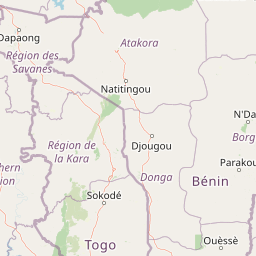
Pendjari National Park is situated in a region of Benin with rich cultural traditions, though the park itself is primarily valued for its wilderness and conservation significance. The park's name derives from the Pendjari River, a watercourse that has historically supported local communities and shaped regional land-use patterns. The nearby town of Tanguieta serves as the nearest settlement and gateway for visitors to the park. The broader Atakora region is home to various ethnic communities whose traditional lifestyles have intersected with the landscapes now protected within the park. The park's designation as a biosphere reserve and World Heritage Site reflects a balance between conservation objectives and recognition of the human dimensions of the landscape.

Top sights and standout views in Pendjari National Park

Pendjari National Park stands as West Africa's premier wilderness destination, offering visitors the opportunity to encounter iconic African wildlife in one of the region's last intact savanna ecosystems. The park's dramatic landscapes, from the forested Pendjari River valley to the rugged cliffs of the Atakora range, create a scenic backdrop for wildlife viewing that is unmatched in the region. The park's elephant populations represent a conservation success story, with stable numbers making it one of the best places in West Africa to observe these magnificent animals. Bird enthusiasts will find exceptional diversity, with nearly 300 species including the hooded vulture and Pel's fishing-owl. The critically endangered Northwest African cheetah persists in small numbers, offering rare sighting opportunities for fortunate visitors. As part of the transboundary WAP Complex, Pendjari offers a conservation experience that extends across borders, representing the largest protected area in the region.

Best time to visit Pendjari National Park

The optimal time to visit Pendjari National Park is during the dry season from November through May, when wildlife viewing is at its best and the landscape is more accessible. During these months, vegetation is less dense and animals congregate around remaining water sources, making sightings more predictable. The landscape at this time showcases the classic West African savanna scenery with golden grasses and clear skies. The wet season from June to November brings heavy rainfall that can make certain areas of the park inaccessible and may disrupt travel plans, though this period supports lush vegetation and represents the park's primary growing season. Visitors planning trips during the wet season should be prepared for temporary road closures and should check current conditions before arriving.

Park location guide

Geography guide, regional context, and park location map for Pendjari National Park

Pendjari National Park park geography, regions, and map view in Benin
Understand where Pendjari National Park sits in Benin through a broader geographic reading of the surrounding landscape, nearby location context, and its mapped position within the national park landscape.

How Pendjari National Park fits into Benin

Benin is a West African nation formerly known as Dahomey. It gained independence from France in 1960 and operates as a unitary presidential republic. The country is known for its coastal location along the Bight of Benin, its historical kingdom of Dahomey, and its agricultural economy centered on palm oil and cotton exports.

Wider geography shaping Pendjari National Park in Benin

Benin is located in West Africa, bordered by Togo to the west, Nigeria to the east, Burkina Faso to the northwest, and Niger to the northeast. The country occupies the southern coastline of the Bight of Benin, which is part of the Gulf of Guinea in the northernmost tropical portion of the Atlantic Ocean. The terrain ranges from coastal plains to hilly uplands in the north.

Map view of Pendjari National Park

Use this park location map to pinpoint Pendjari National Park in Benin, understand its exact geographic position, and read its mapped placement within the surrounding landscape more clearly.

Pigeon | © OpenStreetMap contributors

Location context for Pendjari National Park

Alibori Department
Park atlas

Compare adjacent protected landscapes, tracing the wider WAP Complex across West Africa's savanna ecosystems.

Discover Other National Parks and Protected Areas Near Pendjari National Park
After exploring Pendjari National Park, browse other national parks and protected areas within the broader West African savanna ecosystem. Continue your atlas discovery by comparing distinct river valleys, mountain ranges, and conservation landscapes that define this vital transboundary region.
National parkKara Region

Oti-Kéran National Park: Togo's Vast Protected Savanna Ecosystem and Regional Geography

Explore the mapped terrain and protected landscape of this key national park.

Delve into the geography of Oti-Kéran National Park, Togo's largest national park situated in the Kara Region. This protected savanna landscape, recognized as a Ramsar site, offers insights into its unique sudanian zone terrain, important bird habitats, and its function as a wildlife migration corridor. Understanding its mapped boundaries and ecological significance provides a core piece of the West African protected areas atlas.

Area
690 km²
Established
1950
IUCN
II
Relief
Lowland
National parkNiger

W National Park: Niger National Park, UNESCO World Heritage Site & Ramsar Wetland

Transborder savanna ecosystem and dramatic Niger River landscape.

W National Park in Niger offers a unique atlas view of a vast protected landscape defined by the Niger River's iconic W-shaped bend. As a UNESCO World Heritage Site and Ramsar Wetland, it protects crucial savanna plains, extensive floodplains, and rocky outcrops. This transborder conservation area is a vital habitat for West African wildlife, providing a rich context for geographic discovery and landscape exploration.

Area
10,000 km²
Established
1954
IUCN
II
Relief
Mixed relief
National parkOti Region

Kyabobo National Park: Ghana's Highland National Park with Mount Dzebobo and Forest-Savanna Transition

Explore mountainous terrain, park boundaries, and regional geography in Oti Region.

Kyabobo National Park is a significant protected landscape in Ghana's Oti Region, celebrated for its mountainous topography and the commanding presence of Mount Dzebobo. This national park, established in 1993, safeguards a critical ecological transition zone featuring diverse habitats from dense forests to open tree savanna. Its unique geography and protected status make it a vital site for understanding regional conservation and atlas-based landscape exploration in West Africa, offering insights into varied terrain and ecosystems.

Area
360 km²
Established
1993
IUCN
II
National parkBurkina Faso

Kaboré Tambi National Park: Burkina Faso's Largest National Park and Protected Landscape

Explore the mapped savanna and birdwatching geography of this vital West African area.

Kaboré Tambi National Park represents a critical protected area in Burkina Faso, spanning a considerable expanse of Sudan-Guinea savanna. The park's geography is defined by the Nazinon River and a mosaic of woodland and grassland ecosystems, making it a significant site for understanding regional protected lands and landscape ecology. It offers a valuable point of reference for atlas-based exploration of West African natural areas.

Area
1,555 km²
Established
1976
IUCN
II
Relief
Lowland
National parkOyo State

Old Oyo National Park: Mapped Savanna Terrain and Historical Significance in Nigeria

Explore its geographic setting and protected landscape features.

Old Oyo National Park is a prominent national park situated in Nigeria's Oyo State, covering a substantial area of lowland savanna. The park's terrain features include scattered granite outcrops, ridges, and important archaeological sites, remnants of the ancient Oyo Empire. Its mapped geography reveals a dynamic landscape shaped by river systems and elevated formations, offering a unique blend of natural and cultural heritage for dedicated atlas exploration.

Area
2,512 km²
IUCN
II
National parkSavannah Region

Mole National Park: A Premier Protected Landscape in Ghana's Savannah Region

Explore mapped boundaries and Guinea savannah ecosystems.

Mole National Park represents a significant protected landscape within Ghana's Savannah Region, serving as the country's largest national park and a crucial conservation area for West African wildlife. The park's geography is defined by extensive Guinea savannah, characterized by grasslands with scattered woodlands and a prominent escarpment along its southern edge. Its vast expanse offers a unique opportunity to study mapped park boundaries and understand the ecosystem's role in regional conservation efforts. Discover the unique landscape context and protected area identity of this major West African wildlife refuge.

Area
4,840 km²
Established
1958
IUCN
II
National parkBono East Region

Digya National Park: Ghana's Oldest National Park, Bordering Lake Volta

Explore its unique geography and mapped protected boundaries.

Digya National Park is a significant protected area in Ghana, renowned as the nation's oldest, established in 1900 and gazetted as a national park in 1971. Occupying 3,743 square kilometers in the Bono East Region, it is distinctively bordered on three sides by the vast Lake Volta, creating an unparalleled terrestrial-aquatic habitat interface. This national park represents a key point in Ghana's geographic atlas, situated in a transitional zone between forest and savanna ecosystems, and is a vital hub for wildlife conservation and the study of its unique landscape character.

Area
3,743 km²
Established
1971
IUCN
II
National parkBurkina Faso

Deux Balés National Park: Burkina Faso's Elephant Sanctuary and Savanna Protected Landscape

Explore mapped terrain and key geographic features of this protected area.

Deux Balés National Park serves as a vital protected area within Burkina Faso, acclaimed for harboring the largest elephant population in West Africa. This national park's protected landscape is defined by undulating granitic plains, lateritic plateaux, and distinct gallery forests lining the Black Volta River. The presence of ancient African baobab trees adds a unique visual character to the savanna ecosystem. Investigating this park reveals its significance for regional conservation, its mapped geographic boundaries, and its role within the broader context of protected lands in West Africa.

Area
810 km²
Established
1937
IUCN
II
Relief
Lowland

Common questions about visiting, size, designation, and location context for Pendjari National Park

Pendjari National Park FAQs for park facts, access, geography, and protected area context
Find quick answers about Pendjari National Park, including protected-area facts, park geography, trail and visitor context, and how the park fits into its surrounding country and regional landscape.
MoriAtlas Explorer

Continue Your Protected Areas Search Across the Global Atlas

Deepen your exploration by continuing the structured search for national parks and protected areas worldwide. Utilize the comprehensive filtering capabilities to compare different conservation landscapes and refine your understanding of global park geography. Discover more about the distribution and characteristics of protected natural areas.

Global natural geography