Mori Atlas logo
National parkPhú Quốc National Park

Mapping the protected boundaries and diverse terrain of Vietnam's largest island national park.

Phú Quốc National Park: Protected Tropical Island Landscape and Marine Ecosystem

(Vườn quốc gia Phú Quốc)

Phú Quốc National Park represents a significant protected island landscape within Kiên Giang Province, Vietnam. Established to safeguard the island's rich biodiversity, it spans approximately 70 percent of Phú Quốc Island and its surrounding marine waters. This comprehensive protection covers diverse terrains, from lowland tropical forests and rolling hills to crucial coastal habitats, offering an invaluable glimpse into the region's natural geography and ecosystem complexities for atlas-based exploration.

Tropical islandMarine protected areaNational parkDugong habitatGulf of ThailandMekong Delta

Phú Quốc National Park

National park

Park overview

Structured park overview, official facts, and landscape profile for Phú Quốc National Park

Phú Quốc National Park park facts, protected area profile, and essential visitor context
Review the core facts for Phú Quốc National Park, including designation, size, terrain, visitor scale, habitats, and operating context in one park-focused overview.

About Phú Quốc National Park

Phú Quốc National Park represents one of Vietnam's most important protected island ecosystems, spanning roughly 70 percent of Phú Quốc Island in the Gulf of Thailand. The park's establishment in 2001 marked a significant expansion of Vietnam's national park system into the country's island territories, reflecting growing recognition of the ecological and conservation value of tropical island environments. The park encompasses a variety of landforms including lowland tropical forests, hills such as Ham Rong Mount, and coastal areas where terrestrial landscapes meet marine environments. The inclusion of marine waters within the park's boundaries distinguishes it from many terrestrial-focused protected areas in Vietnam, allowing for the protection of complete ecosystems from forest to reef. Phú Quốc Island itself forms part of Kiên Giang Province in the Mekong Delta region, positioning the park within one of Vietnam's most ecologically diverse areas. The park's location near the border with Cambodia gives it regional significance within the broader Indochinese peninsula's protected area network.

Quick facts and research context for Phú Quốc National Park

Phú Quốc National Park occupies 31,422 hectares on Vietnam's largest island, situated in the Gulf of Thailand off the coast of Kiên Giang Province in the Mekong Delta. The protected area includes both terrestrial and marine components, with 8,603 hectares designated as a strictly protected zone, 22,603 hectares allocated for biological restoration, and 33 hectares for administrative facilities. The park was formally established in 2001 when the Northern Phú Quốc Islands Preservation Zone was upgraded to national park status, reflecting Vietnam's expanding network of protected areas during the early 2000s. The park's marine waters provide habitat for the dugong, a marine mammal that serves as an indicator species for healthy seagrass ecosystems.

Park context

Deeper park guide and search-rich context for Phú Quốc National Park

Phú Quốc National Park history, landscape, wildlife, and travel context
Explore Phú Quốc National Park through its history, landscape character, ecosystems, wildlife, conservation priorities, cultural context, and seasonal travel timing in a structured park guide built for atlas discovery and search intent.

Why Phú Quốc National Park stands out

Phú Quốc National Park is particularly known for its dual terrestrial and marine protection, rare among Vietnam's national parks. The park protects significant populations of the dugong, a vulnerable marine mammal that inhabits the shallow coastal waters surrounding the island. The park's tropical forest ecosystems support biodiversity characteristic of the Gulf of Thailand region, while its designation as an IUCN Category II protected area places it within the global framework of national parks recognized for both conservation and sustainable use. The park's extensive coverage of Phú Quốc Island makes it unique among Vietnam's protected areas, preserving a substantial portion of the country's island wilderness.

Phú Quốc National Park history and protected-area timeline

Phú Quốc National Park was officially established in 2001 through Decision 91/2001/QĐ-TTg, signed by the Prime Minister of Vietnam on June 8, 2001. This decision upgraded the existing Northern Phú Quốc Islands Preservation Zone to national park status, reflecting Vietnam's growing investment in protected area management during the early 2000s. The park's establishment came during a period of expansion for Vietnam's national park system, as the country sought to strengthen biodiversity conservation across its diverse ecological zones. The governing body for the park rests with the People's Committee of Kiên Giang Province, which oversees management and protection activities within the protected area. The transition from preservation zone to national park brought increased resources and formal protection status, recognizing the island's ecological significance within Vietnam's broader conservation framework.

Phú Quốc National Park landscape and geographic character

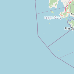
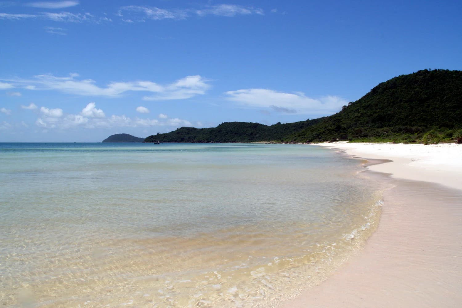
The physical landscape of Phú Quốc National Park encompasses the diverse terrain found across Phú Quốc, Vietnam's largest island. The park includes coastal areas along the Gulf of Thailand, rolling hills such as Ham Rong Mount, and the lowland tropical forests that historically covered much of the island. The marine component of the park extends into the surrounding waters, protecting the seabed, coral communities, and seagrass beds that support marine life. The island's position in the Gulf of Thailand places it within a tropical maritime environment characterized by warm waters and seasonal weather patterns. The park's boundaries encompass several communes including Gành Dầu, Bãi Thơm, Cửa Cạn, and portions of Cửa Dương, Hàm Ninh, Dương Tơ, and Dương Đông Township, creating a comprehensive protected area that spans the island's northern and central regions.

Phú Quốc National Park ecosystems, habitats, and plant life

The ecological character of Phú Quốc National Park reflects its position within the tropical Gulf of Thailand region, supporting ecosystems that differ from mainland Vietnam's more seasonal environments. The park's terrestrial areas feature tropical forest habitats that provide shelter for resident and migratory species, while the marine component protects the underwater environments that make the island's surrounding waters ecologically significant. The dugong represents the park's most notable marine species, depending on seagrass beds in shallow coastal waters for its survival. These marine herbivores serve as flagship species for the park's marine conservation efforts, indicating the broader health of the coastal ecosystem. The park's biological restoration area, encompassing the majority of its terrestrial territory, reflects a management approach that balances protection with ecological recovery in areas that have experienced human disturbance.

Phú Quốc National Park wildlife and species highlights

The wildlife of Phú Quốc National Park includes both terrestrial and marine species that depend on the island's diverse habitats. The dugong stands as the park's most internationally recognized species, a marine mammal that inhabits the shallow waters surrounding Phú Quốc Island. These gentle herbivores feed on seagrass beds in coastal areas, making the protection of marine waters essential for their survival. The park's terrestrial forests provide habitat for various bird species, small mammals, and invertebrates that constitute the island's native biodiversity. While specific species inventories would require more detailed source material, the park's designation as a protected area and its inclusion of both land and sea environments suggests a diverse assemblage of species adapted to tropical island conditions. The presence of a strictly protected zone within the park indicates areas set aside specifically for wildlife conservation where human disturbance is minimized.

Phú Quốc National Park conservation status and protection priorities

Phú Quốc National Park contributes to Vietnam's conservation framework as an IUCN Category II protected area, placing it within the global system of national parks recognized for their ecological significance and biodiversity protection. The park's dual protection of terrestrial and marine environments reflects an ecosystem-based approach that recognizes the connections between island forests and surrounding waters. The protection of dugong habitat represents a particular conservation priority, as this species faces pressures throughout its range in Southeast Asian waters. The park's zoning structure, with strictly protected areas, biological restoration zones, and administrative areas, demonstrates a management approach that balances conservation objectives with practical operational needs. The inclusion of marine waters within the park boundaries is particularly significant, as it allows for the protection of complete ecological communities rather than isolated terrestrial fragments.

Phú Quốc National Park cultural meaning and human context

Phú Quốc Island and its national park exist within a landscape shaped by human communities whose relationship with the island predates its protected area designation. The park encompasses several communes where local communities maintain traditional connections to the land and marine resources. The island's position near the Vietnamese coast in Kiên Giang Province places it within a region with distinct cultural traditions tied to fishing, agriculture, and maritime activities. While the national park designation imposes restrictions on land use within its boundaries, the presence of established communities within the park area reflects the complexity of integrating conservation with human settlement. The park's management by the People's Committee of Kiên Giang Province involves balancing conservation objectives with the needs of local residents who inhabit areas within and adjacent to the protected zone.

Top sights and standout views in Phú Quốc National Park

Phú Quốc National Park stands out as Vietnam's largest island national park, protecting approximately 70 percent of Phú Quốc Island along with its surrounding marine waters. The park's dual terrestrial and marine protection makes it distinctive within Vietnam's protected area system, preserving complete island ecosystems from forest to reef. The presence of dugongs in the park's coastal waters provides a flagship species that connects the park to broader marine conservation efforts in the Gulf of Thailand region. The park's establishment in 2001 reflects Vietnam's commitment to expanding protected area coverage to include island environments, representing a significant addition to the country's national park network.

Best time to visit Phú Quốc National Park

The best time to visit Phú Quốc National Park coincides with the dry season typically running from November through April, when lower rainfall and milder temperatures make outdoor exploration more comfortable. This period corresponds with cooler temperatures compared to the hot season from February to May, though the island maintains year-round tropical warmth. The marine areas surrounding the park are accessible throughout the year, though sea conditions may vary with seasonal weather patterns. Visitors interested in wildlife viewing, particularly marine species such as dugongs, may find certain seasons more favorable depending on animal movement patterns and water visibility.

Park location guide

Geography guide, regional context, and park location map for Phú Quốc National Park

Phú Quốc National Park park geography, regions, and map view in Vietnam
Understand where Phú Quốc National Park sits in Vietnam through a broader geographic reading of the surrounding landscape, nearby location context, and its mapped position within the national park landscape.

How Phú Quốc National Park fits into Vietnam

Vietnam, officially the Socialist Republic of Viet Nam, is a unitary communist state in Southeast Asia. It occupies roughly 331,000 square kilometres along the eastern edge of Mainland Southeast Asia, with a population exceeding 102 million. The country is bordered by China to the north, Laos and Cambodia to the west, and has maritime boundaries in the Gulf of Thailand and South China Sea.

Wider geography shaping Phú Quốc National Park in Vietnam

Vietnam occupies the eastern edge of Mainland Southeast Asia, stretching along the Gulf of Thailand to the southwest and the South China Sea to the east. The country is bordered by China to the north, and Laos and Cambodia to the west. It has a diverse landscape ranging from the Red River Delta in the north to the Mekong Delta in the south.

Map view of Phú Quốc National Park

Use this park location map to pinpoint Phú Quốc National Park in Vietnam, understand its exact geographic position, and read its mapped placement within the surrounding landscape more clearly.

Pigeon | © OpenStreetMap contributors

Location context for Phú Quốc National Park

Kiên Giang ProvinceMekong Delta
Park atlas

Trace the regional protected landscapes and marine zones across Vietnam and the Gulf of Thailand, comparing conservation areas beyond Phú Quốc Island.

Discover More National Parks and Protected Areas Near Phú Quốc National Park, Vietnam
Explore national parks and protected areas near Phú Quốc National Park, uncovering terrestrial forests, coastal ecosystems, and marine zones across Vietnam's Gulf of Thailand region. Compare the unique conservation profiles and geographic spread of these regional parks, gaining a deeper understanding of Southeast Asian protected-area networks and their varied ecosystems.
National parkSihanoukville Province

Ream National Park: Protected Coastal Landscape and Marine Biodiversity in Sihanoukville Province

Explore unique mangrove ecosystems and mapped terrain within Cambodia.

Ream National Park is a significant protected area in Cambodia, celebrated for its intricate coastal and terrestrial ecosystems. This national park offers a detailed view of mangrove wetlands, evergreen forests, rolling hills, and marine habitats like coral reefs and sea grass beds. Situated in Sihanoukville Province, its landscape is characterized by rivers flowing through the terrain into the sea, providing vital habitats for diverse species and contributing to its atlas significance for regional geography and protected-area study.

Area
146.76 km²
Established
1993
IUCN
II
National parkKep Province

Kep National Park: Cambodia's Coastal Mountain Protected Landscape

Explore mapped terrain and panoramic viewpoints of this national park.

Kep National Park is a protected national park situated in Kep Province, Cambodia, known for its unique hilly terrain that rises from the coastal lowlands. This protected area offers elevated viewpoints with commanding sights across the Gulf of Thailand, stretching towards Phu Quoc island and the distant Bokor Ranges. Its landscape character is defined by the contrast between its mountainous interior and the surrounding flat coastal regions, making it a significant feature for understanding regional geography and mapped protected areas. The park provides an accessible experience of Cambodia's coastal mountainous ecosystems.

Area
11.52 km²
Established
1993
IUCN
II
National parkKampot Province

Preah Monivong Bokor National Park: An ASEAN Heritage Mountain Park in Kampot Province

Explore diverse forests and colonial history within its mapped terrain.

Preah Monivong Bokor National Park is a protected national park in Kampot Province, Cambodia, distinguished by its mountainous geography within the Dâmrei Mountains. Covering over 1,500 square kilometers, it showcases varied forest ecosystems and is recognized as an ASEAN Heritage Park. The park's landscape combines significant natural biodiversity with remnants of French colonial history, offering a rich context for atlas-based geographic exploration and protected-area understanding.

Area
1,544.58 km²
Established
1993
IUCN
II
National parkKampong Speu Province

Kirirom National Park: Cambodia's Pioneering Protected Mountain Landscape

Explore its mapped terrain and regional geography in Kampong Speu Province

Kirirom National Park stands as Cambodia's foundational national park, safeguarding a significant portion of the eastern Cardamom Mountains. This protected landscape is defined by its elevated terrain and mountain forest ecosystems, offering a distinct geographic character within Kampong Speu Province. Its atlas-style exploration reveals the mapped boundaries and regional context of this pioneering conservation area, providing insight into Cambodia's commitment to preserving its natural heritage.

Area
283.75 km²
Established
1993
IUCN
II
Relief
Mixed relief
National parkCambodia

Botum Sakor National Park: Cambodia's Largest National Park and Coastal Wilderness

Explore its mapped geography and protected landscape features.

Botum Sakor National Park represents Cambodia's largest national park, offering a unique protected landscape where the Cardamom Mountains meet the Gulf of Thailand. The park's diverse geography includes extensive evergreen forests, grasslands, and significant coastal wetland ecosystems, such as mangrove and freshwater swamp forests. Examining its mapped boundaries reveals a critical area for biodiversity and regional ecological context within Southeast Asia's protected lands.

Area
1,825.85 km²
Established
1993
IUCN
II
National parkKoh Kong province

Southern Cardamom National Park: A Vital Protected Landscape in Koh Kong Province

Explore its mapped boundaries and conservation significance.

Southern Cardamom National Park is a crucial protected area in southwestern Cambodia, encompassing a significant portion of the Cardamom Mountains. This national park serves as a vital atlas point for understanding the regional geography and conservation efforts in Southeast Asia. Its expansive territory is dedicated to safeguarding critical habitats and supporting ambitious wildlife programs, making it a cornerstone of landscape-level conservation and a key element in mapping the protected areas of the region.

Area
4,103.92 km²
Established
2016
IUCN
II
National parkKiên Giang Province

U Minh Thượng National Park: Vietnam's Premier Mekong Delta Wetland Protected Area

Mapping the rich biodiversity and peat swamp ecosystems of Kiên Giang Province.

U Minh Thượng National Park is a key protected wetland in Kiên Giang Province, recognized for its exceptional biodiversity and status as a Ramsar site. Covering vast peat swamp forests and freshwater marshes, this national park offers critical insights into the Mekong Delta's unique ecology and hydrological systems. Its extensive mapped boundaries and distinct landscape character make it a vital point of study for understanding regional protected area networks and the natural geography of Southeast Asia.

Area
80.53 km²
Established
2002
IUCN
II
National parkCà Mau province

U Minh Hạ National Park: Vietnam's Protected Wetland Landscape and Geography

Explore peat swamp forest and seasonal flood dynamics.

U Minh Hạ National Park stands as a crucial protected wetland within Cà Mau province, Vietnam, encompassing a significant expanse of freshwater marsh and peat swamp forest. This national park showcases the complex hydrological patterns of the Mekong Delta, including extensive seasonal flooding that shapes its unique landscape and supports specialized flora and fauna. Its protected status highlights the importance of conserving these rare wetland ecosystems and understanding their geographic context for regional ecological balance.

Area
8,286 km²
Established
2006
IUCN
II

Common questions about visiting, size, designation, and location context for Phú Quốc National Park

Phú Quốc National Park FAQs for park facts, access, geography, and protected area context
Find quick answers about Phú Quốc National Park, including protected-area facts, park geography, trail and visitor context, and how the park fits into its surrounding country and regional landscape.
MoriAtlas Explorer

Continue Your Protected Areas Search Across the Global Atlas

Deepen your exploration by continuing the structured search for national parks and protected areas worldwide. Utilize the comprehensive filtering capabilities to compare different conservation landscapes and refine your understanding of global park geography. Discover more about the distribution and characteristics of protected natural areas.

Global natural geography