Mori Atlas logo
National parkSalonga National Park

Explore the vast mapped boundaries and riverine geography of this crucial Congo Basin protected landscape.

Salonga National Park: Africa's Largest Tropical Rainforest and Vital Bonobo Habitat

(Parc National de la Salonga)

Salonga National Park represents the largest expanse of intact tropical rainforest in Africa and the second largest globally, a vital component of the Congo Basin ecosystem. This protected area in the Democratic Republic of the Congo spans immense territories, largely untouched by roads and primarily accessed via its extensive river systems. Its significance extends to being a critical sanctuary for endangered species, most notably bonobos and the endemic Congo peafowl, making its mapped landscape a focal point for biodiversity and conservation atlas exploration.

tropical rainforestUNESCO World Heritage Sitebonobo habitatCongo Basinprimate sanctuaryendangered species

Salonga National Park

National park

Park overview

Structured park overview, official facts, and landscape profile for Salonga National Park

Salonga National Park park facts, protected area profile, and essential visitor context
Review the core facts for Salonga National Park, including designation, size, terrain, visitor scale, habitats, and operating context in one park-focused overview.

About Salonga National Park

Salonga National Park occupies a central position within the Congo Basin, the world's second-largest tropical rainforest after the Amazon. The park's extraordinary size of approximately 36,000 square kilometers creates a vast wilderness area that has allowed ecological processes to continue relatively undisturbed by human activity. This continuity is particularly significant in central Africa, where many other forest areas have been fragmented by logging, agriculture, and human settlement. The park's geography is defined by its river systems, including the Salonga River which flows through its center to join the Busira River, and the Lokoro River which provides access to the southern regions inhabited by the Iyaelima people. The absence of internal road infrastructure means that much of the park remains in a state of near-pristine isolation, with some sections never having been systematically explored by scientists. This remoteness, while presenting challenges for conservation management and research, has also served as a natural barrier against some forms of environmental degradation. The park's designation as a World Heritage Site reflects its global significance as a reservoir of biodiversity and a functioning ecosystem representative of African tropical forest environments.

Quick facts and research context for Salonga National Park

Salonga National Park covers 36,000 square kilometers of contiguous rainforest in central Democratic Republic of the Congo, making it Africa's largest tropical forest protected area. The park is situated roughly midway between the capital Kinshasa and the city of Kisangani, within the Congo River basin. It was originally established as Tshuapa National Park in 1956 and received its present boundaries through a presidential decree in 1970. The park is co-managed by the Institut Congolais pour la Conservation de la Nature and the World Wide Fund for Nature since 2015. Notable wildlife includes bonobos, forest elephants, Congo peafowl, and numerous primate species. The Iyaelima people remain the last remaining residents within the park boundary.

Park context

Deeper park guide and search-rich context for Salonga National Park

Salonga National Park history, landscape, wildlife, and travel context
Explore Salonga National Park through its history, landscape character, ecosystems, wildlife, conservation priorities, cultural context, and seasonal travel timing in a structured park guide built for atlas discovery and search intent.

Why Salonga National Park stands out

Salonga National Park is most renowned for protecting the largest tract of intact tropical rainforest in Africa and serving as the primary stronghold for bonobo populations in the wild. The park is one of the few places on Earth where these endangered great apes persist in viable numbers, particularly in the southern regions near Iyaelima settlements where human-wildlife coexistence has proven beneficial. The park also shelters the Congo peafowl, the national bird of the Democratic Republic of the Congo and a species endemic to the Congo Basin. Its status as a UNESCO World Heritage Site, combined with its ecological significance as a biodiversity reservoir in the world's second-largest tropical rainforest, makes Salonga one of Africa's most important protected areas.

Salonga National Park history and protected-area timeline

The formal protection of Salonga's forests began in 1956 when the area was established as Tshuapa National Park. The park received its current boundaries and the name Salonga through a presidential decree issued in 1970 by President Mobutu Sese Seko, consolidating the protected area into its present form. In 1984, the park was inscribed on the UNESCO World Heritage List in recognition of its ecological significance and relatively intact rainforest environment. The park's history took a troubled turn in 1999 when it was added to the List of World Heritage in Danger, primarily due to the civil conflict affecting the eastern regions of the Democratic Republic of the Congo and associated pressures from poaching and unauthorized settlement. Beginning in 2015, the park's management transitioned to a co-management arrangement between the Institut Congolais pour la Conservation de la Nature and the World Wide Fund for Nature. This partnership has worked to address conservation challenges while engaging with the two main human populations residing within the park: the Iyaelima people, who represent the last remaining residents of the park and have played a constructive role in bonobo conservation, and the Kitawalistes, a religious community that settled in the park following its creation. In 2021, following years of improved conservation efforts, Salonga was removed from the List of World Heritage in Danger, marking a significant achievement in the park's management.

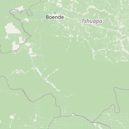
Salonga National Park landscape and geographic character

The landscape of Salonga National Park is characterized by vast stretches of lowland tropical rainforest interspersed with a network of river systems that drain into the Congo River basin. The terrain is generally flat to gently rolling, typical of the central African plateau, with elevations varying only slightly across the extensive park boundaries. The Salonga River meanders through the park in a generally northwest direction before joining the Busira River, while the Lokoro River flows through the center and northern regions, providing the primary access route to the southern areas inhabited by the Iyaelima people. Dense canopy forest covers the majority of the landscape, with the forest structure varying between primary forest areas that have never been significantly disturbed and secondary forest in areas that have experienced more human activity. River banks and forested wetlands create additional habitat diversity within the broader forest matrix. The park's remoteness and the absence of internal roads have helped preserve the landscape in a relatively unmodified state, with the only access points being the rivers that serve as corridors through the continuous forest cover.

Salonga National Park ecosystems, habitats, and plant life

Salonga National Park protects one of the most ecologically significant tropical forest ecosystems in Africa. Located in the heart of the Congo Basin, the park's size and ecological complexity have allowed species and ecological communities to evolve with minimal human interference. Studies in the southwestern region have documented 735 plant species, with an remarkable 85 percent relying on animals for seed dispersal, indicating the sophisticated ecological relationships within this forest system. The park's biodiversity extends across multiple taxonomic groups, from large mammals to primates, birds, fish, and reptiles. The conservation of this extensive forest area is particularly important given the global significance of the Congo Basin as the world's second-largest tropical rainforest and a critical component of the Earth's carbon cycle and climate regulation. The park's status as a World Heritage Site acknowledges its role as a representative sample of African tropical forest biodiversity that merits preservation for future generations.

Salonga National Park wildlife and species highlights

Salonga National Park supports an exceptional diversity of wildlife, with particular significance for primate populations and large mammals. The park is renowned as one of the most important strongholds for bonobos, the endangered great ape endemic to the Democratic Republic of the Congo. Studies have documented remarkably high bonobo densities in the vicinity of Iyaelima settlements, where local communities have maintained traditional practices that do not threaten these primates. The primate community includes numerous species such as Dryas monkey, Thollon's red colobus, Allen's swamp monkey, golden-bellied mangabey, red-tailed monkey, potto, and dwarf bushbaby. Large mammals present in the park include bongo antelopes, black-crested mangabeys, leopards, forest elephants, hippopotamus, African golden cat, red river hog, and various duiker species. The avian fauna includes the Congo peafowl, a threatened species endemic to the Congo Basin and the national bird of the Democratic Republic of the Congo, as well as storks, egrets, and numerous other bird species. Aquatic species include 56 documented fish species and African slender-snouted crocodiles, with pangolins and otters among the more specialized mammalian residents.

Salonga National Park conservation status and protection priorities

Salonga National Park represents a critical conservation priority in Africa due to its role as the largest protected tropical rainforest on the continent. The park's World Heritage designation reflects its outstanding universal value as a biodiversity reservoir and a functioning ecosystem. The site was placed on the List of World Heritage in Danger from 1999 to 2021 due to threats from poaching, civil conflict, and unauthorized settlement, but was removed from the endangered list following significant improvements in conservation management. The co-management partnership between the Institut Congolais pour la Conservation de la Nature and the World Wide Fund for Nature, established in 2015, has strengthened anti-poaching efforts and community engagement. The collaboration with the Iyaelima people has proven particularly valuable, as their presence in the park has not conflicted with bonobo conservation, and in some cases appears to have contributed to higher primate densities in their vicinity. Conservation challenges remain significant given the park's vast size, limited infrastructure, and the socioeconomic pressures in surrounding regions.

Salonga National Park cultural meaning and human context

The human dimension of Salonga National Park includes the presence of the Iyaelima people, who represent the last remaining residents within the park's boundaries. This indigenous community has maintained its presence in the southern region of the park, accessible via the Lokoro River, and has developed a relationship with the landscape that has not been fundamentally incompatible with conservation goals. The Iyaelima have been described as playing a strong role in bonobo conservation, as bonobo populations reach their highest densities in areas surrounding Iyaelima villages. Park guards utilize Iyaelima villages as guard posts, creating an integrated approach to protection that leverages local knowledge and presence. A second community within the park consists of the Kitawalistes, a religious sect that installed themselves in the park shortly after its formal establishment. Ongoing consultation between park management and both communities reflects the complexity of balancing conservation objectives with the rights and livelihoods of people who call the park home.

Top sights and standout views in Salonga National Park

Salonga National Park stands as Africa's largest tropical rainforest reserve, a UNESCO World Heritage Site, and one of the most important biodiversity conservation areas on the continent. The park protects the second-largest tropical rainforest in the world and serves as the primary habitat for bonobo populations, the endangered great apes found only in the Democratic Republic of the Congo. Its extensive river systems, including the Salonga and Lokoro rivers, provide both ecological diversity and the primary access routes through this vast wilderness. The presence of the Congo peafowl, the national bird and an endemic species of the Congo Basin, adds to the park's conservation significance. The successful collaboration between park management and the Iyaelima people demonstrates a model of community-based conservation that has contributed to the species protection. The park's removal from the World Heritage in Danger list in 2021 reflects substantial progress in addressing the conservation challenges that have faced this remarkable protected area.

Best time to visit Salonga National Park

Visiting Salonga National Park requires careful planning due to the park's remote location and limited infrastructure. The dry season, typically from December to March, generally offers more accessible conditions for river travel and wildlife observation, though the park remains accessible by water year-round. The wet season, from April to November, can make river travel more challenging but may offer different wildlife viewing opportunities as animals concentrate around water sources. Given the park's limited tourism infrastructure and the need for specialized logistics to navigate its rivers, visits typically require coordination with park management or authorized operators. The park's inaccessibility means that visitor numbers remain low, preserving the wilderness character of the experience but also requiring substantial advance preparation.

Park location guide

Geography guide, regional context, and park location map for Salonga National Park

Salonga National Park park geography, regions, and map view in Democratic Republic of the Congo
Understand where Salonga National Park sits in Democratic Republic of the Congo through a broader geographic reading of the surrounding landscape, nearby location context, and its mapped position within the national park landscape.

How Salonga National Park fits into Democratic Republic of the Congo

The Democratic Republic of the Congo is a Central African country bordered by the Republic of the Congo, Angola, Zambia, Tanzania, Uganda, Rwanda, Burundi, and the Central African Republic, with a small Atlantic coastline. It occupies the Congo Basin, one of the world's largest tropical rainforest regions. French is the official language, though over 200 indigenous languages are spoken. Kinshasa is the capital and largest city.

Wider geography shaping Salonga National Park in Democratic Republic of the Congo

The DRC occupies a central position in Central Africa, bordering the Republic of the Congo and the South Atlantic Ocean to the west, the Central African Republic and South Sudan to the north, Uganda, Rwanda, Burundi, and Tanzania to the east (across Lake Tanganyika), and Zambia and Angola to the south. The country's terrain is dominated by the Congo Basin, a vast lowland plain covered in equatorial rainforest, while the eastern and southeastern regions feature highlands and mountains including the Albertine Rift.

Map view of Salonga National Park

Use this park location map to pinpoint Salonga National Park in Democratic Republic of the Congo, understand its exact geographic position, and read its mapped placement within the surrounding landscape more clearly.

Pigeon | © OpenStreetMap contributors

Location context for Salonga National Park

Équateur ProvinceKasaï ProvinceMai Ndombe ProvinceSankuru Province
Park atlas

Explore the Regional Context and Conservation Landscapes Surrounding Africa's Largest Tropical Rainforest.

Discover Other National Parks and Protected Areas Near Salonga National Park
Browse a curated selection of national parks and protected areas across the Congo Basin, offering geographic and ecological context to Salonga National Park's vast rainforest. Compare diverse conservation landscapes throughout the region, tracing the spread of significant wildlife habitats and unique ecosystems from an atlas perspective.
National parkDemocratic Republic of the Congo

Lomami National Park: Central African Protected Landscape and Biodiversity Hub

Explore its lowland tropical rainforest and distinct bonobo habitat.

Lomami National Park is a recently established national park in the Democratic Republic of the Congo, covering nearly 9,000 square kilometers of lowland tropical rainforest. Situated in the central Congo Basin, it plays a crucial role in protecting unique biodiversity, including genetically distinct bonobo populations separated by the Lomami River. The park also supports populations of okapi and the Congo peafowl, making it a vital area for conservation and geographic discovery within Central Africa.

Area
8,879 km²
Established
2016
IUCN
II
National parkCentral African Republic

Dzanga-Ndoki National Park National Park: Mapped Boundaries and Geographic Context in Central Africa

Explore protected landscape geography and park atlas details.

Gain a structured understanding of Dzanga-Ndoki National Park as a protected area in the Central African Republic. This page focuses on its precise geographic scope, mapped park boundaries, and its identity as a National Park. It serves as an entry point for exploring the park's landscape context and its place within the atlas of protected natural areas, offering factual details for geographic discovery.

Area
1,143.26 km²
Established
1990
IUCN
II
Relief
Lowland
National parkEast Region

Lobéké National Park: A Pristine National Park within Cameroon's East Region Geography

Explore mapped boundaries of semi-evergreen forest and unique bais habitats.

Lobéké National Park represents a critical component of Central Africa's protected landscape atlas, situated in Cameroon's East Region. This national park encompasses vast tracts of pristine semi-evergreen forest, notable for its lack of commercial logging. Its landscape is distinguished by natural saline swamp savannas, riverine habitats, and the iconic mineral-rich bais clearings that attract significant megafauna. Understanding Lobéké National Park offers insight into the ecological richness and geographic context of the Congo Basin's conservation areas.

Area
2,178 km²
Established
1999
IUCN
II
Relief
Lowland
National parkDemocratic Republic of the Congo

Maiko National Park National Park: Map and Protected Landscape Exploration

Discover primary forest terrain and endemic species sanctuary.

Maiko National Park, situated in the Democratic Republic of the Congo, is a cornerstone of central African conservation, protecting over 10,000 square kilometers of pristine tropical rainforest. This national park is recognized globally for its critical role in harboring endemic species such as Grauer's gorilla and the okapi, alongside significant populations of forest elephants and chimpanzees. Its extensive river systems and varied terrain within the Ituri Rainforest ecosystem provide essential habitat, establishing Maiko as a key area for understanding and preserving central African biodiversity and landscape context.

Area
10,885 km²
Established
1970
IUCN
II
National parkHaut-Ogooué Province

Batéké Plateau National Park: Mapped Geography of a Central African Forest-Savanna Mosaic

Discover the terrain and protected landscape of Haut-Ogooué Province.

Batéké Plateau National Park is defined by its expansive forest-savanna mosaic, a rare ecological formation across Central Africa. Located within Haut-Ogooué Province, this national park showcases unique terrain characterized by savanna grasslands interspersed with woodlands and forested corridors. Understanding its geographic context and protected boundaries provides valuable insight into the region's natural heritage and conservation significance.

Area
2,034 km²
Established
2002
IUCN
II
National parkSouth Kivu Province

Kahuzi-Biéga National Park: A Protected Landscape in South Kivu Province's Albertine Rift

Explore its mapped boundaries and diverse terrain.

Kahuzi-Biéga National Park, a significant national park in South Kivu Province, is defined by its dramatic geographic diversity. Spanning approximately 6,000 square kilometers, it features a unique ecological gradient from dense lowland equatorial rainforest in the west to the subalpine zones of the Mitumba Mountains in the east, dominated by the dormant volcanoes Mount Kahuzi and Mount Biéga. This protected landscape offers a rich atlas context for understanding the biodiversity and regional geography of the Albertine Rift, showcasing a vital transition in terrain and habitat.

Area
6,000 km²
Established
1970
IUCN
II
National parkDemocratic Republic of the Congo

Virunga National Park: Democratic Republic of the Congo's Premier Protected Landscape

Mapped boundaries and diverse Albertine Rift endemic geography.

Virunga National Park represents a pivotal protected area within the Democratic Republic of the Congo, characterized by an exceptional range of geographic features and vital ecosystems. Its protected landscape includes active volcanoes like Nyiragongo with its lava lake, the towering Rwenzori Mountains, and diverse lowland savannas. This atlas-focused entry highlights the park's unique position in the Albertine Rift, crucial for numerous endemic species and offering significant insight into regional geography and protected land context.

Area
7,800 km²
Established
1925
IUCN
II
National parkGabon

Ivindo National Park: A Protected Rainforest Landscape in Gabon

Explore its waterfalls, diverse ecosystems, and mapped geographic context.

Ivindo National Park represents a significant protected landscape within Gabon, spanning a vast area of intact tropical rainforest. Recognized as a UNESCO World Heritage Site, the park is defined by the Ivindo River and its dramatic waterfalls, including the famous Kongou and Mingouli Falls. Its geography includes mountainous terrain and vital riverine ecosystems, supporting critical populations of forest elephants and great apes. This page offers a gateway to understanding the park's protected status, its unique natural features, and its role in the broader geography of Central Africa.

Area
3,000 km²
Established
2002
IUCN
II

Common questions about visiting, size, designation, and location context for Salonga National Park

Salonga National Park FAQs for park facts, access, geography, and protected area context
Find quick answers about Salonga National Park, including protected-area facts, park geography, trail and visitor context, and how the park fits into its surrounding country and regional landscape.
MoriAtlas Explorer

Continue Your Protected Areas Search Across the Global Atlas

Deepen your exploration by continuing the structured search for national parks and protected areas worldwide. Utilize the comprehensive filtering capabilities to compare different conservation landscapes and refine your understanding of global park geography. Discover more about the distribution and characteristics of protected natural areas.

Global natural geography