Mori Atlas logo
Marine protected areaAustralian Whale Sanctuary

A comprehensive look at the maritime boundaries and oceanic environments under national conservation protection.

Australian Whale Sanctuary: Understanding Australia's Continent-Scale Marine Protected Area Geography

The Australian Whale Sanctuary covers the full extent of Australia's exclusive economic zone, creating one of the world's largest marine protected areas. This oceanic refuge spans a diverse range of marine environments, from the tropical waters of the Indian Ocean and the Coral Sea to the turbulent, frigid conditions of the Southern Ocean and the Australian Antarctic Territory. Through this vast jurisdictional framework, the sanctuary provides legal protection for cetaceans across hemispheric-scale aquatic ecosystems.

marine sanctuarycetacean protectionexclusive economic zonesouthern oceanmarine mammalswhaling dispute

Australian Whale Sanctuary

Marine protected area

Park overview

Structured park overview, official facts, and landscape profile for Australian Whale Sanctuary

Australian Whale Sanctuary park facts, protected area profile, and essential visitor context

Review the core facts for Australian Whale Sanctuary, including designation, size, terrain, visitor scale, habitats, and operating context in one park-focused overview.

About Australian Whale Sanctuary

The Australian Whale Sanctuary is a legally defined marine zone that protects all cetaceans, including whales, dolphins, and porpoises, from hunting across waters under Australian jurisdiction. Established in 1999, it represents a continent-wide commitment to cetacean conservation and reflects the Australian government's view that the country's vast surrounding ocean areas form a coherent conservation estate for marine mammals.

The sanctuary's geographic scope is its most defining feature. It covers the Exclusive Economic Zone around the Australian mainland and extends outward to include waters surrounding Australian external territories such as Christmas Island, the Cocos (Keeling) Islands, Norfolk Island, Macquarie Island, and the Heard Island and McDonald Islands. The result is a single contiguous marine protection framework that spans dramatically different ocean environments, from coral-rich tropical seas to cold Southern Ocean waters.

The sanctuary is administered at the federal level, with oversight through Australia's environment department, and it operates under domestic law that makes the taking or harming of cetaceans within the designated waters an offense. This legal foundation has allowed Australian authorities and the Federal Court to act against foreign vessels that have engaged in whaling within the protected waters, particularly in the Southern Ocean to the south of the continent.

Beyond its legal and geographic significance, the Australian Whale Sanctuary is also conceptually interesting because it functions as a protection layer rather than a place in the traditional sense. There are no visitor centers, trails, or fixed boundaries a traveler can walk through. Instead, the sanctuary is best understood as a regulatory and ecological commitment, a statement that wherever Australian maritime law applies, the marine mammals encountered there are protected from hunting.

Quick facts and research context for Australian Whale Sanctuary

The Australian Whale Sanctuary was established in 1999 under the Australian government's Environment Protection and Biodiversity Conservation Act framework and is administered through the Commonwealth's environmental department. It is defined by the full extent of the Australian Exclusive Economic Zone, covering waters out to 200 nautical miles from the coast of mainland Australia and a range of external territories.

These territories include Indian Ocean outposts such as Christmas Island and the Cocos (Keeling) Islands, the Tasman Sea location of Norfolk Island, the subantarctic Macquarie Island, and the remote Heard Island and McDonald Islands in the southern Indian Ocean. The sanctuary is oriented specifically toward cetacean protection, distinguishing it from broader marine park arrangements, and has been used as a legal foundation in international whaling disputes.

Protection and recognition

Marine conservation framework and official protected area designation records

Australian Whale Sanctuary Protection Status and Marine Governance

Marine conservation records for Australian Whale Sanctuary outline the documented protection status and governance scope. Official administrative data tracks management mandates and international recognition sources across the designated marine zone.

Protection details

Protection scope
Marine
Transboundary protection
No
Park context

Deeper park guide and search-rich context for Australian Whale Sanctuary

Australian Whale Sanctuary history, landscape, wildlife, and travel context

Explore Australian Whale Sanctuary through its history, landscape character, ecosystems, wildlife, conservation priorities, cultural context, and seasonal travel timing in a structured park guide built for atlas discovery and search intent.

Why Australian Whale Sanctuary stands out

The Australian Whale Sanctuary is best known for its jurisdictional scale. Rather than protecting a specific bay, reef, or coastline, it safeguards an enormous swath of ocean that encompasses every marine zone under Australian control, from tropical equatorial islands to subantarctic waters near Antarctica. This scale makes it one of the largest cetacean-focused protected areas in the world by ocean surface area. The sanctuary is also known for its role in the legal conflict between Australia and Japan over whaling in the Southern Ocean. Australian courts have relied on the sanctuary's legal framework to challenge Japanese whaling operations, and the protected designation has become a key element in Australia's diplomatic and legal opposition to commercial and scientific whaling in the region.
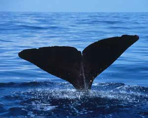
The dark, triangular tail fluke of a sperm whale rising above the surface of deep blue water.
A sperm whale fluke breaks the surface of the ocean.

Australian Whale Sanctuary history and protected-area timeline

The Australian Whale Sanctuary was formally established in 1999 as part of Australia's domestic marine protection framework. Its creation aligned with a broader period in the late twentieth century during which Australia was strengthening its environmental legislation, particularly through measures that consolidated federal responsibility over marine species and protected areas.

The sanctuary's early legal significance became evident when it was invoked in disputes over whaling in the Southern Ocean. Whales have long been present in the waters off southern Australia, and Australia's environmental policy evolved alongside international shifts away from commercial whaling. The sanctuary was designed to give domestic legal force to those international commitments.

The sanctuary became internationally prominent in the late 2000s during the escalating dispute between Australia and Japan over whaling near Antarctic waters. In 2008, the Federal Court of Australia ruled that it was illegal under Australian law for the Japanese whaling fleet to kill whales within the sanctuary. This ruling set a precedent in applying Australian domestic legislation to foreign-flagged vessels operating in the Southern Ocean.

The legal conflict escalated further in 2015, when the Japanese whaling company Kyodo Senpaku Kaisha Ltd was found guilty of wilful contempt of court for continuing whaling activities in defiance of Australian rulings. The company was fined A$1,000,000, marking one of the most significant enforcement outcomes tied directly to the sanctuary's existence. These events cemented the sanctuary's role not just as a conservation designation, but as an active legal instrument in international marine mammal politics.

Australian Whale Sanctuary landscape and geographic character

The Australian Whale Sanctuary does not have a fixed terrestrial landscape in the conventional sense. Instead, its landscape is oceanic, defined by the full perimeter of Australia's maritime jurisdiction. The protected waters reach from the warm tropical seas of the Indian Ocean's eastern reaches, around the Coral and Timor Sea environments of northern Australia, through the temperate coastal waters of the southern mainland, and into the cold, remote Southern Ocean.

Around the external territories, the oceanic landscape becomes especially distinctive. Near Christmas Island and the Cocos (Keeling) Islands, the sanctuary covers equatorial waters known for deep pelagic environments and proximity to broader Indian Ocean currents. Around Norfolk Island in the Tasman Sea, the protected waters lie in a transition zone influenced by both subtropical and temperate marine systems. Far to the south, Macquarie Island sits within often turbulent and biologically rich subantarctic waters, while the Heard Island and McDonald Islands region is characterized by extreme remoteness, volcanic seabeds, and some of the stormiest seas on Earth.

The waters adjacent to the Australian Antarctic Territory, recognized by a small number of countries, extend the sanctuary's oceanic landscape even further south into polar and subpolar marine zones. The result is a sanctuary whose 'landscape' is best understood as a continuous gradient of ocean conditions spanning roughly hemispheric scales.

Australian Whale Sanctuary ecosystems, habitats, and plant life

The Australian Whale Sanctuary encompasses an enormous range of marine ecological zones, all selected through the unifying theme of cetacean protection. Because the sanctuary covers waters from equatorial islands to the subantarctic, it intersects with an unusually broad spectrum of ocean habitats.

In the northern waters around tropical islands such as Christmas Island and the Cocos (Keeling) Islands, the sanctuary covers warm, oligotrophic oceanic environments that host migratory cetaceans and pelagic marine life. The temperate waters along the southern mainland are highly productive feeding grounds for larger whale species, particularly during seasonal migrations. Further south, the subantarctic and Antarctic-adjacent waters feature high-energy, cold marine systems that support krill-based food webs, which in turn sustain the great whales that have historically drawn both scientific interest and international debate.

The sanctuary's ecological importance lies in this wide ecological coverage. By protecting cetaceans across all of these zones, the sanctuary functions as an umbrella measure that benefits not only whales and dolphins themselves, but also the broader marine systems on which these species depend.

Australian Whale Sanctuary wildlife and species highlights

The sanctuary's wildlife focus is cetaceans. Its principal protected subjects are whales, dolphins, and porpoises, the group collectively known as cetaceans, that inhabit Australian waters at some point in their life cycle. Because the sanctuary's geographic range covers nearly the entire Australian maritime estate, a wide variety of cetacean species fall within its scope.

These include the great migratory whales of the Southern Ocean, smaller coastal dolphin species found along the mainland and island shores, and tropical cetaceans encountered around the Indian Ocean and Pacific island territories. The result is a sanctuary that protects both wide-ranging oceanic species and those with more localized distributions, tying species conservation to the full spatial extent of Australia's ocean jurisdiction.

Australian Whale Sanctuary conservation status and protection priorities

The Australian Whale Sanctuary represents a distinctive conservation approach because it uses jurisdiction rather than geography as its organizing principle. Instead of selecting a specific reef, bay, or coastal zone for protection, Australia extended cetacean safeguards to every marine area under its legal control.

This wide scope gives the sanctuary considerable conservation reach, ensuring that whales and dolphins encountered across an enormous ocean area enjoy the same baseline legal protection. It also allows the sanctuary to function as a legal lever in international disputes, allowing Australia to act against whaling by foreign-flagged vessels operating within the protected waters.

The sanctuary's conservation significance is especially strong in the Southern Ocean, where it has shaped the legal framework behind Australian efforts to limit whaling activity near the Antarctic continent. The successful 2015 contempt-of-court ruling against a Japanese whaling company demonstrated that the sanctuary is not merely a symbolic designation, but a practically enforceable element of Australia's environmental policy.

Australian Whale Sanctuary cultural meaning and human context

The Australian Whale Sanctuary carries cultural weight through its connection to long-running public attitudes toward whaling. Whales have featured prominently in Australian environmental debate since the twentieth century, and the establishment of the sanctuary reflects a societal consensus that whales and dolphins should not be hunted in waters under Australian control.

The sanctuary also intersects with broader narratives about Australia's role in Southern Ocean governance. Its existence, and the legal disputes it has enabled, place Australia in an ongoing conversation with other whaling nations about marine mammal protection. This makes the sanctuary not only a conservation tool, but also a marker of Australia's position in international marine policy debates.

Top sights and standout views in Australian Whale Sanctuary

The sanctuary's standout feature is its sheer oceanic scale. By covering Australia's full Exclusive Economic Zone, it protects cetaceans across tropical, temperate, and polar waters in a single regulatory framework, an approach rarely attempted elsewhere in the world.

The sanctuary is also notable for its legal force. Australian courts have used the sanctuary to rule against foreign whaling operations, and a major Japanese whaling company has been found in contempt of court and heavily fined for defying those rulings. These outcomes demonstrate that the sanctuary carries genuine enforcement power.

Finally, the sanctuary's inclusion of remote subantarctic islands such as Heard Island, McDonald Islands, and Macquarie Island anchors it to some of the most pristine marine ecosystems on the planet, giving it conservation value far beyond what its boundaries on a map might suggest.

Best time to visit Australian Whale Sanctuary

The Australian Whale Sanctuary is a jurisdictional marine zone rather than a fixed visitor destination, so traditional visit-timing advice does not apply in the usual sense. However, the broader cetacean patterns across Australian waters are strongly seasonal. Cooler months along the southern coast of Australia are typically associated with seasonal whale migrations, when humpback and other migratory whales pass through waters that fall within the sanctuary. Warmer months in tropical northern waters are also known for active marine mammal presence around reef and pelagic environments.


Monthly climate preview

Long-term representative coordinate measurements of monthly temperature and precipitation.

Australian Whale Sanctuary Climate Normals and Annual Temperature Rhythm

Historical climatology data reveals measured annual temperature swings and consistent monthly precipitation patterns across the representative park coordinate. Examining the complete twelve-month profile provides deeper analytical clarity regarding long-term environmental conditions.
Annual mean12 °C
5 °C20 °C
Jan20°
Feb19°
Mar16°
Apr13°
May
Jun
Jul
Aug
Sep
Oct12°
Nov15°
Dec18°
Warmest month
January

20.1 °C

Coolest month
July

5 °C

Wettest month
February

2.8 mm/day

Driest month
May

1.3 mm/day

Park location guide

Geography guide, regional context, and park location map for Australian Whale Sanctuary

Australian Whale Sanctuary park geography, regions, and map view in Australia

Understand where Australian Whale Sanctuary sits in Australia through a broader geographic reading of the surrounding landscape, nearby location context, and its mapped position within the national park landscape.

How Australian Whale Sanctuary fits into Australia

Australia is a constitutional monarchy and federal parliamentary democracy comprising six states and ten territories. With a population of nearly 28 million, it is one of the world's most urbanised countries, with most people concentrated on the eastern seaboard. The country has a high Human Development Index and is known for its cultural diversity, ancient Aboriginal heritage, and unique wildlife.

Wider geography shaping Australian Whale Sanctuary in Australia

Australia occupies the entire Australian continent, the island of Tasmania, and numerous smaller islands. It is the world's flattest and driest inhabited continent, featuring vast deserts in the interior (the Outback), tropical rainforests along the eastern coast, and a coastline bordering the Indian and Pacific Oceans.

Map view of Australian Whale Sanctuary

Use this park location map to pinpoint Australian Whale Sanctuary in Australia, understand its exact geographic position, and read its mapped placement within the surrounding landscape more clearly.

Pigeon | © OpenStreetMap contributors

Visualizing protected marine environments, oceanic habitats, and coastal waters across the continental sanctuary scale.

Australian Whale Sanctuary Photos, Scenery, and Mapped Ocean Landscapes

Australian Whale Sanctuary images reveal vast oceanic landscapes, ranging from tropical equatorial waters to stormy subantarctic seas. Examining these protected marine environments helps clarify the immense geographic scale and ecological diversity of the sanctuary.

The dark, triangular tail fluke of a sperm whale rising above the surface of deep blue water.

Park atlas

Compare surrounding marine zones, coastal reserves, and regional protected landscapes.

Explore Protected Areas and Parks Near Australian Whale Sanctuary

Continue exploring regional conservation areas and marine habitats connected to the Australian Whale Sanctuary. Compare neighboring maritime protected zones and regional habitats to understand broader oceanic geography.
Nature reserveAustralian Capital Territory
About 2.5 km away#1 closest

Southeast

Jerrabomberra Wetlands Nature Reserve: Protected Area Atlas and Geographic Landscape Overview

A vital wetland network on the Molonglo River floodplain.

Located in the Australian Capital Territory, Jerrabomberra Wetlands Nature Reserve comprises a unique concentration of permanent and ephemeral wetlands formed along ancient river courses. This protected area represents an essential habitat for migratory species and illustrates the intersection of urban geography, floodplain terrain, and intentional conservation efforts within the capital region.

Area
1.74 km²
Established
1990
Relief
Lowland
Climate
Temperate
A soft watercolor illustration of a grassy woodland landscape with scattered trees, rolling hills in the background, and a small meandering creek in the foreground.
Nature reserveAustralian Capital Territory
About 13 km away#2 closest

North

Mulligans Flat Woodland Sanctuary: A Detailed Geographic and Protected Landscape Overview

Ecological restoration and woodland geography in the Australian Capital Territory

Mulligans Flat Woodland Sanctuary operates as a fenced nature reserve in northern Canberra, protecting expansive grassy woodland habitats and native ecosystems. The site provides a unique look at temperate woodland recovery, featuring a diverse mix of remnant eucalypt forests, seasonal wetlands, and volcanic terrain that serves as a key component of regional ecological connectivity.

Area
12.53 km²
Established
1994
IUCN
IV
Relief
Upland
National parkAustralian Capital Territory
About 20 km away#3 closest

Southwest

Namadgi National Park: Protected Landscape and Geographic Context in Australian Capital Territory

Explore the mapped boundaries and regional geography of this national park.

Namadgi National Park is a designated national park situated in the Australian Capital Territory. This dedicated page offers detailed information on its protected status, geographic features, and its role within the regional landscape atlas of Australia. Dive into the mapped terrain and understand the park's environmental significance and its contribution to the conservation landscape of the Australian Capital Territory.

Area
1,060.95 km²
Established
1984
IUCN
II
Relief
Mountain
National parkNew South Wales
About 23 km away#4 closest

West

Brindabella National Park: A Protected Mountain Landscape in New South Wales' Australian Alps

Discover its mapped terrain and regional geographic context.

Brindabella National Park offers a unique perspective on the mountainous terrain of the Brindabella Range, forming a vital protected area within the Australian Alps. Located in New South Wales, its landscape features rugged ridgelines and diverse subalpine vegetation, recognized for its national environmental significance. This park serves as a key destination for understanding protected area geography and the mapped context of Australia's high country.

Area
184.54 km²
Established
1996
IUCN
II
Relief
Mountain
Nature reserveAustralian Capital Territory
About 27 km away#5 closest

Southwest

Tidbinbilla Nature Reserve Protected Area: Landscape and Geographic Context

A vital conservation valley in the Australian Capital Territory

Tidbinbilla Nature Reserve functions as a significant ecological anchor on the fringe of the Australian Capital Territory. Defined by the contrast between deep valley basins and steep escarpments, this nature reserve integrates long-standing Aboriginal heritage with ongoing conservation programs for native wildlife in a rugged bushland environment.

Area
54.5 km²
Established
1971
IUCN
II
Relief
Mountain
National parkNew South Wales
About 35 km away#6 closest

East

Tallaganda National Park: New South Wales Protected Area and Geographic Atlas Entry

Explore mapped boundaries and natural landscape context.

Tallaganda National Park serves as a vital protected landscape within the state of New South Wales, offering users a deep dive into its specific geographic identity and mapped territory. As a national park, its protected boundaries are crucial for understanding its role in regional geography and conservation. This detail page provides the foundation for atlas-style exploration, focusing on the park's unique landscape characteristics and its place within Australia's network of protected areas.

Access
Moderate access
Scope
Terrestrial
Water
Minor water
Forest
Mostly forested
Watercolor painting showing mountains, fields, and a river
National parkNew South Wales
About 38 km away#7 closest

Southwest

Kosciuszko National Park: Australia's Highest Alpine Terrain and Mapped Protected Landscape

Discover unique glacial landscapes and geographic context in New South Wales.

Kosciuszko National Park represents the pinnacle of Australia's alpine geography, preserving the continent's only true alpine ecosystems. This extensive national park in New South Wales features dramatic glacial landforms, including its namesake Mount Kosciuszko, Australia's highest peak. Users can explore the park's mapped boundaries, surrounding natural terrain, and unique landscape features for a comprehensive understanding of this significant protected area.

Area
6,900 km²
Established
1944
IUCN
II
Visitors
3.3M annual
Nature reserveNew South Wales
About 42 km away#8 closest

South

Queanbeyan Nature Reserve: Geography and Protected Area Atlas of the Southern Tablelands

Conserving threatened grassland and woodland habitats in New South Wales

Queanbeyan Nature Reserve sits on the undulating terrain of the Southern Tablelands, protecting essential remnants of Natural Temperate Grassland and Box-Gum Woodland. This site provides a critical refuge for endangered species within a landscape shaped by suburban and rural boundaries. Study the terrain and ecological features that define this significant conservation area near the Canberra region.

Area
0.67 km²
Established
1989
IUCN
IV
Relief
Upland

Common questions about visiting, size, designation, and location context for Australian Whale Sanctuary

Australian Whale Sanctuary FAQs for park facts, access, geography, and protected area context

Find quick answers about Australian Whale Sanctuary, including protected-area facts, park geography, trail and visitor context, and how the park fits into its surrounding country and regional landscape.
MoriAtlas Explorer

Continue Your Protected Areas Search Across the Global Atlas

Deepen your exploration by continuing the structured search for national parks and protected areas worldwide. Utilize the comprehensive filtering capabilities to compare different conservation landscapes and refine your understanding of global park geography. Discover more about the distribution and characteristics of protected natural areas.

Global natural geography