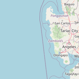
Why Bataan National Park stands out
Bataan National Park is best known for its dramatic volcanic landscape centered on Mount Natib, which contains one of the peninsula's most distinctive forested calderas. The park's tropical jungle terrain features several waterfalls including Pasukulan and Dunsulan falls, which are popular destinations for visitors trekking through the park's rugged interior. The area serves as an Important Bird Area, supporting populations of significant bird species within its diverse habitats. The park also preserves critical watershed areas that supply water to surrounding communities on the Bataan Peninsula.
Bataan National Park history and protected-area timeline
Bataan National Park was first established on December 1, 1945 under Proclamation No. 24, representing one of the earliest protected area designations in the Philippines following the end of World War II. The initial designation covered approximately 31,000 hectares and included portions of what would later become the Subic Bay Freeport Zone. The park's boundaries were significantly modified in 1987 when its area was reduced to the present 23,688 hectares, and the protected area was fully consolidated within Bataan province. This reduction in size reflected changing land use considerations and the need to balance conservation with development pressures on the peninsula. The park has been continuously managed by the Department of Environment and Natural Resources since its establishment, maintaining its protected status through multiple decades of environmental policy evolution in the Philippines.
Bataan National Park landscape and geographic character
The landscape of Bataan National Park is defined by its mountainous terrain forming the interior spine of the Bataan Peninsula. The park's topography features rugged slopes, deep ravines, and forested ridges that create a dramatic backdrop visible from Manila Bay on clear days. The most prominent geological feature is Mount Natib, a volcanic structure containing a distinctive 6 by 7 kilometer caldera that resembles an acorn in shape. This caldera, formed by ancient volcanic activity, now contains forested land that represents one of the park's most ecologically significant zones. The park is intersected by numerous rivers and streams that flow from the higher elevations down through the tropical forest, eventually feeding into the lowland watersheds. Two notable waterfalls, Pasukulan and Dunsulan, are found within the park's boundaries, providing scenic focal points for visitors exploring the interior. The combination of volcanic terrain, forested slopes, and water features creates a diverse landscape that supports multiple ecological communities.
Bataan National Park ecosystems, habitats, and plant life
Bataan National Park supports diverse tropical ecosystems within its 23,688-hectare boundaries. The park's vegetation is characterized by tropical jungle cover that transitions through various zones as elevation increases from the lower slopes to the forested slopes of Mount Natib. The park's designation as an Important Bird Area by BirdLife International reflects its significance for avian biodiversity, with the forested habitats supporting populations of bird species that depend on mature tropical forest environments. The park's rivers, springs, and waterfalls create riparian corridors that add ecological variety to the forest habitats, while the caldera of Mount Natib provides a protected micro-environment with its own distinctive plant communities. The diverse insect fauna adds to the park's ecological complexity, with various species contributing to pollination and decomposition processes that sustain the forest ecosystem.
Bataan National Park wildlife and species highlights
The wildlife of Bataan National Park includes several notable animal groups that inhabit its tropical forest environments. The park is home to populations of wild monkeys, which can be observed in the forest canopy as visitors explore the park's trails. Birdlife is particularly significant, with the park's Important Bird Area status reflecting the presence of species that depend on its forested habitats. The diverse insect populations represent another important component of the park's wildlife, contributing to the overall biodiversity of the protected area. The combination of forest habitats, riparian areas, and the unique caldera environment creates multiple niches that support various animal species throughout the park's elevations.
Bataan National Park conservation status and protection priorities
Bataan National Park serves as a critical conservation area within the Central Luzon region, protecting substantial tropical forest resources on the Bataan Peninsula. The park's designation as an IUCN Category II protected area reflects its management approach focused on preserving natural ecosystems while allowing for limited recreational use. Its recognition as an Important Bird Area by BirdLife International highlights its international significance for bird conservation, identifying it as a site supporting bird species of global conservation concern. The park also provides essential watershed functions, with its forested slopes and water systems supplying water to communities throughout the Bataan Peninsula. These ecosystem services add to the conservation value of the protected area, demonstrating how biodiversity preservation connects to human community needs.
Bataan National Park cultural meaning and human context
Bataan National Park is situated within a region that holds significant historical importance in Philippine history. The Bataan Peninsula was the site of the infamous Bataan Death March during World War II, and the park's mountainous terrain served as a backdrop to events that shaped the nation's modern history. While the park itself does not contain specific cultural heritage sites of pre-colonial or colonial significance, its location within the peninsula places it within a landscape shaped by centuries of human settlement and historical events. The park's boundaries encompassing multiple municipalities reflect the traditional land use patterns of communities that have inhabited the Bataan Peninsula long before its designation as a protected area.
Top sights and standout views in Bataan National Park
The highlights of Bataan National Park include the dramatic volcanic landscape centered on Mount Natib and its distinctive forested caldera, which represents one of the park's most ecologically significant and visually striking features. The park's waterfalls, particularly Pasukulan and Dunsulan falls, provide accessible destinations for visitors seeking to experience the park's natural beauty through trekking activities. The tropical jungle environment, with its diverse flora and fauna, offers opportunities for nature viewing and bird watching in a relatively accessible location approximately 101 kilometers from Manila. The park's visibility across Manila Bay creates a scenic backdrop that connects the protected area to the metropolitan landscape of the Philippine capital.
Best time to visit Bataan National Park
The best time to visit Bataan National Park is during the dry season from November to May, when weather conditions are most favorable for trekking and outdoor activities in the park's mountainous terrain. The dry months typically offer clearer visibility for views across Manila Bay and more comfortable conditions for exploring the park's trails and waterfalls. Visitors should note that the wet season from June to October brings increased rainfall that can make trail conditions more challenging and potentially affect access to some areas of the park. The cooler months from December through February generally provide the most comfortable temperatures for hiking, while the hot season from March to May can make strenuous activities more difficult.