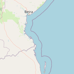
Why Bazaruto Archipelago National Park stands out
Bazaruto Archipelago National Park is most renowned for hosting the largest and only remaining viable population of dugongs in the Western Indian Ocean. The park is also the sole known location in the western Indian Ocean where all five regional turtle species nest. Its coral reefs are considered the least disturbed in this part of the Indian Ocean, supporting over 2,000 species of fish and 500 mollusc species. The extraordinary marine biodiversity, combined with exceptional water clarity reaching 30 meters, makes this one of the premier diving and snorkeling destinations in Africa.
Bazaruto Archipelago National Park history and protected-area timeline
The Bazaruto Archipelago National Park was officially proclaimed on May 25, 1971, making it one of the earliest marine protected areas established in Mozambique. The park was created in response to growing concerns about the vulnerability of dugong populations and marine turtles in the region, recognizing that the archipelago's islands and surrounding waters provided critical habitat for these species. For many years, the park operated under varying levels of protection and management effectiveness, facing challenges from illegal fishing, resource overuse, and poorly regulated tourism activities. In December 2017, a significant management transition occurred when African Parks, a renowned conservation organization, took over co-management responsibilities alongside Mozambique's National Administration of Conservation Areas. This partnership brought renewed focus to conservation efforts, improved infrastructure, and community engagement programs. Under African Parks management, the park has experienced measurable improvements in protection of endangered species and economic opportunities for local communities through conservation-led practices.
Bazaruto Archipelago National Park landscape and geographic character
The Bazaruto Archipelago presents a striking mosaic of tropical coastal landscapes that distinguish it from mainland Mozambique. The islands feature dramatic sand dunes that rise prominently above the shoreline, some reaching considerable heights and creating distinctive silhouettes against the Indian Ocean. Behind these coastal dunes, the islands transition into lush tropical forest zones and savannah grasslands, providing habitat diversity within a relatively compact area. Several inland freshwater lakes and wetlands punctuate the islands, adding further ecological variety and supporting different species communities. The marine landscape is equally spectacular, with clear turquoise waters, extensive seagrass meadows, and coral reef formations that stretch across the archipelago. The contrast between the white sandy beaches and the deep blue ocean creates a visually striking environment that has long attracted visitors. The overall landscape character combines the raw beauty of natural dune systems with the more cultivated appearance of island forests, all framed by the endless horizon of the Indian Ocean.
Bazaruto Archipelago National Park ecosystems, habitats, and plant life
The ecological character of Bazaruto Archipelago National Park is defined by the interplay between its marine and terrestrial environments, each supporting exceptional biodiversity. The marine realm encompasses coral reefs, seagrass beds, and open ocean waters that together create a highly productive ecosystem. The coral reefs in particular are noted as the least disturbed in this portion of the Indian Ocean, providing habitat for an extraordinary diversity of marine organisms. Seagrass meadows blanket the seabed in many areas, serving as the primary food source for dugongs and providing nursery habitat for numerous fish species. Terrestrially, the islands support a mix of tropical forest, savannah, and wetland habitats that host their own distinct communities of plants and animals. The combination of these habitats within a relatively small area creates remarkable ecological density, with species interactions that occur across the marine-terrestrial boundary.
Bazaruto Archipelago National Park wildlife and species highlights
The wildlife of Bazaruto Archipelago National Park is extraordinary for its diversity and the presence of globally significant populations of endangered species. The dugong population represents the park's most notable conservation importance, as it hosts the largest and only remaining viable population in the Western Indian Ocean, with these animals listed as critically endangered. All five regional species of marine turtles nest on the islands, the only known location in the western Indian Ocean where this occurs. The marine environment supports six species of dolphins, humpback whales that migrate through the area during winter months, and whale sharks present from October through April. Over 2,000 fish species and 500 mollusc species have been recorded in park waters. The bird population is equally impressive, with more than 240 varieties including coucals, crab-plovers, and sea eagles. Freshwater lakes on the islands are home to crocodiles, adding to the predator diversity. The park also protects endangered ray species including guitarfish and wedgefish, listed among the world's most threatened marine fishes.
Bazaruto Archipelago National Park conservation status and protection priorities
Bazaruto Archipelago National Park holds global conservation significance primarily due to its role as the last stronghold for dugong populations in the Western Indian Ocean. The species was listed as critically endangered on the IUCN Red List for East Africa in 2022, highlighting the urgent need for continued protection. The park's coral reefs, among the least disturbed in the region, represent relatively intact marine ecosystems that serve as reference points for conservation science and restoration efforts. The protection of all five regional turtle species' nesting grounds makes this archipelago irreplaceable for marine turtle conservation in the western Indian Ocean. Conservation challenges include illegal fishing practices that destroy seagrass habitats, pollution, and the broader pressures of resource extraction on local communities. The management transition to African Parks has strengthened anti-poaching efforts and introduced sustainable tourism practices designed to generate economic benefits while minimizing environmental impact. The WWF has also developed programs to help local communities participate in conservation revenue sharing, creating incentives for protecting valuable ecological resources.
Bazaruto Archipelago National Park cultural meaning and human context
The Bazaruto Archipelago is home to approximately 6,500 residents distributed across seven communities on three of the five islands. These communities represent the human dimension of the park ecosystem, with livelihoods deeply intertwined with marine resources. Approximately 70 percent of households depend on small-scale fishing as their primary source of income and food security, while others engage in harvesting sand oysters and various marine resources, crop cultivation, and livestock raising. The communities are characterized by high poverty rates and face ongoing challenges related to declining fish catches and resource scarcity. Tourism development has created employment opportunities that have positively impacted the local economy, and conservation-led economic initiatives have expanded since 2019. Traditional fishing practices using dhows remain visually prominent in the archipelago, representing a cultural connection to the sea that has defined island life for generations.
Top sights and standout views in Bazaruto Archipelago National Park
The archipelago's global significance stems from its dugong population, the last viable group in the Western Indian Ocean and listed as critically endangered. The waters host all five regional turtle species during nesting season, a uniqueness unmatched elsewhere in the western Indian Ocean. Divers and snorkelers encounter exceptional visibility of up to 30 meters alongside more than 2,000 fish species and unspoiled coral reefs. Humpback whales migrate through the park's waters in winter, while whale sharks appear seasonally from October to April. The five islands offer contrasting landscapes from dune-covered shores to forested interiors with freshwater lakes. The transition of park management to African Parks in 2017 brought renewed conservation focus and improved community benefits.
Best time to visit Bazaruto Archipelago National Park
The optimal time to visit Bazaruto Archipelago National Park depends on desired activities, with the dry season from May to October offering comfortable temperatures and minimal rainfall ideal for general exploration. Whale sharks are present in park waters from October through April, making this period particularly appealing for divers and snorkelers interested in encounters with these gentle giants. Humpback whales migrate through the area during the winter months, typically June through November, providing excellent whale watching opportunities. The turtle nesting seasons vary among species but occur throughout the year, meaning hatchlings can be observed during multiple months. The summer months from December to March tend to be warmer with higher humidity, though this is also the season when whale sharks are most reliably present. Water visibility is consistently excellent year-round due to the park's protected status and healthy marine environments, though the calmest sea conditions generally occur during the dry winter months.