

Why Bosque Protector Cerro Paraíso stands out
Cerro Paraíso is best known for being one of the last large surviving patches of native dry tropical forest near Guayaquil, offering a relatively accessible window onto a coastal ecosystem that has almost disappeared elsewhere in western Ecuador. The reserve is also well known for its elevated viewpoint over the city and the Guayas estuary, the surprisingly rich birdlife packed into a small forest footprint, and its role as an environmental education site on the outskirts of a major urban area.
Bosque Protector Cerro Paraíso history and protected-area timeline
Bosque Protector Cerro Paraíso was formally established in 1989, when the Ecuadorian state declared the upper slopes of Cerro San Eduardo a Protective Forest, a category reserved for ecosystems that deserve conservation protection because of their fragility, ecological value, or watershed function. The designation recognized that the dry tropical woodland on the hill represented a rare surviving example of a biome that had largely been cleared elsewhere in the surrounding Guayas lowlands.
When it was first declared, the protected area encompassed a larger footprint than it does today. The original extent of around 420 hectares has gradually been reduced over the following decades, and the reserve now covers approximately 299 hectares. The reduction reflects the broader pressures on dry coastal forests in western Ecuador, where agricultural expansion, urban growth, and infrastructure development have steadily eaten into remaining native vegetation.
Since its establishment, the reserve has developed a dual identity. On one hand, it functions as a strict conservation site for native flora and fauna. On the other, because it lies so close to the populated districts of eastern Guayaquil, it has become a recurring site for environmental education and community engagement, including programs that combine art and nature for children. This dual role has shaped how the reserve is managed, used, and understood by the surrounding urban population.
Bosque Protector Cerro Paraíso landscape and geographic character
The landscape of Cerro Paraíso is defined by the relief of Cerro San Eduardo, a coastal hill that rises east of the city of Guayaquil. The reserve occupies the highest wooded slopes of this elevation, which gives the protected area a noticeably different character from the flat coastal plains that dominate most of the surrounding region.
At the summit area, a mirador sits at roughly 175 meters above sea level, providing sweeping views across almost the entirety of Guayaquil, the broad Guayas River that gives the province its name, and the Estero Salado, the tidal estuary that runs along the western side of the city. The contrast between forested hillside and dense urban surroundings is one of the most striking visual features of the site.
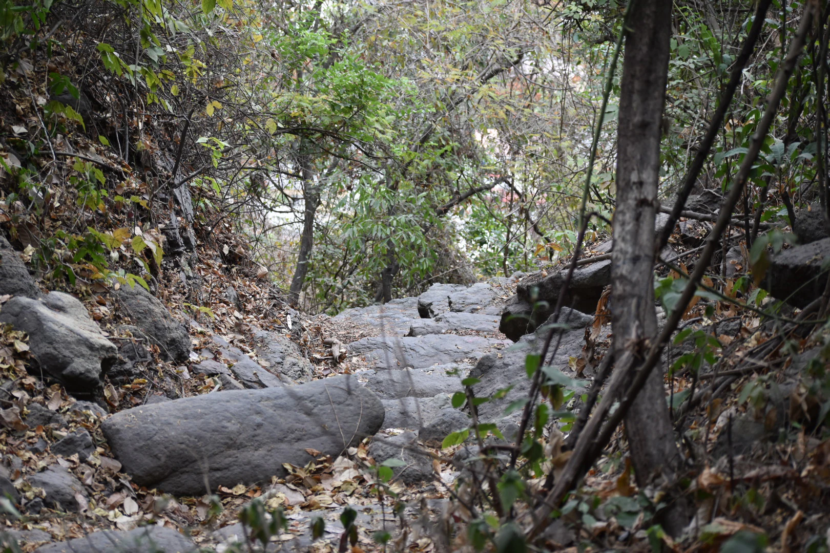
The terrain itself supports dry tropical woodland rather than the wetter forests more commonly associated with Ecuador. Vegetation is adapted to a strongly seasonal coastal climate with a long dry period, and the resulting forest is characterized by deciduous and semi-deciduous trees, dry-adapted shrubs, and a ground layer that becomes sparse during the dry months. Walking trails cut through this woodland link the lower access points, including the Bellavista area, up toward the elevated viewpoint.
Bosque Protector Cerro Paraíso ecosystems, habitats, and plant life
The reserve protects a remnant of dry tropical forest, one of the most threatened ecosystems in Ecuador. Dry tropical forests once extended across large portions of the coastal lowlands of Guayas and neighboring provinces, but centuries of clearing for agriculture, cattle ranching, charcoal production, and urban development have reduced them to scattered fragments. Cerro Paraíso is among the more substantial surviving fragments in the immediate vicinity of Guayaquil.
Vegetation on the hill reflects the seasonality of the coastal climate. The forest becomes notably greener during the rainy season, when canopy trees come into leaf and understory plants revive, and it thins visibly during the dry months. This pronounced cycle is part of what defines the dry tropical forest character and distinguishes it from the wetter forests found in other parts of Ecuador.
Beyond its plant communities, the reserve functions as a refuge for wildlife in an otherwise heavily urbanized setting. Its position on a steep, vegetated hill on the edge of the city creates a distinct microhabitat that supports a wide range of species in a very small area, making it especially valuable for local biodiversity conservation.
Bosque Protector Cerro Paraíso wildlife and species highlights
Cerro Paraíso is most notable for its birdlife. The reserve hosts more than 100 recorded bird species, an unusually high concentration for a forest of this size, and birdwatching is one of the main points of interest for visitors. This richness reflects the reserve's role as a refuge within a heavily altered coastal landscape, where surviving dry forest patches become critical habitat for forest-dependent species.
Reptiles are also well represented. Iguanas are commonly seen in the reserve, and several snake species, referred to locally as culebras, are present in the dry forest habitat. Amphibians, particularly frogs, occupy the wetter microhabitats along the hill's slopes and ravines, especially during the rainy season.
Among mammals, the reserve supports smaller species adapted to dry tropical woodland, including foxes, native mice, and squirrels. Larger mammals are not typical of the area, but the presence of these smaller species, combined with the rich bird community, reinforces the reserve's value as an urban-proximity refuge for native fauna.
Bosque Protector Cerro Paraíso conservation status and protection priorities
As a formally designated Bosque Protector, Cerro Paraíso has a defined institutional role in Ecuador's protected-area system. Its establishment in 1989 was specifically intended to protect the dry tropical forest on the upper slopes of Cerro San Eduardo, a habitat type that has been heavily reduced across the coastal region. The reserve's continuing importance lies precisely in the fact that so little of this original vegetation remains elsewhere in Guayas Province.
The reserve also plays an important role in environmental education. Its proximity to Guayaquil makes it accessible to a large urban population, and programs combining nature observation with art activities for children have made it a working example of urban-adjacent conservation in Ecuador.
Despite its protected status, the reserve faces significant and ongoing threats. Forest fires are a recurring issue, particularly during the dry season, when the dry-adapted vegetation and surrounding human activity both increase ignition risk. At the same time, informal construction along the edges of the reserve has been a persistent pressure as the city of Guayaquil continues to expand eastward. These twin pressures on a relatively small protected forest make the reserve's long-term survival dependent on continued active management and community involvement.
Bosque Protector Cerro Paraíso cultural meaning and human context
Cerro Paraíso sits within a long history of human interaction with the dry coastal forests of Guayas. Before modern urban expansion, the woodlands on hills like Cerro San Eduardo were part of a broader ecosystem that supported local agriculture, charcoal making, and small-scale extraction of forest products. The reserve's survival today, in reduced form, reflects both the diminished extent of these forests and the explicit decision in 1989 to protect what remained.
Within Guayaquil, the reserve has also acquired a cultural role as an accessible natural space close to dense urban neighborhoods. Its use for educational programs with children, including activities that combine art with nature observation, has helped carve out a place for the forest in the everyday life of the surrounding communities, particularly in the Bellavista area, which serves as a primary access point to the trails and the mirador.
Top sights and standout views in Bosque Protector Cerro Paraíso
Bosque Protector Cerro Paraíso combines three unusually compatible elements: a rare coastal dry tropical forest, a commanding viewpoint over one of Ecuador's largest cities, and strong bird diversity in a compact protected footprint.
Taken together, these qualities make the reserve a notable example of urban-adjacent conservation, a place where ecology, public education, and landscape views come together on the edge of Guayaquil.
Best time to visit Bosque Protector Cerro Paraíso
The character of a visit to Cerro Paraíso shifts noticeably with the seasons of Ecuador's coastal lowlands. During the wetter months, the dry tropical forest becomes noticeably greener and more active, with the canopy in full leaf, understory plants revived, and amphibians and birdlife generally more visible.
During the dry season, by contrast, the forest thins out visually, the landscape takes on a drier, more open appearance, and the risk of forest fires affecting the reserve increases. Dry-season visits can offer clearer views from the mirador but come with greater fire risk in and around the reserve. Birdwatching and general wildlife observation are generally rewarding throughout the year, although the experience of walking through the trails feels quite different depending on the seasonal state of the forest.