

Why Canberra Nature Park stands out
Canberra Nature Park is best known for weaving native bushland directly into the fabric of a national capital. Its reserves surround and penetrate the city, preserving the forested and grassy hills that visually frame Canberra from all directions, and giving residents immediate access to Australian woodland and grassland habitats. The system is also recognized for its grassland reserves, which protect some of the last remnants of temperate lowland native grassland in southeastern Australia. These open grassy patches sit alongside forested ridges and wetlands, producing a varied mosaic of habitats within the bounds of a single metropolitan area.
Canberra Nature Park history and protected-area timeline
The protection of bushland around Canberra was written into the design of the national capital from its earliest planning phase. Walter Burley Griffin's plan for Canberra positioned the new city within a landscape of surrounding hills and natural features, and this vision of a city set against a maintained backdrop of bushland shaped later policy. Today, most of the forested and wooded hills visible from central Canberra, including Black Mountain, Mount Ainslie, Mount Majura, Mount Pleasant, Russell Hill, Red Hill, Mount Mugga, O'Connor Ridge, Bruce Ridge, Aranda Bushland, Mount Painter, The Pinnacle, Lyneham Ridge, Oakey Hill, Mount Taylor, Isaacs Ridge, Mount Stromlo, Mount Arawang, Neighbour Hill, Wanniassa Hill, and Narrabundah Hill, are protected from development under the National Capital Plan.
Much of the land now forming the park was historically used for grazing, and large parts had been cleared of native vegetation during the pastoral era. Over time, these areas came under formal conservation management, and revegetation and rehabilitation programs have been used to return cleared land to native bushland. This restoration work has gradually expanded the extent of habitat available to native wildlife within the city's footprint and remains an ongoing focus of management.
As additional reserves were progressively added, including the large Mulligans Flat Woodland Sanctuary, the grassland reserves to the north of the city, and the Jerrabomberra Wetlands along the Molonglo floodplain, the individual protected areas grew into a coordinated system of 39 nature reserves collectively known as Canberra Nature Park.
Canberra Nature Park landscape and geographic character
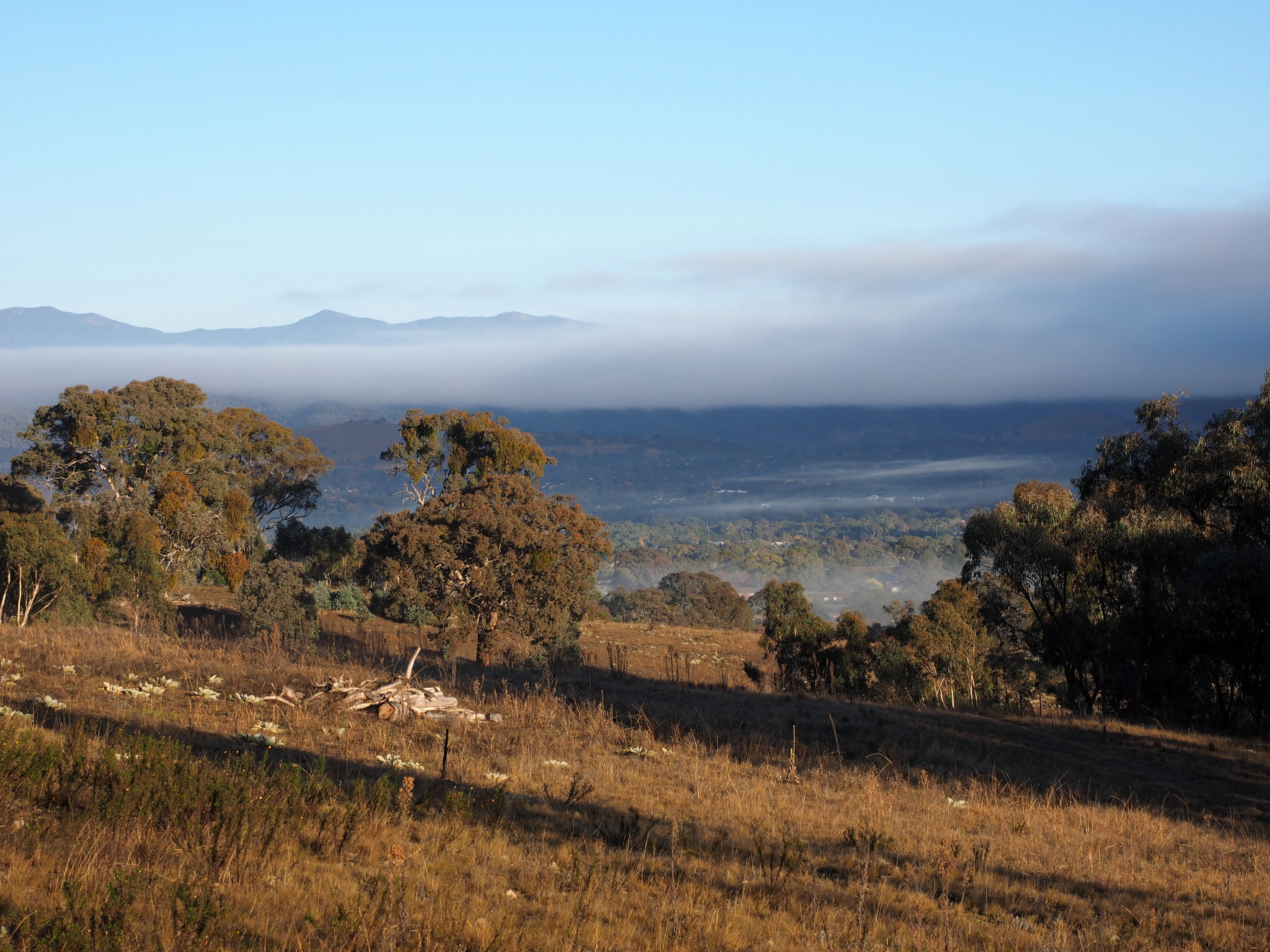
The landscape of Canberra Nature Park is defined by the hills, ridges, valleys, and plains of the Australian Capital Territory. Many of the reserves sit on the inner hills that ring Canberra's urban centre, including the prominent ridges of Black Mountain, Mount Ainslie, and Mount Majura to the east and north, Red Hill and Mount Taylor to the south, and Isaacs Ridge and Wanniassa Hills in the south of the city. These hills provide the layered, bush-clad backdrop that defines the city's skyline, with views extending outward to the Brindabella Range on the western horizon.
Outside the inner hills, the park extends across valleys and escarpments such as Kowen Escarpment and Molonglo Gorge, where forested slopes drop to river corridors. To the north and west of the city, the landscape opens into flatter country carrying native grasslands, grassy woodlands, and, in the case of Jerrabomberra Wetlands, floodplain habitat. The result is a landscape that moves from steep forested hills near the urban core, through gentle wooded slopes, into wide grassy plains and open wetland margins.
Canberra Nature Park ecosystems, habitats, and plant life
Canberra Nature Park protects an unusually diverse set of habitats for an urban reserve system, because its 39 components collectively cover forest, woodland, native grassland, grassy woodland, and wetland. Dry sclerophyll forest dominates the higher hills and escarpments, where eucalypt species such as red stringybark, scribbly gum, and brittle gum form a tall canopy over an understorey of acacias and native grasses. Woodlands and grassy woodlands are widespread across the slopes and lowlands, supporting characteristic box-gum woodland species that are now rare across much of southeastern Australia.
The lowland native grassland reserves protect some of the most threatened ecological communities in the region. These open grassy plains, dominated by native tussock grasses and seasonal wildflowers, were once widespread across the Southern Tablelands but have been heavily reduced by agricultural clearing, leaving remnants such as those at Crace, Gungaderra, Mulanggari, Jarramlee-West MacGregor, Dunlop, and Budjan Galindji as important refuges. At the opposite hydrological end of the system, Jerrabomberra Wetlands provides freshwater and estuarine habitat around the Molonglo River floodplain, attracting waterbirds and wetland species that are not found in the upland reserves.
Canberra Nature Park wildlife and species highlights
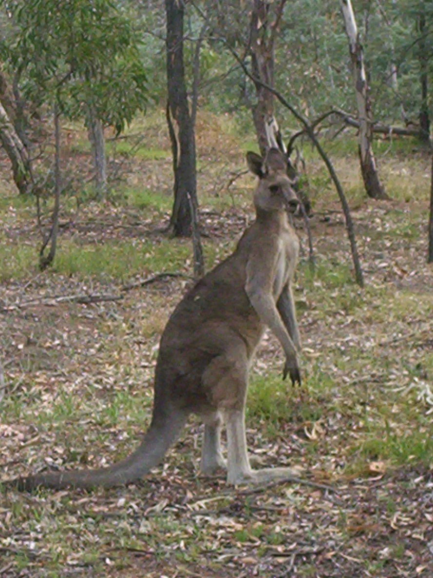
The reserves of Canberra Nature Park frequently host eastern grey kangaroos, which are commonly seen grazing on open grassy slopes and woodland edges, particularly around reserves such as Mount Majura and Mulligans Flat. The mosaic of habitats across the park supports a wide range of other native fauna as well, including wallabies, echidnas, and a rich bird community typical of southeastern Australian woodland and grassland environments.
Larger woodland sanctuaries such as Mulligans Flat and Goorooyarroo are particularly important for wildlife conservation, providing habitat for species that depend on intact woodland and supporting predator-free or managed areas for threatened species. The wetland environment of Jerrabomberra Wetlands, by contrast, draws a different set of species, including a wide variety of waterbirds and shorebirds, especially during seasonal movements. Together, the park's forests, woodlands, grasslands, and wetlands provide habitat for hundreds of native species within the bounds of the capital.
Canberra Nature Park conservation status and protection priorities
Canberra Nature Park is significant from a conservation perspective because it conserves large patches of native vegetation inside and immediately around a national capital, rather than relegating them to distant reserves. The system protects multiple threatened ecological communities of southeastern Australia, including temperate lowland native grassland and box-gum woodland, both of which have been extensively cleared across the surrounding region.
The reserves are protected from urban development under the National Capital Plan, giving them a high level of planning security uncommon in other Australian cities. Active management, including revegetation of former grazing land, weed control, fencing, and ecological monitoring, is used to restore habitat and maintain the integrity of these communities. The park also provides landscape-scale connectivity, with forested hills, woodland corridors, and grassland patches supporting wildlife movement across the urban matrix.
Canberra Nature Park cultural meaning and human context
Canberra Nature Park carries a strong cultural identity tied to the city's founding vision. The protection of the surrounding hills was central to Walter Burley Griffin's plan for Canberra, in which bushland was treated as an essential element of the national capital rather than as leftover land. Most of the prominent hills now within the park were identified for protection during the early planning of the city and have remained protected throughout Canberra's growth.
For many residents, these reserves are part of everyday life. Walking, running, and observing wildlife in the surrounding bushland is a defining part of living in the capital, and the hills form a recognizable part of the city's identity and cultural landscape.
Top sights and standout views in Canberra Nature Park
Canberra Nature Park's defining feature is the way its bushland hills, woodlands, and grasslands are threaded through the urban fabric of a national capital, giving residents immediate access to native habitat. The system covers an unusually varied range of vegetation types, from dry forest on the inner hills to lowland native grassland on the plains and freshwater wetland along the Molonglo floodplain.
Key components of the network include Black Mountain, Mount Ainslie, Mount Majura, Red Hill, Mount Taylor, and Goorooyarroo for forested and wooded scenery; Mulligans Flat Woodland Sanctuary for large-scale intact woodland; Crace, Gungaderra, and Mulanggari grasslands for native grassland conservation; and Jerrabomberra Wetlands for waterbirds and wetland habitat. Together, they form one of the most integrated urban nature networks in Australia.
Best time to visit Canberra Nature Park
Canberra's bushland is most pleasant to walk during spring and autumn, when daytime temperatures are mild, native wildflowers are in bloom across the grassland reserves, and the woodland canopy is green rather than dry. Early morning and late afternoon in these seasons offer the most active wildlife viewing, including kangaroos grazing on open spaces.
Summer can be hot and dry in the ACT, with limited shade on exposed grassland reserves, while winter brings cooler temperatures and a quieter, more subdued character to the bushland. Bird and wildlife activity remains a feature throughout the year, though wetland and grassland scenery change noticeably across the seasons.