

Mori Atlas logo
National parkCapertee National Park

Discover the protected landscape and terrain of Capertee National Park within Australia's atlas.

Capertee National Park: Explore Australia's National Park Geography and Mapped Boundaries

Capertee National Park stands as a significant protected area within Australia's vast geography. This entry provides essential context for understanding its role as a national park, focusing on its mapped landscape, distinct terrain, and the broader regional context it inhabits. Engage with a structured view of Capertee National Park to appreciate its protected boundaries and its contribution to Australia's natural atlas.

woodland conservationthreatened species habitatbirdwatchingNew South Wales national parksAustralian wildlifevalley landscape

Capertee National Park

National park

Park overview

Structured park overview, official facts, and landscape profile for Capertee National Park

Capertee National Park park facts, protected area profile, and essential visitor context

Review the core facts for Capertee National Park, including designation, size, terrain, visitor scale, habitats, and operating context in one park-focused overview.

About Capertee National Park

Capertee National Park represents an important addition to New South Wales's protected area network, preserving a distinctive valley landscape that might otherwise have been lost to agriculture or development. The park's location in the Central West region places it within a broader network of conservation areas that together form a significant refuge for temperate woodland species. The Capertee Valley's geological diversity has created varied microhabitats and niches, supporting an impressive array of vegetation communities within the park's boundaries. This ecological richness, combined with the park's relatively recent reservation, makes it a living example of ongoing conservation effort in Australia. The park's expansion through successive land additions reflects a growing recognition of the valley's conservation significance, with the 2020 incorporation of the former Glenolan property adding important habitat connectivity to the reserve.

Quick facts and research context for Capertee National Park

Capertee National Park covers 6,796 hectares in the Central West of New South Wales, Australia, within the traditional Country of the Wiradjuri People. The park protects 11 distinct vegetation communities, including the critically endangered White Box - Yellow Box - Blakely's Red Gum Woodland. It provides habitat for 32 threatened animal species, particularly significant for several declining woodland bird populations. The park was established in 2010 and has grown through land additions in 2015, 2016, and 2020.

Protection and recognition

Tracking terrestrial conservation status and documented protection data within the global atlas.

Capertee National Park Protection Status and Conservation Designation

Geographic records for Capertee National Park outline its terrestrial protection status and formal conservation boundaries. Reviewing verified designation details and official management scopes helps researchers map global conservation frameworks accurately.

Protection details

Protection scope
Terrestrial
Transboundary protection
No
Park context

Deeper park guide and search-rich context for Capertee National Park

Capertee National Park history, landscape, wildlife, and travel context

Explore Capertee National Park through its history, landscape character, ecosystems, wildlife, conservation priorities, cultural context, and seasonal travel timing in a structured park guide built for atlas discovery and search intent.

Why Capertee National Park stands out

Capertee National Park is best known for its protection of critically endangered White Box - Yellow Box - Blakely's Red Gum Woodland, one of Australia's most threatened ecological communities. The park serves as a crucial refuge for the critically endangered regent honeyeater, a bird species in severe decline across its range. The Capertee Valley itself is recognized for its geological diversity, which has produced a variety of vegetation communities within a relatively limited area. The park also protects important populations of other threatened woodland birds including the gang-gang cockatoo, diamond firetail, and hooded robin.

Capertee National Park history and protected-area timeline

Capertee National Park was formally reserved in 2010, establishing protection for what was previously a mix of freehold and leasehold agricultural land associated with the property known as Port Macquarie. The reservation represented a significant shift in land use for the valley, transitioning from grazing and pastoral purposes to conservation stewardship. Subsequent additions to the park were made in 2015 and 2016, incorporating Crown land into the protected area. The most recent expansion occurred in 2020 with the addition of the freehold property known as Glenolan, further extending the park's conservation footprint. This gradual expansion through multiple phases reflects an incremental approach to conservation reservation that has allowed for careful integration of different land parcels into a coherent protected area.

Capertee National Park landscape and geographic character

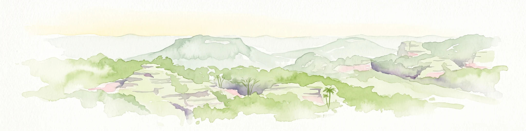
The Capertee Valley is characterized by its geological diversity, which manifests in varied terrain and substrate conditions across the park. The valley floor and surrounding slopes support distinct vegetation communities that reflect the underlying geology and soil conditions. This geological variety has created a patchwork of habitats within a relatively limited area, contributing to the park's significant biodiversity values. The landscape includes woodland communities ranging from more open grassy woodlands on the valley floor to denser woodland formations on steeper terrain. The combination of valley topography with diverse geology produces a distinctive landscape character that distinguishes Capertee from surrounding areas.

Capertee National Park ecosystems, habitats, and plant life

The ecological significance of Capertee National Park derives from its protection of 11 distinct vegetation communities, making it a biodiversity hotspot within the Central West region. The park contains remnants of the critically endangered White Box - Yellow Box - Blakely's Red Gum Woodland, a ecological community that has been drastically reduced across its former range through clearing for agriculture and development. This woodland type once dominated much of the temperate grassy woodlands of southeastern Australia, and its preservation within the park represents a significant conservation achievement. The diversity of vegetation communities within the park reflects the geological variety of the Capertee Valley, with different communities occupying distinct niches based on aspect, soil type, and moisture conditions.

Capertee National Park wildlife and species highlights

Capertee National Park protects the habitats of 32 threatened animal species, making it a significant refuge for wildlife in the Central West region. The park is particularly important for threatened woodland bird species that have suffered severe declines across their range due to habitat loss and fragmentation. The critically endangered regent honeyeater relies on the park's woodlands for foraging and breeding habitat, representing one of the last strongholds for this declining species. Other threatened birds protected within the park include the gang-gang cockatoo, diamond firetail, and hooded robin. These species face common threats including clearing of native vegetation, fragmentation of woodland habitat, reduced availability of food resources, and loss of hollow-bearing trees that provide essential nesting sites.

Capertee National Park conservation status and protection priorities

Capertee National Park contributes to the protection of Australia's most endangered woodland ecosystem while serving as a critical corridor within a broader network of protected areas. The park's protected vegetation communities represent remnants of ecological communities that have been extensively cleared across their former range, making conservation within reserves like Capertee essential for biodiversity persistence. The woodland bird populations dependent on the park face severe pressure from cumulative threats including ongoing habitat fragmentation, reduced food resources, and loss of nest trees. The park's connectivity with other conservation areas including Wollemi National Park and Gardens of Stone National Park allows for potential genetic exchange between wildlife populations, supporting broader ecosystem resilience.

Capertee National Park cultural meaning and human context

Capertee National Park lies within the traditional Country of the Wiradjuri People, the Indigenous inhabitants of much of central New South Wales. The Wiradjuri people have maintained connection to this landscape through generations, with the valley and its resources forming part of their cultural landscape. While the park was only formally reserved in 2010, the land has been managed by Indigenous peoples for tens of thousands of years, with traditional burning practices and land management contributing to the development of the ecological communities the park now protects. The incorporation of the park into the protected area network acknowledges, at least partially, the ongoing cultural significance of the landscape to the Wiradjuri community.

Top sights and standout views in Capertee National Park

The critically endangered White Box - Yellow Box - Blakely's Red Gum Woodland represents the park's most significant ecological asset,保护 Australia's most threatened woodland ecosystem. The regent honeyeater population provides a tangible focus for conservation effort, with the species in critical decline across its range. The geological diversity of Capertee Valley supports remarkable vegetation variety within the 6,796-hectare park, with 11 distinct communities represented. Connection to the broader network of Wollemi and Gardens of Stone protected areas creates a significant conservation corridor in the Central West.

Best time to visit Capertee National Park

The temperate climate of the Central West region makes Capertee National Park suitable for visitation throughout the year, though the experience varies with seasons. Spring brings optimal conditions for wildlife observation, with flowering eucalypts providing nectar for birds including the regent honeyeater, and milder temperatures comfortable for walking and exploration. Autumn offers similar advantages with comfortable temperatures and potential for bird activity as species prepare for winter. Summer can bring hot conditions typical of inland New South Wales, while winter offers a quieter experience though with colder temperatures.

Monthly climate preview

Trace long-term monthly temperature swings and precipitation patterns across representative terrain.

Capertee National Park Climate Normals and Annual Temperature Rhythm

Representative coordinates record measured monthly temperature ranges and precipitation baselines from 1991 through 2020. Opening the complete climate profile reveals full twelve-month weather statistics for detailed geographic analysis.
Annual mean14 °C
7 °C22 °C
Jan22°
Feb21°
Mar18°
Apr14°
May11°
Jun
Jul
Aug
Sep11°
Oct15°
Nov18°
Dec20°
Warmest month
January

22 °C

Coolest month
July

6.8 °C

Wettest month
February

3.4 mm/day

Driest month
May

1.3 mm/day

Park location guide

Geography guide, regional context, and park location map for Capertee National Park

Capertee National Park park geography, regions, and map view in Australia

Understand where Capertee National Park sits in Australia through a broader geographic reading of the surrounding landscape, nearby location context, and its mapped position within the national park landscape.

How Capertee National Park fits into Australia

Australia is a constitutional monarchy and federal parliamentary democracy comprising six states and ten territories. With a population of nearly 28 million, it is one of the world's most urbanised countries, with most people concentrated on the eastern seaboard. The country has a high Human Development Index and is known for its cultural diversity, ancient Aboriginal heritage, and unique wildlife.

Wider geography shaping Capertee National Park in Australia

Australia occupies the entire Australian continent, the island of Tasmania, and numerous smaller islands. It is the world's flattest and driest inhabited continent, featuring vast deserts in the interior (the Outback), tropical rainforests along the eastern coast, and a coastline bordering the Indian and Pacific Oceans.

Map view of Capertee National Park

Use this park location map to pinpoint Capertee National Park in Australia, understand its exact geographic position, and read its mapped placement within the surrounding landscape more clearly.

Pigeon | © OpenStreetMap contributors

Location context for Capertee National Park

Central WestNew South Wales
Park atlas

Compare adjacent conservation zones and mapped protected landscapes in Central West New South Wales.

Parks and Protected Areas: Continue Your Discovery from Capertee National Park

After exploring Capertee National Park, continue your discovery by browsing other protected areas within the Central West region of New South Wales. This curated selection allows for comparison of diverse conservation landscapes and supports deeper geographic understanding of Australia's protected natural heritage.
Protected landscapeNew South Wales
About 2.5 km away#1 closest

Southeast

Mugii Murum-ban State Conservation Area: Mesa Country and Capertee Valley Protected Geography

Sandstone pagoda formations and industrial heritage in New South Wales

Discover the geographic complexity of Mugii Murum-ban State Conservation Area, where twin sandstone mesas rise 500 metres above the Capertee Valley floor. This protected landscape preserves iconic pagoda rock pinnacles, rare relict plant communities, and heritage-listed remnants of the New Hartley oil shale industry. The area serves as a critical junction of cultural significance and geological erosion, offering a window into the rugged terrain characteristic of the broader Blue Mountains sandstone belt.

Area
36.5 km²
Established
2011
Relief
Mountain
Climate
Temperate
National parkNew South Wales
About 8.3 km away#2 closest

South

Gardens of Stone National Park: National Park Protected Landscape and Geographic Atlas

New South Wales protected area and mapped terrain exploration.

Delve into the protected landscape of Gardens of Stone National Park, an important national park situated in New South Wales, Australia. This page offers an atlas-centric view, focusing on the park's distinct geographic identity, its mapped protected boundaries, and its contribution to the regional context of protected lands. Understand the fundamental landscape character and terrain that define this significant natural area for structured geographic discovery.

Area
150.8 km²
Established
1994
IUCN
II
Relief
Highland
National parkNew South Wales
About 14 km away#3 closest

Southwest

Turon National Park National Park: Protected Landscape and Geographic Atlas Details

Mapped boundaries and regional context within New South Wales.

Turon National Park is a protected national park in New South Wales, Australia, offering a distinct geographic identity for atlas exploration. This entry focuses on its mapped boundaries, natural terrain, and its role as a conservation landscape. Users can discover its specific features and regional context, enhancing their understanding of Australia's protected areas.

Established
2002
IUCN
II
Relief
Mixed relief
Climate
Temperate
National parkNew South Wales
About 15 km away#4 closest

Northeast

Wollemi National Park: Mapping Australia's Protected Natural Landscape in New South Wales

Detailed geographic context and protected area exploration.

Wollemi National Park is a critical component of New South Wales' protected natural areas, offering rich opportunities for geographic discovery. This national park provides a distinct focus for understanding the mapped terrain and regional landscape context of Australia. Explore its position within New South Wales, uncovering the details that define its unique protected status and natural geography for dedicated atlas exploration.

Area
5,017.03 km²
Established
1979
IUCN
Ib
Relief
Mountain
National parkNew South Wales
About 61 km away#5 closest

East

Yengo National Park: Protected Landscape Identity and Geographic Context

Explore its mapped terrain and wilderness character.

Yengo National Park in New South Wales, Australia, is a vast protected area known for its remote wilderness character and significant geographical landmarks such as Mount Yengo. As a vital part of the Greater Blue Mountains World Heritage Site, the park showcases rugged mountainous terrain and diverse natural landscapes. This entry focuses on its atlas-value, detailing the park's mapped boundaries, regional geography, and its identity as a significant protected landscape for nature exploration.

Area
1,543.28 km²
Established
1988
IUCN
Ib
Relief
Mountain
National parkNew South Wales
About 69 km away#6 closest

North

Goulburn River National Park: New South Wales National Park with River Ecosystems and Heritage

Explore mapped protected lands and regional geography.

Goulburn River National Park offers a significant protected landscape within New South Wales, Australia, celebrated for its expansive Goulburn River frontage and diverse natural terrain. This national park is pivotal for understanding regional geography, featuring sandstone geological formations and serving as a critical habitat for endangered species, including the regent honeyeater. Its extensive river corridor also protects numerous Aboriginal heritage sites, contributing a rich layer of cultural significance to its conservation value. MoriAtlas helps users explore the mapped boundaries and environmental context of this vital protected area.

Area
722.96 km²
Established
1983
IUCN
II
Relief
Mixed relief
National parkNew South Wales
About 72 km away#7 closest

South

Kanangra-Boyd National Park: A Protected Landscape within New South Wales' Geography

Mapped boundaries and regional park context.

Kanangra-Boyd National Park represents a significant protected area, offering valuable insights into the natural landscapes and geographic context of New South Wales. As a national park, it provides a clear example of mapped terrain and protected land distribution, crucial for anyone exploring the atlas of Australian conservation areas. Understanding this park contributes to a broader appreciation of its regional geography and specific landscape identity.

Area
686.6 km²
Established
1969
IUCN
Ib
Relief
Mountain
Nature reserveNew South Wales
About 72 km away#8 closest

North

Munghorn Gap Nature Reserve: A Detailed Atlas of Protected Sandstone Landscapes in New South Wales

Transition zone geography on the Great Dividing Range

Munghorn Gap Nature Reserve represents a unique geographic crossing point on the Great Dividing Range. This protected area features dramatic pagoda-like sandstone formations, diverse eucalypt forests, and critical bird habitats that sustain a wide range of species across a rugged and weathered mountain landscape.

Area
59.34 km²
Established
1961
IUCN
Ia
Relief
Mountain

Common questions about visiting, size, designation, and location context for Capertee National Park

Capertee National Park FAQs for park facts, access, geography, and protected area context

Find quick answers about Capertee National Park, including protected-area facts, park geography, trail and visitor context, and how the park fits into its surrounding country and regional landscape.
MoriAtlas Explorer

Continue Your Protected Areas Search Across the Global Atlas

Deepen your exploration by continuing the structured search for national parks and protected areas worldwide. Utilize the comprehensive filtering capabilities to compare different conservation landscapes and refine your understanding of global park geography. Discover more about the distribution and characteristics of protected natural areas.

Global natural geography