Why Dhilba Guuranda-Innes National Park stands out
Dhilba Guuranda-Innes National Park is best known for its spectacular coastal scenery featuring towering cliffs, accessible beaches, and excellent surfing conditions at Pondalowie Bay. The park is particularly significant for its conservation value, protecting critical habitat for the endangered western whipbird and malleefowl, both of which were key reasons for the park's original establishment. The park also preserves the historic mining settlement of Inneston, offering visitors a tangible connection to South Australia's early twentieth-century gypsum industry. The presence of stromatolite-supporting lakes, accessible coastal walks, and diverse marine wildlife including seals, dolphins, and seasonal whale sightings further enhance the park's appeal.
Dhilba Guuranda-Innes National Park history and protected-area timeline
The land now comprising Dhilba Guuranda-Innes National Park has been continuously occupied by the Narungga people for thousands of years, consisting of four clans: the Kurnara of the north, the Windera of the east, the Wari of the west, and the Dilpa of the south. These traditional owners maintain strong cultural links to the landscape, with numerous sites of spiritual significance identified throughout the area. European colonization began in 1846 with sheep grazing near Cape Spencer, followed by small-scale crop farming in the nineteenth and early twentieth centuries. The park takes its name from William Innes, who discovered commercial quantities of gypsum in the early 1900s and founded the mining town of Inneston in 1913. At its peak, the town supported around 500 residents. Gypsum extraction continued until 1930 when the Great Depression made mining uneconomical. The South Australian government acquired the town and surrounding land in 1970, establishing Innes National Park on 5 March 1970 under the National Parks Act 1966. The founding purpose was to conserve important habitat for the western whipbird and malleefowl while protecting heritage buildings at Inneston. Land was added to the park in 1977, 1984, and 1993 to accommodate increasing recreational use. On 14 November 2020, the park was renamed Dhilba Guuranda-Innes National Park to reflect a co-management agreement between the government and Narungga people.
Dhilba Guuranda-Innes National Park landscape and geographic character
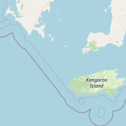
The physical landscape of Dhilba Guuranda-Innes National Park presents a compelling combination of coastal formations, cliff systems, and interior water bodies. The coastline from Willyama Bay to Cape Spencer features multiple bays including Cable Bay and Stenhouse Bay, punctuated by prominent headlands such as Rhino Head, and backed by a line of cliffs between Cable Bay and Stenhouse Bay. From Cape Spencer to West Cape, an unbroken line of cliffs ranging between 37 and 79 metres in height dominates the southwestern coast, with sandy beaches at their base. Between West Cape and Pondalowie Bay, the cliff line is relatively lower in profile. From the southern end of Pondalowie Bay extending to Gym Beach, extensive sand dunes dominate the shoreline and immediately adjoining land, with the exception of Royston Head and the cliff line extending eastward to Dolphin Beach. The interior of the park contains a network of saline lakes including Marion Lake, Snow Lake, Spider Lake, Deep Lake, and Inneston Lake, which were associated with historical gypsum mining. Several islands immediately adjoin the coastline, including Chinamans Hat Island, Middle Island, South Island, and Royston Island.
Dhilba Guuranda-Innes National Park ecosystems, habitats, and plant life
The park supports a remarkable diversity of habitats and plant communities across its coastal, dune, and lake environments. As of 2003, 333 species of native plants had been recorded within the park, of which 115 species were of conservation significance. Twenty-four of these species are scheduled under the South Australian National Parks and Wildlife Act 1972, while four are listed under the Commonwealth Environment Protection and Biodiversity Conservation Act 1999: annual candles, winter spider-orchid, bead samphire, and splendid bush-pea. The saline lakes support unique microbial communities including stromatolites, with Deep Lake, Inneston Lake, and Marion Lake listed on the South Australian Heritage Register for this scientific value. The park falls within the Southern Spencer Gulf Marine Park habitat protection zone, extending protection to the coastal waters adjoining the park including those surrounding the four islands. The park forms part of the Southern Yorke Peninsula Important Bird Area identified by BirdLife International, recognizing its significance for supporting populations of threatened bird species.
Dhilba Guuranda-Innes National Park wildlife and species highlights
Dhilba Guuranda-Innes National Park supports diverse wildlife across terrestrial and marine environments. Native mammals include New Zealand fur seal, Australian sea lion, western grey kangaroo, short-beaked echidna, southwestern pygmy possum, and various bat species including Gould's wattled bat and chocolate wattled bat. Marine mammals documented in adjacent waters include common dolphin, bottlenose dolphin, and southern right whales which visit seasonally. The park is particularly significant for birdlife, with 111 species of native birds recorded, including 13 species scheduled under Australian and state legislation. The malleefowl is recognized as vulnerable under both state and Commonwealth legislation, while the western whipbird, chestnut quail-thrush, fairy tern, hooded plover, little tern, osprey, painted button-quail, peregrine falcon, rock parrot, shy heathwren, and white-bellied sea-eagle are all protected species. Reptile diversity includes tiger snakes, brown snakes, various skinks, geckos, dragons, and the sleepy lizard. Following the Marna Banggara conservation project, locally extinct species including brush-tailed bettongs have been reintroduced since 2021, with plans to return approximately 20 species by 2040.
Dhilba Guuranda-Innes National Park conservation status and protection priorities
Dhilba Guuranda-Innes National Park holds significant conservation value as a protected area preserving coastal ecosystems and threatened species habitat on southern Yorke Peninsula. The park was established specifically to protect critical habitat for the western whipbird and malleefowl, both species of conservation concern. The park is classified as an IUCN Category II protected area and forms part of the Southern Spencer Gulf Marine Park, extending protection to coastal waters and island habitats. The designation as an Important Bird Area by BirdLife International further recognizes its role in conserving threatened bird populations. Conservation efforts have included the Marna Banggara project (formerly Great Southern Ark), which aims to eradicate pest species and reintroduce locally extinct fauna, beginning with brush-tailed bettongs from Wedge Island in 2021. The presence of stromatolite-supporting lakes adds scientific significance, with three lakes listed on the South Australian Heritage Register. The co-management agreement with Narungga people integrates traditional ecological knowledge into conservation planning.
Dhilba Guuranda-Innes National Park cultural meaning and human context
The park sits within the traditional Country of the Narungga people, who have occupied Yorke Peninsula for thousands of years across four clan groups: the Kurnara, Windera, Wari, and Dilpa. These traditional owners maintain deep cultural connections to the landscape, with 21 sites of significance to the Narungga identified within the park, including burial sites and archaeological locations. The renaming of the park to Dhilba Guuranda-Innes in 2020, following a co-management agreement, formally recognizes Aboriginal cultural values in park management and ensures traditional knowledge contributes to conservation and visitor experiences. European heritage is also well represented through the preserved remnants of the former mining settlement at Inneston, where restored buildings now serve as accommodation. The park contains at least four protected shipwrecks including the SS Marion, barque Ethel, SS Ferret, and barque Hougomont, spanning the period from 1862 to 1932 and representing significant maritime heritage. The gypsum mining complex at Inneston and Stenhouse Bay Jetty are also listed on the South Australian Heritage Register.
Top sights and standout views in Dhilba Guuranda-Innes National Park
The park offers exceptional coastal landscapes with towering cliffs at Cape Spencer, accessible beaches at Ethel Beach and Stenhouse Bay, and the dramatic headland of Royston Head. The Pondalowie Bay surf break attracts surfers seeking quality waves, while the underwater shipwreck at Ethel Beach provides diving interest. The restored buildings at Inneston offer unique heritage accommodation, and the Thomson Pfitzner Plaster Trail connects Stenhouse Bay to Inneston along a scenic coastal route. Wildlife viewing opportunities include southern right whales during migration season, colonies of New Zealand fur seals, and the chance to observe endangered malleefowl and western whipbird in their native habitat. The saline lakes with their stromatolite communities represent scientific significance rarely found in other protected areas.
Best time to visit Dhilba Guuranda-Innes National Park
The park can be visited year-round, though autumn and spring generally offer mild temperatures ideal for bushwalking and outdoor activities. Summer months see peak visitation due to school holidays, with warm conditions suitable for beach activities and surfing at Pondalowie Bay. Winter brings the possibility of southern right whale sightings along the coastline as these majestic animals migrate through the region. The park's coastal trails are most comfortable during cooler months, while the summer season aligns with the optimal surfing conditions at Pondalowie Bay. Visitors interested in wildlife viewing should note that bird activity is particularly noticeable during spring breeding season, while whale sightings are most reliable from May to October.