


Why Fellital stands out
Fellital is best known as a dramatic alpine side valley that combines steep vertical relief with multi-tiered landscape protection. The valley's profile, with its long descent from the Fellilücke pass down to the Reuss, has made it a recognizable feature of the Uri Alps and an anchor point of the Maderanertal-Fellital national landscape inventory entry. Beyond its natural character, the valley is also remembered for its use as a military route during the campaigns of 1799, when French and Russian forces maneuvered across the passes of the central Swiss Alps.
Fellital history and protected-area timeline
Fellital's documented significance extends beyond its natural character into the well-documented campaign history of the Second Coalition War of 1799. In August 1799, French troops under General Claude-Jacques Lecourbe, comprising two battalions and eight grenadier companies, passed through the Fellital and across the Fellilücke pass during a flanking maneuver designed to outflank opposing positions in the Reuss valley. Their movement continued toward Andermatt and ultimately led to engagements with Russian forces under General Alexander Suvorov at the Schöllenen, where commemorative monuments today recall the events of 25 September 1799.
In the modern era, the valley's importance has shifted from a military and transalpine passage toward landscape and ecological preservation. Its 1977 inclusion in the Maderanertal-Fellital entry of the Federal Inventory of Landscapes and Natural Monuments of National Importance marked a formal recognition of its scenic and ecological value at the national level. This was followed in 1992 by the designation of the valley as a cantonal nature reserve in Uri, consolidating its role as a protected alpine landscape within Switzerland's broader system of conservation areas.
Fellital landscape and geographic character
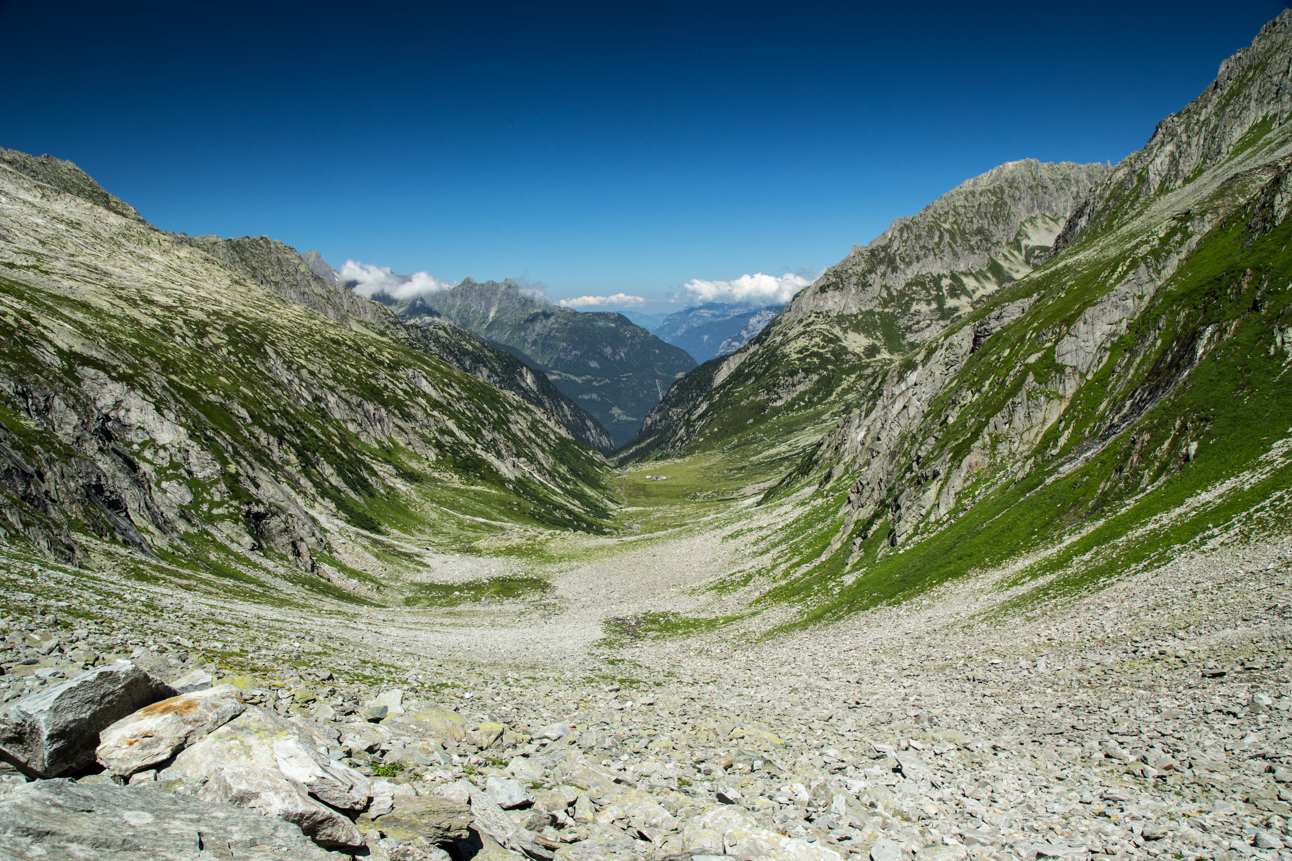
Fellital's landscape is defined by the sharp vertical scale typical of the northern Urner Alps. The valley runs roughly eight kilometers from the Fellilücke pass in the south, which connects toward the Oberalp pass, down through a steadily steepening profile to the Reuss valley near Gurtnellen in the north. Between these endpoints lies a drop of roughly 1,800 meters, shaping a valley of pronounced alpine character.
Two distinct pass connections frame the valley's circulation. At its upper end, the Fellilücke provides a high-grade crossing toward the Oberalp pass and the headwaters of the Vorderrhein in Graubünden. Lower down the valley, the Pörtlilücke opens eastward into the Etzlital, creating an additional lateral connection to surrounding alpine terrain and reinforcing Fellital's role as a corridor between multiple high-elevation valleys. The Swiss Alpine Club's Treschhütte lies within the valley, providing both a focal point for visitors and a clear marker of the valley's character as a working alpine landscape used for hiking and hut-based tourism alongside its conservation status.
Fellital ecosystems, habitats, and plant life
Fellital sits within a protected alpine ecological framework that combines national and cantonal designations. Its status as a federal hunting ban area, layered with the 1977 inclusion of the Maderanertal-Fellital area in the Federal Inventory of Landscapes and Natural Monuments of National Importance and the 1992 cantonal nature reserve designation by Uri, reflects recognition of the valley as a continuous, relatively undisturbed alpine habitat.
The combination of high-elevation terrain near the Fellilücke and lower slopes descending into the Reuss valley creates a range of alpine and subalpine conditions within a compact area. These transitions support the kind of habitat diversity and ecological continuity that underpin the valley's multi-level protection and its role as part of a broader national-scale landscape inventory in the central Swiss Alps.
Fellital conservation status and protection priorities
Fellital carries one of the more layered conservation profiles in the canton of Uri. It has long been designated as a federal hunting ban area (Jagdbanngebiet), restricting hunting and reinforcing protections for wildlife within the valley. Since 1977, the valley has been part of the Maderanertal-Fellital entry in the Federal Inventory of Landscapes and Natural Monuments of National Importance, formalizing its recognition at the national level as a landscape of distinctive scenic and ecological value.
In 1992, the cantonal authorities added a further layer of protection by designating Fellital as a cantonal nature reserve. Together, these federal and cantonal designations establish the valley as a protected alpine landscape where habitat and scenery are actively maintained in a region otherwise dominated by historical alpine land use.
Fellital cultural meaning and human context
The cultural context of Fellital is shaped by its long tradition as a working alpine landscape alongside its more recent identity as a protected natural area. The presence of the Swiss Alpine Club's Treschhütte within the valley connects it to the centuries-old Swiss culture of alpine club huts, hut-to-hut travel, and pastoral alpine use that has shaped mountain communities across Uri and neighboring cantons.
The valley also carries a notable military-historical layer. Its use by French forces under Claude-Jacques Lecourbe during the Second Coalition War maneuvers of 1799, and its connection through the Fellilücke to the broader Schöllenen battlefield where Suvorov's Russian troops were engaged, places Fellital within the wider network of routes across which the political and military history of the Helvetic region has unfolded.
Top sights and standout views in Fellital
Fellital's most distinctive features combine dramatic relief with strong conservation and historical credentials. The roughly 1,800-meter elevation gain along an eight-kilometer valley creates an unusually steep alpine profile, framed at the top by the Fellilücke pass and at the bottom by the Reuss valley near Gurtnellen.
Equally distinctive is the layered protection the valley enjoys: federal hunting ban area status, inclusion since 1977 in the Maderanertal-Fellital national landscape inventory, and cantonal nature reserve status since 1992. These designations are complemented by historical resonance, since the valley was used by French forces under Lecourbe as a key flanking route into the Reuss valley during the 1799 campaigns linked to the battles at the Schöllenen.