

Why Galyat stands out
Galyat is best known as a string of forested hill resorts set in cool mountain valleys north-east of Islamabad. Its defining character comes from the gentle passes, or galis, between ridges rather than from the highest summits, giving it a softer, more accessible landscape compared with the higher Himalayan ranges further north. The tract is also known for its mixed forests of pine, cedar, oak, walnut, and maple, and for its function as a long-established summer escape from the plains. Resorts such as Nathia Gali, Ayubia, and Murree anchor the region's identity, while the presence of the Karlal people and the Dhundi-Kairali dialect of Hindko gives the area a distinctive local cultural and linguistic profile.
Galyat history and protected-area timeline
The documented history of Galyat as a wider resort region begins in the mid-nineteenth century with the British colonial exploration of the hills north of what is now Islamabad. British officials, including James Abbott, ventured into the area around 1846 to 1847 and began to recognize its climatic advantages. The British administration developed a number of sites as hill stations, using the cool mountain environment as an escape from the heat of the surrounding lowlands. During the colonial period the area was also referred to as 'Karral country', after the dominant local Karlal tribe.
After the partition and independence of Pakistan in 1947, the hill resorts of the Galyat were somewhat neglected for a period. From the 1960s onward, however, the region saw renewed development and grew into a popular destination within Pakistan. A more recent milestone came in 2023, when UNESCO recognized the Galyat as part of an international biosphere reserve site, reflecting the growing acknowledgment of its ecological alongside its recreational significance.
Galyat landscape and geographic character
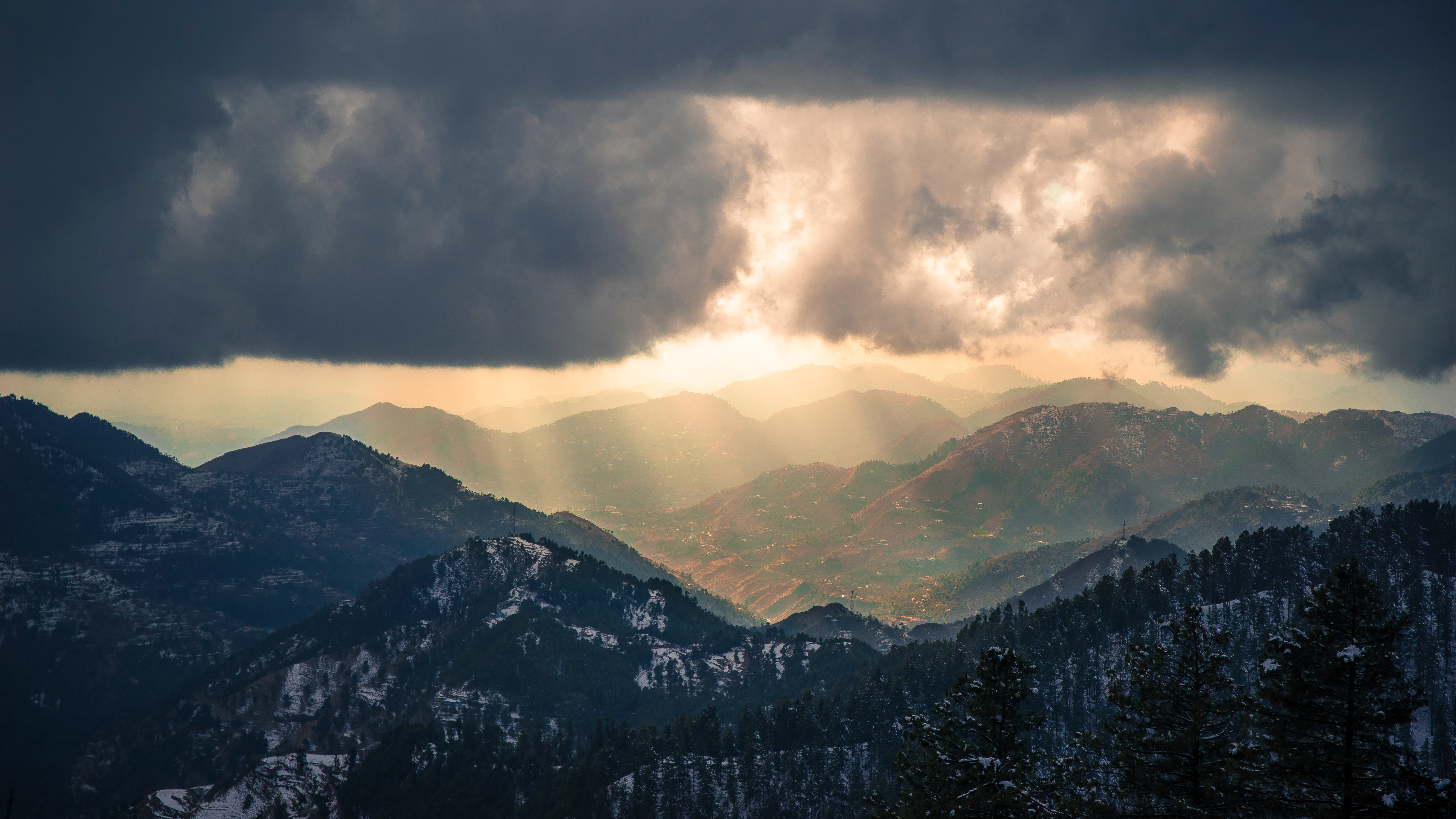
The Galyat landscape is built around a series of forested ridges and intermediate passes rather than around towering summits. The Urdu word gali, which gives the region its name, specifically refers to an alley or lower pass between two mountains, not to the highest saddle in a range. This gives the area a distinctive geography of valleys interspersed with gentle saddles, where roads and settlements tend to gather.
The terrain is heavily wooded. Pine, cedar, oak, walnut, and maple stands cover much of the hillsides, with the forests wrapping around the small hill towns. The contrast between these green, forested slopes and the warmer plains towards Islamabad has historically made the area feel like a sharp climatic and visual transition. While elevations within the region support the higher hill stations, the character of Galyat is defined less by altitude extremes than by the rhythm of alternating ridges, valleys, and named passes such as Nathia Gali, Changla Gali, Dunga Gali, Khaira Gali, Bara Gali, Jhika Gali, and Ghora Gali.
Galyat ecosystems, habitats, and plant life
Galyat's ecological character is shaped by its position as a forested mountain corridor between the lowlands of Punjab and the higher hills of Khyber Pakhtunkhwa. The region's mixed temperate forests, with pine, cedar, oak, walnut, and maple, create continuous tree cover across much of the tract and support the cool, moist microclimate that the hill stations depend on.
This forested setting, combined with the altitudinal gradient between the surrounding plains and the hill summits, gives the area significant ecological value. The 2023 UNESCO recognition of the region as part of a biosphere reserve indicates that this combination of forest cover, watershed function, and habitat connectivity is now seen as regionally important rather than merely as a recreational landscape. The presence of substantial woodland blocks also makes the area part of an important corridor for forest-dependent wildlife within northern Pakistan.
Galyat wildlife and species highlights
Galyat's wildlife character is closely tied to its extensive forest cover and its position between lowland and highland habitats. The mature stands of pine, cedar, oak, walnut, and maple that dominate the hillsides provide habitat for forest birds, small mammals, and other temperate woodland species typical of the western Himalayan foothills in northern Pakistan.
While the source material does not enumerate specific species in detail, the ecological role of the region is clear: the continuous forest blocks, the range of elevations across the ridges and passes, and the relatively limited disturbance in the upper parts of the tract all combine to make the Galyat an important reservoir of forest habitat in an otherwise heavily populated corridor between Islamabad and the northern mountains.
Galyat conservation status and protection priorities
Conservation attention in the Galyat has historically been indirect, focused on the protection and management of forests that also serve the region's role as a hill resort. The mixed stands of pine, cedar, oak, walnut, and maple represent a significant block of temperate forest in a landscape otherwise dominated by agriculture and urban expansion on the surrounding plains.
The most important conservation development came in 2023, when UNESCO included the Galyat among its recognized biosphere reserve sites. This recognition reflects the region's combined ecological, hydrological, and biodiversity values, and places it within an international framework that emphasizes the link between conservation, research, and sustainable use. The designation marks a shift from viewing the Galyat primarily as a recreational zone toward recognizing it as a landscape of broader environmental significance.
Galyat cultural meaning and human context
The Galyat has a strong local cultural identity rooted in the Karlal tribe, which has historically been the dominant community of the area and which gave the region its colonial-era nickname of 'Karral country'. Tribal traditions, local land use patterns, and settlement networks still shape life across the hill towns.
Linguistically, the region is part of a wider linguistic continuum that also includes parts of Kashmir and the Murree hills, and the local dialect of Hindko spoken here, known as Dhundi-Kairali, has been of particular interest to social scientists because of the difficulty of classifying it neatly. Alongside this indigenous cultural layer sits the more recent resort culture introduced during the British colonial period and continued in the Pakistani era, which has given the area a dual identity as both a tribal homeland and a leisure landscape.
Top sights and standout views in Galyat
The defining highlights of Galyat include its chain of forested hill stations such as Nathia Gali, Ayubia, Thandiani, Changla Gali, Dunga Gali, Khaira Gali, and Murree; its mixed forests of pine, cedar, oak, walnut, and maple; and its geography of named passes, or galis, that give the region its distinctive character.
Equally significant is the 2023 UNESCO biosphere reserve recognition of the region, which frames Galyat not just as a place to visit but as a landscape of recognized international ecological value. The combination of Karlal tribal heritage, the Dhundi-Kairali dialect, and a long history as a summer retreat gives the Galyat a layered identity that blends nature, culture, and resort tradition.
Best time to visit Galyat
Galyat is fundamentally a summer destination in the regional imagination. The hill tract developed historically as an escape from the heat of the surrounding plains, and the higher elevations around the forested passes keep temperatures cooler than nearby Islamabad and the Punjab lowlands during the warmer months.
Summers are therefore the most natural season to experience the region as it was designed to be experienced: green forests, active resort towns, and the full recreation of Nathia Gali, Ayubia, Murree, and the other hill settlements. Outside the summer months the area cools considerably and snowfall can occur at higher elevations, which transforms the atmosphere of the forests and the small towns into a quieter, colder landscape with limited activity.