Why Gouraya National Park stands out
Gouraya National Park is best known for its population of Barbary macaques, one of Africa's few native primate species and a conservation priority due to its limited global distribution. The park's dramatic coastal landscape of steep cliffs, accessible beaches, and the prominent Gouraya Mountain creates a distinctive Mediterranean setting. The presence of marine mammals including sperm whales, common dolphins, bottlenose dolphins, and harbor porpoises in the adjacent waters adds marine ecological significance. The combination of terrestrial biodiversity, coastal geomorphology, and the cultural presence of Berber communities within a protected landscape makes Gouraya distinctive among Algerian national parks.
Gouraya National Park history and protected-area timeline
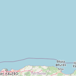
Gouraya National Park was established in 1984 as part of Algeria's expanding network of protected areas during the late twentieth century. The park's creation responded to the need to conserve the region's distinctive Mediterranean ecosystems and the endangered species they support, particularly the Barbary macaque population. A significant milestone in the park's institutional history came in 2004 when UNESCO designated Gouraya as a biosphere reserve, elevating its international conservation profile. This recognition acknowledged both the ecological significance of the coastal ecosystem and the successful integration of local Berber communities within the protected area framework. The park's proximity to Béjaïa, one of Algeria's important coastal cities, has influenced its management approach, balancing conservation objectives with public access to recreational beaches and natural landscapes.
Gouraya National Park landscape and geographic character
The physical landscape of Gouraya National Park presents a dramatic contrast between its mountainous interior and coastal perimeter. Gouraya Mountain rises to 660 meters above sea level, composed of calcaro-dolomitic geology that creates distinctive karst features and rocky outcrops. The elevation range within the park extends from 660 meters at the summit down to 135 meters below sea level in certain coastal areas, representing one of the more extreme elevation differentials among Algerian protected areas. The coastline features steep cliffs that drop directly into the Mediterranean, interspersed with beach areas that are accessible for swimming. Lake Mézaïa, an inland lake within the park, adds hydrological complexity to the terrain. The combination of mountain, cliff, beach, and lake environments creates a compact but ecologically diverse landscape that supports multiple habitat types within a relatively limited area.
Gouraya National Park ecosystems, habitats, and plant life
Gouraya National Park supports a rich mosaic of Mediterranean vegetation communities that have been classified through phytosociological study into seven distinct vegetation groups spanning four phytosociological classes. The Quercetea ilicis vegetation represents the evergreen oak woodland that characterizes much of the park's forested areas. The Querco-Fagetea class includes deciduous oak communities where they occur. The Crithmo-limonielea class covers coastal halophytic vegetation adapted to saline conditions along the shoreline. The Asplenietea rupestris class encompasses rocky cliff vegetation specialized for exposed calcareous substrates. Protected plant species within the park include tree spurge and prickly juniper, both valued Mediterranean species facing conservation pressure in some portions of their range. The park's position on the North African coast places it within a biogeographic transition zone where Mediterranean, temperate, and African floral elements intersect.
Gouraya National Park wildlife and species highlights
The wildlife of Gouraya National Park includes both terrestrial and marine species of conservation significance. The Barbary macaque represents the park's most notable terrestrial mammal, a primate species whose global range is now limited to portions of Morocco, Algeria, and the disjunct population in Gibraltar. This macaque population inhabits the forested areas of the park, particularly the oak woodlands and maquis where food resources and shelter are abundant. Additional terrestrial mammals include golden jackals, wild cats, and Algerian hedgehogs, all species of the broader North African fauna. The marine environment adjacent to the park supports populations of sperm whales, short-beaked common dolphins, bottlenose dolphins, and harbor porpoises, species of national conservation importance. The combination of significant primate populations and marine mammal diversity gives Gouraya exceptional wildlife value within the Algerian protected area network.
Gouraya National Park conservation status and protection priorities
Gouraya National Park holds significant conservation importance at both national and international scales. The 2004 UNESCO biosphere reserve designation recognized the park's ecological values and its model of integrating human communities within a protected landscape. The Barbary macaque population represents a conservation priority given the species' restricted global distribution and vulnerability. The park protects representative Mediterranean coastal ecosystems that have faced development pressure along Algeria's coastline. The presence of protected flora including tree spurge and prickly juniper reflects the broader conservation value of the vegetation communities. Marine mammal protection in the adjacent waters extends the park's conservation mandate beyond the terrestrial boundary, acknowledging the ecological connections between coastal and marine environments.
Gouraya National Park cultural meaning and human context
Gouraya National Park is home to a permanent population of approximately 1,655 Berber inhabitants distributed across 13 villages within the park boundaries. These communities represent the indigenous population of the Kabylie region, maintaining traditional connections to the landscape that predate the park's formal establishment. The integration of human settlements within a national park creates a distinctive management context, one that UNESCO recognized through the biosphere reserve designation which explicitly accommodates sustainable human presence. The park's name derives from the local toponym for Gouraya Mountain, reflecting the deep connection between this landscape and the communities who have inhabited it. Traditional land use practices, agricultural activities, and cultural heritage of these Berber communities form part of the living cultural context that coexists with the park's conservation function.
Top sights and standout views in Gouraya National Park
Gouraya National Park combines coastal Mediterranean beauty with significant biodiversity, most notably its population of Barbary macaques. The dramatic summit of Gouraya Mountain at 660 meters provides panoramic views over the coastline and the city of Béjaïa below. Coastal features including the cliffs of Cap Carbon and accessible beaches offer both scenic value and recreational opportunity. The presence of marine mammals in the surrounding waters extends the park's ecological significance beyond its terrestrial boundary. The integration of traditional Berber villages within the protected landscape demonstrates a model of conservation that accommodates human communities. The UNESCO biosphere reserve status since 2004 confirms the park's international recognition as a significant protected area.
Best time to visit Gouraya National Park
Gouraya National Park can be visited throughout the year, though the Mediterranean climate shapes optimal seasons. Spring months from March through May offer mild temperatures and flowering vegetation that enhances the park's natural beauty. Summer brings warm conditions and peak beach visitation as Algerians escape to the coast, though this also means more crowded access areas. Autumn provides another favorable period with comfortable temperatures and reduced crowds compared to summer. Winter months are mild but see less visitation. The Barbary macaques can be observed year-round, though morning hours often provide best viewing opportunities as the animals are more active in cooler temperatures. Visitors interested in marine mammal sightings should be aware that seasonal variations affect cetacean presence in the adjacent waters.